Shale Falls
By Armen Suny · Last verified Mar 2026
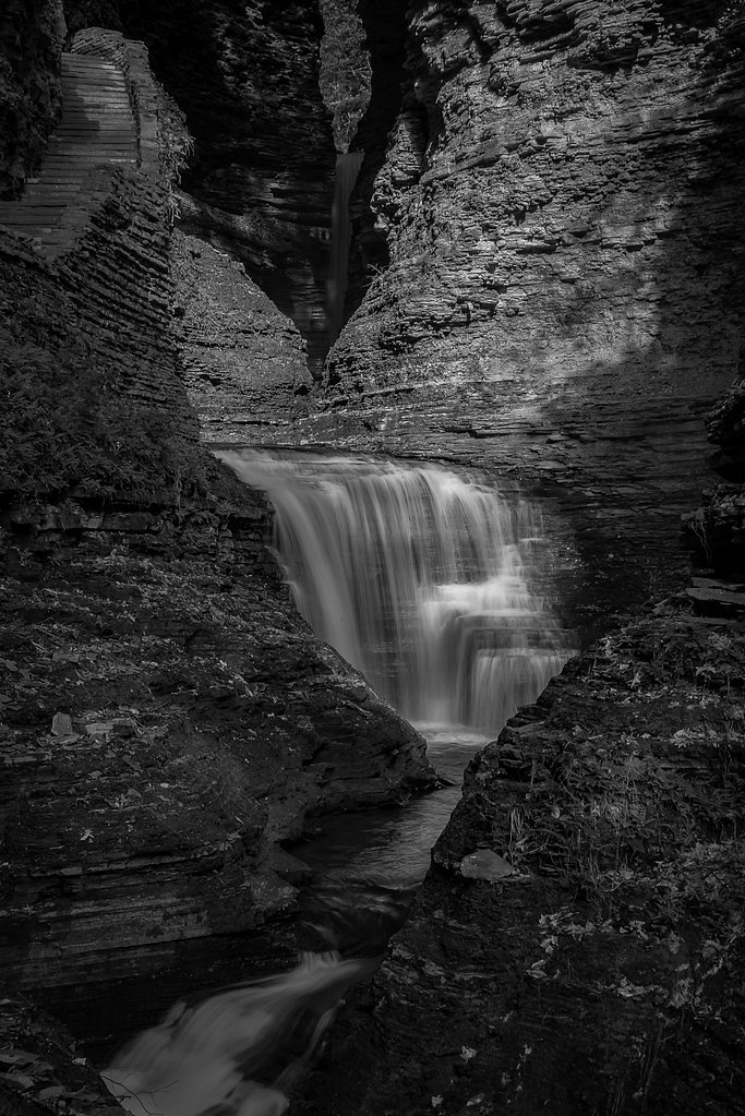
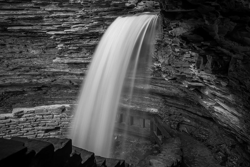
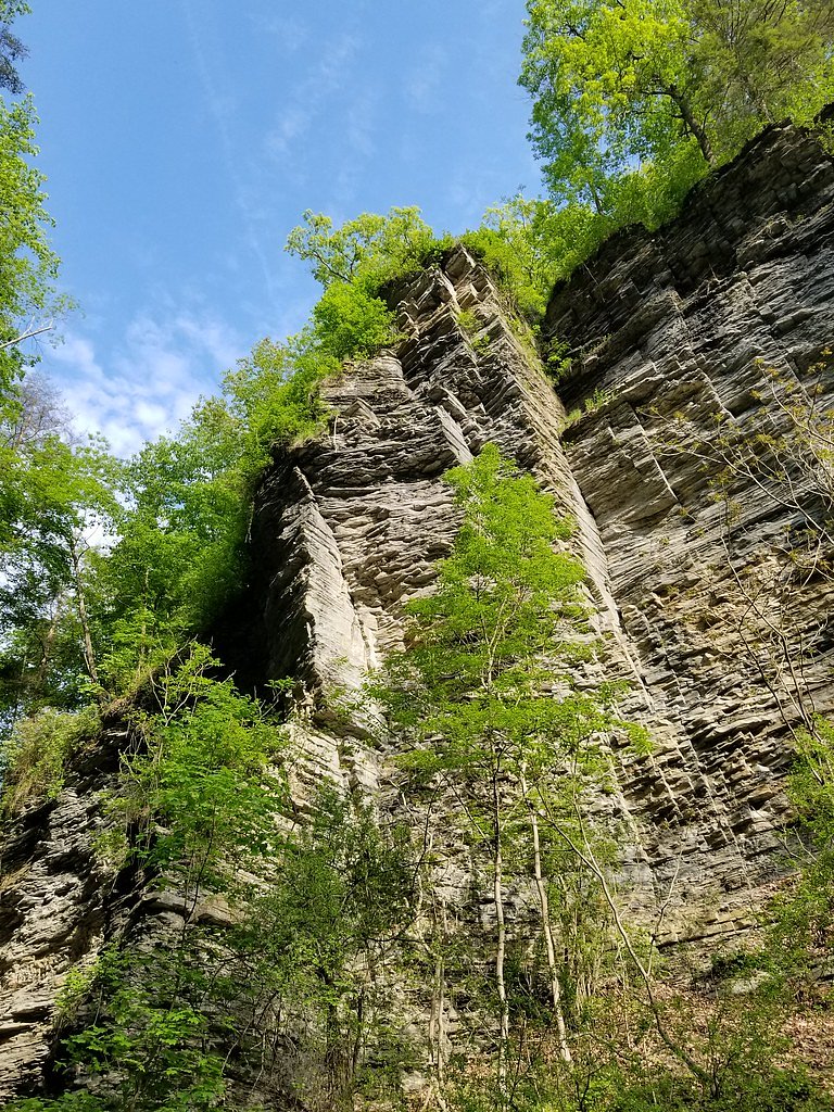
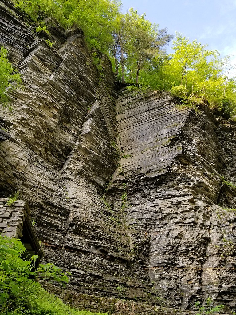

Photo Credits (5)
Difficulty
Moderate
Trail Length
2.4 miles
Trail Type
Out And Back
Elevation Gain
350 ft
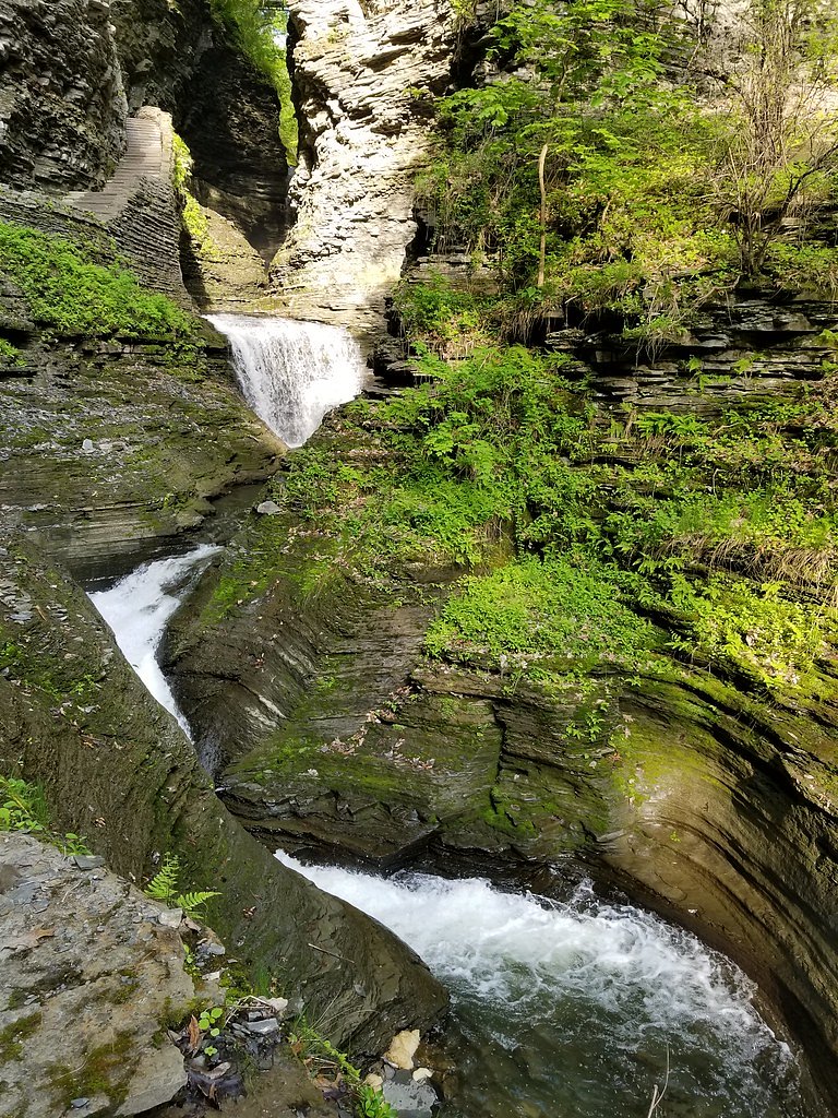
About Shale Falls
Shale Falls is a small, picturesque cascade tucked into Wisconsin’s Brule River State Forest and managed by the State Department of Natural Resources (SDNR) as part of the forest’s State Recreation Management Area (SRMA). Framed by layered shale rock and quiet, mixed woods, the falls are a peaceful, lesser-known destination that rewards visitors with serene views and good photo opportunities away from busier parks. The falls are reached via a moderate, 2.4-mile out-and-back hike that climbs roughly 350 feet—perfect for hikers who enjoy a short, forested route with some uneven footing. The nearest developed camping is Horseshoe Lake Recreation Area, about 32.2 km away, so plan overnight stays accordingly. Check Brule River State Forest notices from SDNR before you go for any seasonal information or access updates.
The Setting
Shale Falls sits at 692 feet within Brule River State Forest, fed by the Bois Brule River, in the foothills of Wisconsin.
Trail & Hike Details
The Approach
The moderate 2.4-mile out-and-back trail gains 350 feet of elevation on the way to the falls.
Trail Description
Length: 2.4 miles (out-and-back). Elevation gain: ~350 feet. Difficulty: Moderate. Trail type: out-and-back. Terrain: wooded sections with uneven footing and short, moderate climbs; the route leads through forested tread to the waterfall. Surface/grade/class: SDNR records do not document a formal trail surface, grade, or technical class for this route, so expect natural, sometimes rocky or rooty trail conditions. Managed by: SDNR within Brule River State Forest (SRMA).
What to Expect
Visitors can expect a tranquil setting with a small waterfall cascading over shale rock formations. The area is surrounded by natural beauty, making it a great spot for photography and quiet reflection.
Accessibility
The trail is not wheelchair accessible. Uneven terrain and elevation changes require steady footing.
Frequently Asked Questions
🐶 Are Dogs Allowed at Shale Falls?
❌ Dogs are not allowed
Are There Any Fees or Permits Required?
🆖 No fees required
🏊 Is There Swimming at Shale Falls?
❌ Swimming is not allowed
When to Visit
Spring and early summer are ideal times to visit, as water flow is typically higher due to snowmelt and rainfall.
Seasonal Access
The best time to visit is Spring, Summer, and Fall. Winter access may be limited.
Safety Information
Visitors should be cautious of slippery rocks near the waterfall and uneven terrain on the trail. Check weather conditions and avoid visiting during heavy rain or icy conditions.
Current Water Conditions
115 ft³/s
Current discharge — how much water is flowing
Much lower than usual for this time of year
Based on 81 years of record
1.52 ft
Water depth at gauge
7-Day Discharge Trend
What does this mean for your visit?
Flow is well below normal for this time of year, so the waterfall may be a trickle.
About This Gauge
This gauge is on a nearby waterway and may not reflect exact conditions at the falls.
7-Day Flow Outlook
Based on the USGS gauge BOIS BRULE RIVER AT BRULE, WI (17 km away).
Today
Low
115 cfs
6/10Tomorrow
Low
114 cfs
6/10Sun
Moderate
130 cfs
4/10Mon
Moderate
137 cfs
4/10Tue
Moderate
141 cfs
4/10Wed
Moderate
131 cfs
5/10Thu
Moderate
137 cfs
4/10Best window: Today — low flow, partly sunny (trip score 6/10).
Best time of year: this gauge typically runs highest from late March to mid June, peaking in April.
How we calculate this
This is a transparent outlook, not a precise forecast. We take the waterfall's current flow strength (how it ranks against its historical normal for today, from the nearest USGS stream gauge), carry that ranking forward along the gauge's seasonal curve, and nudge it for forecast rain. Confidence is highest for the next day or two and falls further out. Always check official conditions and your own judgment before visiting — high flows can be dangerous.
Know when to go.
Get a free email alert when waterfalls near Brule hit peak flow. We only send when conditions are worth the trip — no weekly newsletters, no spam.
Weather Forecast
Location & Access
Getting There
Shale Falls is located in a rural area of Wisconsin. Specific directions may vary, so it is recommended to use a GPS or consult local maps for the most accurate route.
Get Directions on Google MapsParking
Parking availability is unclear, but visitors may need to park along nearby roads or at designated trailheads if available.
Elevation
692 feet above sea level
Coordinates
46.691049° N, -91.600186° W
Land Management
Managed by SDNR
Visitor Tips & Gear
Wear sturdy footwear as the terrain may be uneven. Bring insect repellent during warmer months and check weather conditions before visiting.
As an Amazon Associate, we earn from qualifying purchases.
With 2.4 miles and 350 ft of elevation gain, sturdy boots and trekking poles will help on this moderate trail. Sun exposure on the trail makes good sun protection a must in summer.

Polarized Sunglasses (Knockaround)
Cuts glare off the water so you actually see the falls — and your photos turn out better too.

Columbia Watertight II Rain Jacket
Packs into its own pocket, seam-sealed, and keeps you dry from spray and surprise rain.

Earth Pak Waterproof Dry Bag
Keeps your phone and gear dry when waterfall mist soaks everything else.

Waterproof Phone Pouch (AiRunTech)
Cheap insurance — take photos right next to the falls without killing your phone.

Timberland Euro Sprint Mid Waterproof
Trusted waterproof boot with premium leather and grippy rubber sole — reliable on rocky, wet trails.

TrailBuddy Trekking Poles
Lightweight aluminum, cork grips, and flip-locks that actually hold — a best-seller for good reason.
Where to Stay

Lift Bridge Lodge, an Ascend Collection Hotel

Pier B Resort

South Pier Inn

Cobblestone Hotel & Suites - Superior Duluth
Browse vacation cabins and private rentals nearby
Unique outdoor stays — tents, yurts, and treehouses
Rent a campervan or RV for your waterfall road trip
Some links are affiliate links. We may earn a commission at no extra cost to you.
Nearby Campground
Horseshoe Lake Recreation Area
20 miles away · 0 sites
If you looking for an equestrian style base camp to explore area trails or a destination campground with plenty of room for your family, try the Horseshoe Lake Recreations Area located north of Ino, Wisconsin on the Washburn Ranger District. The terrain is gently rolling with a sandy loam surface ideal for horse riding. The trail weaves through towering pine and hardwood forests as well as through the area's open barrens. Whether you are interested in plants, scenery or wildlife, touring the trai
Book on Recreation.govAdditional Information
Nearby Attractions
Nearby attractions may include other natural landmarks and hiking trails in the region. Specific recommendations are not available.
Wildlife
The area may host a variety of wildlife, including birds, deer, and small mammals. Visitors should respect the natural habitat.
Cities near Shale Falls
Writing about Shale Falls? Embed this waterfall on your site for free.