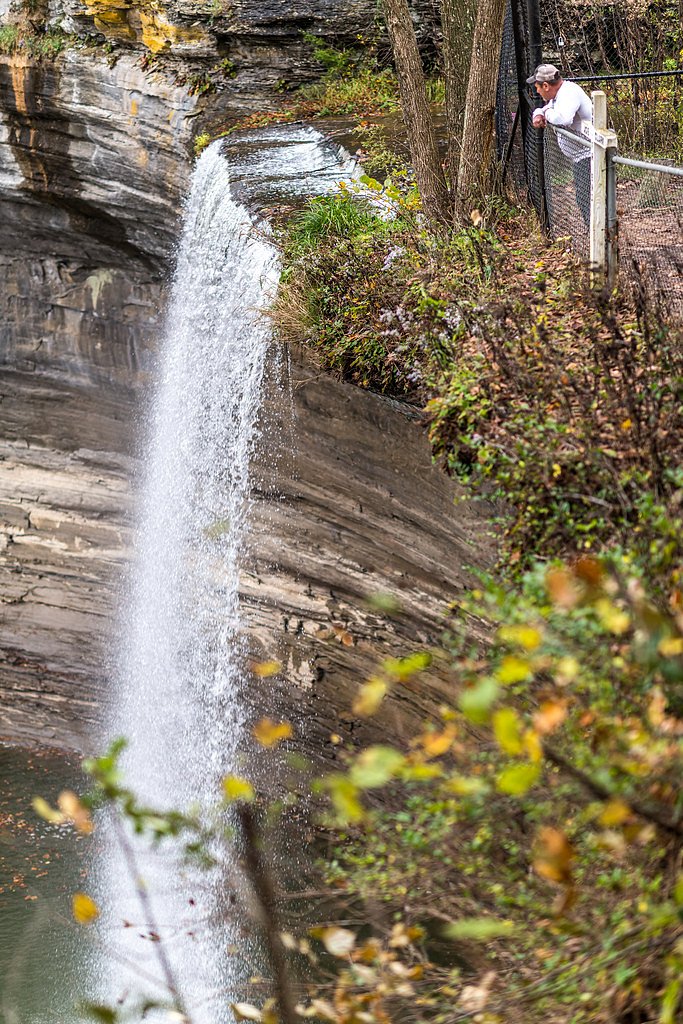
Seventy Six Falls
Kentucky • 76 ft
By Armen Suny · Last verified Mar 2026
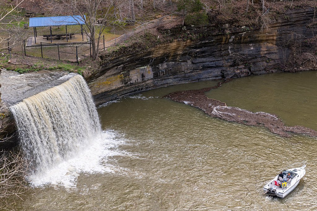
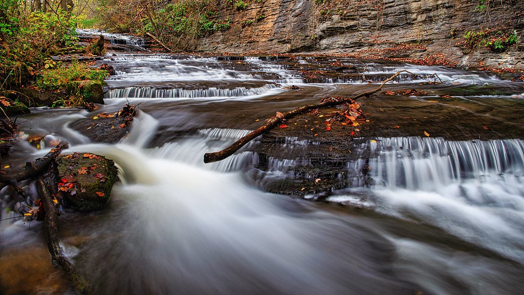
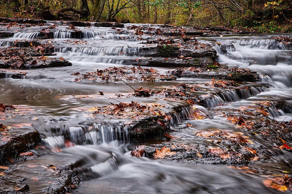
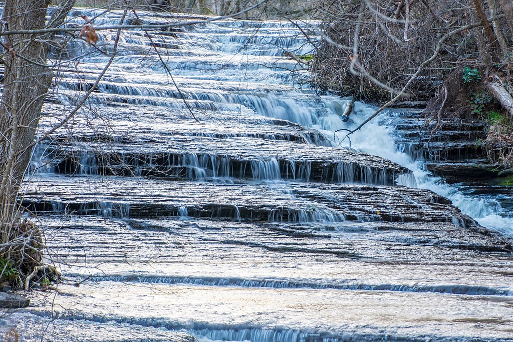

Photo Credits (5)
Difficulty
Moderate
Trail Length
2.4 miles
Trail Type
Out And Back
Elevation Gain
350 ft
About Seventy Six Falls
Seventy Six Falls is a scenic waterfall on Indian Creek in Clinton County, Kentucky, tucked near the shores of Lake Cumberland. Nestled within the Cumberland Recreation Area and managed by the U.S. Army Corps of Engineers, the falls drop roughly 76 feet and make for a photogenic stop along the waterway. The feature takes its name from the nearby community of Seventy Six; a popular local belief held that the falls’ height matched the name before Lake Cumberland was impounded, though contemporary accounts put the pre-impoundment height at about 84 feet.
The Setting
Seventy Six Falls sits at 745 feet within Cumberland Recreation Area, fed by the Beaver Creek, in the foothills of Kentucky. The falls drop 76 feet.
Height: 76 feet
Trail & Hike Details
The Approach
The moderate 2.4-mile out-and-back trail gains 350 feet of elevation on the way to the falls.
Trail Description
The hike to Seventy Six Falls is an out-and-back route of about 2.4 miles round trip with roughly 350 feet of elevation gain. Rated moderate, the trail requires steady footing through natural terrain and a few uphill sections, and it culminates at viewpoints above the falls along Indian Creek. The route is best suited to hikers prepared for uneven surfaces and moderate climbs rather than a simple roadside viewing.
What to Expect
The falls cascade 76 feet. Dogs are welcome.
Accessibility
The trail is not wheelchair accessible. Uneven terrain and elevation changes require steady footing.
Frequently Asked Questions
🐶 Are Dogs Allowed at Seventy Six Falls?
✅ Dogs are allowed
Are There Any Fees or Permits Required?
🆖 No fees required
🏊 Is There Swimming at Seventy Six Falls?
❌ Swimming is not allowed
When to Visit
Spring and early summer are ideal for visiting, as the water flow is typically strongest during these seasons.
Seasonal Access
The best time to visit is Spring, Summer, Fall, and Winter.
Safety Information
Exercise caution near the edge of the falls, as the rocks can be slippery. Avoid visiting during heavy storms or flooding conditions.
Current Water Conditions
6 ft³/s
Current discharge — how much water is flowing
About average for this time of year
Based on 33 years of record
2.08 ft
Water depth at gauge
7-Day Discharge Trend
What does this mean for your visit?
Flow is about average for this time of year.
About This Gauge
This gauge is on a nearby waterway and may not reflect exact conditions at the falls.
7-Day Flow Outlook
Based on the USGS gauge BEAVER CREEK NEAR MONTICELLO, KY (21 km away).
Today
Barely Flowing
7 cfs
5/10Tomorrow
Low
9 cfs
3/10Sat
Low
10 cfs
3/10Sun
Low
8 cfs
3/10Mon
Barely Flowing
8 cfs
5/10Tue
Barely Flowing
7 cfs
5/10Wed
Barely Flowing
7 cfs
5/10Best window: Today — barely flowing flow, mostly sunny (trip score 5/10).
Best time of year: this gauge typically runs highest from mid February to late March, peaking in March.
How we calculate this
This is a transparent outlook, not a precise forecast. We take the waterfall's current flow strength (how it ranks against its historical normal for today, from the nearest USGS stream gauge), carry that ranking forward along the gauge's seasonal curve, and nudge it for forecast rain. Confidence is highest for the next day or two and falls further out. Always check official conditions and your own judgment before visiting — high flows can be dangerous.
Know when to go.
Get a free email alert when waterfalls near Albany hit peak flow. We only send when conditions are worth the trip — no weekly newsletters, no spam.
Weather Forecast
Location & Access
Getting There
Seventy Six Falls is located off KY-3062 near the town of Albany, Kentucky. Visitors can follow signs to the falls, which are accessible via a short drive from the main road.
Get Directions on Google MapsParking
There is a small parking area near the falls, but availability may be limited during peak seasons.
Elevation
745 feet above sea level
Coordinates
36.779257° N, -85.125873° W
Land Management
Managed by USACE
Visitor Tips & Gear
Visit after recent rainfall for the best water flow. The area can become slippery, so wear sturdy shoes. Arrive early during peak seasons to secure parking.
As an Amazon Associate, we earn from qualifying purchases.
With 2.4 miles and 350 ft of elevation gain, sturdy boots and trekking poles will help on this moderate trail. Icy conditions are common in winter — traction cleats are a smart addition.

Columbia Watertight II Rain Jacket
Packs into its own pocket, seam-sealed, and keeps you dry from spray and surprise rain.

Polarized Sunglasses (Knockaround)
Cuts glare off the water so you actually see the falls — and your photos turn out better too.

Earth Pak Waterproof Dry Bag
Keeps your phone and gear dry when waterfall mist soaks everything else.

Waterproof Phone Pouch (AiRunTech)
Cheap insurance — take photos right next to the falls without killing your phone.

Timberland Euro Sprint Mid Waterproof
Trusted waterproof boot with premium leather and grippy rubber sole — reliable on rocky, wet trails.

TrailBuddy Trekking Poles
Lightweight aluminum, cork grips, and flip-locks that actually hold — a best-seller for good reason.
Where to Stay

Baymont by Wyndham Albany

Sleep Inn & Suites Columbia

Lake Cumberland Cabin - Spa, Firepit, Scenic Views

Kozy Haven Log Cabin Rentals
Browse vacation cabins and private rentals nearby
Unique outdoor stays — tents, yurts, and treehouses
Rent a campervan or RV for your waterfall road trip
Some links are affiliate links. We may earn a commission at no extra cost to you.
Nearby Campground
KENDALL CAMPGROUND
6.5 miles away · 120 sites
Overview Kendall Campground is located at 80 Kendall Road, south of Jamestown, Kentucky, just below Wolf Creek Dam, which forms beautiful Lake Cumberland. Click here for the Lake Cumberland virtual tour. Recreation Lake Cumberland is the largest man-made lake east of the Mississippi River. Its large surface acreage and over 1,200 miles of shoreline provide a myriad of recreational activities. Kendall Campground offers visitors convenient access to a cold water trout stream, making it a popular fi
Book on Recreation.govAdditional Information
Nearby Attractions
Lake Cumberland, Dale Hollow Lake, and the town of Albany offer additional recreational opportunities such as boating, fishing, and hiking.
Wildlife
The area around Seventy Six Falls is home to various bird species, deer, and other small wildlife.
Cities near Seventy Six Falls
Writing about Seventy Six Falls? Embed this waterfall on your site for free.