Selway Falls
By Armen Suny · Last verified Mar 2026
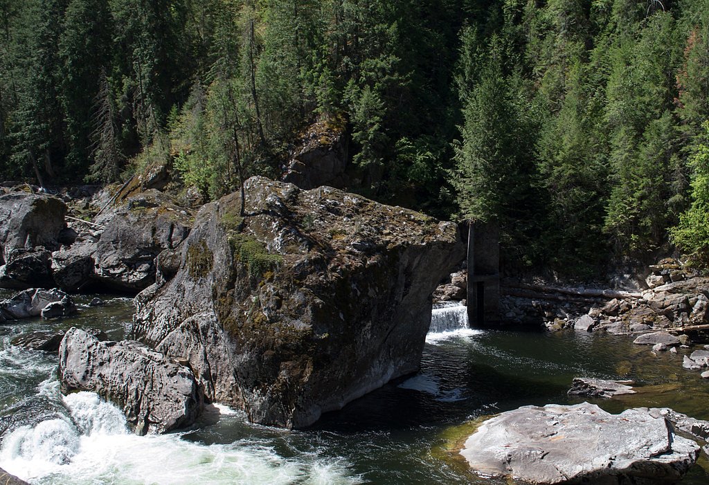
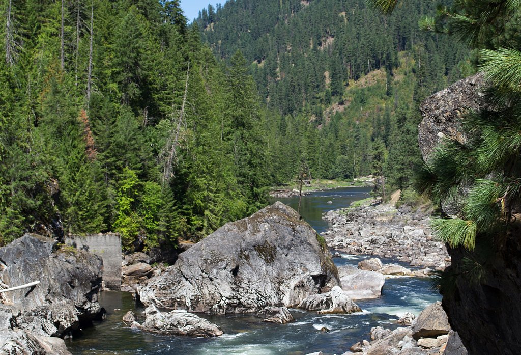
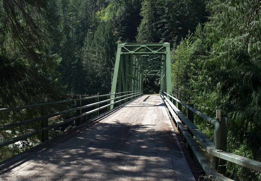
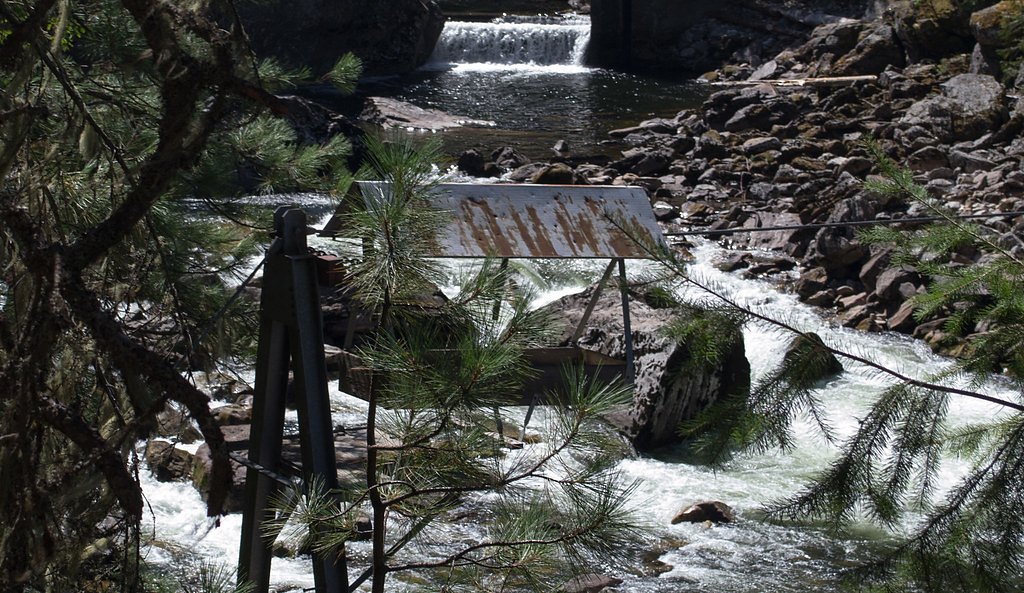
Photo Credits (5)
Difficulty
Moderate
Trail Length
2.4 miles
Trail Type
Out And Back
Elevation Gain
350 ft
About Selway Falls
Selway Falls is a rugged, photogenic stretch of cascading rapids on the Selway River, celebrated more for its pounding ledges and river-carved canyon than for a single vertical plunge. The falls lie within the Middle Fork Clearwater land unit of the Idaho Wild and Scenic Rivers (designation: WSR), with landowner DESG and management by the U.S. Forest Service, so the setting feels protected and remote — a classic slice of Idaho backcountry where the river’s power and the surrounding conifer forest dominate the scene. Accessing the viewpoints rewards you with the thunder and spray of the rapids and plentiful photo opportunities rather than developed overlooks. The route to the falls is an out-and-back hike of modest length and effort, popular with day hikers and anglers seeking a wild-river experience; there are minimal facilities, so bring water and be prepared for natural, sometimes uneven terrain.
The Setting
Selway Falls sits at 1,706 feet within Middle Fork Clearwater, Idaho Wild and Scenic River, fed by the Selway River, in the hills of Idaho.
Trail & Hike Details
The Approach
The moderate 2.4-mile out-and-back trail gains 350 feet of elevation on the way to the falls.
Trail Description
The trail to Selway Falls is a 2.4-mile out-and-back with roughly 350 feet of elevation gain and is rated moderate. The tread is largely undeveloped natural surface—expect roots, rock and uneven footing rather than paved or heavily maintained trailwork—and short, steeper pitches on the approach. The route begins at the small parking/entry area and follows a straightforward alignment to several views of the cascading rapids; because facilities are minimal and the corridor is managed as part of the Middle Fork Clearwater unit of the Idaho Wild and Scenic Rivers by the USFS, plan for a simple backcountry walk rather than a developed trail experience.
What to Expect
Dogs are welcome.
Accessibility
The trail is not wheelchair accessible. Uneven terrain and elevation changes require steady footing.
Frequently Asked Questions
🐶 Are Dogs Allowed at Selway Falls?
✅ Dogs are allowed
Are There Any Fees or Permits Required?
🆖 No fees required
🏊 Is There Swimming at Selway Falls?
❌ Swimming is not allowed
When to Visit
Spring and early summer are the best times to visit, as the water flow is typically higher due to snowmelt.
Seasonal Access
The best time to visit is Spring, Summer, and Fall. Winter access may be limited.
Safety Information
Be cautious near the water, as the currents are strong and the rocks can be slippery. Cell phone service is limited in the area, so plan accordingly.
Current Water Conditions
3,610 ft³/s
Current discharge — how much water is flowing
Lower than usual for this time of year
Based on 97 years of record
5.20 ft
Water depth at gauge
7-Day Discharge Trend
What does this mean for your visit?
Flow is lower than usual for this time of year.
About This Gauge
This gauge is on a nearby waterway and may not reflect exact conditions at the falls.
7-Day Flow Outlook
Based on the USGS gauge SELWAY RIVER NR LOWELL ID (16 km away).
Today
Strong
3985 cfs
8/10Tomorrow
Roaring
3972 cfs
6/10Tue
Roaring
3721 cfs
6/10Wed
Roaring
3663 cfs
6/10Thu
Roaring
3537 cfs
6/10Fri
Roaring
3620 cfs
6/10Sat
Strong
2901 cfs
10/10Best window: Sat — strong flow, sunny (trip score 10/10).
Best time of year: this gauge typically runs highest from early April to early July, peaking in May.
How we calculate this
This is a transparent outlook, not a precise forecast. We take the waterfall's current flow strength (how it ranks against its historical normal for today, from the nearest USGS stream gauge), carry that ranking forward along the gauge's seasonal curve, and nudge it for forecast rain. Confidence is highest for the next day or two and falls further out. Always check official conditions and your own judgment before visiting — high flows can be dangerous.
Know when to go.
Get a free email alert when waterfalls near Elk City hit peak flow. We only send when conditions are worth the trip — no weekly newsletters, no spam.
Weather Forecast
Location & Access
Getting There
Selway Falls is located in the Selway-Bitterroot Wilderness in Idaho. It can be accessed via Selway Road (Forest Road 223), which follows the Selway River. The falls are approximately 20 miles east of Lowell, Idaho.
Get Directions on Google MapsParking
There is a small parking area near the falls, but availability may be limited during peak seasons.
Elevation
1,706 feet above sea level
Coordinates
46.051894° N, -115.307239° W
Land Management
Managed by USFS
Visitor Tips & Gear
Visit during spring or early summer for the best water flow. Bring a camera to capture the scenic beauty. Be cautious near the water, as the currents can be strong.
As an Amazon Associate, we earn from qualifying purchases.
With 2.4 miles and 350 ft of elevation gain, sturdy boots and trekking poles will help on this moderate trail. Sun exposure on the trail makes good sun protection a must in summer.

Polarized Sunglasses (Knockaround)
Cuts glare off the water so you actually see the falls — and your photos turn out better too.

Columbia Watertight II Rain Jacket
Packs into its own pocket, seam-sealed, and keeps you dry from spray and surprise rain.

Earth Pak Waterproof Dry Bag
Keeps your phone and gear dry when waterfall mist soaks everything else.

Waterproof Phone Pouch (AiRunTech)
Cheap insurance — take photos right next to the falls without killing your phone.

Timberland Euro Sprint Mid Waterproof
Trusted waterproof boot with premium leather and grippy rubber sole — reliable on rocky, wet trails.

TrailBuddy Trekking Poles
Lightweight aluminum, cork grips, and flip-locks that actually hold — a best-seller for good reason.
Where to Stay

Browse vacation cabins and private rentals nearby
Unique outdoor stays — tents, yurts, and treehouses
Rent a campervan or RV for your waterfall road trip
Some links are affiliate links. We may earn a commission at no extra cost to you.
Nearby Campground
OHARA
10.2 miles away · 32 sites
Overview O'Hara Campground sits along the Selway River amid lush vegetation and old cedar trees. This is the largest campground on the Selway, with 32 sites, and makes a great base for exploring all the recreational activities and attractions in the area. *Water is currently unavailable at this campground as it is under maintenence for the 2024 season. Water and dump station can be found at Cedar Flats, 1.5 miles from campground on Selway Road. Recreation The Selway River is a destination fly fis
Book on Recreation.govNearby Hot Springs
Hot springs near Elk City, Idaho
Stuart Hot Springs
Stuart Hot Springs demands commitment. Tucked more than five miles from Fog Mountain Road in the Nezperce National Forest, this...
Marten Hot Springs
Marten Hot Springs sits deep in the backcountry of the Nezperce National Forest, more than 8.4 miles from the nearest road. Als...

Stanley Hot Springs
Reaching Stanley Hot Springs in the Selway-Bitterroot Wilderness requires a nearly three-mile hike from the Wilderness Gateway ...
Red River Hot Springs
Red River Hot Springs produces 131 degrees Fahrenheit water at 5,040 feet elevation in Idaho County's Nezperce National Forest,...
Running Warm Springs
Running Warm Springs flows at 106 degrees in the Nezperce National Forest at 4,140 feet, carrying some of the most alkaline wat...
Weir Creek Hot Springs
Weir Creek Hot Springs surfaces at 117°F with strongly alkaline water (pH 9.4) in Idaho's Clearwater National Forest. Located a...
Looking for a soak after your hike? Explore more hot springs near Elk City, Idaho on SoakingSprings.
Explore Idaho springsAdditional Information
Nearby Attractions
The Selway-Bitterroot Wilderness offers numerous hiking trails, camping spots, and fishing opportunities. The nearby Lochsa River is also popular for whitewater rafting.
Wildlife
The area is home to a variety of wildlife, including deer, elk, black bears, and numerous bird species.
Cities near Selway Falls
Writing about Selway Falls? Embed this waterfall on your site for free.