
Photo Credits (2)
Difficulty
Moderate
Trail Length
2.4 miles
Trail Type
Out And Back
Elevation Gain
350 ft
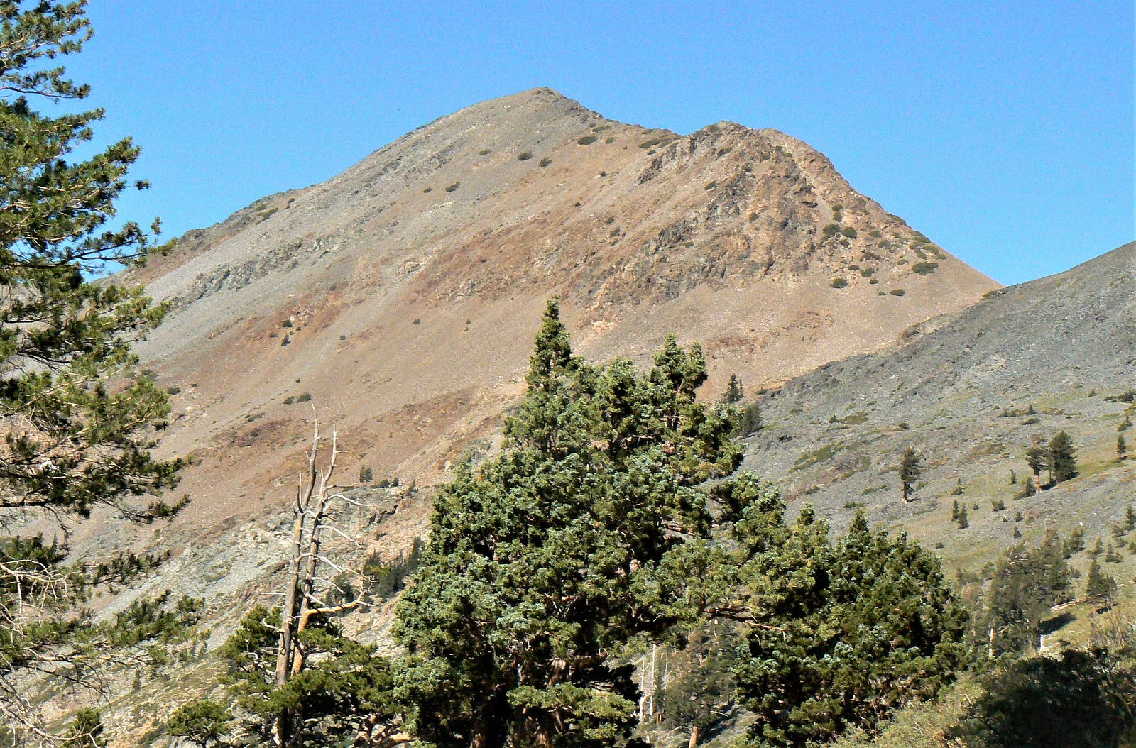
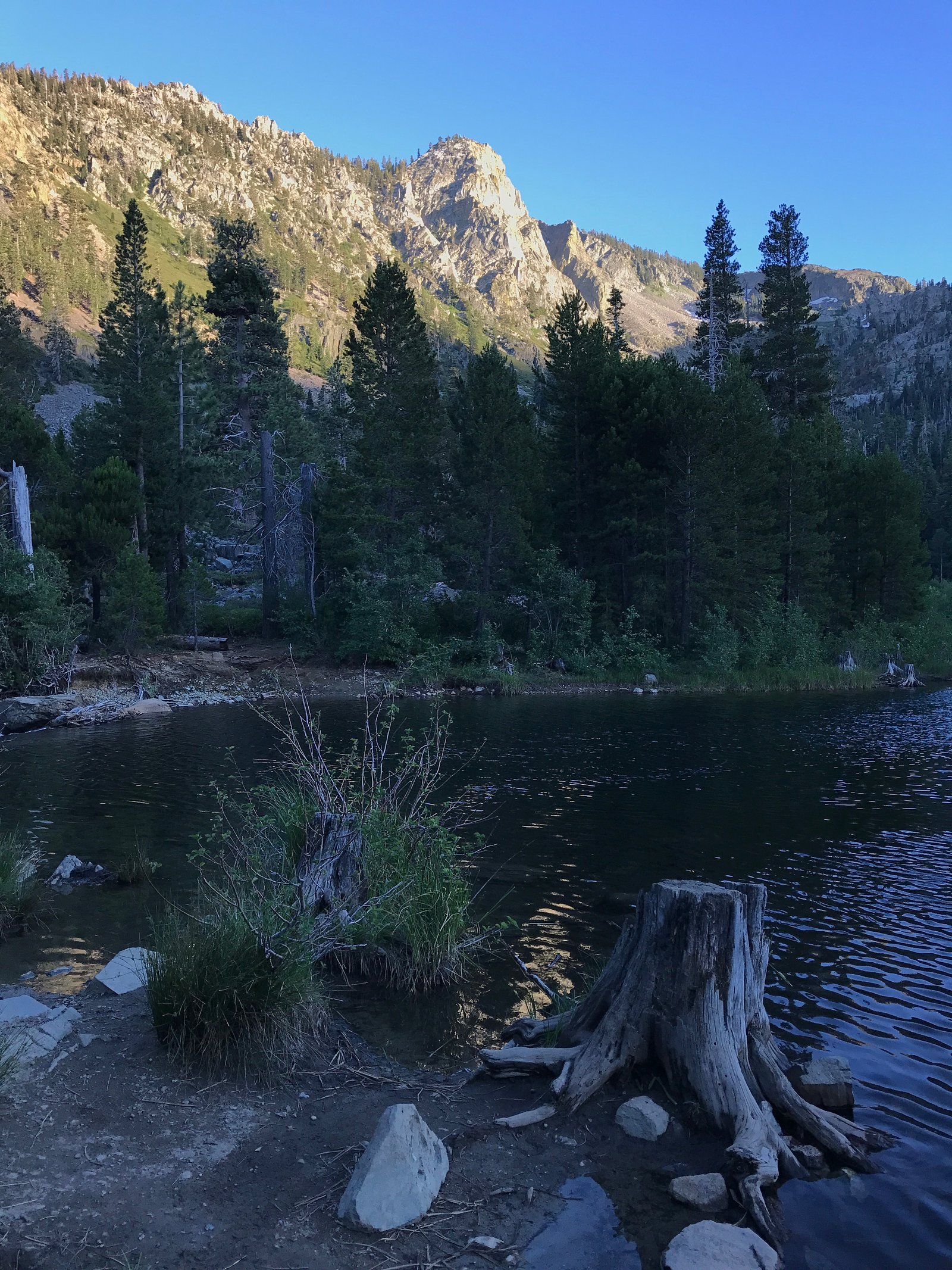
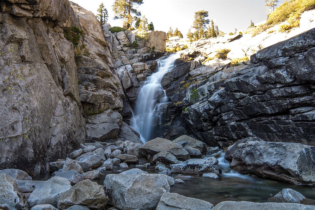
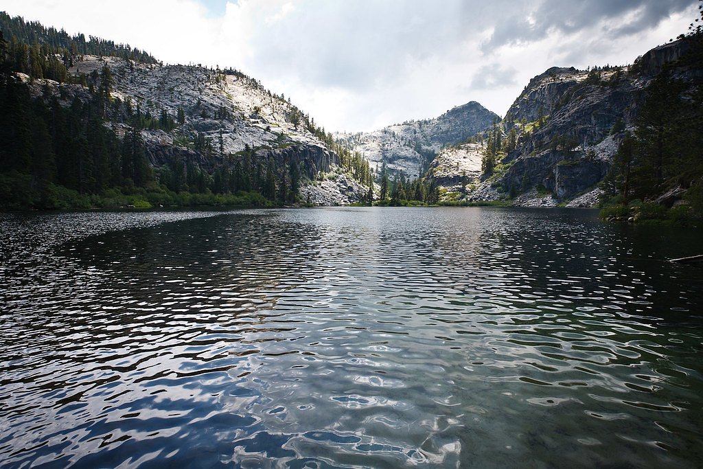
About Sawyier Falls
Sawyier Falls is a lesser-known waterfall in California that rewards visitors with a peaceful, picture-postcard setting away from busier trailheads. The approach is short but satisfying: the route to the falls is a moderately rated out-and-back hike of 2.4 miles with about 350 feet of elevation gain, making it a good half-day option for hikers who want a bit of climb without a full-day commitment. Facilities at the falls are minimal, but there is nearby overnight camping at Badgers Den campground within Camp Richardson Resort, roughly 7.69 km away, which makes for a convenient base if you want to turn the trip into an overnight outing. As always, check local trail reports before you go, bring layers and water, and plan for changing conditions on the approach.
Trail & Hike Details
The Approach
The moderate 2.4-mile out-and-back trail gains 350 feet of elevation on the way to the falls.
Trail Description
Length: 2.4 miles (out-and-back, total). Elevation gain: ~350 feet. Difficulty: Moderate. Trail type: out-and-back. No official USFS trail name or number, surface, grade, or trail class information was provided in the available data; visitors should consult local rangers or Camp Richardson Resort resources for current conditions and access details. Trail conditions can vary seasonally, so pack sturdy footwear and be prepared for uneven footing and variable footing underfoot.
What to Expect
Visitors can expect a peaceful natural setting with a waterfall that may vary in flow depending on the season. The area is likely to be less crowded compared to more popular waterfalls.
Accessibility
The trail is not wheelchair accessible. Uneven terrain and elevation changes require steady footing.
Frequently Asked Questions
🐶 Are Dogs Allowed at Sawyier Falls?
❌ Dogs are not allowed
Are There Any Fees or Permits Required?
🆖 No fees required
🏊 Is There Swimming at Sawyier Falls?
❌ Swimming is not allowed
When to Visit
Spring and early summer are typically the best times to visit, as the waterfall may have a stronger flow due to snowmelt or seasonal rains.
Seasonal Access
The best time to visit is Spring, Summer, and Fall. Access roads and trails may close during winter due to snow.
Safety Information
Trail conditions may vary, and the area may have uneven terrain or slippery rocks near the waterfall. Visitors should exercise caution and avoid visiting during heavy rains or storms.
Current Water Conditions
24 ft³/s
Current discharge — how much water is flowing
Lower than usual for this time of year
Based on 51 years of record
3.44 ft
Water depth at gauge
59°F
ColdBracing — limit time in water
7-Day Discharge Trend
What does this mean for your visit?
Flow is lower than usual for this time of year. Water temperature is a bracing 59 degrees F, limit your time in the water. Expect crystal clear visibility.
Water Quality
Water Clarity
Crystal clearExcellent visibility
About This Gauge
This gauge is on a nearby waterway and may not reflect exact conditions at the falls.
7-Day Flow Outlook
Based on the USGS gauge UPPER TRUCKEE RV AT SOUTH LAKE TAHOE, CA (10 km away).
Today
Low
25 cfs
4/10Tomorrow
Low
25 cfs
4/10Sun
Barely Flowing
19 cfs
5/10Mon
Barely Flowing
17 cfs
5/10Tue
Barely Flowing
16 cfs
5/10Wed
Barely Flowing
16 cfs
5/10Thu
Barely Flowing
14 cfs
5/10Best window: Sun — barely flowing flow, sunny (trip score 5/10).
Best time of year: this gauge typically runs highest from late March to late June, peaking in May.
How we calculate this
This is a transparent outlook, not a precise forecast. We take the waterfall's current flow strength (how it ranks against its historical normal for today, from the nearest USGS stream gauge), carry that ranking forward along the gauge's seasonal curve, and nudge it for forecast rain. Confidence is highest for the next day or two and falls further out. Always check official conditions and your own judgment before visiting — high flows can be dangerous.
Know when to go.
Get a free email alert when waterfalls near Meyers hit peak flow. We only send when conditions are worth the trip — no weekly newsletters, no spam.
Weather Forecast
Location & Access
Getting There
The exact location and directions to Sawyier Falls are not well-documented. Visitors are advised to consult local hiking resources or maps for guidance.
Get Directions on Google MapsParking
Parking availability is unclear. It is recommended to check with local authorities or trail resources before visiting.
Elevation
6,745 feet above sea level
Coordinates
38.877444° N, -120.091063° W
Visitor Tips & Gear
Bring a map or GPS device as the trail may not be well-marked. Wear sturdy footwear and carry plenty of water. Check weather conditions before heading out.
This trail sits at 6,745 ft above sea level
Elevated TrailUV radiation is roughly 27% stronger at this elevation than at sea level, and the dry air accelerates dehydration. Extra sun protection and fluids go a long way.
As an Amazon Associate, we earn from qualifying purchases.

Coppertone Sport SPF 50 Sunscreen
UV intensity jumps ~4% per 1,000 ft — at this elevation you can burn in half the time.

Sun Bum SPF 30 Lip Balm (3-Pack)
Lips have almost no natural UV protection and burn fast in thin, dry mountain air.

Liquid I.V. Electrolyte Packets
You lose moisture ~2x faster at elevation — electrolytes help you absorb water efficiently.

ROCKNIGHT Polarized UV400 Sunglasses
High-altitude glare off rock and water is intense — UV400 lenses block 99%+ of UVA/UVB.
As an Amazon Associate, we earn from qualifying purchases.
With 2.4 miles and 350 ft of elevation gain, sturdy boots and trekking poles will help on this moderate trail. Sun exposure on the trail makes good sun protection a must in summer.

Polarized Sunglasses (Knockaround)
Cuts glare off the water so you actually see the falls — and your photos turn out better too.

Columbia Watertight II Rain Jacket
Packs into its own pocket, seam-sealed, and keeps you dry from spray and surprise rain.

Earth Pak Waterproof Dry Bag
Keeps your phone and gear dry when waterfall mist soaks everything else.

Waterproof Phone Pouch (AiRunTech)
Cheap insurance — take photos right next to the falls without killing your phone.

Timberland Euro Sprint Mid Waterproof
Trusted waterproof boot with premium leather and grippy rubber sole — reliable on rocky, wet trails.

TrailBuddy Trekking Poles
Lightweight aluminum, cork grips, and flip-locks that actually hold — a best-seller for good reason.
Where to Stay

HiMark Hotel

Station House Inn South Lake Tahoe

Tahoe Lakeshore Lodge & Spa

Margaritaville Resort Lake Tahoe
Browse vacation cabins and private rentals nearby
Unique outdoor stays — tents, yurts, and treehouses
Rent a campervan or RV for your waterfall road trip
Some links are affiliate links. We may earn a commission at no extra cost to you.
Nearby Campground
Badgers Den at Camp Richardson Resort
4.8 miles away · 84 sites
Overview Badger’s Den Campground provides a Lake Tahoe and Camp Richardson Resort experience unlike any other. Featuring beach access, and all the amenities you can think of within walking distance, guests get to bask in the remarkable beauty of Tahoe without sacrificing the resort experience. The campground has 66 single standard tent sites and 18 standard double tent sites. Each campsite has a bear-proof food locker, picnic table, and fire pit with cooking grate. Tent camping only in this campg
Book on Recreation.govNearby Hot Springs
Hot springs near Meyers, California
Myers Warm Spring
Myers Warm Spring flows at 75°F (24°C) near South Lake Tahoe at an elevation of 7,615 feet—one of California's highest-elevatio...
Walleys Hot Springs
Walleys Hot Springs flows at 160°F in Douglas County at 4,690 feet elevation, positioned just 20 meters from the roadside near ...

Grovers Hot Springs
Grovers Hot Springs emerges at a powerful 147 degrees Fahrenheit in Toiyabe National Forest, displaying a remarkable 100-degree...
Grover Hot Springs State Park
Grover Hot Springs State Park operates a developed pool complex fed by natural thermal waters at 5,921 feet elevation in Dougla...

Brockway Hot Springs
Brockway Hot Springs surges at 131°F directly into Lake Tahoe's frigid waters at 6,337 feet elevation near Kings Beach. Located...
Hobo Hot Springs
Hobo Hot Springs flows at 114 degrees Fahrenheit on Stewart Community tribal land in Douglas County at 4,760 feet elevation, po...
Looking for a soak after your hike? Explore more hot springs near Meyers, California on SoakingSprings.
Explore California springsAdditional Information
Nearby Attractions
Nearby attractions are not well-documented. Visitors may explore other natural areas or trails in the region.
Wildlife
The area may feature typical California wildlife such as birds, deer, and small mammals. Be cautious of potential encounters with snakes or other wildlife.
Cities near Sawyier Falls
Nearby Waterfalls
Writing about Sawyier Falls? Embed this waterfall on your site for free.