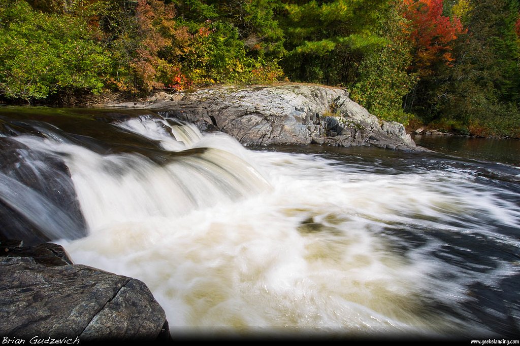
Sarampus Falls
By Armen Suny · Last verified May 2026
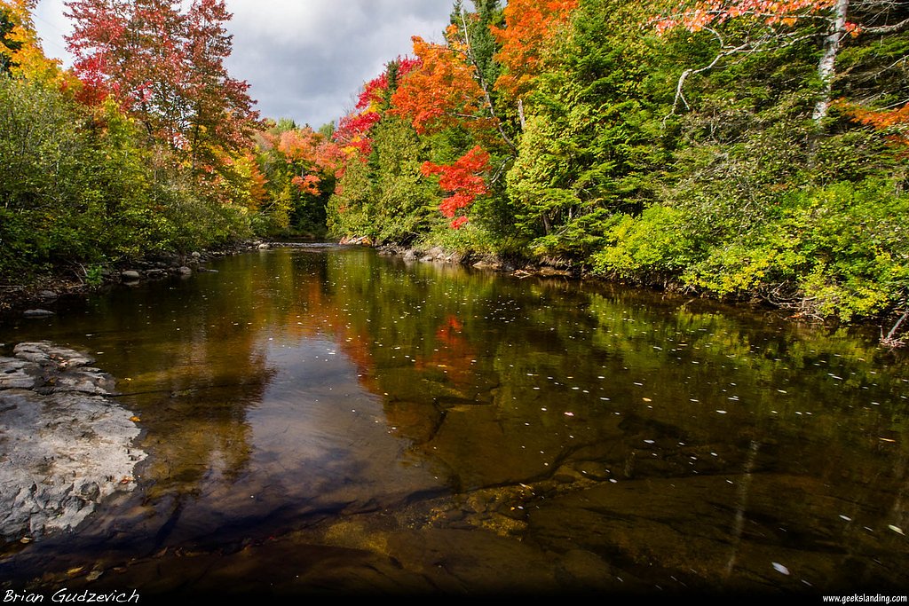

Photo Credits (3)
Difficulty
Moderate
Trail Length
2.4 miles
Trail Type
Out And Back
Elevation Gain
350 ft
About Sarampus Falls
Sarampus Falls is a scenic, forest-framed cascade in Maine that rewards visitors with a peaceful stretch of wilderness and a strong sense of remoteness. The falls sit within the Penobscot Off-Reservation Trust Land — a TRIBL-designated parcel owned by DESG and managed by TRIB — giving the site a protected, locally managed character that makes the approach feel quietly special. Expect classic northern New England woods, mossy rocks and the steady roar of falling water when you arrive. The most common approach is an out-and-back route of moderate challenge that climbs into the surrounding forest and opens to sweeping views of the falls. Because the site is managed as trust land, amenities are minimal, so plan for a rustic experience and leave no trace. The setting and short-but-meaningful hike make Sarampus Falls a great half-day outing for hikers who want a mix of solitude and scenic payoff.
The Setting
Sarampus Falls sits at 1,243 feet within Penobscot Off-Reservation Trust Land, fed by the Spencer Stream, in the foothills of Maine.
Trail & Hike Details
The Approach
The moderate 2.4-mile out-and-back trail gains 350 feet of elevation on the way to the falls.
Trail Description
This out-and-back route is 2.4 miles in length with approximately 350 feet of elevation gain and is rated moderate. The trail leads through wooded terrain to the waterfall and back, offering a steady climb but no technical obstacles noted in available data. Expect a mostly single-track path appropriate for hikers comfortable with moderate grades and uneven footing; there are no USFS trail surface/grade/class details provided for this route.
What to Expect
Dogs are welcome.
Accessibility
The trail is not wheelchair accessible. Uneven terrain and elevation changes require steady footing.
Frequently Asked Questions
🐶 Are Dogs Allowed at Sarampus Falls?
✅ Dogs are allowed
Are There Any Fees or Permits Required?
🆖 No fees required
🏊 Is There Swimming at Sarampus Falls?
❌ Swimming is not allowed
When to Visit
Spring and early summer are ideal for visiting Sarampus Falls, as water flow is typically higher due to snowmelt and rainfall.
Seasonal Access
The best time to visit is Spring, Summer, and Fall. Winter access may be limited.
Safety Information
Exercise caution near the water, as rocks can be slippery. During winter, ice may make the trail hazardous. Cell service may be limited in the area, so plan accordingly.
Current Water Conditions
Based on a USGS gauge 17.6 miles away
556 ft³/s
Current discharge — how much water is flowing
Higher than usual for this time of year
Based on 26 years of record
3.90 ft
Water depth at gauge
7-Day Discharge Trend
What does this mean for your visit?
The water is flowing higher than usual for this time of year.
About This Gauge
This gauge is on a regional waterway. Conditions at the falls may differ, especially after local rain.
7-Day Flow Outlook
Based on the USGS gauge Spencer Stream near Grand Falls, Maine (28 km away).
Today
Strong
634 cfs
7/10Tomorrow
Strong
786 cfs
7/10Mon
Moderate
1034 cfs
9/10Tue
Moderate
845 cfs
6/10Wed
Moderate
959 cfs
6/10Thu
Moderate
844 cfs
6/10Fri
Moderate
717 cfs
6/10Best window: Mon — moderate flow, sunny (trip score 9/10).
Best time of year: this gauge typically runs highest from late March to mid June, peaking in April.
How we calculate this
This is a transparent outlook, not a precise forecast. We take the waterfall's current flow strength (how it ranks against its historical normal for today, from the nearest USGS stream gauge), carry that ranking forward along the gauge's seasonal curve, and nudge it for forecast rain. Confidence is highest for the next day or two and falls further out. Always check official conditions and your own judgment before visiting — high flows can be dangerous.
Know when to go.
Get a free email alert when waterfalls near Rangeley hit peak flow. We only send when conditions are worth the trip — no weekly newsletters, no spam.
Weather Forecast
Location & Access
Getting There
Sarampus Falls is located near the town of Sebec in Piscataquis County, Maine. Access is typically via local roads, and visitors should consult maps or GPS for precise directions as signage may be limited.
Get Directions on Google MapsParking
Parking is available near the falls, but it may be limited and unpaved. Visitors should prepare for potentially uneven or natural parking areas.
Elevation
1,243 feet above sea level
Coordinates
45.301718° N, -70.603680° W
Land Management
Managed by TRIB
Visitor Tips & Gear
Wear sturdy footwear as the trail may be uneven or muddy, especially after rain. Bring insect repellent during warmer months, and check weather conditions before visiting.
As an Amazon Associate, we earn from qualifying purchases.
With 2.4 miles and 350 ft of elevation gain, sturdy boots and trekking poles will help on this moderate trail. Sun exposure on the trail makes good sun protection a must in summer.

Polarized Sunglasses (Knockaround)
Cuts glare off the water so you actually see the falls — and your photos turn out better too.

Columbia Watertight II Rain Jacket
Packs into its own pocket, seam-sealed, and keeps you dry from spray and surprise rain.

Earth Pak Waterproof Dry Bag
Keeps your phone and gear dry when waterfall mist soaks everything else.

Waterproof Phone Pouch (AiRunTech)
Cheap insurance — take photos right next to the falls without killing your phone.

Timberland Euro Sprint Mid Waterproof
Trusted waterproof boot with premium leather and grippy rubber sole — reliable on rocky, wet trails.

TrailBuddy Trekking Poles
Lightweight aluminum, cork grips, and flip-locks that actually hold — a best-seller for good reason.
Where to Stay

LE JAZZ- Chalet rustique/chic avec SPA

Havre De Paix

Hotel Motel Arnold

Cozy Chalet with Breathtaking Mountain View
Browse vacation cabins and private rentals nearby
Unique outdoor stays — tents, yurts, and treehouses
Rent a campervan or RV for your waterfall road trip
Some links are affiliate links. We may earn a commission at no extra cost to you.
Additional Information
Nearby Attractions
Sebec Lake and Peaks-Kenny State Park are nearby and offer additional recreational opportunities such as hiking, boating, and picnicking.
Wildlife
The area is home to various bird species, deer, and other forest wildlife. Visitors may also spot fish in the river.
Cities near Sarampus Falls
Nearby Waterfalls
Writing about Sarampus Falls? Embed this waterfall on your site for free.