Salmon Falls (historical)
By Armen Suny · Last verified Mar 2026
Difficulty
Moderate
Trail Length
2.4 miles
Trail Type
Out And Back
Elevation Gain
350 ft
About Salmon Falls (historical)
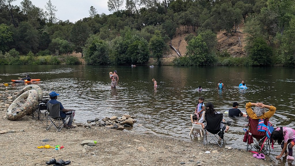
Salmon Falls (historical) in California refers to a site along the South Fork of the American River, which was once a prominent location during the Gold Rush era. The original waterfall was submerged following the construction of the Folsom Dam and the creation of Folsom Lake. Today, the area is known for its historical significance and recreational opportunities near the lake.
The Setting
Salmon Falls (historical) sits at 430 feet within Folsom Lake, in the coastal lowlands of California.
Trail & Hike Details
The Approach
The moderate 2.4-mile out-and-back trail gains 350 feet of elevation on the way to the falls.
Trail Description
The area around Salmon Falls offers access to several trails, including portions of the South Fork American River Trail. These trails provide scenic views of the river, rolling hills, and remnants of historical sites. The terrain includes dirt paths, rocky sections, and occasional steep inclines.
What to Expect
Dogs are welcome.
Accessibility
The trail is not wheelchair accessible. Uneven terrain and elevation changes require steady footing.
Frequently Asked Questions
🐶 Are Dogs Allowed at Salmon Falls (historical)?
✅ Dogs are allowed
Are There Any Fees or Permits Required?
🤑 Fee: $0.00
🏊 Is There Swimming at Salmon Falls (historical)?
❌ Swimming is not allowed
When to Visit
Spring and fall are ideal for visiting due to mild weather and vibrant scenery. Summer can be hot, but the proximity to Folsom Lake offers opportunities for water-based activities.
Seasonal Access
The best time to visit is Spring, Summer, Fall, and Winter.
Safety Information
Be cautious of poison oak, rattlesnakes, and uneven trail surfaces. During summer, high temperatures can lead to dehydration, so carry sufficient water. Avoid swimming in the river due to strong currents.
Current Water Conditions
3,970 ft³/s
Current discharge — how much water is flowing
About average for this time of year
Based on 70 years of record
7.83 ft
Water depth at gauge
60°F
ColdBracing — limit time in water
7-Day Discharge Trend
What does this mean for your visit?
Flow is about average for this time of year. Water temperature is a bracing 60 degrees F, limit your time in the water.
About This Gauge
This gauge is on a nearby waterway and may not reflect exact conditions at the falls.
7-Day Flow Outlook
Based on the USGS gauge AMERICAN R A FAIR OAKS CA (19 km away).
Today
Strong
4288 cfs
8/10Tomorrow
Strong
4274 cfs
10/10Sun
Strong
4109 cfs
10/10Mon
Strong
4098 cfs
10/10Tue
Strong
4144 cfs
10/10Wed
Strong
4156 cfs
10/10Thu
Strong
4167 cfs
10/10Best window: Tomorrow — strong flow, partly sunny (trip score 10/10).
Best time of year: this gauge typically runs highest from mid June to early August, peaking in March.
How we calculate this
This is a transparent outlook, not a precise forecast. We take the waterfall's current flow strength (how it ranks against its historical normal for today, from the nearest USGS stream gauge), carry that ranking forward along the gauge's seasonal curve, and nudge it for forecast rain. Confidence is highest for the next day or two and falls further out. Always check official conditions and your own judgment before visiting — high flows can be dangerous.
Know when to go.
Get a free email alert when waterfalls near Granite Bay hit peak flow. We only send when conditions are worth the trip — no weekly newsletters, no spam.
Weather Forecast
Location & Access
Getting There
Salmon Falls is located near the Salmon Falls Bridge, which crosses the South Fork of the American River in El Dorado County, California. The area is accessible via Salmon Falls Road, approximately 10 miles north of El Dorado Hills.
Get Directions on Google MapsParking
Parking is available near the Salmon Falls Bridge, with some designated areas for visitors. However, parking may be limited during peak seasons.
Elevation
430 feet above sea level
Coordinates
38.759068° N, -121.069945° W
Land Management
Managed by USBR
Visitor Tips & Gear
Arrive early to secure parking, especially on weekends or during peak seasons. Bring plenty of water and wear sturdy footwear, as some trails can be rocky or uneven. Be mindful of poison oak and wildlife in the area.
As an Amazon Associate, we earn from qualifying purchases.
With 2.4 miles and 350 ft of elevation gain, sturdy boots and trekking poles will help on this moderate trail. Icy conditions are common in winter — traction cleats are a smart addition.

Columbia Watertight II Rain Jacket
Packs into its own pocket, seam-sealed, and keeps you dry from spray and surprise rain.

Polarized Sunglasses (Knockaround)
Cuts glare off the water so you actually see the falls — and your photos turn out better too.

Earth Pak Waterproof Dry Bag
Keeps your phone and gear dry when waterfall mist soaks everything else.

Waterproof Phone Pouch (AiRunTech)
Cheap insurance — take photos right next to the falls without killing your phone.

Timberland Euro Sprint Mid Waterproof
Trusted waterproof boot with premium leather and grippy rubber sole — reliable on rocky, wet trails.

TrailBuddy Trekking Poles
Lightweight aluminum, cork grips, and flip-locks that actually hold — a best-seller for good reason.
Where to Stay

Holiday Inn Express Hotel & Suites Lincoln-Roseville Area by IHG

Comfort Inn & Suites Rocklin - Roseville

Holiday Inn Express Hotel & Suites El Dorado Hills by IHG

Courtyard by Marriott Roseville Galleria Mall/Creekside Ridge Drive
Browse vacation cabins and private rentals nearby
Unique outdoor stays — tents, yurts, and treehouses
Rent a campervan or RV for your waterfall road trip
Some links are affiliate links. We may earn a commission at no extra cost to you.
Nearby Campground
Dru Barner Campground
20.8 miles away · 0 sites
The campground is ideal for equestrian use, with four water troughs, several pull through spaces, and access to trails. The park provides day-use facilities for staging nonmotorized trails recreation.Location: 7.5 miles east of Georgetown on Wentworth Springs Road (Forest Road 1), then 1 mile north east on Forest Road 13N16 and 0.5 miles northwest on Forest Road 13N58.Dru Barner Recreation Opportunity Guide (ROG) - This guide contain information, maps, and directions to assist you in enjoying you
Book on Recreation.govNearby Hot Springs
Hot springs near Granite Bay, California
Looking for a soak after your hike? Explore more hot springs near Granite Bay, California on SoakingSprings.
Explore California springsAdditional Information
Nearby Attractions
Folsom Lake State Recreation Area, El Dorado Hills, and the historic town of Coloma.
Wildlife
The area is home to deer, wild turkeys, various bird species, and occasional sightings of coyotes or bobcats.
Cities near Salmon Falls (historical)
Writing about Salmon Falls (historical)? Embed this waterfall on your site for free.