
Photo Credits (5)
Difficulty
Moderate
Trail Length
3.0 miles
Trail Type
Out And Back
Elevation Gain
450 ft
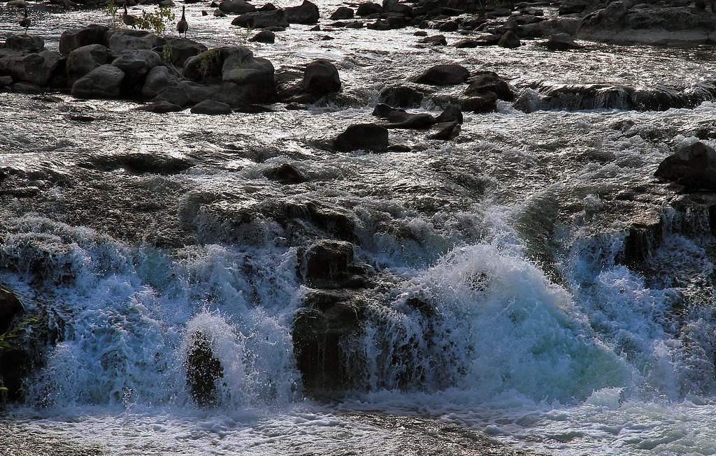
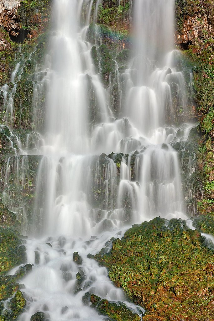
About Rush Falls
Tucked into Idaho’s Payette National Forest and managed by the US Forest Service, Rush Falls is a lesser-known cascade that rewards hikers with a quiet, forested setting and close-up views of tumbling water framed by lush vegetation. The waterfall is accessed via the USFS Rush Creek Trail (Trail #262), making it a great choice for those seeking a peaceful outing away from busier recreation sites. The approach is pleasantly straightforward but still feels like an adventure: the route to Rush Falls is typically hiked as an approximately 3.0-mile out-and-back with about 450 feet of elevation gain. The USFS GIS records the Rush Creek Trail at 2.69 miles (Trail #262). The trail’s native-material tread and Class 3 designation mean the route can be more rugged than a paved path, so come prepared with sturdy footwear. If you want to camp nearby, Buck Park Cabin is the closest campground-style option at roughly 8.05 km from the falls.
The Setting
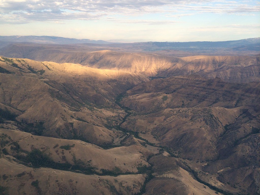
Rush Falls sits at 6,079 feet within Payette National Forest, fed by the Weiser River, in the high mountains of Idaho.
Trail & Hike Details
The Approach
The moderate hike follows Rush Creek (#262), a 3.0-mile out-and-back trail over natural surface. Expect 450 feet of elevation gain. The trail is developed (Class 3).
USFS Trail
RUSH CREEK #262
Trail Class
Developed
Surface
USFS Segment
2.69 miTrail Description
Rush Creek (USFS Trail #262) — Payette National Forest. Surface: native material. USFS trail class: 3. USFS GIS length: 2.69 miles; commonly described hiking distance: ~3.0 miles (out-and-back). Elevation gain: ~450 feet. Difficulty: moderate. This out-and-back Forest Service trail follows native tread through forested terrain to the Rush Falls area. The Class 3 rating and native-material surface reflect a trail that can be uneven and more rugged in places, so expect natural footing rather than a developed paved or graveled grade. Nearest managed camping is Buck Park Cabin, about 8.05 km away.
What to Expect
Visitors can expect a tranquil environment with natural beauty. The waterfall may vary in flow depending on the season, with spring and early summer likely offering the most impressive views.
Accessibility
The trail is not wheelchair accessible. Uneven terrain and elevation changes require steady footing.
Frequently Asked Questions
🐶 Are Dogs Allowed at Rush Falls?
❌ Dogs are not allowed
Are There Any Fees or Permits Required?
🆖 No fees required
🏊 Is There Swimming at Rush Falls?
❌ Swimming is not allowed
When to Visit
Spring and early summer are typically the best times to visit, as the waterfall is likely to have the highest flow during these seasons.
Seasonal Access
The best time to visit is Spring, Summer, and Fall. Access roads and trails may close during winter due to snow. Check with Payette National Forest for seasonal road closures.
Safety Information
Visitors should be cautious of slippery rocks near the waterfall and be prepared for uneven or unmarked trails. Always inform someone of your plans before venturing into remote areas.
Current Water Conditions
170 ft³/s
Current discharge — how much water is flowing
Lower than usual for this time of year
Based on 87 years of record
3.31 ft
Water depth at gauge
7-Day Discharge Trend
What does this mean for your visit?
Flow is lower than usual for this time of year.
About This Gauge
This gauge is on a nearby waterway and may not reflect exact conditions at the falls.
7-Day Flow Outlook
Based on the USGS gauge WEISER RIVER NR CAMBRIDGE ID (16 km away).
Today
Roaring
184 cfs
6/10Tomorrow
Roaring
180 cfs
6/10Tue
Roaring
159 cfs
9/10Wed
Strong
137 cfs
10/10Thu
Roaring
139 cfs
6/10Fri
Roaring
124 cfs
9/10Sat
Strong
119 cfs
10/10Best window: Wed — strong flow, sunny (trip score 10/10).
Best time of year: this gauge typically runs highest from mid March to mid June, peaking in May.
How we calculate this
This is a transparent outlook, not a precise forecast. We take the waterfall's current flow strength (how it ranks against its historical normal for today, from the nearest USGS stream gauge), carry that ranking forward along the gauge's seasonal curve, and nudge it for forecast rain. Confidence is highest for the next day or two and falls further out. Always check official conditions and your own judgment before visiting — high flows can be dangerous.
Know when to go.
Get a free email alert when waterfalls near Cambridge hit peak flow. We only send when conditions are worth the trip — no weekly newsletters, no spam.
Weather Forecast
Location & Access
Getting There
Specific directions to Rush Falls are not widely documented. Visitors are advised to consult local maps or contact nearby ranger stations for guidance.
Get Directions on Google MapsParking
Parking availability near Rush Falls is unclear. Visitors should prepare for limited or informal parking options.
Elevation
6,079 feet above sea level
Coordinates
44.719327° N, -116.689880° W
Land Management
Managed by USFS
Visitor Tips & Gear
Check weather conditions before visiting, as trails may become muddy or slippery. Bring a map or GPS device, as the area may lack clear signage.
This trail sits at 6,079 ft above sea level
Elevated TrailUV radiation is roughly 24% stronger at this elevation than at sea level, and the dry air accelerates dehydration. Extra sun protection and fluids go a long way.
As an Amazon Associate, we earn from qualifying purchases.

Coppertone Sport SPF 50 Sunscreen
UV intensity jumps ~4% per 1,000 ft — at this elevation you can burn in half the time.

Sun Bum SPF 30 Lip Balm (3-Pack)
Lips have almost no natural UV protection and burn fast in thin, dry mountain air.

Liquid I.V. Electrolyte Packets
You lose moisture ~2x faster at elevation — electrolytes help you absorb water efficiently.

ROCKNIGHT Polarized UV400 Sunglasses
High-altitude glare off rock and water is intense — UV400 lenses block 99%+ of UVA/UVB.
As an Amazon Associate, we earn from qualifying purchases.
With 3.0 miles and 450 ft of elevation gain, sturdy boots and trekking poles will help on this moderate trail. Sun exposure on the trail makes good sun protection a must in summer.

Polarized Sunglasses (Knockaround)
Cuts glare off the water so you actually see the falls — and your photos turn out better too.

Columbia Watertight II Rain Jacket
Packs into its own pocket, seam-sealed, and keeps you dry from spray and surprise rain.

Earth Pak Waterproof Dry Bag
Keeps your phone and gear dry when waterfall mist soaks everything else.

Waterproof Phone Pouch (AiRunTech)
Cheap insurance — take photos right next to the falls without killing your phone.

Timberland Euro Sprint Mid Waterproof
Trusted waterproof boot with premium leather and grippy rubber sole — reliable on rocky, wet trails.

TrailBuddy Trekking Poles
Lightweight aluminum, cork grips, and flip-locks that actually hold — a best-seller for good reason.
Where to Stay

Alpine Lodge Hotel

Hotel NoBo Cascade, Tapestry Collection by Hilton

Cozy Cabin in McCall

Ponderosa
Browse vacation cabins and private rentals nearby
Unique outdoor stays — tents, yurts, and treehouses
Rent a campervan or RV for your waterfall road trip
Some links are affiliate links. We may earn a commission at no extra cost to you.
Nearby Campground
BUCK PARK CABIN
5 miles away · 1 sites
Overview Buck Park Cabin is located on Cuddy Mountain, in the Payette National Forest of central Idaho. Guests enjoy the remote area for its hunting opportunities and abundance of hiking, biking, horseback riding and off-road vehicle trails. The cabin sits at an elevation of 7,280 feet within Buck Park, a scenic meadow surrounded by a dense conifer forest. Rush Lake, Hornet and Lower Hornet reservoirs are nearby. This very rustic cabin can accommodate a maximum of three people. Metal cots are pro
Book on Recreation.govNearby Hot Springs
Hot springs near Cambridge, Idaho
Lakey Hot Spring
Lakey Hot Spring discharges at 158 degrees Fahrenheit in Adams County, making it one of western Idaho's hottest thermal feature...
Fairchild Hot Spring
Fairchild Hot Spring rises at 126 degrees F near the town of Weiser in Washington County, sitting at just 2,700 feet elevation,...
Keithly Warm Spring
Keithly Warm Spring surfaces at a mild 86 degrees Fahrenheit near Weiser in Washington County, right off the road at 2,560 feet...
Starkey Hot Springs
Starkey Hot Springs delivers 131-degree water at just 3,290 feet elevation in Adams County, one of the lower-elevation thermal ...
Council Mtn Hot Springs
Council Mountain Hot Springs surfaces at 154 degrees Fahrenheit in Payette National Forest, running a full 109 degrees above th...
White Licks Hot Spring
White Licks Hot Spring produces 140°F water with exceptionally high mineral content: sodium at 420 mg/L, sulfate at 660 mg/L, a...
Looking for a soak after your hike? Explore more hot springs near Cambridge, Idaho on SoakingSprings.
Explore Idaho springsAdditional Information
Nearby Attractions
Nearby attractions may include other natural landmarks or hiking trails in the surrounding Idaho wilderness.
Wildlife
The area around Rush Falls may host a variety of wildlife, including birds, deer, and small mammals. Visitors should be cautious of potential encounters with bears or other large animals.
Cities near Rush Falls
Nearby Waterfalls
Writing about Rush Falls? Embed this waterfall on your site for free.