
Photo Credits (5)
Difficulty
Moderate
Trail Length
2.4 miles
Trail Type
Out And Back
Elevation Gain
350 ft
About Rocky Falls
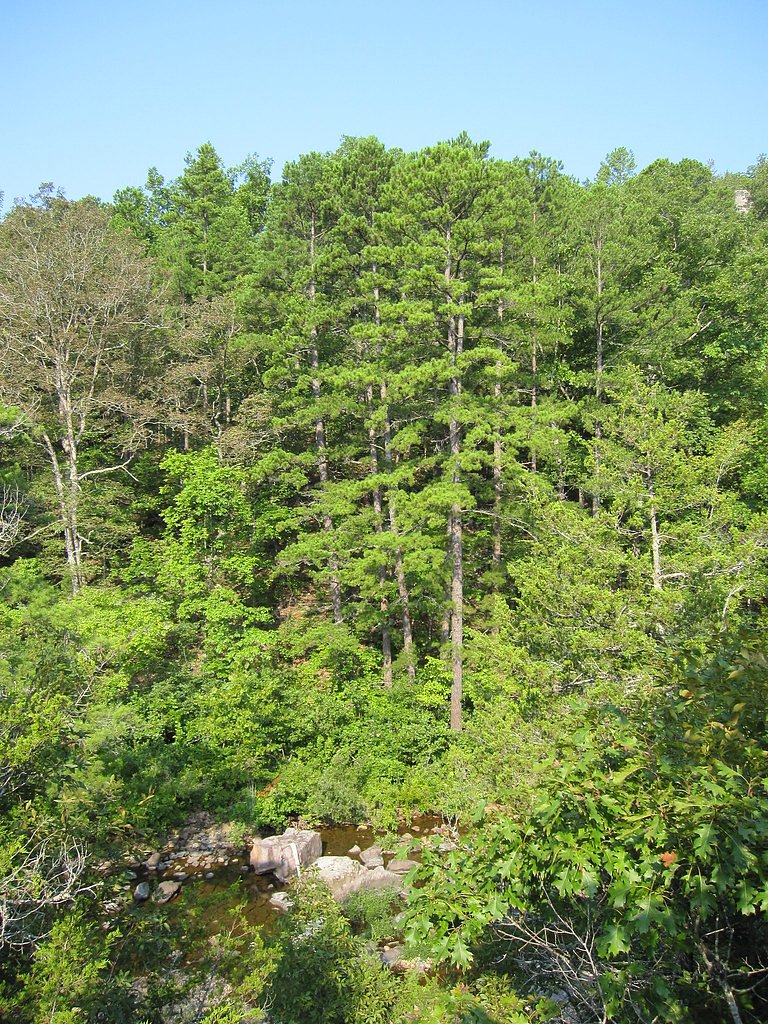
Rocky Falls is a picturesque cascading waterfall located in the Ozark National Scenic Riverways in Missouri. It is part of Rocky Creek, which flows over rhyolite rock formations, creating a stunning natural feature. The area is popular for picnicking, photography, and enjoying the serene surroundings.
The Setting
Rocky Falls sits at 758 feet within Ozark National Scenic Riverways, fed by the Jacks Fork, in the foothills of Missouri.
Trail & Hike Details
The Approach
The moderate 2.4-mile out-and-back trail gains 350 feet of elevation on the way to the falls.
Trail Description
The trail to Rocky Falls is very short and easy, making it accessible for most visitors. It leads directly from the parking area to the base of the falls, with minimal elevation gain. The path is well-maintained and suitable for families and individuals of all fitness levels.
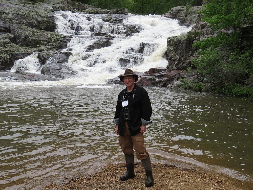
What to Expect
Swimming is permitted. Dogs are welcome.
Accessibility
The trail is not wheelchair accessible. Uneven terrain and elevation changes require steady footing.
Frequently Asked Questions
🐶 Are Dogs Allowed at Rocky Falls?
✅ Dogs are allowed
Are There Any Fees or Permits Required?
🆖 No fees required
🏊 Is There Swimming at Rocky Falls?
✅ Swimming is allowed
When to Visit
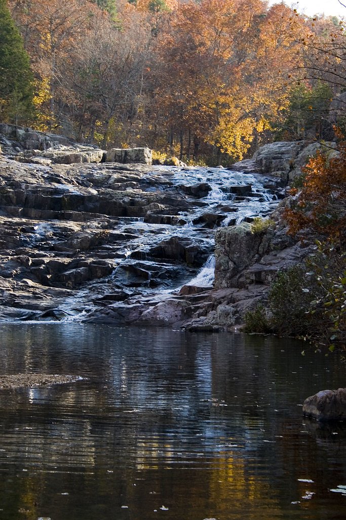
Spring and early summer are the best times to visit, as the water flow is typically stronger due to seasonal rains. Fall offers beautiful foliage, while summer is great for wading and cooling off.
Seasonal Access
The best time to visit is Spring, Summer, and Fall. Winter access may be limited. Check the National Park Service website for current conditions.
Safety Information
The rocks around the falls can be slippery, so wear appropriate footwear and exercise caution. Be mindful of water levels, especially after heavy rains, as the creek may flow more rapidly. Always supervise children near the water.
Current Water Conditions
306 ft³/s
Current discharge — how much water is flowing
About average for this time of year
Based on 104 years of record
2.28 ft
Water depth at gauge
7-Day Discharge Trend
What does this mean for your visit?
Flow is about average for this time of year.
About This Gauge
This gauge is on a nearby waterway and may not reflect exact conditions at the falls.
7-Day Flow Outlook
Based on the USGS gauge Jacks Fork at Eminence, MO (15 km away).
Today
Strong
349 cfs
7/10Tomorrow
Strong
310 cfs
10/10Mon
Moderate
275 cfs
9/10Tue
Moderate
264 cfs
9/10Wed
Moderate
262 cfs
9/10Thu
Strong
291 cfs
7/10Fri
Roaring
307 cfs
6/10Best window: Tomorrow — strong flow, sunny (trip score 10/10).
Best time of year: this gauge typically runs highest from early March to late May, peaking in May.
How we calculate this
This is a transparent outlook, not a precise forecast. We take the waterfall's current flow strength (how it ranks against its historical normal for today, from the nearest USGS stream gauge), carry that ranking forward along the gauge's seasonal curve, and nudge it for forecast rain. Confidence is highest for the next day or two and falls further out. Always check official conditions and your own judgment before visiting — high flows can be dangerous.
Know when to go.
Get a free email alert when waterfalls near Eminence hit peak flow. We only send when conditions are worth the trip — no weekly newsletters, no spam.
Weather Forecast
Location & Access
Getting There
Rocky Falls is located near Eminence, Missouri, and can be accessed via Highway 106 and Shannon County Road NN-522. The falls are part of the Ozark National Scenic Riverways and are well-marked with signs leading to the parking area.
Get Directions on Google MapsParking
There is a small parking area near the falls, which provides easy access to the site. Parking is free but may be limited during peak seasons.
Elevation
758 feet above sea level
Coordinates
37.093383° N, -91.209575° W
Land Management
Managed by NPS
Visitor Tips & Gear
Arrive early during weekends or holidays to secure parking, as the area can get busy. Bring water shoes if you plan to wade in the creek, as the rocks can be slippery. Pack a picnic to enjoy the scenic surroundings.
As an Amazon Associate, we earn from qualifying purchases.
With 2.4 miles and 350 ft of elevation gain, sturdy boots and trekking poles will help on this moderate trail. Sun exposure on the trail makes good sun protection a must in summer.
America the Beautiful Annual Pass
Covers entrance fees at 2,000+ federal recreation sites — required at most National Parks.

Polarized Sunglasses (Knockaround)
Cuts glare off the water so you actually see the falls — and your photos turn out better too.

Columbia Watertight II Rain Jacket
Packs into its own pocket, seam-sealed, and keeps you dry from spray and surprise rain.

Earth Pak Waterproof Dry Bag
Keeps your phone and gear dry when waterfall mist soaks everything else.

Waterproof Phone Pouch (AiRunTech)
Cheap insurance — take photos right next to the falls without killing your phone.

Timberland Euro Sprint Mid Waterproof
Trusted waterproof boot with premium leather and grippy rubber sole — reliable on rocky, wet trails.

TrailBuddy Trekking Poles
Lightweight aluminum, cork grips, and flip-locks that actually hold — a best-seller for good reason.
Where to Stay

Secluded Ranch House Cabin in Eminence Ozarks

Secluded Ozarks Cabin in the woods Eminence MO

Montauk Pines

Honeysuckle Inn
Browse vacation cabins and private rentals nearby
Unique outdoor stays — tents, yurts, and treehouses
Rent a campervan or RV for your waterfall road trip
Some links are affiliate links. We may earn a commission at no extra cost to you.
Nearby Campground
TWO RIVERS
8 miles away · 22 sites
Overview In the rolling, forested landscape of Two Rivers, two of America's most beautiful spring-fed rivers combine to make up the Ozark National Scenic Riverways.As the first national park area to protect a wild river system, visitors have plenty of scenic water activities to enjoy as well as hiking, horseback riding and wildlife viewing. Recreation The crystal clear Current River flows past the campground, offering excellent canoeing, tubing, swimming, and fishing. Jacks Fork meets the Current
Book on Recreation.govNearby Hot Springs
Hot springs near Eminence, Missouri
Looking for a soak after your hike? Explore more hot springs near Eminence, Missouri on SoakingSprings.
Explore Missouri springsAdditional Information
Nearby Attractions
Nearby attractions include Alley Spring and Mill, Blue Spring, and the Current River, all of which are part of the Ozark National Scenic Riverways.
Wildlife
The area is home to a variety of wildlife, including birds, deer, and small mammals. Visitors may also see fish and aquatic life in the creek.
Cities near Rocky Falls
Other waterfalls named Rocky Falls
2 other waterfalls share this name across the U.S.
Writing about Rocky Falls? Embed this waterfall on your site for free.