Difficulty
Moderate
Trail Length
2.0 miles
Trail Type
Out And Back
Elevation Gain
300 ft
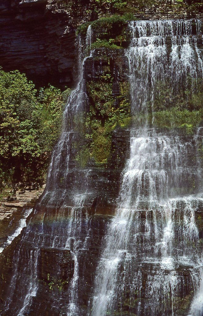
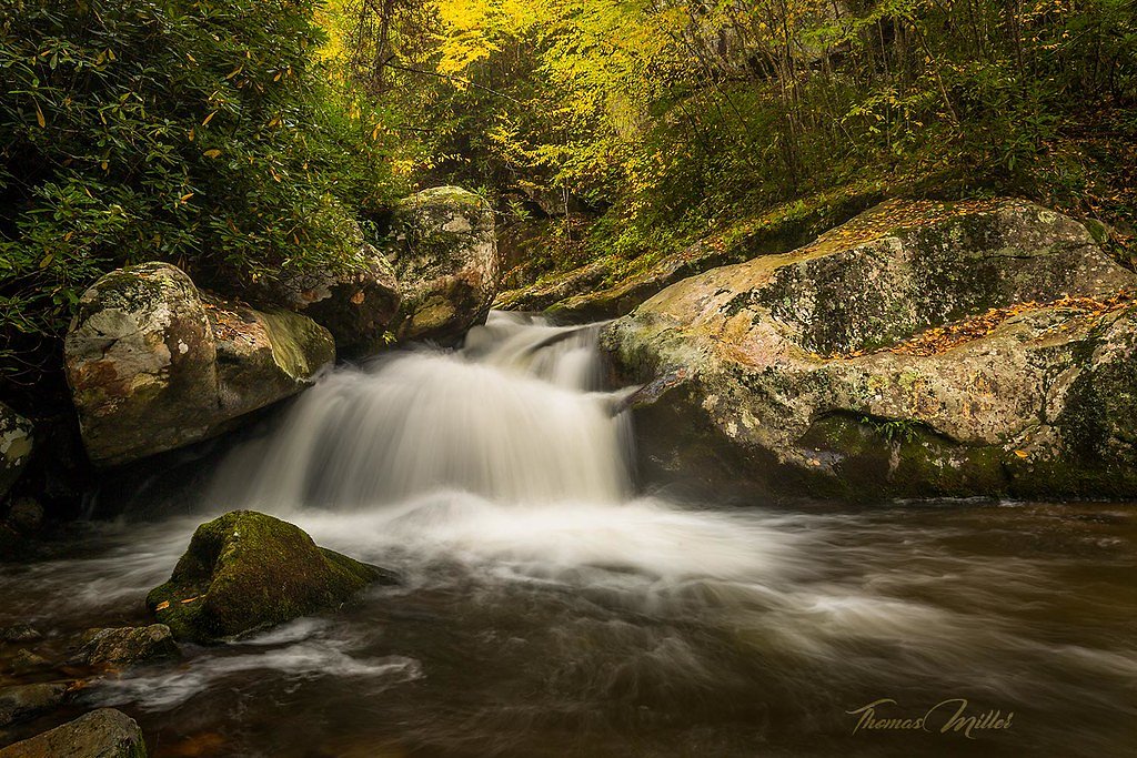
About Rockstack Falls
Tucked into Tennessee’s quiet woodlands, Rockstack Falls is a lesser-known cascade that offers a peaceful escape for hikers and photographers. The falls are best reached via a roughly 2.0-mile out-and-back hike that gains about 300 feet—an accessible, moderate outing that rewards you with shady forest, the sound of tumbling water, and a sense of solitude away from busier parks. The approach winds through dense, leafy forest and opens intermittently to rocky ledges and the waterfall’s viewing spots. Expect uneven surfaces and moderate inclines along the route, so plan on sturdy footwear and bringing water. Camping is not immediate to the falls (the nearest mapped campground, Chickamauga Battlefield Group Campground, lies about 29.7 km away), so this is best enjoyed as a day trip or with plans to overnight elsewhere.
Nearby Falls Worth Visiting
Falling Water Falls (110 ft) lies 0.9 miles to the east.
Trail & Hike Details
The Approach
The moderate 2.0-mile out and back trail gains 300 feet of elevation on the way to the falls.
Trail Description
Trail type: out-and-back. Length: ~2.0 miles round-trip with approximately 300 feet of elevation gain. Difficulty: Moderate. Surface and grade: natural forest trail with rocky, uneven sections and occasional steeper pitches—expect shaded singletrack wooded sections and short rock steps near the creek crossings. Trail class: non-technical hiking; no special equipment required beyond appropriate footwear and basic trail gear. Trail conditions can be slick when wet, so use caution on exposed rock and near the falls.
What to Expect
Visitors can expect a tranquil hike through a wooded area leading to a cascading waterfall. The area around the falls may be slippery, so caution is advised. The waterfall is most impressive after rainfall, but the trail may also be muddy during these times.
Accessibility
The trail is not wheelchair accessible. Uneven terrain and elevation changes require steady footing.
Frequently Asked Questions
🐶 Are Dogs Allowed at Rockstack Falls?
❌ Dogs are not allowed
Are There Any Fees or Permits Required?
🆖 No fees required
🏊 Is There Swimming at Rockstack Falls?
❌ Swimming is not allowed
When to Visit
Spring and early summer are ideal times to visit, as the waterfall flow is typically strongest during these seasons. Fall offers beautiful foliage, while winter may provide a quieter experience, though trail conditions could be icy.
Seasonal Access
The best time to visit is Spring, Summer, and Fall. Winter access may be limited.
Safety Information
The trail may be slippery, especially after rain. Visitors should wear appropriate footwear and exercise caution near the waterfall. Always stay on marked trails and avoid climbing on wet rocks.
Current Water Conditions
0 ft³/s
Current discharge — how much water is flowing
About average for this time of year
Based on 10 years of record
2.35 ft
Water depth at gauge
7-Day Discharge Trend
What does this mean for your visit?
Flow is about average for this time of year.
About This Gauge
7-Day Flow Outlook
Based on the USGS gauge NORTH CHICKAMAUGA CR AT MILE STRAIGHT, TN (8 km away).
Today
Low
0 cfs
3/10Tomorrow
Low
0 cfs
3/10Tue
Low
0 cfs
3/10Wed
Low
0 cfs
3/10Thu
Low
2 cfs
3/10Fri
Low
2 cfs
3/10Sat
Low
2 cfs
3/10Best window: Today — low flow, mostly sunny then chance showers and thunderstorms (trip score 3/10).
Best time of year: this gauge typically runs highest from mid February to early March, peaking in January.
How we calculate this
This is a transparent outlook, not a precise forecast. We take the waterfall's current flow strength (how it ranks against its historical normal for today, from the nearest USGS stream gauge), carry that ranking forward along the gauge's seasonal curve, and nudge it for forecast rain. Confidence is highest for the next day or two and falls further out. Always check official conditions and your own judgment before visiting — high flows can be dangerous.
Know when to go.
Get a free email alert when waterfalls near Falling Water hit peak flow. We only send when conditions are worth the trip — no weekly newsletters, no spam.
Weather Forecast
Location & Access
Getting There
Rockstack Falls is located in Tennessee, but specific directions to the trailhead may vary depending on the starting point. Visitors are encouraged to use GPS or consult local hiking resources for the most accurate route.
Get Directions on Google MapsParking
Parking availability is unclear, but visitors should expect limited parking near the trailhead. It is recommended to arrive early, especially during peak seasons.
Hours
Elevation
1,490 feet above sea level
Coordinates
35.193652° N, -85.297652° W
Visitor Tips & Gear
Start your hike early to avoid crowds and ensure you have enough daylight for the return trip. Bring plenty of water and wear sturdy hiking shoes. Check weather conditions before your visit, as the trail can become slippery after rain.
As an Amazon Associate, we earn from qualifying purchases.
With 2.0 miles and 300 ft of elevation gain, sturdy boots and trekking poles will help on this moderate trail. Sun exposure on the trail makes good sun protection a must in summer.

Columbia Watertight II Rain Jacket
Packs into its own pocket, seam-sealed, and keeps you dry from spray and surprise rain.

Earth Pak Waterproof Dry Bag
Keeps your phone and gear dry when waterfall mist soaks everything else.

Waterproof Phone Pouch (AiRunTech)
Cheap insurance — take photos right next to the falls without killing your phone.

Timberland Euro Sprint Mid Waterproof
Trusted waterproof boot with premium leather and grippy rubber sole — reliable on rocky, wet trails.

TrailBuddy Trekking Poles
Lightweight aluminum, cork grips, and flip-locks that actually hold — a best-seller for good reason.

Polarized Sunglasses (Knockaround)
Cuts glare off the water so you actually see the falls — and your photos turn out better too.
Where to Stay

TownePlace Suites by Marriott Hixson

Holiday Inn Express & Suites Chattanooga-Hixson by IHG

The Hotel Chalet at The Choo Choo

La Quinta Inn & Suites by Wyndham Chattanooga Downtown/South
Browse vacation cabins and private rentals nearby
Unique outdoor stays — tents, yurts, and treehouses
Rent a campervan or RV for your waterfall road trip
Some links are affiliate links. We may earn a commission at no extra cost to you.
Nearby Campground
Chickamauga Battlefield Group Campground
18.4 miles away · 9 sites
Overview THIS IS NOT A PUBLIC CAMPGROUND. SCOUTS AND CIVIC ORGANIZATIONS ONLY. These sites are for overnight camping by organized non-profit (501c) youth groups (scouts, church youth groups) under adult supervision for the purpose of education of the historic resources of the battlefield. Due to limited space and facilities, camping for solely recreational purposes is not allowed. Groups must choose sites according to the size of their group. Recreation Hiking, biking, and horseback riding are p
Book on Recreation.govAdditional Information
Nearby Attractions
Nearby attractions may include other hiking trails and natural landmarks in the area. Visitors should research local points of interest for additional activities.
Wildlife
The area is home to a variety of wildlife, including birds, deer, and small mammals. Visitors should be mindful of their surroundings and avoid disturbing the natural habitat.
Cities near Rockstack Falls
Nearby Waterfalls
Writing about Rockstack Falls? Embed this waterfall on your site for free.