Roaring River Falls
By Armen Suny · Last verified Mar 2026
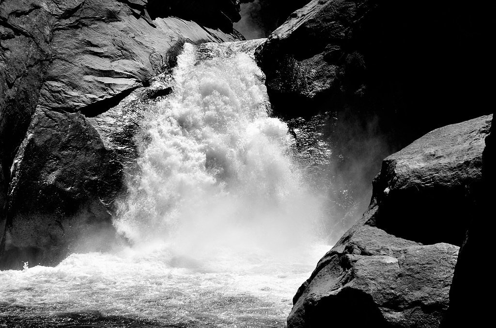
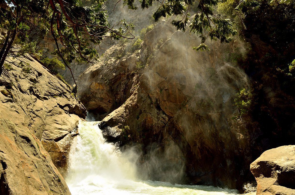
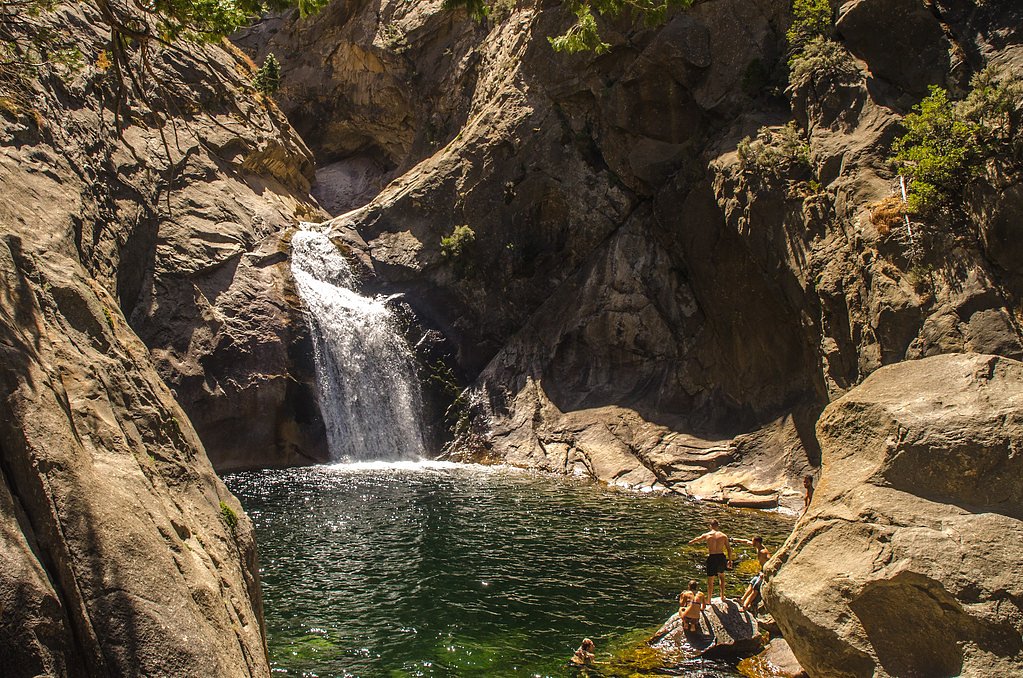
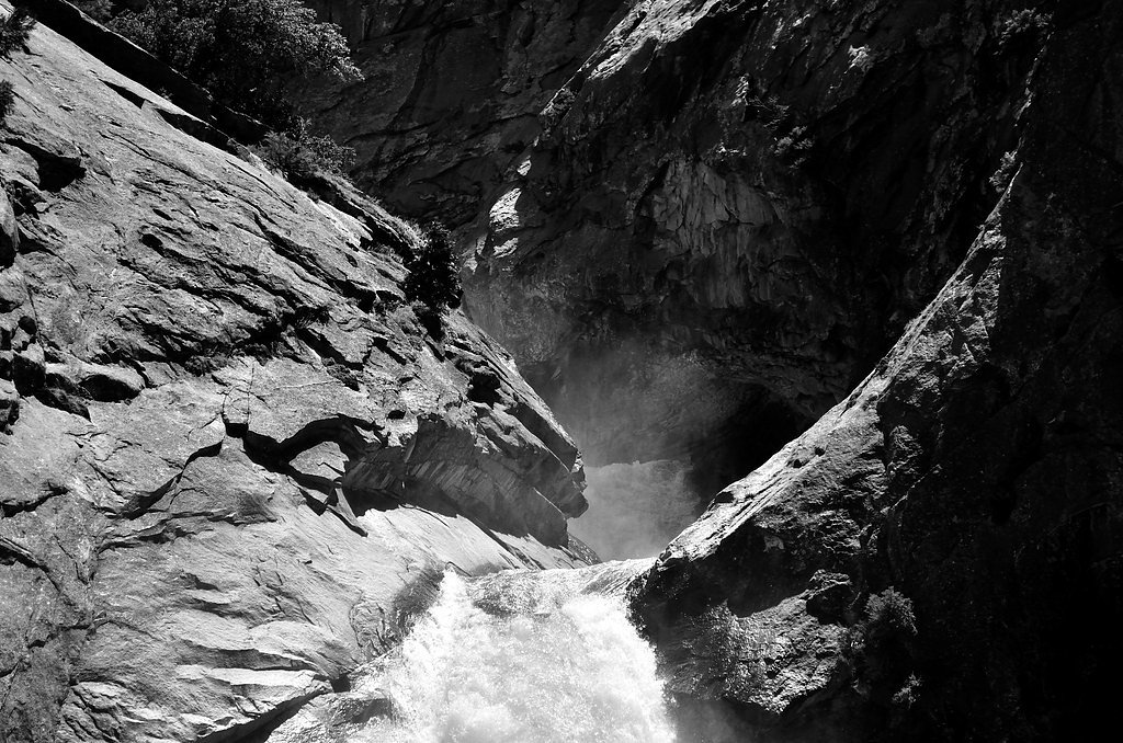

Photo Credits (5)
Difficulty
Moderate
Trail Length
2.4 miles
Trail Type
Out And Back
Elevation Gain
350 ft
About Roaring River Falls
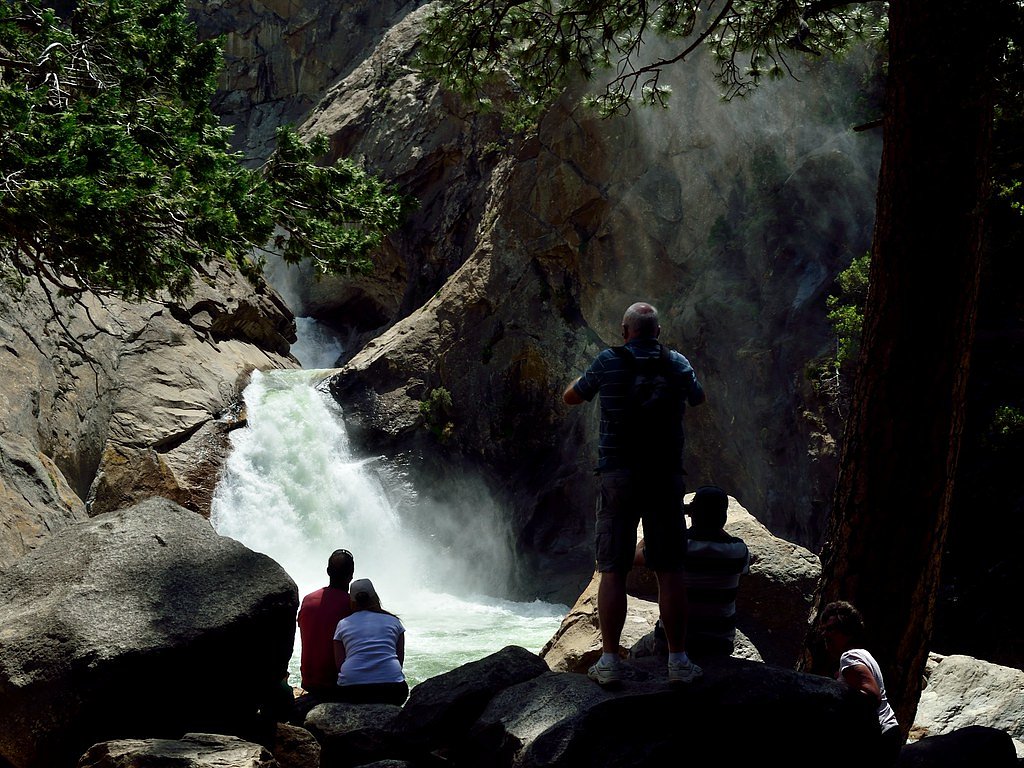
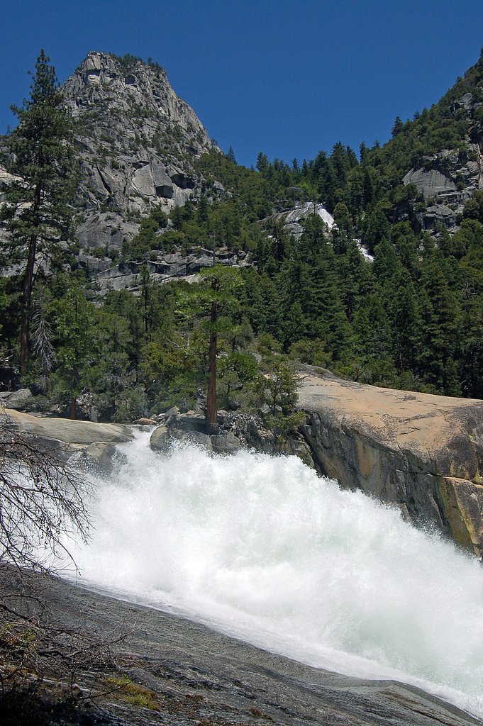
Roaring River Falls is a picturesque waterfall located in Kings Canyon National Park, California. It is known for its powerful flow, especially during the spring and early summer when snowmelt feeds the river. The waterfall is easily accessible and surrounded by granite cliffs and lush vegetation, making it a popular stop for visitors to the park.
The Setting
Roaring River Falls sits at 5,085 feet within Kings Canyon National Park, fed by the Marble Fork Kaweah R, in the high mountains of California.
Trail & Hike Details
The Approach
The moderate 2.4-mile out-and-back trail gains 350 feet of elevation on the way to the falls.
Trail Description
The trail to Roaring River Falls is a short, paved path that is suitable for most visitors, including those with mobility challenges. It leads directly to a viewing area where you can enjoy the waterfall up close.
What to Expect
Visitors can expect a short and easy walk to a stunning waterfall surrounded by granite cliffs. The falls are particularly impressive in spring and early summer when the water flow is at its peak. The area is serene and offers opportunities for photography and relaxation.
Accessibility
The trail is not wheelchair accessible. Uneven terrain and elevation changes require steady footing.
Frequently Asked Questions
🐶 Are Dogs Allowed at Roaring River Falls?
❌ Dogs are not allowed
Are There Any Fees or Permits Required?
🤑 Fee: $35.00
🏊 Is There Swimming at Roaring River Falls?
❌ Swimming is not allowed
When to Visit
The best time to visit Roaring River Falls is in the spring or early summer when the snowmelt creates a powerful flow. Fall is also a good time to visit for fewer crowds and cooler weather.
Seasonal Access
The best time to visit is Spring, Summer, and Fall. Access roads and trails may close during winter due to snow. Check the National Park Service website for current conditions.
Safety Information
Be cautious near the water, as the current is strong and the rocks can be slippery. Always stay on designated trails and viewing areas. Watch for wildlife and follow park guidelines to ensure your safety.
Current Water Conditions
9 ft³/s
Current discharge — how much water is flowing
About average for this time of year
Based on 12 years of record
7.23 ft
Water depth at gauge
57°F
ColdBracing — limit time in water
7-Day Discharge Trend
What does this mean for your visit?
Flow is about average for this time of year. Water temperature is a bracing 57 degrees F, limit your time in the water.
About This Gauge
This gauge is on a nearby waterway and may not reflect exact conditions at the falls.
7-Day Flow Outlook
Based on the USGS gauge MARBLE FORK KAWEAH R AB HORSE C NR LODGEPOLE CA (20 km away).
Today
Barely Flowing
9 cfs
5/10Tomorrow
Barely Flowing
9 cfs
5/10Mon
Barely Flowing
8 cfs
5/10Tue
Barely Flowing
7 cfs
5/10Wed
Barely Flowing
6 cfs
5/10Thu
Barely Flowing
8 cfs
5/10Fri
Barely Flowing
7 cfs
5/10Best window: Today — barely flowing flow, sunny (trip score 5/10).
Best time of year: this gauge typically runs highest from late March to late June, peaking in June.
How we calculate this
This is a transparent outlook, not a precise forecast. We take the waterfall's current flow strength (how it ranks against its historical normal for today, from the nearest USGS stream gauge), carry that ranking forward along the gauge's seasonal curve, and nudge it for forecast rain. Confidence is highest for the next day or two and falls further out. Always check official conditions and your own judgment before visiting — high flows can be dangerous.
Know when to go.
Get a free email alert when waterfalls near Wilsonia hit peak flow. We only send when conditions are worth the trip — no weekly newsletters, no spam.
Weather Forecast
Location & Access
Getting There
Roaring River Falls is located off Highway 180 in Kings Canyon National Park. From the Cedar Grove Visitor Center, it is a short drive east to the parking area for the falls.
Get Directions on Google MapsParking
There is a designated parking area near the trailhead for Roaring River Falls. Parking is typically available, but it may fill up during peak seasons.
Elevation
5,085 feet above sea level
Coordinates
36.780496° N, -118.620933° W
Land Management
Managed by NPS
Visitor Tips & Gear
Visit early in the day to avoid crowds, especially during the summer months. Bring water and wear comfortable walking shoes. Be cautious near the water, as the current is strong and the rocks can be slippery.
As an Amazon Associate, we earn from qualifying purchases.
With 2.4 miles and 350 ft of elevation gain, sturdy boots and trekking poles will help on this moderate trail. Sun exposure on the trail makes good sun protection a must in summer.
America the Beautiful Annual Pass
Covers entrance fees at 2,000+ federal recreation sites — required at most National Parks.

Polarized Sunglasses (Knockaround)
Cuts glare off the water so you actually see the falls — and your photos turn out better too.

Columbia Watertight II Rain Jacket
Packs into its own pocket, seam-sealed, and keeps you dry from spray and surprise rain.

Earth Pak Waterproof Dry Bag
Keeps your phone and gear dry when waterfall mist soaks everything else.

Waterproof Phone Pouch (AiRunTech)
Cheap insurance — take photos right next to the falls without killing your phone.

Timberland Euro Sprint Mid Waterproof
Trusted waterproof boot with premium leather and grippy rubber sole — reliable on rocky, wet trails.

TrailBuddy Trekking Poles
Lightweight aluminum, cork grips, and flip-locks that actually hold — a best-seller for good reason.
Where to Stay

Montecito Sequoia Lodge

Sequoia Resort

Big Woods Retreat

Cozy Cottage
Browse vacation cabins and private rentals nearby
Unique outdoor stays — tents, yurts, and treehouses
Rent a campervan or RV for your waterfall road trip
Some links are affiliate links. We may earn a commission at no extra cost to you.
Nearby Campground
Sheep Creek Campground
2.2 miles away · 111 sites
Overview Sheep Creek Campground in Cedar Grove is nestled in the stunning Kings Canyon, one of the deepest canyons in the United States. With the sound of the Kings River, and glowing mountainsides just beyond the trees, Sheep Creek Campground is a wonderful place for families to spend time in the great outdoors. Recreation Cedar Grove provides a plethora of hiking trails, from the hiking newcomer to the avid backpacker, and everyone in between. Day hikers can hike to Mist Falls, Cedar Grove Over
Book on Recreation.govNearby Hot Springs
Hot springs near Wilsonia, California
Kern Hot Spring
Kern Hot Spring emerges at 109°F in Sequoia National Park at 6,908 feet elevation, accessible only via backcountry hiking. Prot...

Blaney Meadows Hot Springs
Blaney Meadows Hot Springs emerges at 109 degrees Fahrenheit from the Sierra National Forest at 7,676 feet elevation, deliverin...
Keough Hot Springs
Keough Hot Springs emerges at 124°F in the Owens Valley near Bishop, situated just seven miles south along US Highway 395. The ...

Little Hunter Canyon Springs
Little Hunter Canyon Springs emerges at just 81°F in the arid Inyo County desert near Lone Pine. This warm spring produces wate...

Lower Warm Springs
Lower Warm Springs discharges at 110°F in Death Valley National Park, accessible only via a challenging 5.9-mile backcountry ro...
Palm Spring
Palm Spring, locally known as Wizard Pool, flows at 120 degrees Fahrenheit deep within Death Valley National Park, creating a 4...
Looking for a soak after your hike? Explore more hot springs near Wilsonia, California on SoakingSprings.
Explore California springsAdditional Information
Nearby Attractions
Nearby attractions include Zumwalt Meadow, Mist Falls, and the Cedar Grove Visitor Center.
Wildlife
Wildlife in the area may include deer, black bears, and various bird species. Always maintain a safe distance from animals and store food properly to avoid attracting wildlife.
Cities near Roaring River Falls
Nearby Waterfalls
Writing about Roaring River Falls? Embed this waterfall on your site for free.