Photo Credits (5)
Difficulty
Moderate
Trail Length
2.4 miles
Trail Type
Out And Back
Elevation Gain
350 ft
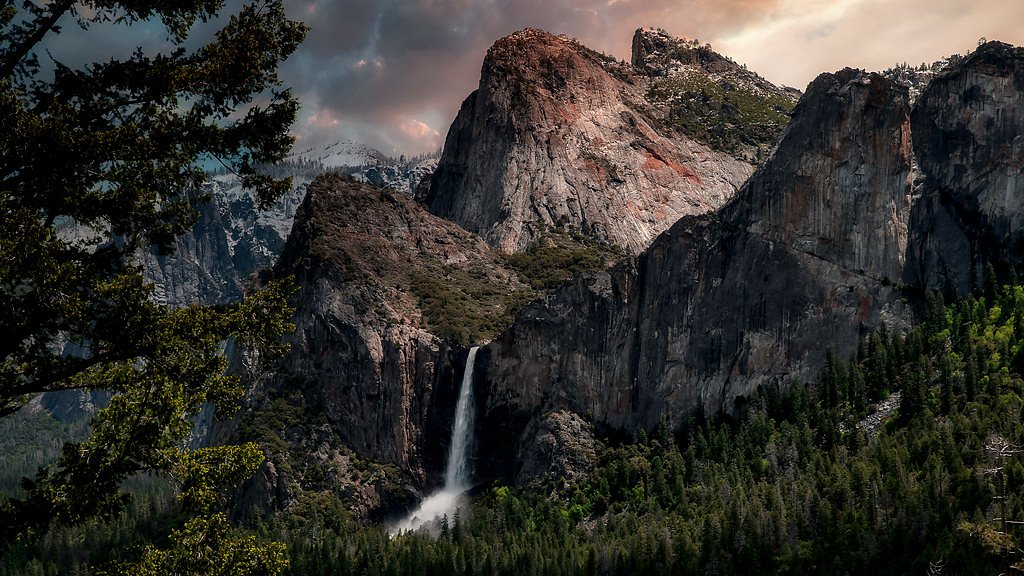
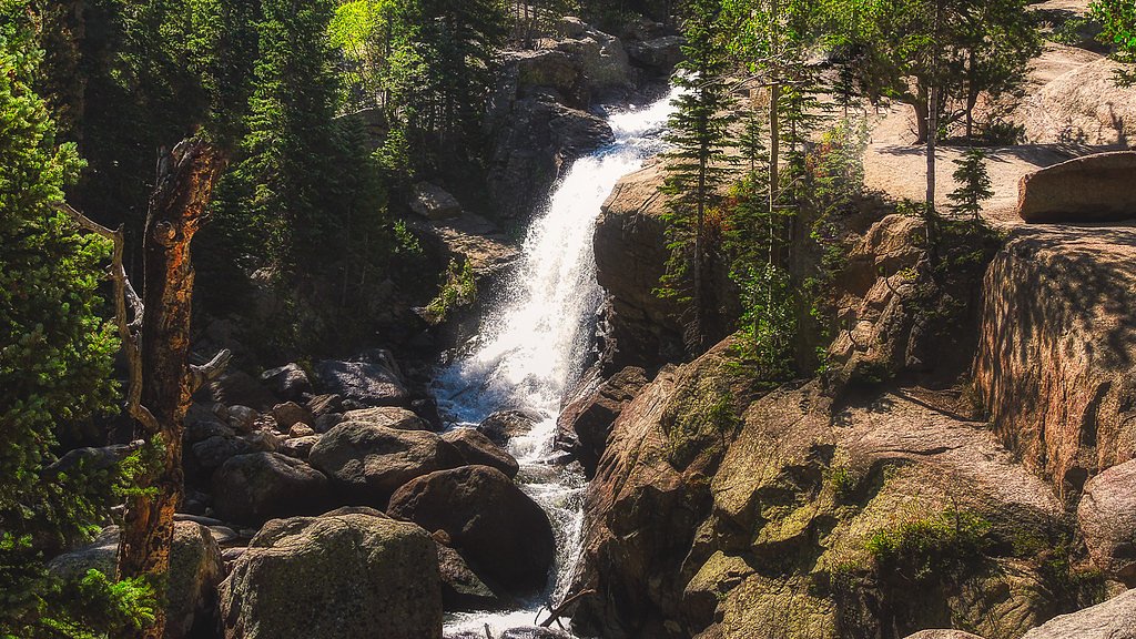
About Red Falls
Red Falls is a picturesque Colorado cascade framed by warm-hued red rock and a serene, natural setting that draws hikers and photographers alike. The contrast between the water and the surrounding stone makes for memorable views and a peaceful escape from busier trailheads. Reaching the falls involves a moderate hike: the route is a 2.4-mile out-and-back with about 350 feet of elevation gain. The hike is short enough for a half-day outing but offers enough ups and downs to feel like an adventure, making Red Falls a rewarding destination for those looking for a scenic, moderately paced trek.
The Setting
Red Falls sits at 8,812 feet along the San Juan River, in the high alpine of Colorado.
Trail & Hike Details
The Approach
The moderate 2.4-mile out-and-back trail gains 350 feet of elevation on the way to the falls.
Trail Description
Trail to Red Falls: a 2.4-mile out-and-back route with approximately 350 feet of elevation gain and a moderate difficulty rating. Available sources do not document an official USFS trail name/number, surface type, grade, or trail class for this route; hikers should expect typical natural-trail conditions and come prepared for uneven footing and moderate climbs. The trail follows the same route out and back.
What to Expect
Visitors can expect a scenic waterfall surrounded by red rock formations. The area may be remote and less crowded, offering a peaceful experience.
Accessibility
The trail is not wheelchair accessible. Uneven terrain and elevation changes require steady footing.
Frequently Asked Questions
🐶 Are Dogs Allowed at Red Falls?
❌ Dogs are not allowed
Are There Any Fees or Permits Required?
🆖 No fees required
🏊 Is There Swimming at Red Falls?
❌ Swimming is not allowed
When to Visit
Spring and summer are typically the best times to visit, as the waterfall may have higher flow due to snowmelt. Fall offers beautiful foliage, while winter conditions may make access more challenging.
Seasonal Access
The best time to visit is Spring, Summer, and Fall. Access roads and trails may close during winter due to snow.
Safety Information
The trail may involve rugged terrain and potential hazards such as loose rocks or slippery surfaces near the waterfall. Visitors should exercise caution and avoid visiting during severe weather.
Current Water Conditions
Based on a USGS gauge 19.3 miles away
36 ft³/s
Current discharge — how much water is flowing
Much lower than usual for this time of year
Based on 90 years of record
4.02 ft
Water depth at gauge
7-Day Discharge Trend
What does this mean for your visit?
Flow is well below normal for this time of year, so the waterfall may be a trickle.
About This Gauge
This gauge is on a regional waterway. Conditions at the falls may differ, especially after local rain.
7-Day Flow Outlook
Based on the USGS gauge SAN JUAN RIVER AT PAGOSA SPRINGS, CO (31 km away).
Today
Low
34 cfs
3/10Tomorrow
Barely Flowing
31 cfs
5/10Sun
Barely Flowing
26 cfs
5/10Mon
Barely Flowing
23 cfs
5/10Tue
Barely Flowing
21 cfs
5/10Wed
Barely Flowing
23 cfs
5/10Thu
Barely Flowing
22 cfs
5/10Best window: Tomorrow — barely flowing flow, sunny (trip score 5/10).
Best time of year: this gauge typically runs highest from early April to early July, peaking in June.
How we calculate this
This is a transparent outlook, not a precise forecast. We take the waterfall's current flow strength (how it ranks against its historical normal for today, from the nearest USGS stream gauge), carry that ranking forward along the gauge's seasonal curve, and nudge it for forecast rain. Confidence is highest for the next day or two and falls further out. Always check official conditions and your own judgment before visiting — high flows can be dangerous.
Know when to go.
Get a free email alert when waterfalls near Chama hit peak flow. We only send when conditions are worth the trip — no weekly newsletters, no spam.
Weather Forecast
Location & Access
Getting There
The exact location of Red Falls is not widely documented, but it is believed to be accessible via a trail in a remote area of Colorado. Visitors should consult local hiking resources or park services for precise directions.
Get Directions on Google MapsParking
Parking availability is unclear. Visitors may need to park at a nearby trailhead or designated area.
Elevation
8,812 feet above sea level
Coordinates
37.178619° N, -106.676701° W
Visitor Tips & Gear
Check local weather conditions before visiting. Bring sufficient water, wear sturdy footwear, and be prepared for potential changes in trail conditions.
This trail sits at 8,812 ft — the air is noticeably thinner
High AltitudeSome visitors experience headaches, fatigue, or shortness of breath at this elevation. Take it slow, stay hydrated, and consider supplemental oxygen if you're coming from a lower altitude.
As an Amazon Associate, we earn from qualifying purchases.

Coppertone Sport SPF 50 Sunscreen
UV intensity jumps ~4% per 1,000 ft — at this elevation you can burn in half the time.

Sun Bum SPF 30 Lip Balm (3-Pack)
Lips have almost no natural UV protection and burn fast in thin, dry mountain air.

Liquid I.V. Electrolyte Packets
You lose moisture ~2x faster at elevation — electrolytes help you absorb water efficiently.

ROCKNIGHT Polarized UV400 Sunglasses
High-altitude glare off rock and water is intense — UV400 lenses block 99%+ of UVA/UVB.

Boost Oxygen 10L Canister (2-Pack)
Portable supplemental oxygen for quick relief from headaches and shortness of breath.

Altitude Rx OxyBoost Complex
Antioxidant formula designed to support your body's natural altitude acclimation.
As an Amazon Associate, we earn from qualifying purchases.
With 2.4 miles and 350 ft of elevation gain, sturdy boots and trekking poles will help on this moderate trail. Sun exposure on the trail makes good sun protection a must in summer.

Polarized Sunglasses (Knockaround)
Cuts glare off the water so you actually see the falls — and your photos turn out better too.

Columbia Watertight II Rain Jacket
Packs into its own pocket, seam-sealed, and keeps you dry from spray and surprise rain.

Earth Pak Waterproof Dry Bag
Keeps your phone and gear dry when waterfall mist soaks everything else.

Waterproof Phone Pouch (AiRunTech)
Cheap insurance — take photos right next to the falls without killing your phone.

Timberland Euro Sprint Mid Waterproof
Trusted waterproof boot with premium leather and grippy rubber sole — reliable on rocky, wet trails.

TrailBuddy Trekking Poles
Lightweight aluminum, cork grips, and flip-locks that actually hold — a best-seller for good reason.
Where to Stay

Western Skies

Owl's Nest

Elktrace Bed and Breakfast

TALISMAN AMAZING VIEWS Walk to Uptown Sleeps 4
Browse vacation cabins and private rentals nearby
Unique outdoor stays — tents, yurts, and treehouses
Rent a campervan or RV for your waterfall road trip
Some links are affiliate links. We may earn a commission at no extra cost to you.
Nearby Campground
BLANCO RIVER GROUP CAMPGROUND
11.6 miles away · 1 sites
Overview Blanco River Group Campground is located four miles off U.S. Highway 84, on Forest Road 656. It is about 15 miles southeast of Pagosa Springs, on the Blanco River. The campground is a convenient stopping point between the towns of Chama, N.M., and Pagosa Springs, Colo. Secluded and quiet, the campgound is an ideal place for family and friends to gather. Recreation The Blanco River can be accessed from the campground, offering good fishing. Anglers cast for stocked trout on the lightly fi
Book on Recreation.govNearby Hot Springs
Hot springs near Chama, Colorado
Stinking Springs
Stinking Springs earned its name from hydrogen sulfide gas discharged with the water, creating a distinctive smell at this 81-d...

Pagosa Springs
Pagosa Springs (known as The Mother Spring) flows at 136°F in Archuleta County as the primary emergence point for the geotherma...
Pagosa Hot Springs
Pagosa Hot Springs holds local lore as the world's deepest known geothermal spring system, with thermal water emerging near roa...
Rainbow Hot Springs
Rainbow Hot Springs beckons adventurous soakers willing to undertake a substantial backcountry journey in the San Juan Mountain...
Hotz Spring
Hotz Spring emerges within the San Juan National Forest at 7,884 feet elevation in Archuleta County, where US Forest Service ma...

Wagon Wheel Gap Hot Springs
Wagon Wheel Gap Hot Springs emerges at 135 degrees Fahrenheit in the upper Rio Grande River valley near the historic mining tow...
Looking for a soak after your hike? Explore more hot springs near Chama, Colorado on SoakingSprings.
Explore Colorado springsAdditional Information
Nearby Attractions
Other hiking trails and natural landmarks in Colorado may be nearby, but specific attractions are not documented.
Wildlife
The area may host typical Colorado wildlife such as deer, birds, and small mammals. Be cautious of potential encounters with bears or other larger animals.
Cities near Red Falls
Writing about Red Falls? Embed this waterfall on your site for free.