Photo Credits (4)
Difficulty
Moderate
Trail Length
2.4 miles
Trail Type
Out And Back
Elevation Gain
350 ft
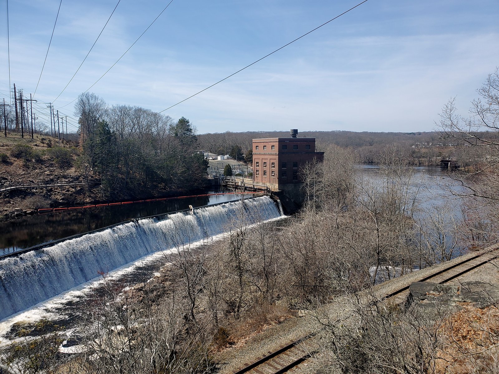
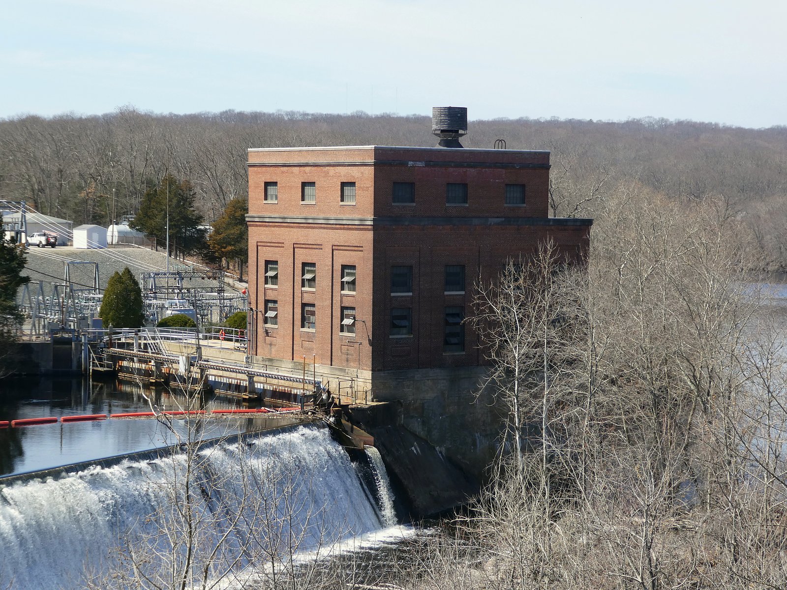
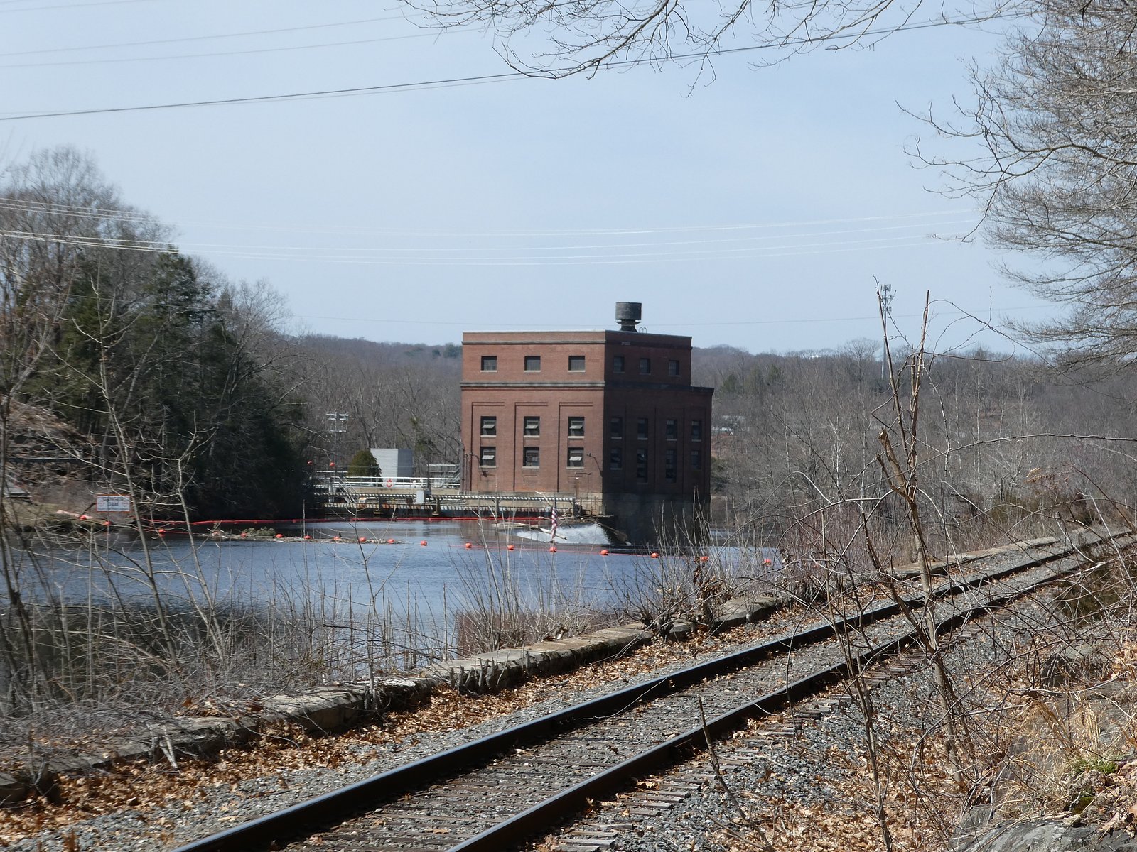
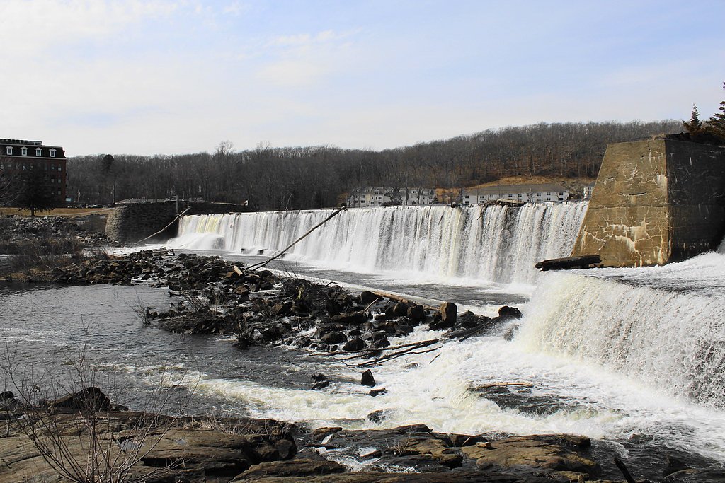
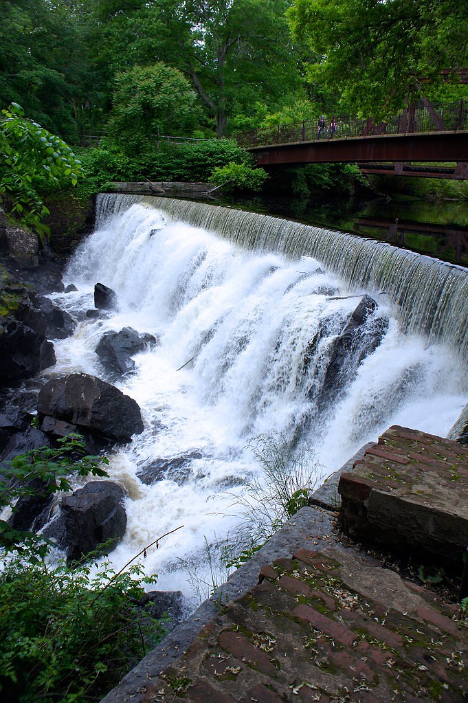
About Quinebaug Falls
Quinebaug Falls, also known as Cargill Falls, is a small but scenic waterfall located in Putnam, Connecticut. It is part of the Quinebaug River and is known for its historical significance as a site of early industrial development.
The Setting
Quinebaug Falls sits at 43 feet along the Yantic River, in the coastal lowlands of Connecticut.
Trail & Hike Details
The Approach
The moderate 2.4-mile out and back trail gains 350 feet of elevation on the way to the falls.
Trail Description
There is no formal hiking trail to Quinebaug Falls as it is visible from nearby roads and public areas in Putnam.
What to Expect
Dogs are welcome.
Accessibility
The trail is not wheelchair accessible. Uneven terrain and elevation changes require steady footing.
Frequently Asked Questions
🐶 Are Dogs Allowed at Quinebaug Falls?
✅ Dogs are allowed
Are There Any Fees or Permits Required?
🆖 No fees required
🏊 Is There Swimming at Quinebaug Falls?
❌ Swimming is not allowed
When to Visit
Spring and early summer are ideal for visiting due to higher water levels.
Seasonal Access
The best time to visit is Spring, Summer, and Fall. Winter access may be limited.
Safety Information
Exercise caution near the riverbanks as they can be slippery. Avoid visiting during heavy rains or flooding conditions.
Current Water Conditions
27 ft³/s
Current discharge — how much water is flowing
About average for this time of year
Based on 95 years of record
1.19 ft
Water depth at gauge
7-Day Discharge Trend
What does this mean for your visit?
Flow is about average for this time of year.
About This Gauge
7-Day Flow Outlook
Based on the USGS gauge YANTIC RIVER AT YANTIC, CT (7 km away).
Today
Moderate
29 cfs
5/10Tomorrow
Moderate
29 cfs
8/10Tue
Low
25 cfs
6/10Wed
Moderate
24 cfs
4/10Thu
Moderate
22 cfs
8/10Fri
Moderate
23 cfs
4/10Sat
Moderate
21 cfs
4/10Best window: Tomorrow — moderate flow, mostly sunny (trip score 8/10).
Best time of year: this gauge typically runs highest from mid February to early May, peaking in March.
How we calculate this
This is a transparent outlook, not a precise forecast. We take the waterfall's current flow strength (how it ranks against its historical normal for today, from the nearest USGS stream gauge), carry that ranking forward along the gauge's seasonal curve, and nudge it for forecast rain. Confidence is highest for the next day or two and falls further out. Always check official conditions and your own judgment before visiting — high flows can be dangerous.
Know when to go.
Get a free email alert when waterfalls near Norwich hit peak flow. We only send when conditions are worth the trip — no weekly newsletters, no spam.
Weather Forecast
Location & Access
Getting There
Quinebaug Falls is located in the town of Putnam, Connecticut, near the intersection of Kennedy Drive and Pomfret Street. The falls are easily accessible from the road.
Get Directions on Google MapsParking
There is limited parking available nearby, including street parking in the town of Putnam.
Hours
Elevation
43 feet above sea level
Coordinates
41.555336° N, -72.041617° W
Visitor Tips & Gear
Visit during the spring or after heavy rains for the best water flow. Be cautious near the riverbanks as they may be slippery.
As an Amazon Associate, we earn from qualifying purchases.
With 2.4 miles and 350 ft of elevation gain, sturdy boots and trekking poles will help on this moderate trail. Sun exposure on the trail makes good sun protection a must in summer.

Polarized Sunglasses (Knockaround)
Cuts glare off the water so you actually see the falls — and your photos turn out better too.

Columbia Watertight II Rain Jacket
Packs into its own pocket, seam-sealed, and keeps you dry from spray and surprise rain.

Earth Pak Waterproof Dry Bag
Keeps your phone and gear dry when waterfall mist soaks everything else.

Waterproof Phone Pouch (AiRunTech)
Cheap insurance — take photos right next to the falls without killing your phone.

Timberland Euro Sprint Mid Waterproof
Trusted waterproof boot with premium leather and grippy rubber sole — reliable on rocky, wet trails.

TrailBuddy Trekking Poles
Lightweight aluminum, cork grips, and flip-locks that actually hold — a best-seller for good reason.
Where to Stay

Comfort Inn Griswold

Comfort Suites Near Casinos

La Quinta by Wyndham Norwich-Plainfield-Casino

Bellissimo Hotel, Trademark by Wyndham Near Foxwoods Casino
Browse vacation cabins and private rentals nearby
Unique outdoor stays — tents, yurts, and treehouses
Rent a campervan or RV for your waterfall road trip
Some links are affiliate links. We may earn a commission at no extra cost to you.
Additional Information
Nearby Attractions
Downtown Putnam offers shops, restaurants, and antique stores. The nearby Quinebaug River Trail is a popular spot for walking and biking.
Wildlife
The area around the falls may feature common river wildlife such as ducks, herons, and fish.
Cities near Quinebaug Falls
Nearby Waterfalls
Writing about Quinebaug Falls? Embed this waterfall on your site for free.