Presbyterian Falls
By Armen Suny · Last verified May 2026
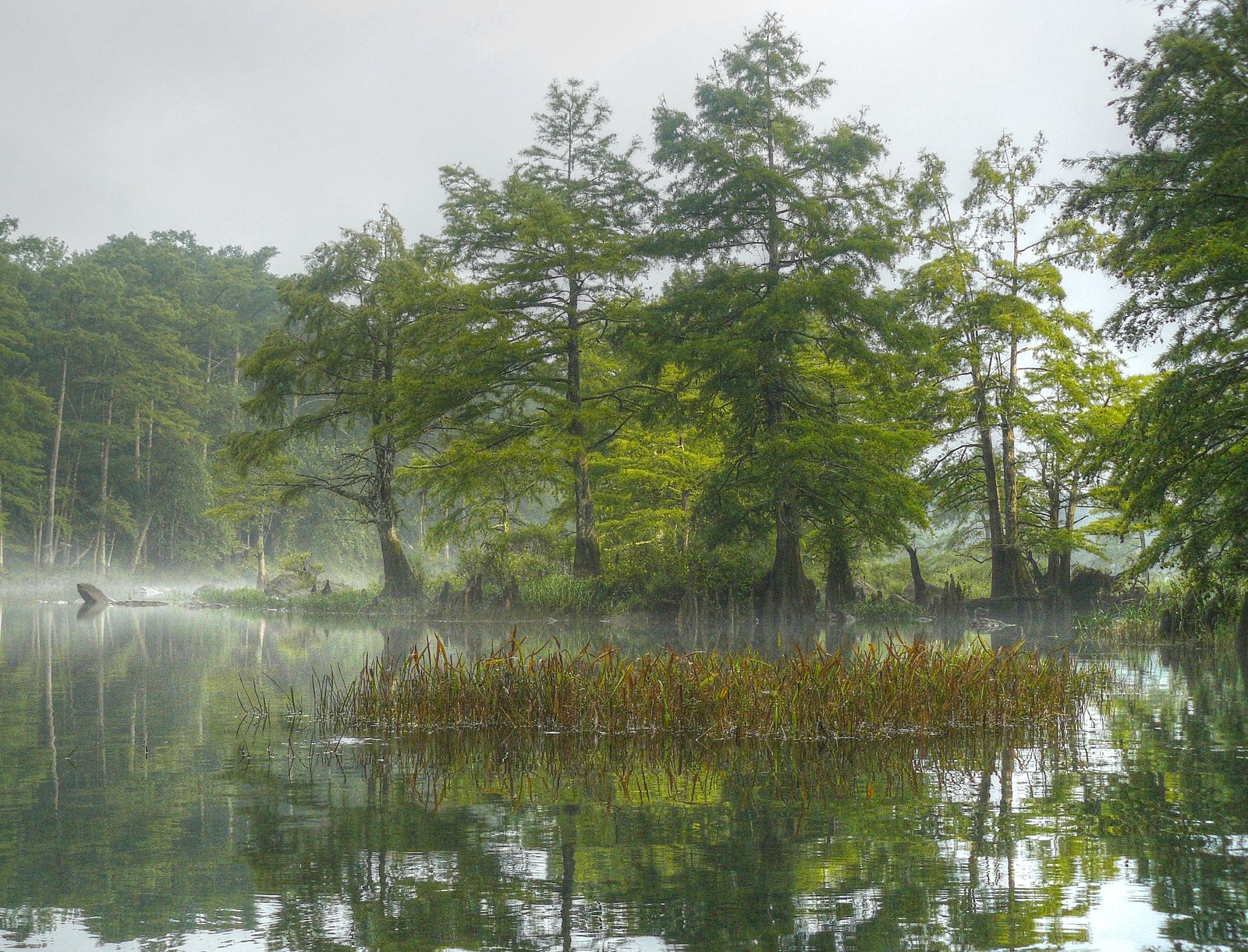
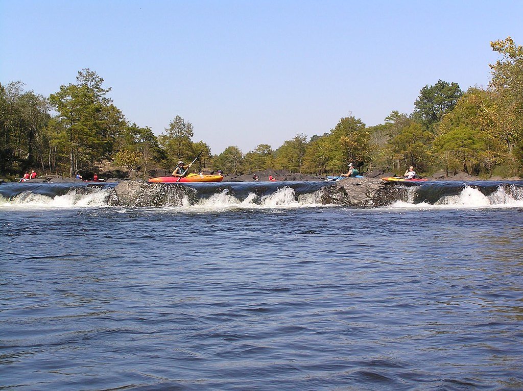
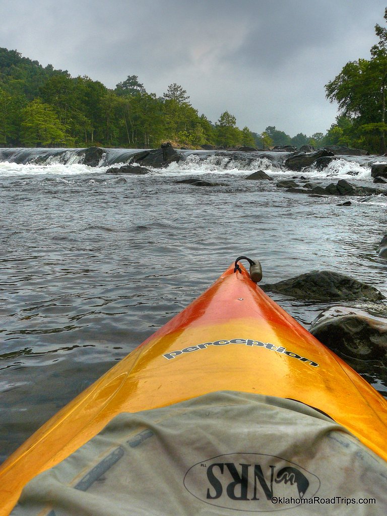

Photo Credits (4)
Difficulty
Moderate
Trail Length
2.4 miles
Trail Type
Out And Back
Elevation Gain
350 ft
About Presbyterian Falls
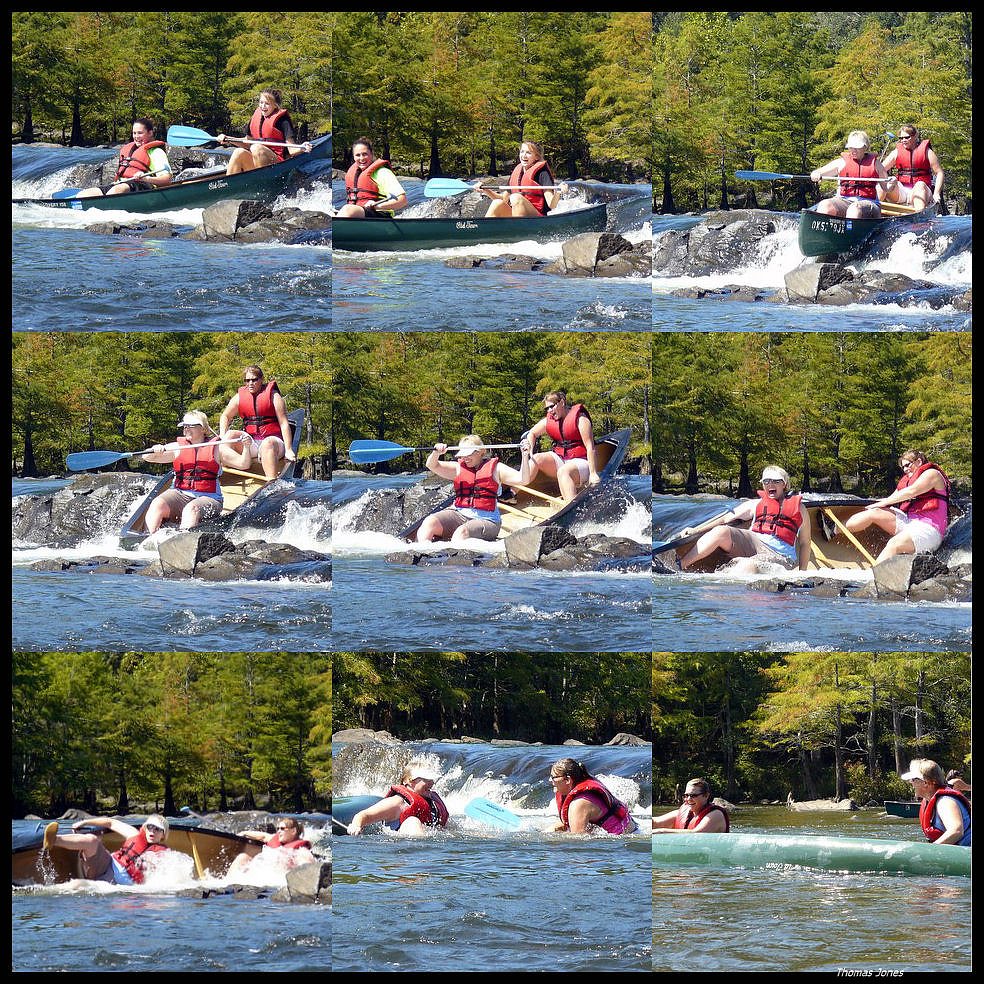
Presbyterian Falls tumbles along the Lower Mountain Fork River in southeastern Oklahoma as a lively series of cascading rapids rather than a single vertical drop — a setting that attracts paddlers, photographers and hikers who enjoy dynamic river scenery. The falls’ braided channels and exposed rock shelves create a mix of quiet pools and rushing water, making it an evocative spot for watching currents and for experienced kayakers to run when flows allow. Its character is more rapid than plunge, so views are best from stable riverbanks and rock ledges rather than a single overlook. The falls lie within the Choctaw Oklahoma Tribal Statistical Area on land owned by DESG and managed by tribal authorities (designation: TRIB), so visitors should respect tribal land use and signage. The approach feels natural and undeveloped — a pleasant outdoor escape that rewards a short hike and careful footing along the river’s edge.
The Setting
Presbyterian Falls sits at 367 feet within Choctaw Oklahoma Tribal Statistical Area, fed by the Mountain Fork, in the coastal lowlands of Oklahoma.
Trail & Hike Details
The Approach
The moderate 2.4-mile out-and-back trail gains 350 feet of elevation on the way to the falls.
Trail Description
The access route to Presbyterian Falls is an out-and-back trail of roughly 2.4 miles with about 350 feet of elevation gain and a moderate difficulty rating. The tread is primarily dirt with uneven surfaces, including rocky, rooty and occasionally steep sections, so sturdy shoes and steady footing are recommended. The trail is suitable for most hikers comfortable with moderate climbs and natural trail conditions; it leads down to the riverbank and the cascading rapids, where views open up and paddlers often launch. Note that this approach is on tribal-managed land, so follow posted rules and stay on established paths.
What to Expect
Swimming is permitted. Dogs are welcome.
Accessibility
The trail is not wheelchair accessible. Uneven terrain and elevation changes require steady footing.
Frequently Asked Questions
🐶 Are Dogs Allowed at Presbyterian Falls?
✅ Dogs are allowed
Are There Any Fees or Permits Required?
🆖 No fees required
🏊 Is There Swimming at Presbyterian Falls?
✅ Swimming is allowed
When to Visit
Spring and early summer are ideal for visiting Presbyterian Falls, as the water levels are typically higher, enhancing the beauty of the rapids.
Seasonal Access
The best time to visit is Spring, Summer, and Fall. Winter access may be limited.
Safety Information
Be cautious of slippery rocks and strong currents near the falls. Always supervise children and pets. Water levels can change rapidly, so check conditions before visiting.
Current Water Conditions
356 ft³/s
Current discharge — how much water is flowing
Lower than usual for this time of year
Based on 56 years of record
1.43 ft
Water depth at gauge
73°F
ComfortablePleasant for swimming
7-Day Discharge Trend
What does this mean for your visit?
Flow is lower than usual for this time of year. The water is a comfortable 73 degrees F, pleasant for swimming.
About This Gauge
7-Day Flow Outlook
Based on the USGS gauge Mountain Fork near Eagletown, OK (3 km away).
Today
Strong
413 cfs
8/10Tomorrow
Strong
306 cfs
10/10Sat
Moderate
259 cfs
9/10Sun
Moderate
305 cfs
9/10Mon
Moderate
288 cfs
9/10Tue
Moderate
331 cfs
9/10Wed
Moderate
343 cfs
9/10Best window: Tomorrow — strong flow, partly sunny (trip score 10/10).
Best time of year: this gauge typically runs highest from late March to early April, peaking in March.
How we calculate this
This is a transparent outlook, not a precise forecast. We take the waterfall's current flow strength (how it ranks against its historical normal for today, from the nearest USGS stream gauge), carry that ranking forward along the gauge's seasonal curve, and nudge it for forecast rain. Confidence is highest for the next day or two and falls further out. Always check official conditions and your own judgment before visiting — high flows can be dangerous.
Know when to go.
Get a free email alert when waterfalls near Eagletown hit peak flow. We only send when conditions are worth the trip — no weekly newsletters, no spam.
Weather Forecast
Location & Access
Getting There
Presbyterian Falls is located near Broken Bow, Oklahoma, within the Lower Mountain Fork River area. It can be accessed via local roads, and the closest major town is Broken Bow. Visitors typically park near the river and walk a short distance to the falls.
Get Directions on Google MapsParking
Parking is available near the river, but spaces may be limited during peak seasons. Visitors should plan accordingly.
Elevation
367 feet above sea level
Coordinates
34.069555° N, -94.624103° W
Land Management
Managed by TRIB
Visitor Tips & Gear
Visit during the spring or early summer for the best water flow. Bring water shoes if you plan to explore the riverbank. Be cautious of slippery rocks near the water.
As an Amazon Associate, we earn from qualifying purchases.
With 2.4 miles and 350 ft of elevation gain, sturdy boots and trekking poles will help on this moderate trail. Sun exposure on the trail makes good sun protection a must in summer.

Polarized Sunglasses (Knockaround)
Cuts glare off the water so you actually see the falls — and your photos turn out better too.

Columbia Watertight II Rain Jacket
Packs into its own pocket, seam-sealed, and keeps you dry from spray and surprise rain.

Earth Pak Waterproof Dry Bag
Keeps your phone and gear dry when waterfall mist soaks everything else.

Waterproof Phone Pouch (AiRunTech)
Cheap insurance — take photos right next to the falls without killing your phone.

Timberland Euro Sprint Mid Waterproof
Trusted waterproof boot with premium leather and grippy rubber sole — reliable on rocky, wet trails.

TrailBuddy Trekking Poles
Lightweight aluminum, cork grips, and flip-locks that actually hold — a best-seller for good reason.
Where to Stay

Choctaw Landing Casino & Resort, Trademark Coll by Wyndham

The Ember House - Luxury Honeymoon Cabin

The NEW Luna Lodge in Broken Bow

NEW Farmhouse-Chic Cabin with Hot Tub & Firepit
Browse vacation cabins and private rentals nearby
Unique outdoor stays — tents, yurts, and treehouses
Rent a campervan or RV for your waterfall road trip
Some links are affiliate links. We may earn a commission at no extra cost to you.
Nearby Campground
River Bend Area
6.4 miles away · 0 sites
This recreation area is part of Broken Bow Lake
Book on Recreation.govNearby Hot Springs
Hot springs near Eagletown, Oklahoma

Looking for a soak after your hike? Explore more hot springs near Eagletown, Oklahoma on SoakingSprings.
Explore Oklahoma springsAdditional Information
Nearby Attractions
Beavers Bend State Park, Broken Bow Lake, Hochatown State Park
Wildlife
The area is home to various bird species, fish, and other wildlife typical of southeastern Oklahoma.
Cities near Presbyterian Falls
Writing about Presbyterian Falls? Embed this waterfall on your site for free.