Photo Credits (2)
Difficulty
Moderate
Trail Length
2.5 miles
Trail Type
Out And Back
Elevation Gain
200 ft
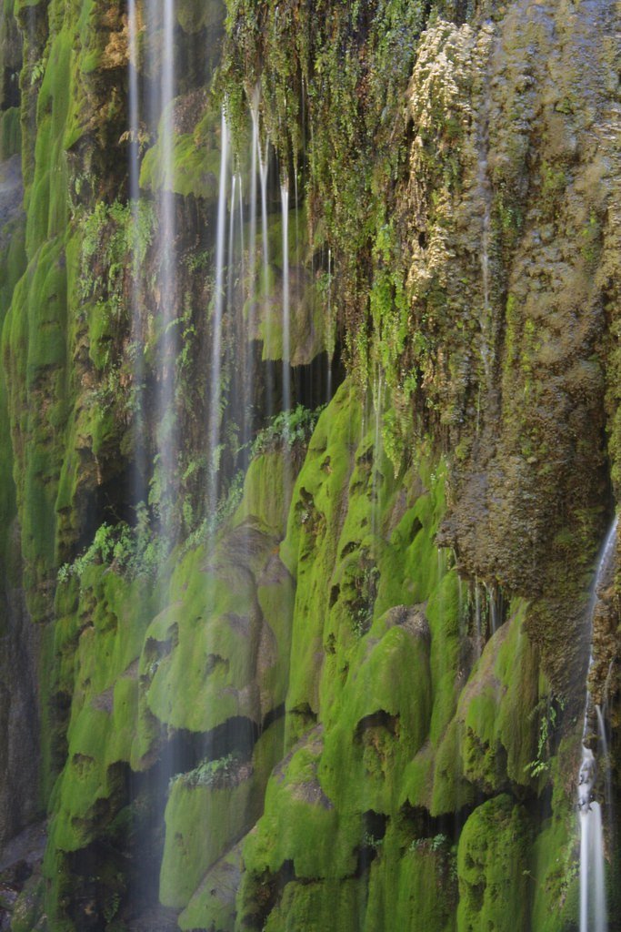
About Post Oak Falls
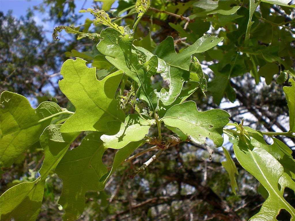
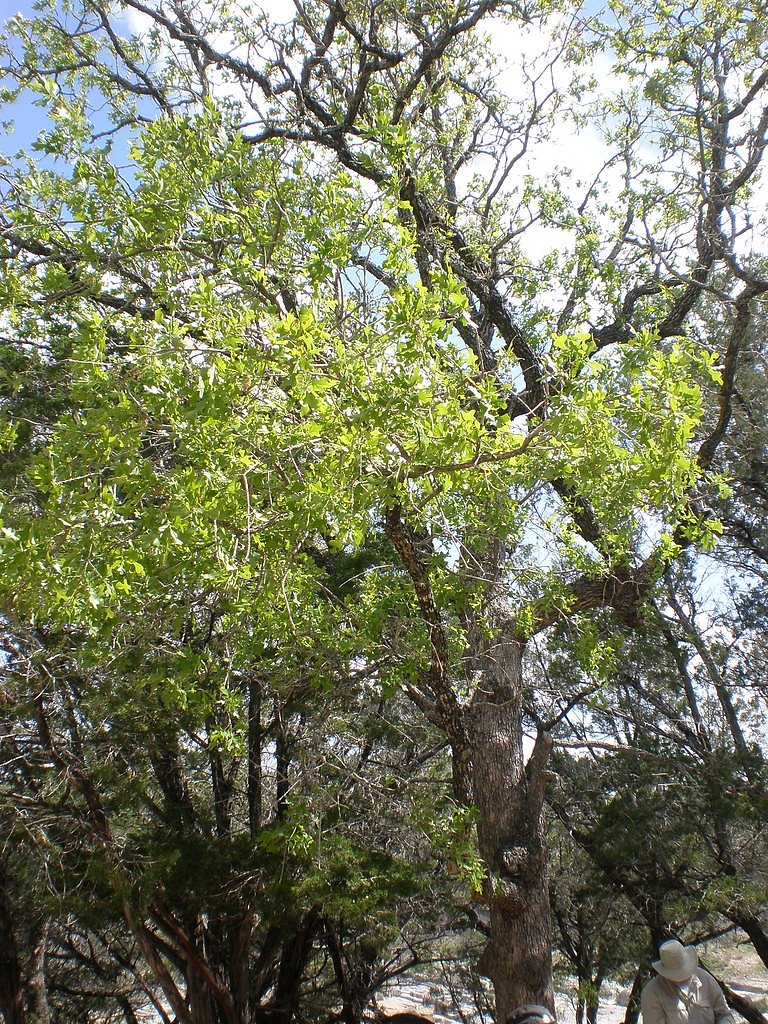
Post Oak Falls is a small but scenic waterfall located in the Wichita Mountains Wildlife Refuge in Oklahoma, not Texas. It is a seasonal waterfall that flows most prominently after rainfall, offering a tranquil and picturesque setting surrounded by rugged terrain and oak trees.
Trail & Hike Details
The Approach
The moderate 2.5-mile out-and-back trail gains 200 feet of elevation on the way to the falls.
Trail Description
The trail to Post Oak Falls is a moderately challenging hike that winds through rocky terrain and oak forests. The path is not always well-marked, so hikers should pay close attention to their surroundings. The waterfall is most active after recent rainfall, and the trail may be muddy or slippery during these times.
What to Expect
Dogs are welcome.
Accessibility
The trail is not wheelchair accessible. Uneven terrain and elevation changes require steady footing.
Frequently Asked Questions
🐶 Are Dogs Allowed at Post Oak Falls?
✅ Dogs are allowed
Are There Any Fees or Permits Required?
🆖 No fees required
🏊 Is There Swimming at Post Oak Falls?
❌ Swimming is not allowed
When to Visit
The best time to visit Post Oak Falls is after recent rainfall, particularly in spring or fall when temperatures are mild and the landscape is lush.
Seasonal Access
The best time to visit is Spring and Fall. Winter access may be limited.
Safety Information
Hikers should be cautious of loose rocks and uneven footing. Watch for wildlife and avoid approaching or feeding animals. Carry plenty of water and be prepared for sudden weather changes.
Current Water Conditions
Based on a USGS gauge 15.9 miles away
323 ft³/s
Current discharge — how much water is flowing
About average for this time of year
Based on 95 years of record
2.96 ft
Water depth at gauge
7-Day Discharge Trend
What does this mean for your visit?
Flow is about average for this time of year.
About This Gauge
This gauge is on a regional waterway. Conditions at the falls may differ, especially after local rain.
7-Day Flow Outlook
Based on the USGS gauge Colorado Rv nr San Saba, TX (26 km away).
Today
Barely Flowing
332 cfs
5/10Tomorrow
Barely Flowing
279 cfs
5/10Mon
Barely Flowing
300 cfs
5/10Tue
Barely Flowing
289 cfs
5/10Wed
Barely Flowing
275 cfs
5/10Thu
Barely Flowing
247 cfs
5/10Fri
Barely Flowing
247 cfs
5/10Best window: Today — barely flowing flow, sunny (trip score 5/10).
Best time of year: this gauge typically runs highest from late April to late June, peaking in June.
How we calculate this
This is a transparent outlook, not a precise forecast. We take the waterfall's current flow strength (how it ranks against its historical normal for today, from the nearest USGS stream gauge), carry that ranking forward along the gauge's seasonal curve, and nudge it for forecast rain. Confidence is highest for the next day or two and falls further out. Always check official conditions and your own judgment before visiting — high flows can be dangerous.
Know when to go.
Get a free email alert when waterfalls near Tow hit peak flow. We only send when conditions are worth the trip — no weekly newsletters, no spam.
Weather Forecast
Location & Access
Getting There
Post Oak Falls is accessed via the Wichita Mountains Wildlife Refuge, located near Lawton, Oklahoma. The trailhead for the falls is typically reached by parking at the Sunset Picnic Area or Treasure Lake parking lot.
Get Directions on Google MapsParking
Parking is available at the Sunset Picnic Area or Treasure Lake parking lot. Spaces may be limited during peak seasons or weekends.
Elevation
1,083 feet above sea level
Coordinates
31.005574° N, -98.459256° W
Visitor Tips & Gear
Wear sturdy hiking shoes due to rocky and uneven terrain. Bring plenty of water, especially during warmer months. Check weather conditions before visiting, as the waterfall may not flow during dry periods.
As an Amazon Associate, we earn from qualifying purchases.
With 2.5 miles and 200 ft of elevation gain, sturdy boots and trekking poles will help on this moderate trail.

Columbia Watertight II Rain Jacket
Packs into its own pocket, seam-sealed, and keeps you dry from spray and surprise rain.

Earth Pak Waterproof Dry Bag
Keeps your phone and gear dry when waterfall mist soaks everything else.

Waterproof Phone Pouch (AiRunTech)
Cheap insurance — take photos right next to the falls without killing your phone.

Timberland Euro Sprint Mid Waterproof
Trusted waterproof boot with premium leather and grippy rubber sole — reliable on rocky, wet trails.

TrailBuddy Trekking Poles
Lightweight aluminum, cork grips, and flip-locks that actually hold — a best-seller for good reason.

JOBY GorillaPod Starter Kit
Wraps around railings and rocks for long-exposure waterfall shots — no flat surface needed.
Where to Stay

Thunderbird Lodge

Oasis Lake Buchanan

Lake Beach Access & Views, 5kings!

Dofflemyer Hotel
Browse vacation cabins and private rentals nearby
Unique outdoor stays — tents, yurts, and treehouses
Rent a campervan or RV for your waterfall road trip
Some links are affiliate links. We may earn a commission at no extra cost to you.
Additional Information
Nearby Attractions
Nearby attractions include Mount Scott, the Holy City of the Wichitas, and other trails within the Wichita Mountains Wildlife Refuge.
Wildlife
The area is home to a variety of wildlife, including bison, elk, deer, and numerous bird species. Visitors should maintain a safe distance from all animals.
Cities near Post Oak Falls
Nearby Waterfalls
Writing about Post Oak Falls? Embed this waterfall on your site for free.