Photo Credits (5)
Difficulty
Moderate
Trail Length
2.4 miles
Trail Type
Out And Back
Elevation Gain
350 ft
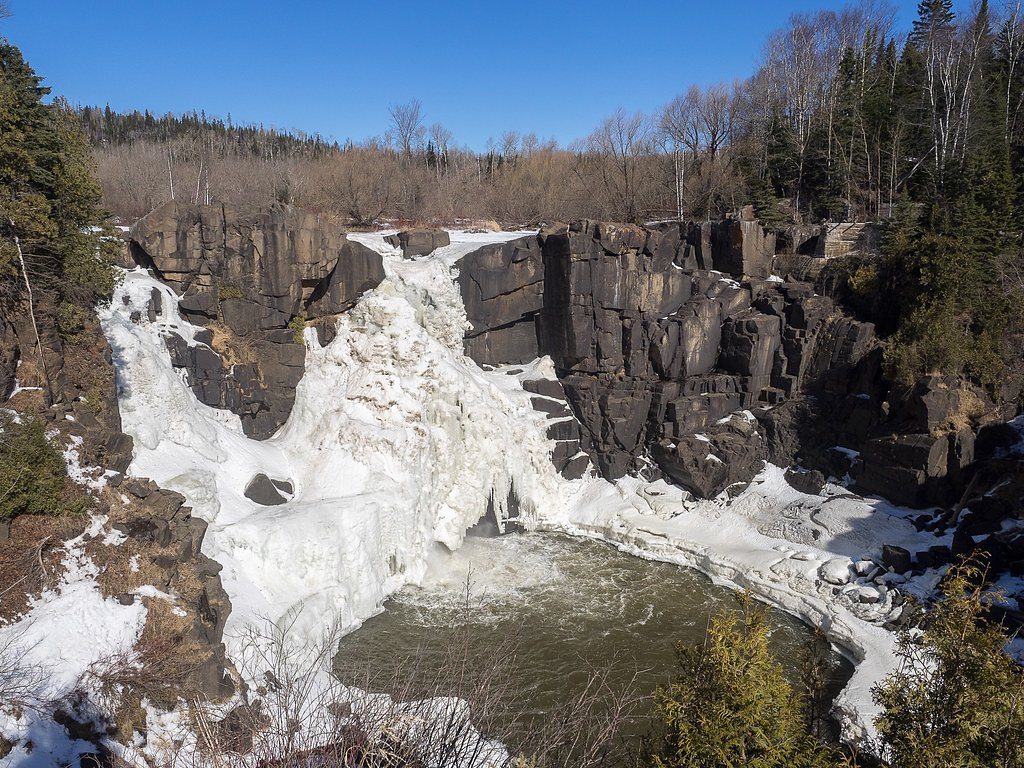
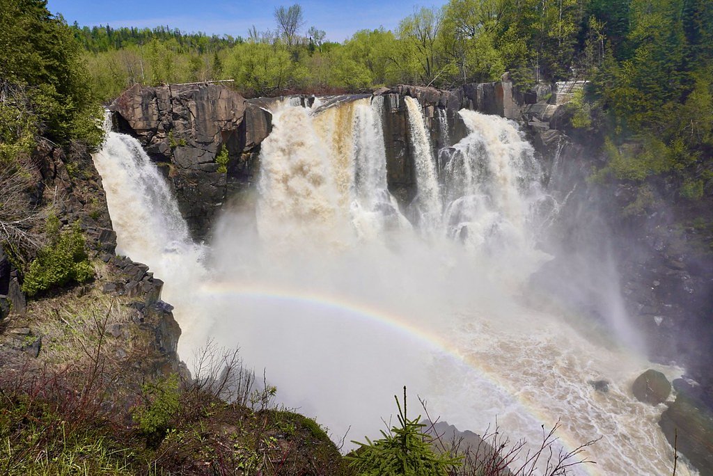
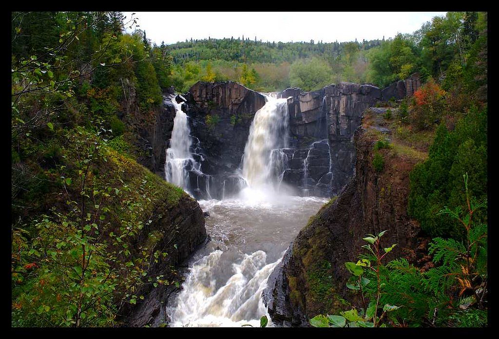
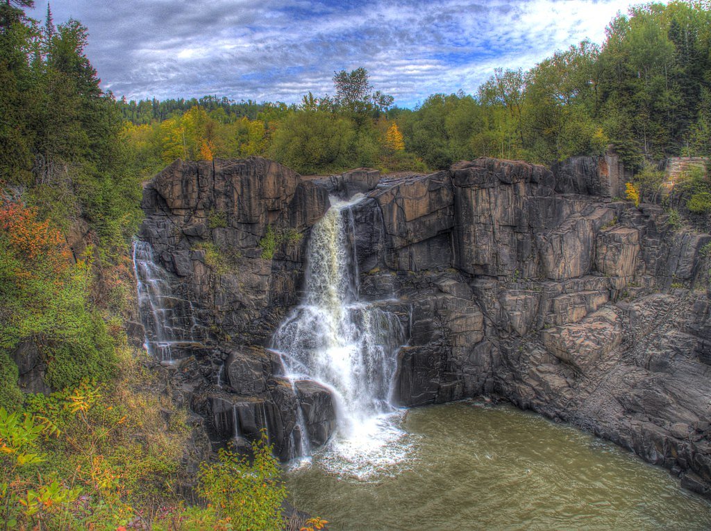
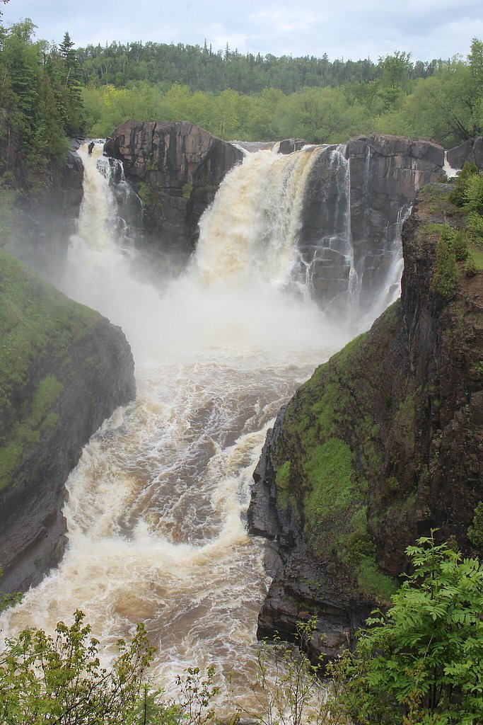
About Portage Falls
Portage Falls sits on National Forest land within the Pigeon River Purchase Unit, managed by the U.S. Forest Service. Framed by quiet, forested surroundings, the falls make for a peaceful destination that rewards a short hike with scenic water views; the site is accessed via the Arrowhead Trail–Otter Lake (Trail #21177). The area’s backcountry feel and native-surface tread give it a low-key, exploratory vibe that’s popular with hikers who prefer less-developed routes. Note: this Portage Falls should not be confused with the better‑known Portage Falls in New York’s Letchworth State Park, which features three large drops near the Genesee Arch Bridge (as documented on Wikipedia). The Minnesota site is distinct and is described and maintained under the Pigeon River Purchase Unit by the USFS.
The Setting
Portage Falls sits at 1,562 feet within Pigeon River Purchase Unit, in the hills of Minnesota.
Trail & Hike Details
The Approach
The moderate hike follows Arrowhead Trail Otter Lake (#21177), a 2.4-mile out-and-back trail over natural surface. Expect 350 feet of elevation gain with grades of 0-5%. The trail is moderately developed (Class 2).
USFS Trail
ARROWHEAD TRAIL-OTTER LAKE #21177
Trail Class
Moderately Developed
Surface
Avg Grade
USFS Segment
0.39 miTrail Description
Follow the Arrowhead Trail–Otter Lake (USFS Trail #21177) for the primary approach; the USFS classifies this segment as Class 2 with a native-material surface and a typical grade of 0–5%. USFS GIS mapping records a 0.39‑mile section of Trail #21177 through the Pigeon River Purchase Unit. Many hikers report the full out‑and‑back route to Portage Falls is about 2.4 miles with roughly 350 feet of elevation gain, rated moderate in difficulty. Expect a mostly natural tread through forested terrain with occasional uneven spots—sturdy footwear is recommended. The trail is an out‑and‑back route; its native surface and gentle grades make it approachable for most hikers, while the moderate overall distance and elevation gain provide a satisfying outing.
What to Expect
Dogs are welcome.
Accessibility
The trail is not wheelchair accessible. Uneven terrain and elevation changes require steady footing.
Frequently Asked Questions
🐶 Are Dogs Allowed at Portage Falls?
✅ Dogs are allowed
Are There Any Fees or Permits Required?
🆖 No fees required
🏊 Is There Swimming at Portage Falls?
❌ Swimming is not allowed
When to Visit
Spring and early summer are ideal times to visit, as the waterfall is typically more active due to snowmelt and rainfall.
Seasonal Access
The best time to visit is Spring, Summer, and Fall. Winter access may be limited. Check with Pigeon River Purchase Unit for seasonal road closures.
Safety Information
Visitors should exercise caution on wet or muddy trails to avoid slipping. Be prepared for changing weather conditions, and carry a map or GPS device as cell service may be limited.
Know when to go.
Get a free email alert when waterfalls near Grand Marais hit peak flow. We only send when conditions are worth the trip — no weekly newsletters, no spam.
Weather Forecast
Location & Access
Getting There
Portage Falls is located within the Superior National Forest in Minnesota. Access may require navigating forest roads, which can be unpaved and rough in some areas. Visitors should check local maps and conditions before traveling.
Get Directions on Google MapsParking
Parking is typically available near the trailhead, but spaces may be limited. Visitors are advised to arrive early during peak seasons.
Elevation
1,562 feet above sea level
Coordinates
47.999609° N, -90.035368° W
Land Management
Managed by USFS
Visitor Tips & Gear
Bring insect repellent during the summer months as mosquitoes can be prevalent. Check weather conditions before visiting, as trails may be muddy after rain. Carry water and snacks, as there are no facilities nearby.
As an Amazon Associate, we earn from qualifying purchases.
With 2.4 miles and 350 ft of elevation gain, sturdy boots and trekking poles will help on this moderate trail. Sun exposure on the trail makes good sun protection a must in summer.

Polarized Sunglasses (Knockaround)
Cuts glare off the water so you actually see the falls — and your photos turn out better too.

Columbia Watertight II Rain Jacket
Packs into its own pocket, seam-sealed, and keeps you dry from spray and surprise rain.

Earth Pak Waterproof Dry Bag
Keeps your phone and gear dry when waterfall mist soaks everything else.

Waterproof Phone Pouch (AiRunTech)
Cheap insurance — take photos right next to the falls without killing your phone.

Timberland Euro Sprint Mid Waterproof
Trusted waterproof boot with premium leather and grippy rubber sole — reliable on rocky, wet trails.

TrailBuddy Trekking Poles
Lightweight aluminum, cork grips, and flip-locks that actually hold — a best-seller for good reason.
Where to Stay

Best Western Plus NorWester Hotel & Conference Centre

Lake Superior Retreat Private Wooded Haven with Panoramic Views
Browse vacation cabins and private rentals nearby
Unique outdoor stays — tents, yurts, and treehouses
Rent a campervan or RV for your waterfall road trip
Some links are affiliate links. We may earn a commission at no extra cost to you.
Nearby Campground
EAST BEARSKIN LAKE CAMPGROUND
16.8 miles away · 32 sites
Overview East Bearskin Lake Campground is located on its namesake lake, at the edge of the Boundary Waters Canoe Area Wilderness in Northern Minnesota. It is a perfect spot for visitors who want the experience found in Boundary Waters and the convenience of car camping. Visitors can reserve standard or walk-in tent sites, or rent small cabins that accommodate up to five or seven people. Canoeing, kayaking and motorized boating is available on East Bearskin Lake. The facility can be conveniently a
Book on Recreation.govAdditional Information
Nearby Attractions
The Superior National Forest offers numerous hiking trails, lakes, and scenic spots to explore. The Boundary Waters Canoe Area Wilderness is also nearby for those seeking additional outdoor adventures.
Wildlife
The area is home to a variety of wildlife, including deer, birds, and small mammals. Visitors should be cautious of black bears, which are occasionally spotted in the region.
Cities near Portage Falls
Nearby Waterfalls
Writing about Portage Falls? Embed this waterfall on your site for free.