
Photo Credits (5)
Difficulty
Moderate
Trail Length
3.5 miles
Trail Type
Out And Back
Elevation Gain
500 ft
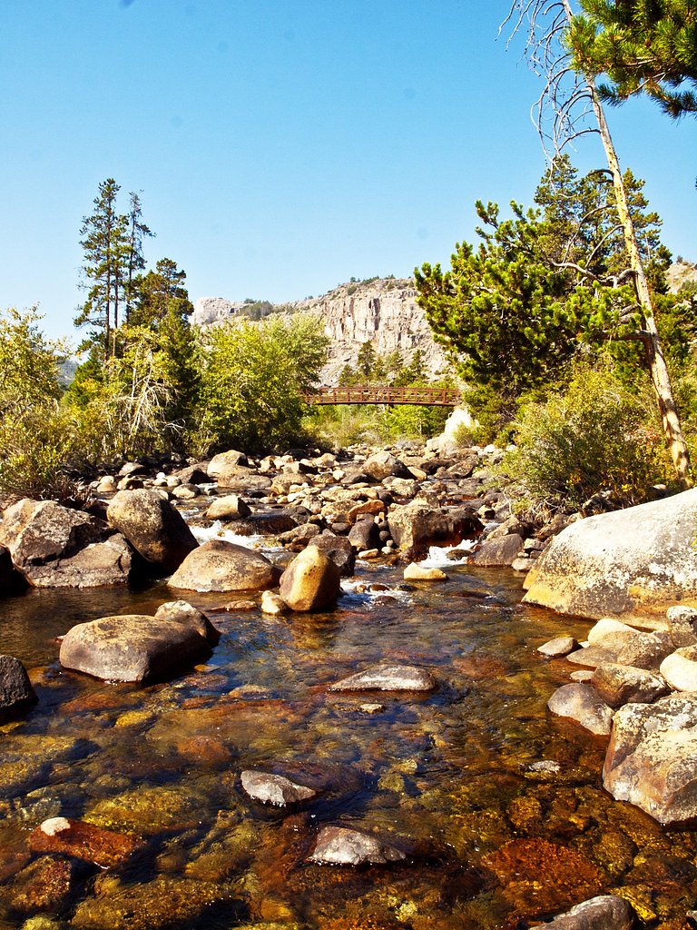
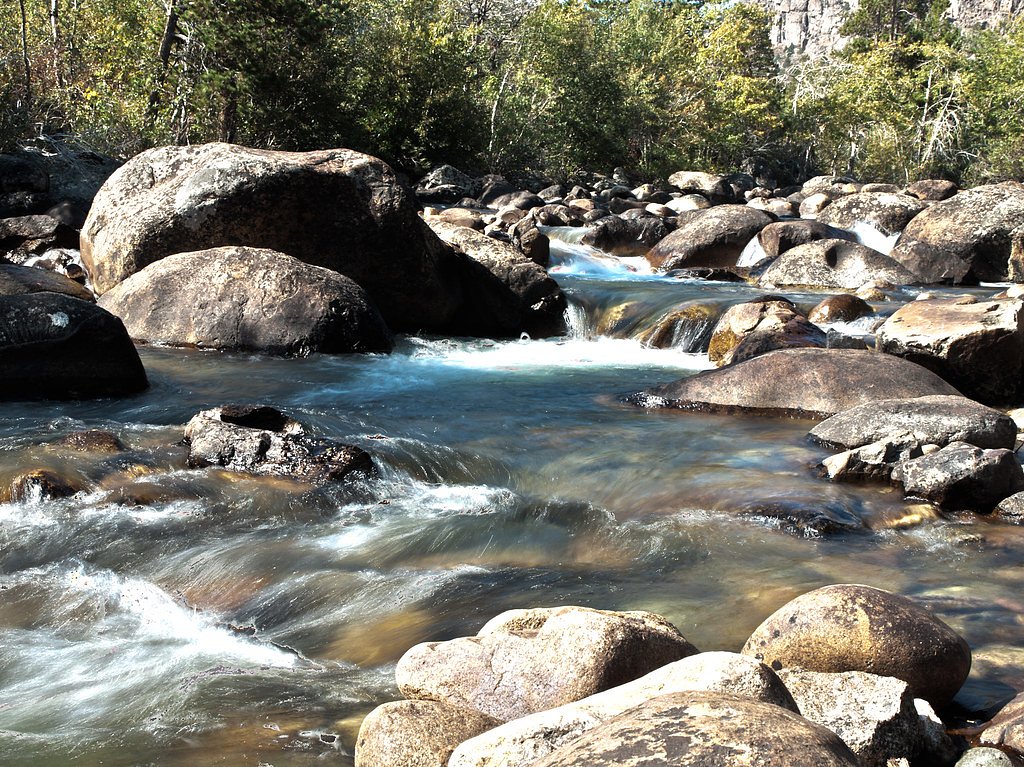
About Popo Agie Falls
Popo Agie Falls tumbles through the Wind River Range a short drive from Lander, Wyoming, and sits within the Shoshone National Forest managed by the U.S. Forest Service. The cascade is a favorite stop for hikers and photographers drawn to its dramatic water flow framed by rugged mountain scenery and mixed forest. The setting feels remote yet accessible, making it a rewarding half-day outing for visitors to the area. Access to the falls is via a roughly 3.5-mile out-and-back route that gains about 500 feet, a moderate trek that rewards you with close river views and a chance to linger at the falls. For those planning an overnight, Worthen Meadow Campground is nearby (about 4.63 km away), offering a convenient basecamp to extend your visit into a multi-day exploration of the Wind Rivers under USFS care.
The Setting
Popo Agie Falls sits at 7,733 feet within Shoshone National Forest, in the high mountains of Wyoming.
Trail & Hike Details
The Approach
The moderate 3.5-mile out-and-back trail gains 500 feet of elevation on the way to the falls.
Trail Description
The trail to Popo Agie Falls is an out-and-back route of about 3.5 miles round-trip with approximately 500 feet of elevation gain and is rated moderate. The tread is well-maintained and follows the Middle Fork of the Popo Agie River, moving through mixed forest and opening to mountain views; the overall grade is moderate, with steady uphill sections but no technical scrambling required. The path is suitable for most hikers who are comfortable with moderate climbs and uneven natural surfaces; there is nearby camping at Worthen Meadow Campground 4.63 km from the trailhead for those staying overnight.
What to Expect
Swimming is permitted. Dogs are welcome.
Accessibility
The trail is not wheelchair accessible. Uneven terrain and elevation changes require steady footing.
Frequently Asked Questions
🐶 Are Dogs Allowed at Popo Agie Falls?
✅ Dogs are allowed
Are There Any Fees or Permits Required?
🆖 No fees required
🏊 Is There Swimming at Popo Agie Falls?
✅ Swimming is allowed
When to Visit
The best time to visit is late spring through early fall when the trail is clear of snow and the water flow is at its peak. Summer offers the most reliable weather conditions.
Seasonal Access
The best time to visit is Spring, Summer, and Fall. Access roads and trails may close during winter due to snow. Check with Shoshone National Forest for seasonal road closures.
Safety Information
Be cautious near the falls, as rocks can be slippery. Watch for changing weather conditions, and carry bear spray as a precaution. During spring, the trail may be muddy or have lingering snow patches.
Current Water Conditions
Based on a USGS gauge 18.8 miles away
359 ft³/s
Current discharge — how much water is flowing
About average for this time of year
Based on 41 years of record
4.12 ft
Water depth at gauge
7-Day Discharge Trend
What does this mean for your visit?
Flow is about average for this time of year.
About This Gauge
This gauge is on a regional waterway. Conditions at the falls may differ, especially after local rain.
7-Day Flow Outlook
Based on the USGS gauge SF L WIND RIV AB WASHAKIE RES, NR FT WASHAKIE, WY (30 km away).
Today
Low
409 cfs
3/10Tomorrow
Moderate
434 cfs
4/10Fri
Low
406 cfs
6/10Sat
Low
446 cfs
3/10Sun
Moderate
484 cfs
4/10Mon
Low
409 cfs
6/10Tue
Barely Flowing
378 cfs
5/10Best window: Fri — low flow, mostly sunny (trip score 6/10).
Best time of year: this gauge typically runs highest from early May to early August, peaking in June.
How we calculate this
This is a transparent outlook, not a precise forecast. We take the waterfall's current flow strength (how it ranks against its historical normal for today, from the nearest USGS stream gauge), carry that ranking forward along the gauge's seasonal curve, and nudge it for forecast rain. Confidence is highest for the next day or two and falls further out. Always check official conditions and your own judgment before visiting — high flows can be dangerous.
Know when to go.
Get a free email alert when waterfalls near Lander hit peak flow. We only send when conditions are worth the trip — no weekly newsletters, no spam.
Weather Forecast
Location & Access
Getting There
Popo Agie Falls is accessed via the Bruce's Parking Area in Sinks Canyon State Park, located about 10 miles southwest of Lander, Wyoming. From the parking area, visitors follow the Popo Agie Falls Trail.
Get Directions on Google MapsParking
Parking is available at Bruce's Parking Area in Sinks Canyon State Park. The lot is typically sufficient for visitors, but it may fill up during peak seasons.
Elevation
7,733 feet above sea level
Coordinates
42.721722° N, -108.882483° W
Land Management
Managed by USFS
Visitor Tips & Gear
Start your hike early in the day to avoid crowds and ensure you have enough daylight. Bring plenty of water, as the trail can be sunny in some sections. Wear sturdy hiking shoes, as parts of the trail may be rocky.
This trail sits at 7,733 ft above sea level
Elevated TrailUV radiation is roughly 31% stronger at this elevation than at sea level, and the dry air accelerates dehydration. Extra sun protection and fluids go a long way.
As an Amazon Associate, we earn from qualifying purchases.

Coppertone Sport SPF 50 Sunscreen
UV intensity jumps ~4% per 1,000 ft — at this elevation you can burn in half the time.

Sun Bum SPF 30 Lip Balm (3-Pack)
Lips have almost no natural UV protection and burn fast in thin, dry mountain air.

Liquid I.V. Electrolyte Packets
You lose moisture ~2x faster at elevation — electrolytes help you absorb water efficiently.

ROCKNIGHT Polarized UV400 Sunglasses
High-altitude glare off rock and water is intense — UV400 lenses block 99%+ of UVA/UVB.
As an Amazon Associate, we earn from qualifying purchases.
With 3.5 miles and 500 ft of elevation gain, sturdy boots and trekking poles will help on this moderate trail. Sun exposure on the trail makes good sun protection a must in summer.

Polarized Sunglasses (Knockaround)
Cuts glare off the water so you actually see the falls — and your photos turn out better too.

Columbia Watertight II Rain Jacket
Packs into its own pocket, seam-sealed, and keeps you dry from spray and surprise rain.

Earth Pak Waterproof Dry Bag
Keeps your phone and gear dry when waterfall mist soaks everything else.

Waterproof Phone Pouch (AiRunTech)
Cheap insurance — take photos right next to the falls without killing your phone.

Timberland Euro Sprint Mid Waterproof
Trusted waterproof boot with premium leather and grippy rubber sole — reliable on rocky, wet trails.

TrailBuddy Trekking Poles
Lightweight aluminum, cork grips, and flip-locks that actually hold — a best-seller for good reason.
Where to Stay

Rodeway Inn Pronghorn Lodge

Holiday Inn Express Hotel & Suites Lander by IHG

Inn at Lander, Travelodge by Wyndham

Exquisite Log Home with Lander Valley Views!
Browse vacation cabins and private rentals nearby
Unique outdoor stays — tents, yurts, and treehouses
Rent a campervan or RV for your waterfall road trip
Some links are affiliate links. We may earn a commission at no extra cost to you.
Nearby Campground
Worthen Meadow Campground
2.9 miles away · 0 sites
Worthen Meadow Campground has 28 campsites on the shores of Worthen Meadow Resevoir. Trailheads at the campground accesses the Popo Agie Wilderness. No trailers over 24 feet. Amenities include potable water, three vault toilets, picnic tables, cook grates and boat ramp. Worthen Meadow Picnic Area is nearby.
Book on Recreation.govNearby Hot Springs
Hot springs near Lander, Wyoming
Washakie Mineral Hot Springs
Washakie Mineral Hot Springs flows at 111°F on the Wind River Reservation in Fremont County, delivering moderately hot water 68...
Steele Hot Springs
Steele Hot Springs flows at 102 degrees Fahrenheit near Pinedale in Sublette County at 7,065 feet elevation, accessible via a 1...
Sweetwater Station Warm Springs
Sweetwater Station Warm Springs emerges at 90°F near Arapahoe in Fremont County at 6,640 feet elevation, requiring a short 103-...
Looking for a soak after your hike? Explore more hot springs near Lander, Wyoming on SoakingSprings.
Explore Wyoming springsAdditional Information
Nearby Attractions
Sinks Canyon State Park, The Sinks and The Rise geological features, and other hiking trails in the Wind River Range.
Wildlife
The area is home to wildlife such as deer, marmots, and various bird species. Be aware of the possibility of encountering bears and take appropriate precautions.
Cities near Popo Agie Falls
Writing about Popo Agie Falls? Embed this waterfall on your site for free.