Pitchfork Falls
By Armen Suny · Last verified Sep 2026
3D terrain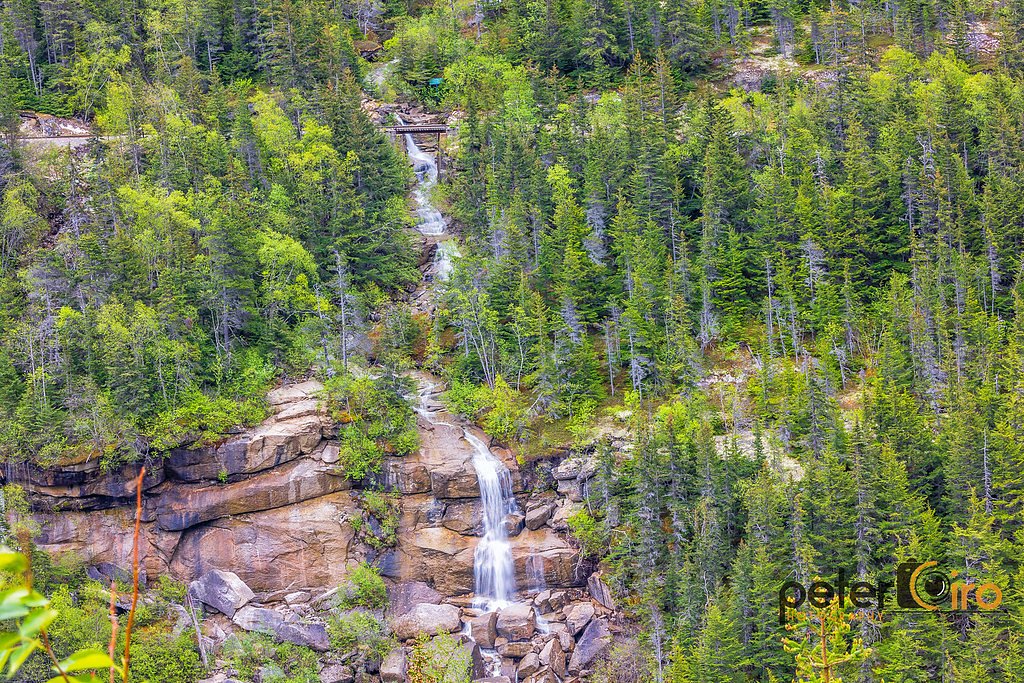
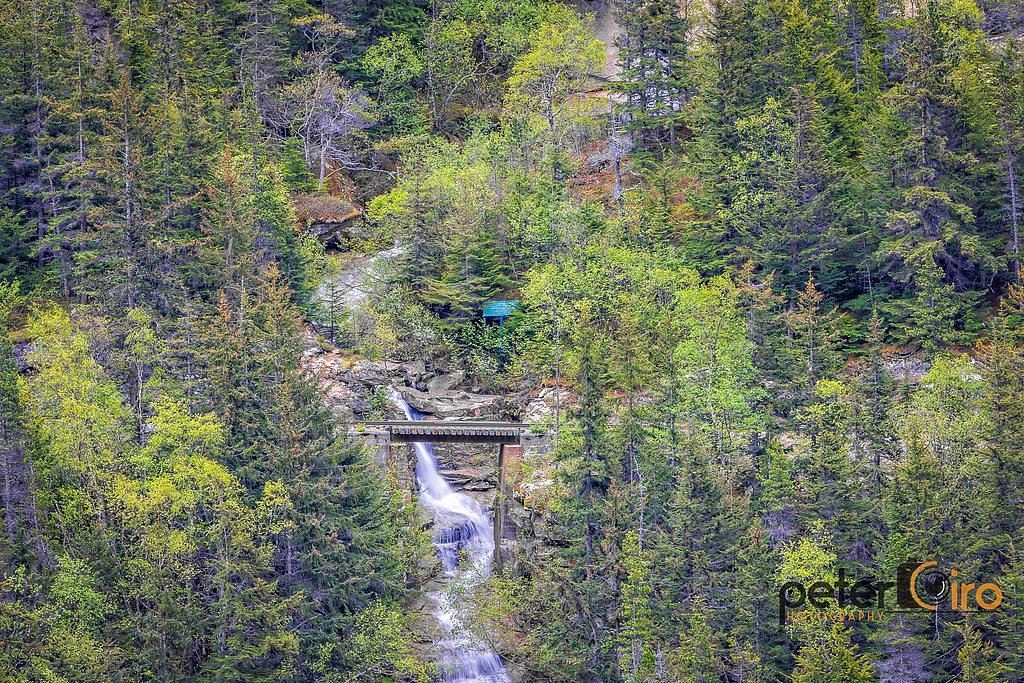
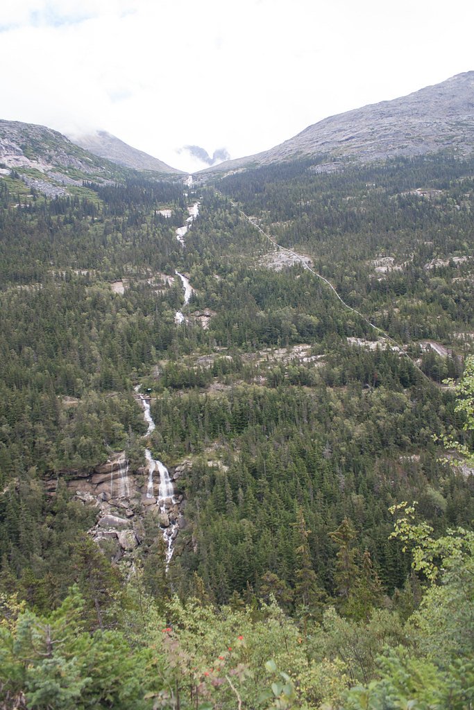
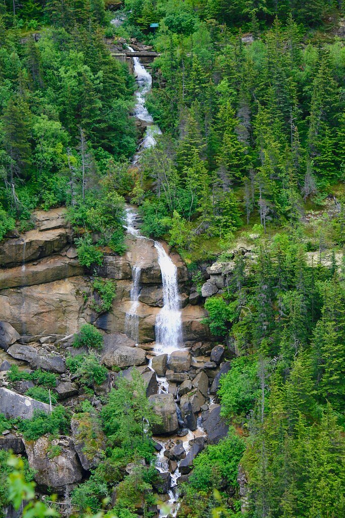
Photo Credits (5)
Difficulty
Drive Up
About Pitchfork Falls
Pitchfork Falls tumbles down a steep mountainside just outside Skagway, Alaska, carving a dramatic ribbon of glacial runoff that is especially impressive during the melt season. The falls are readily visible from the Klondike Highway, making them an easy and rewarding stop for travelers exploring the coastal fjords and alpine scenery of the region. Because the site lies within lands managed by the U.S. Forest Service, Pitchfork Falls is part of the Tongass National Forest landscape and is enjoyed as public forest scenery. For hikers who want more than a roadside view, a managed out-and-back route provides closer access to the falls. The hiking route is a moderate effort through typical Southeast Alaska terrain and the nearby Denver Caboose Cabin campground is about 3.71 km away for those planning an overnight stay, making Pitchfork Falls a convenient day trip or a stop on a longer Tongass exploration.
The Setting
Pitchfork Falls sits at 2,087 feet within Tongass National Forest, in the hills of Alaska.
Trail & Hike Details
The Approach
No hiking required. Pitchfork Falls is accessible by vehicle with a roadside viewing area.
Trail Description
Access to Pitchfork Falls is within the Tongass National Forest and overseen by the U.S. Forest Service. The established route is an out-and-back approximately 2.4 miles in length with roughly 350 feet of elevation gain and is rated moderate in difficulty. Surface, grade, and technical trail class are not specified in the available USFS data, so expect uneven, natural tread and typical Alaskan forest and streamside conditions. Many visitors still view the falls from pullouts along the Klondike Highway; those following the 2.4-mile route should wear sturdy footwear, be prepared for wet or muddy sections, and exercise caution near streambanks and the roadside viewing areas.
What to Expect
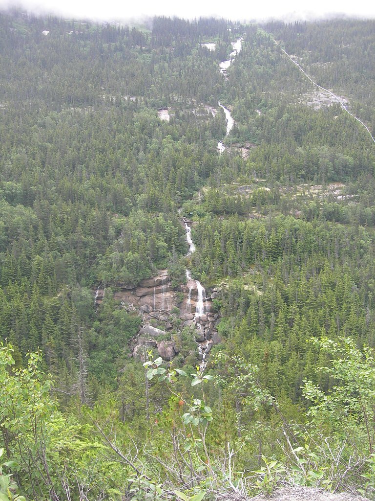
Expect to see a dramatic waterfall cascading down a steep rock face. The falls are particularly impressive during the spring and summer months when glacial meltwater is at its peak. The surrounding area offers stunning views of the Alaskan wilderness.
Accessibility
This waterfall is viewable from a vehicle-accessible area. No hiking is required.
Frequently Asked Questions
🐶 Are Dogs Allowed at Pitchfork Falls?
❌ Dogs are not allowed
Are There Any Fees or Permits Required?
🆖 No fees required
🏊 Is There Swimming at Pitchfork Falls?
❌ Swimming is not allowed
When to Visit
The best time to visit Pitchfork Falls is during the spring and summer when the waterfall is at its fullest due to glacial melt. However, it can be visited year-round.
Seasonal Access
The best time to visit is Spring, Summer, Fall, and Winter. Check with Tongass National Forest for seasonal road closures.
Safety Information
Water temperature is currently 42°F — cold enough to cause numbness quickly. Avoid prolonged water contact and use caution near the falls.
Be cautious when stopping along the highway to view the falls. Watch for passing vehicles and ensure your car is parked safely off the road. In winter, icy road conditions may make access more challenging.
Current Water Conditions
8,180 ft³/s
Current discharge — how much water is flowing
Much higher than usual for this time of year
16.18 ft
Water depth at gauge
42°F
Very coldExpect numbness within minutes
7-Day Discharge Trend
What does this mean for your visit?
The water is flowing much higher than usual, expect an impressive display. Water temperature is very cold at 42 degrees F, expect numbness within minutes.
About This Gauge
This gauge is on a nearby waterway and may not reflect exact conditions at the falls.
7-Day Flow Outlook
Based on the USGS gauge TAIYA R NR SKAGWAY AK (9 km away).
Today
Roaring
8834 cfs
6/10Tomorrow
Roaring
9025 cfs
6/10Wed
Roaring
8204 cfs
6/10Thu
Roaring
7475 cfs
6/10Fri
Roaring
6772 cfs
9/10Sat
Roaring
6022 cfs
6/10Sun
Roaring
6791 cfs
6/10Best window: Fri — roaring flow, partly sunny (trip score 9/10).
Best time of year: this gauge typically runs highest from early June to early September, peaking in August.
How we calculate this
This is a transparent outlook, not a precise forecast. We take the waterfall's current flow strength (how it ranks against its historical normal for today, from the nearest USGS stream gauge), carry that ranking forward along the gauge's seasonal curve, and nudge it for forecast rain. Confidence is highest for the next day or two and falls further out. Always check official conditions and your own judgment before visiting — high flows can be dangerous.
Know when to go.
Get a free email alert when waterfalls near Skagway hit peak flow. We only send when conditions are worth the trip — no weekly newsletters, no spam.
Weather Forecast
The Terrain Around Pitchfork Falls
High-resolution lidar hasn't been flown here yet, so this is the aerial view of the ground around the falls. Open the 3D view to tilt and spin the landscape.
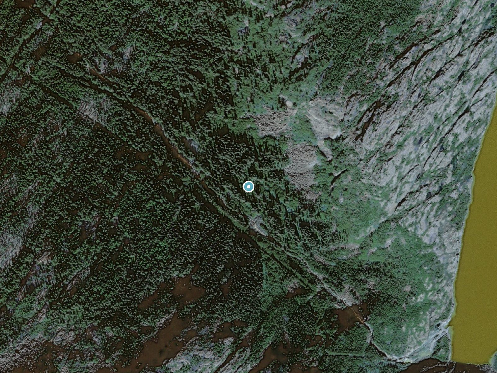
The dot marks the waterfall. The frame is about a mile across.
Aerial imagery: USGS The National Map. Public domain.
Location & Access
Getting There
Pitchfork Falls is located along the Klondike Highway, approximately 7 miles south of Skagway, Alaska. It is easily accessible by car, and the falls can be viewed from the road.
Get Directions on Google MapsParking
There is no designated parking area for Pitchfork Falls, but visitors can pull off to the side of the Klondike Highway to view the falls. Exercise caution when parking and exiting your vehicle.
Elevation
2,087 feet above sea level
Coordinates
59.531111° N, -135.196389° W
Land Management
Managed by USFS
Visitor Tips & Gear
Bring a camera to capture the beauty of the falls. If visiting in winter, check road conditions before traveling. Be cautious when pulling off the highway to view the falls, as there may be limited space and passing traffic.
Where to Stay
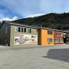
Holland America Skagway Inn
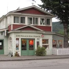
Historic Skagway Inn

Suite 1 Lynn View Lodge
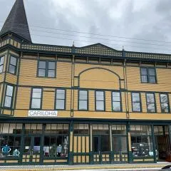
Pack Train Inn
Browse vacation cabins and private rentals nearby
Unique outdoor stays — tents, yurts, and treehouses
Rent a campervan or RV for your waterfall road trip
Some links are affiliate links. We may earn a commission at no extra cost to you.
Nearby Campground
DENVER CABOOSE CABIN
2.3 miles away · 1 sites
Overview This unique cabin is a refurbished 1960s railroad caboose that is retired from the White Pass and Yukon Railroad. It is an ideal base for outdoor enthusiasts who want to hike to the Denver Glacier. Access to Denver Caboose Cabin is via the White Pass and Yukon Railroad from May 1 to September 30. The cabin is closed to reservations in the off-season, since the surrounding area is owned by the railroad. Visitors are responsible for their own travel arrangements and safety and must bring s
Book on Recreation.govAdditional Information
Nearby Attractions
Skagway, Alaska; White Pass & Yukon Route Railroad; Klondike Gold Rush National Historical Park
Wildlife
The area around Pitchfork Falls is home to various Alaskan wildlife, including birds, bears, and mountain goats. Always observe wildlife from a safe distance.
Nearby Waterfalls
Writing about Pitchfork Falls? Embed this waterfall on your site for free.