
Photo Credits (5)
Difficulty
Easy
Trail Length
1.8 miles
Trail Type
Out And Back
Elevation Gain
100 ft
About Pedernales Falls
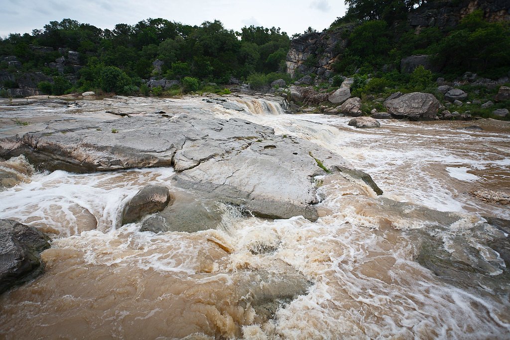
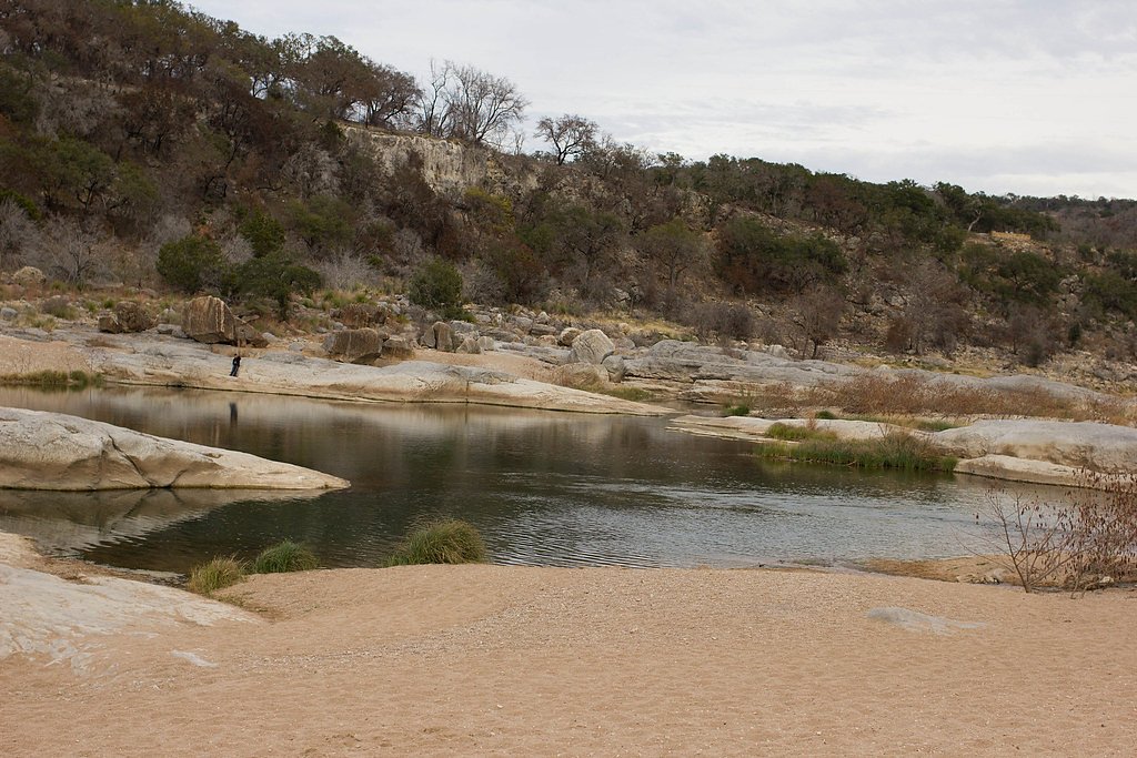
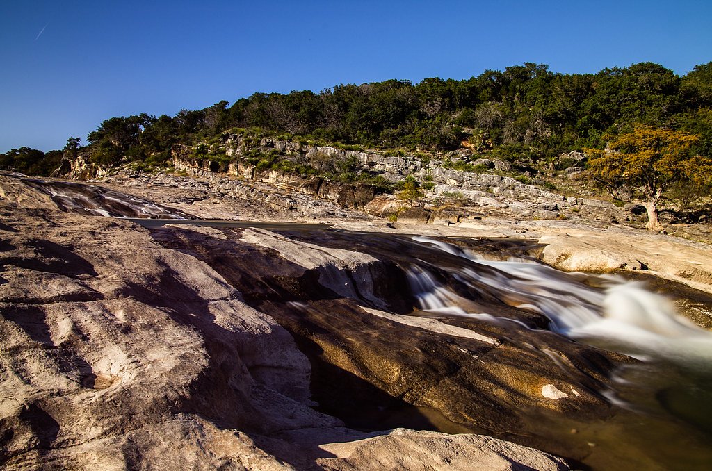
Pedernales Falls is a stunning series of cascading waterfalls located within Pedernales Falls State Park in Texas. The falls are formed by the Pedernales River flowing over massive limestone slabs, creating a picturesque and serene environment. The area is popular for hiking, photography, and enjoying nature.
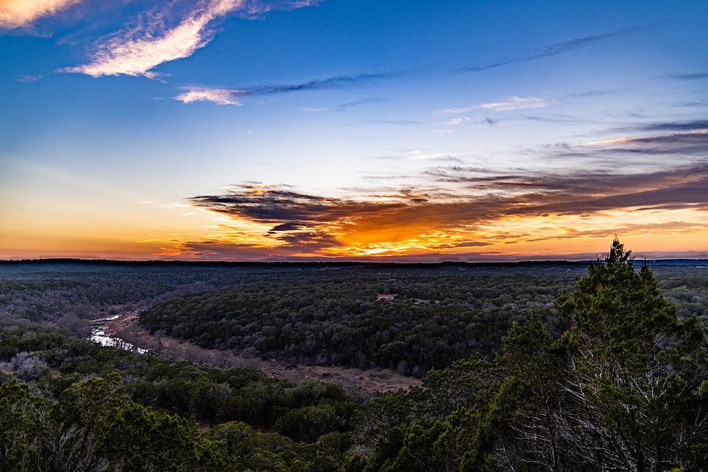
The Setting
Pedernales Falls sits at 853 feet within Pedernales Falls State Park, in the foothills of Texas.
Trail & Hike Details
The Approach
The easy 1.8-mile out-and-back trail gains 100 feet of elevation on the way to the falls.
Trail Description
The trail to Pedernales Falls is well-maintained and relatively short, making it accessible for most visitors. It features a gentle descent to the river area, with some rocky sections near the falls. Visitors can explore the limestone slabs and enjoy views of the cascading water.
What to Expect
Dogs are welcome.
Accessibility
The trail is not wheelchair accessible. Uneven terrain and elevation changes require steady footing.
Frequently Asked Questions
🐶 Are Dogs Allowed at Pedernales Falls?
✅ Dogs are allowed
Are There Any Fees or Permits Required?
🤑 Fee: $6.00
🏊 Is There Swimming at Pedernales Falls?
❌ Swimming is not allowed
When to Visit
Spring and fall are the best times to visit due to mild weather and pleasant conditions. Winter is also a good option for fewer crowds, while summer can be hot but still enjoyable with proper preparation.
Seasonal Access
The best time to visit is Spring, Fall, and Winter.
Safety Information
Flash flooding is a significant hazard in the area. Always check weather conditions before visiting and avoid the riverbed during or after heavy rains. The rocks near the falls can be slippery, so exercise caution.
Current Water Conditions
23 ft³/s
Current discharge — how much water is flowing
About average for this time of year
Based on 87 years of record
10.35 ft
Water depth at gauge
7-Day Discharge Trend
What does this mean for your visit?
Flow is about average for this time of year.
About This Gauge
This gauge is on a nearby waterway and may not reflect exact conditions at the falls.
7-Day Flow Outlook
Based on the USGS gauge Pedernales Rv nr Johnson City, TX (15 km away).
Today
Barely Flowing
23 cfs
5/10Tomorrow
Barely Flowing
21 cfs
5/10Mon
Barely Flowing
16 cfs
5/10Tue
Barely Flowing
18 cfs
5/10Wed
Barely Flowing
17 cfs
5/10Thu
Barely Flowing
18 cfs
5/10Fri
Barely Flowing
18 cfs
5/10Best window: Today — barely flowing flow, sunny (trip score 5/10).
Best time of year: this gauge typically runs highest from early April to early June, peaking in May.
How we calculate this
This is a transparent outlook, not a precise forecast. We take the waterfall's current flow strength (how it ranks against its historical normal for today, from the nearest USGS stream gauge), carry that ranking forward along the gauge's seasonal curve, and nudge it for forecast rain. Confidence is highest for the next day or two and falls further out. Always check official conditions and your own judgment before visiting — high flows can be dangerous.
Know when to go.
Get a free email alert when waterfalls near Round Mountain hit peak flow. We only send when conditions are worth the trip — no weekly newsletters, no spam.
Weather Forecast
Location & Access
Getting There
Pedernales Falls State Park is located about 30 miles west of Austin, Texas. The park entrance is off Ranch Road 2766, and clear signage directs visitors to the falls.
Get Directions on Google MapsParking
There is a designated parking area near the trailhead for Pedernales Falls. Parking is typically ample, but it can fill up during peak seasons or weekends.
Elevation
853 feet above sea level
Coordinates
30.339643° N, -98.254740° W
Land Management
Managed by SPR
Visitor Tips & Gear
Arrive early during weekends or holidays to secure parking and avoid crowds. Wear sturdy shoes for walking on rocky surfaces near the falls. Check the weather forecast, as heavy rains can cause flash flooding in the area.
As an Amazon Associate, we earn from qualifying purchases.
This easy 1.8 miles hike is straightforward — comfortable trail shoes and plenty of water should do. Icy conditions are common in winter — traction cleats are a smart addition.

Columbia Watertight II Rain Jacket
Packs into its own pocket, seam-sealed, and keeps you dry from spray and surprise rain.

Earth Pak Waterproof Dry Bag
Keeps your phone and gear dry when waterfall mist soaks everything else.

Waterproof Phone Pouch (AiRunTech)
Cheap insurance — take photos right next to the falls without killing your phone.

Kahtoola MICROspikes
Cult-favorite traction cleats that grip ice and wet rock — essential for winter waterfall hikes.

JOBY GorillaPod Starter Kit
Wraps around railings and rocks for long-exposure waterfall shots — no flat surface needed.

Polarized Sunglasses (Knockaround)
Cuts glare off the water so you actually see the falls — and your photos turn out better too.
Where to Stay

Blanco River Hotel

La Quinta by Wyndham Marble Falls

Holiday Inn Express & Suites - Dripping Springs - Austin Area by IHG

Carter Creek Winery Resort & Spa
Browse vacation cabins and private rentals nearby
Unique outdoor stays — tents, yurts, and treehouses
Rent a campervan or RV for your waterfall road trip
Some links are affiliate links. We may earn a commission at no extra cost to you.
Additional Information
Nearby Attractions
Nearby attractions include Hamilton Pool Preserve, Enchanted Rock State Natural Area, and the Lyndon B. Johnson National Historical Park.
Wildlife
The park is home to a variety of wildlife, including deer, armadillos, and numerous bird species. Visitors may also spot fish and turtles in the river.
Cities near Pedernales Falls
Writing about Pedernales Falls? Embed this waterfall on your site for free.