Photo Credits (5)
Difficulty
Moderate
Trail Length
2.4 miles
Trail Type
Out And Back
Elevation Gain
350 ft
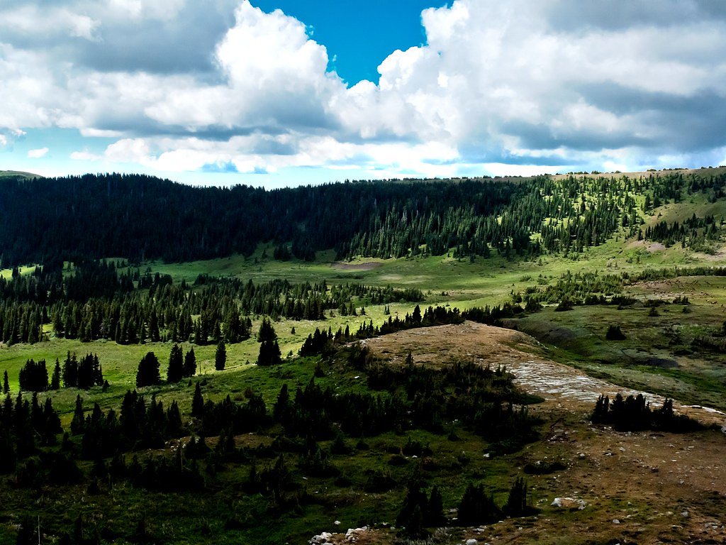
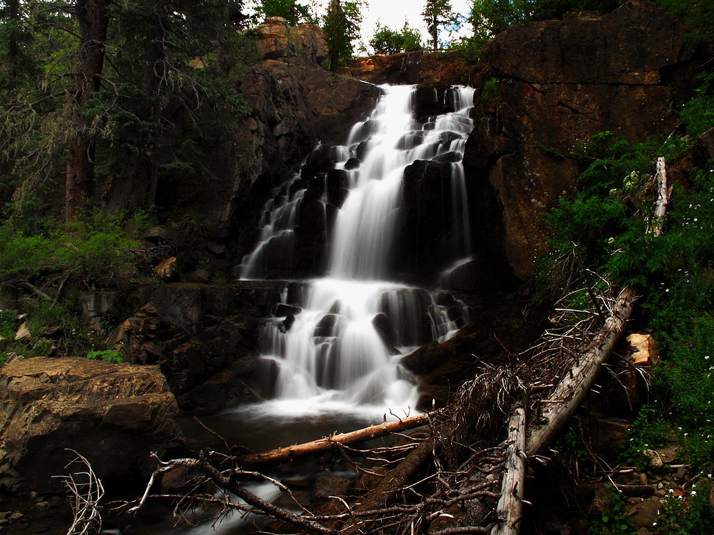
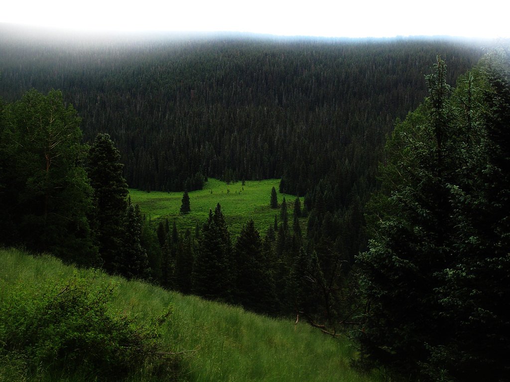
About Pecos Falls
Pecos Falls is a scenic waterfall located in the Pecos Wilderness of New Mexico. It is surrounded by lush forested areas and offers a serene escape for hikers and nature enthusiasts. The falls are part of the Pecos River and are known for their tranquil beauty.
The Setting
Pecos Falls sits at 10,423 feet within Santa Fe National Forest, fed by the Maestas Creek, in the high alpine of New Mexico.
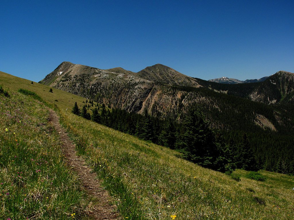
Trail & Hike Details
The Approach
The moderate hike follows Pecos River (#456), a 2.4-mile out-and-back trail over natural surface. Expect 350 feet of elevation gain with grades of +5-8%. The trail is moderately developed (Class 2).
USFS Trail
PECOS RIVER #456
Trail Class
Moderately Developed
Surface
Avg Grade
USFS Segment
3.27 miTrail Description
The trail to Pecos Falls winds through the beautiful Pecos Wilderness, featuring dense forests, meadows, and occasional views of the surrounding mountains. The path can be rocky and uneven in places, with some moderate elevation gain. The waterfall itself is a peaceful spot, ideal for a rest or picnic.
What to Expect
Dogs are welcome.
Accessibility
The trail is not wheelchair accessible. Uneven terrain and elevation changes require steady footing.
Frequently Asked Questions
🐶 Are Dogs Allowed at Pecos Falls?
✅ Dogs are allowed
Are There Any Fees or Permits Required?
🆖 No fees required
🏊 Is There Swimming at Pecos Falls?
❌ Swimming is not allowed
When to Visit
The best time to visit Pecos Falls is during late spring through early fall when the trail is free of snow and the weather is mild. Summer offers lush greenery, while fall provides beautiful foliage.
Seasonal Access
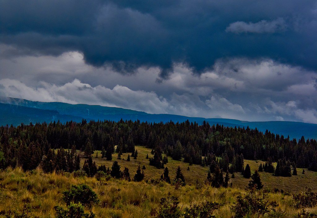
The best time to visit is Spring, Summer, and Fall. Access roads and trails may close during winter due to snow. Watch for flash flood warnings during monsoon season (July through September). Check with Santa Fe National Forest for seasonal road closures.
Safety Information
Be prepared for changing weather conditions and carry a map or GPS device, as trails in the Pecos Wilderness can be confusing. Watch for wildlife and avoid leaving food out. Cell service may be limited.
Current Water Conditions
5.31 ft
Water depth at gauge
About This Gauge
This gauge is on a nearby waterway and may not reflect exact conditions at the falls.
Know when to go.
Get a free email alert when waterfalls near Mora hit peak flow. We only send when conditions are worth the trip — no weekly newsletters, no spam.
Weather Forecast
Location & Access
Getting There
Pecos Falls is located within the Pecos Wilderness, which is accessible via the Pecos Trailhead near the town of Pecos, New Mexico. The trailhead is approximately a 45-minute drive from Santa Fe. Visitors will need to hike to reach the falls.
Get Directions on Google MapsParking
Parking is available at the Pecos Trailhead. The parking area may fill up during peak seasons, so arriving early is recommended.
Elevation
10,423 feet above sea level
Coordinates
35.936780° N, -105.558158° W
Land Management
Managed by USFS
Visitor Tips & Gear
Wear sturdy hiking shoes and bring plenty of water, as the trail can be rocky and uneven. Arrive early to secure parking and avoid crowds. Be prepared for changing weather conditions, especially in spring and fall.
This trail sits at 10,423 ft — roughly 30% less oxygen than sea level
Extreme AltitudeAt this elevation, altitude sickness is a real concern. Monitor how you feel, take frequent rest breaks, and descend if symptoms worsen. Visitors arriving from lower elevations should allow time to acclimatize.
As an Amazon Associate, we earn from qualifying purchases.

Coppertone Sport SPF 50 Sunscreen
UV intensity jumps ~4% per 1,000 ft — at this elevation you can burn in half the time.

Sun Bum SPF 30 Lip Balm (3-Pack)
Lips have almost no natural UV protection and burn fast in thin, dry mountain air.

Liquid I.V. Electrolyte Packets
You lose moisture ~2x faster at elevation — electrolytes help you absorb water efficiently.

ROCKNIGHT Polarized UV400 Sunglasses
High-altitude glare off rock and water is intense — UV400 lenses block 99%+ of UVA/UVB.

Boost Oxygen 10L Canister (2-Pack)
Portable supplemental oxygen for quick relief from headaches and shortness of breath.

Altitude Rx OxyBoost Complex
Antioxidant formula designed to support your body's natural altitude acclimation.

Fingertip Pulse Oximeter
Monitor blood oxygen in real time — SpO2 commonly drops to 85–90% above 10,000 ft.
As an Amazon Associate, we earn from qualifying purchases.
With 2.4 miles and 350 ft of elevation gain, sturdy boots and trekking poles will help on this moderate trail. Sun exposure on the trail makes good sun protection a must in summer.

Polarized Sunglasses (Knockaround)
Cuts glare off the water so you actually see the falls — and your photos turn out better too.

Columbia Watertight II Rain Jacket
Packs into its own pocket, seam-sealed, and keeps you dry from spray and surprise rain.

Earth Pak Waterproof Dry Bag
Keeps your phone and gear dry when waterfall mist soaks everything else.

Waterproof Phone Pouch (AiRunTech)
Cheap insurance — take photos right next to the falls without killing your phone.

Timberland Euro Sprint Mid Waterproof
Trusted waterproof boot with premium leather and grippy rubber sole — reliable on rocky, wet trails.

TrailBuddy Trekking Poles
Lightweight aluminum, cork grips, and flip-locks that actually hold — a best-seller for good reason.
Where to Stay

Inn at Vanessie

Historic Mora Inn & RV Park

La Fonda on the Plaza

Inn on the Alameda
Browse vacation cabins and private rentals nearby
Unique outdoor stays — tents, yurts, and treehouses
Rent a campervan or RV for your waterfall road trip
Some links are affiliate links. We may earn a commission at no extra cost to you.
Nearby Campground
JACKS CREEK GROUP AREA
8.5 miles away · 2 sites
Overview Jack's Creek Group Area is a picturesque, high-elevation campground situated just 50 miles from Santa Fe. Set at an altitude of approximately 8,000 feet within the Santa Fe National Forest, visitors can enjoy moderate temperatures and invigorating mountain breezes. Perfect for family reunions, recreational events, and large gatherings, it features 2 spacious group units to rent (Group A and Group B), each accommodating up to 40 guests. Open from mid-April to mid-November, this campgroun
Book on Recreation.govNearby Hot Springs
Hot springs near Mora, New Mexico
Ponce De Leon Springs
Ponce de Leon Springs delivers 93°F water at 7,400 feet in Taos County, running 45°F above the local annual average of 47.8°F. ...

Montezuma Hot Springs
Montezuma Hot Springs produces 138 °F water at 6,840 feet elevation in San Miguel County — a full 88 degrees above the local an...
Montezuma Hot Springs
Montezuma Hot Springs consists of 20 to 30 individual thermal vents at 6,729 feet elevation near Las Vegas, New Mexico. Also kn...

Manby Hot Springs
Manby Hot Springs discharges 100 °F water into three rock-walled pools with sandy bottoms on BLM land at 6,610 feet in the Rio ...
Manby Hot Springs
This entry represents a second measurement point within the Manby Hot Springs thermal system on BLM land near Arroyo Hondo at 6...
Unnamed Spring Taos County
Black Rock Hot Spring, as mapped by OpenStreetMap, reaches 106 degrees Fahrenheit on BLM land in Taos County — a comfortable so...
Looking for a soak after your hike? Explore more hot springs near Mora, New Mexico on SoakingSprings.
Explore New Mexico springsAdditional Information
Nearby Attractions
Nearby attractions include the Pecos National Historical Park and other trails within the Pecos Wilderness.
Wildlife
The area is home to a variety of wildlife, including deer, elk, and birds. Visitors should be cautious of bears and other potentially dangerous animals.
Cities near Pecos Falls
Nearby Waterfalls
Writing about Pecos Falls? Embed this waterfall on your site for free.