Passage Falls
By Armen Suny · Last verified Mar 2026
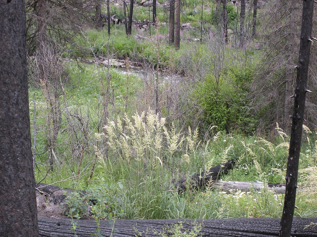
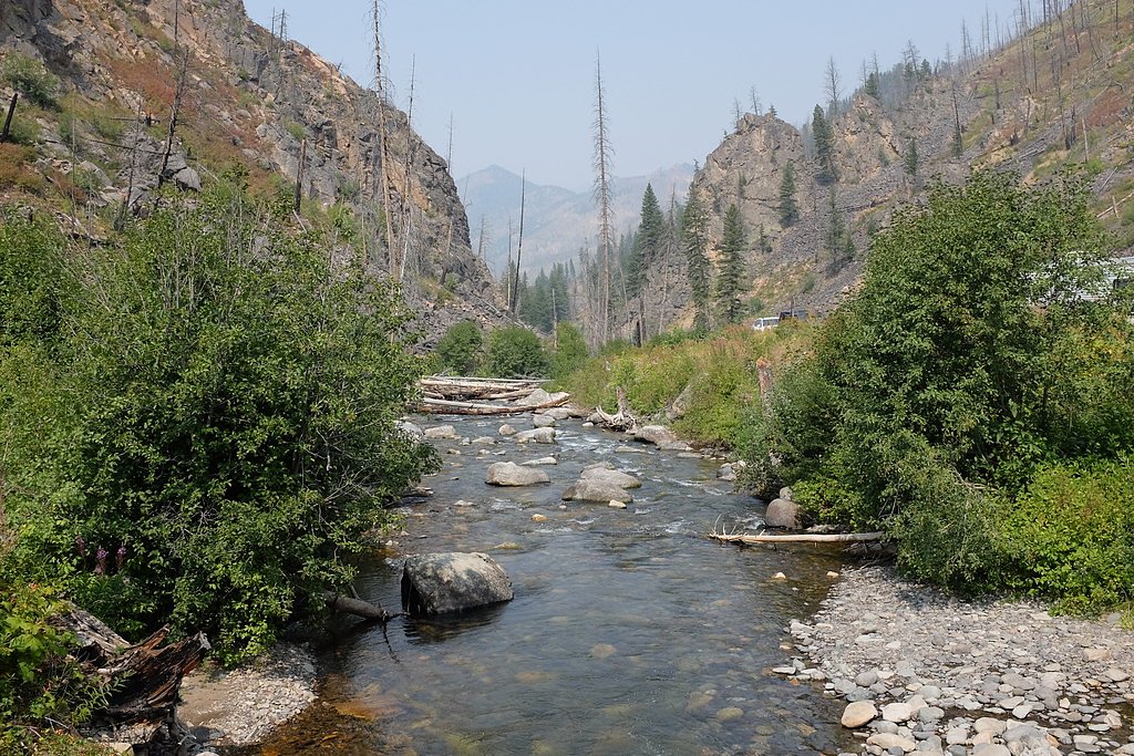
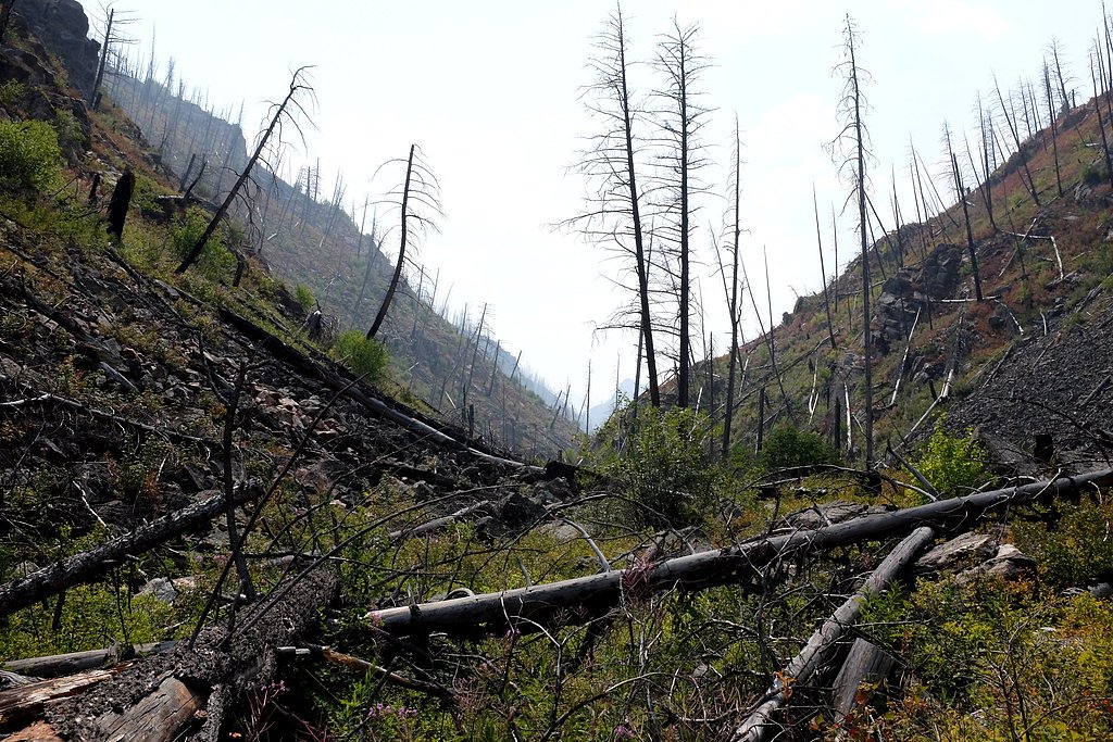
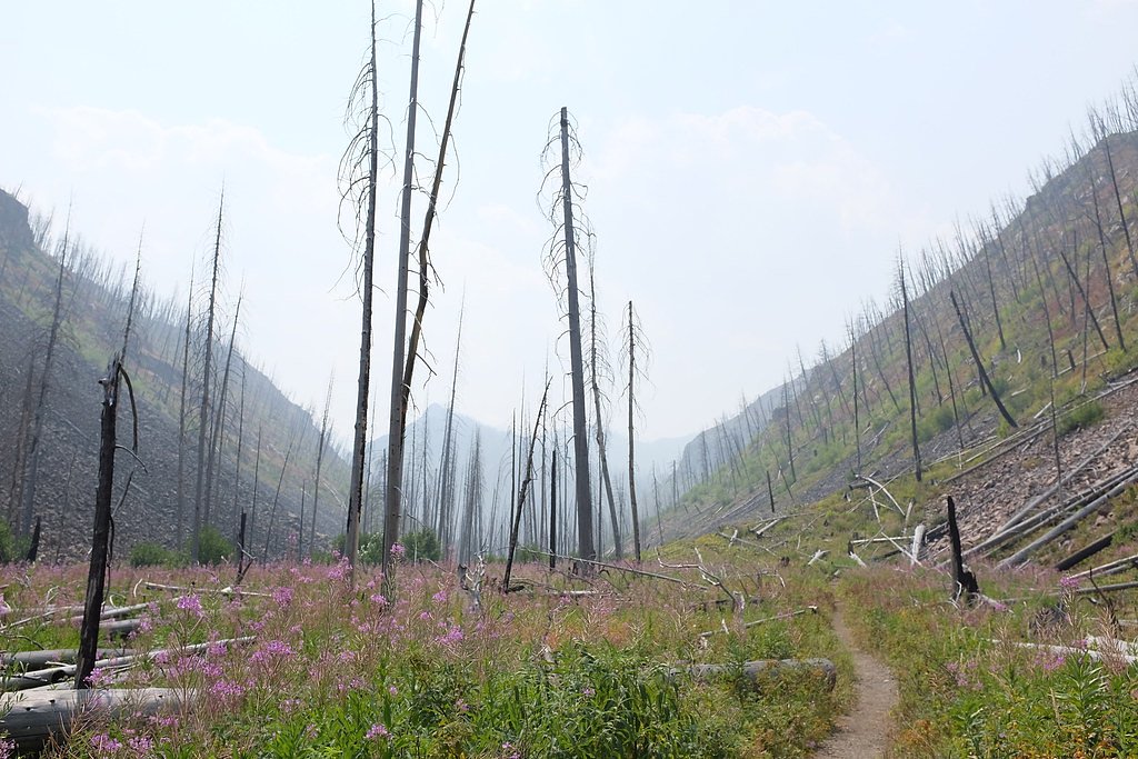
Photo Credits (5)
Difficulty
Moderate
Trail Length
5.6 miles
Trail Type
Out And Back
Elevation Gain
800 ft
About Passage Falls
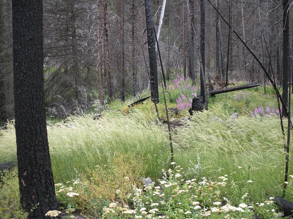
Passage Falls tumbles through the Absaroka-Beartooth Wilderness in southwestern Montana, set within Gallatin National Forest and managed by the U.S. Forest Service. The falls are a popular, picturesque goal for day hikes — a rewarding cascade reached via the USFS Passage Creek Trail (Trail #59) that threads creekside forest and mountain scenery. The setting feels remote yet remains accessible on a moderate hike, making it a favorite for photographers and hikers wanting a classic wilderness waterfall. The approach is an out-and-back route of roughly 5.6 miles with about 800 feet of elevation gain (USFS GIS records list Passage Creek Trail #59 at 6.05 miles). The Forest Service maintains the corridor; the trail tread is native material and the route is rated Class 2. For campers, Mill Creek Cabin campground sits about 6.47 km away, offering a nearby option if you want to turn the visit into an overnight backcountry outing.
The Setting
Passage Falls sits at 6,440 feet within Gallatin National Forest, fed by the Yellowstone River, in the high mountains of Montana.
Trail & Hike Details
The Approach
The moderate hike follows Passage Creek (#59), a 5.6-mile out-and-back trail over natural surface. Expect 800 feet of elevation gain. The trail is moderately developed (Class 2).
USFS Trail
PASSAGE CREEK #59
Trail Class
Moderately Developed
Surface
USFS Segment
6.05 miTrail Description
USFS Passage Creek Trail (Trail #59) is a Class 2, native-surface out-and-back that follows Passage Creek through forested terrain en route to Passage Falls. The route is approximately 5.6 miles long with roughly 800 feet of climbing (USFS GIS length listed as 6.05 miles) and is generally described as moderate in difficulty. Expect a natural tread of native materials and a steady but not steep grade for most of the hike; the trail terminates at the base of the waterfall where you can pause for views and photos. Mill Creek Cabin campground is the nearest established camping option, about 6.47 km away.
What to Expect
Dogs are welcome.
Accessibility
The trail is not wheelchair accessible. Uneven terrain and elevation changes require steady footing.
Frequently Asked Questions
🐶 Are Dogs Allowed at Passage Falls?
✅ Dogs are allowed
Are There Any Fees or Permits Required?
🆖 No fees required
🏊 Is There Swimming at Passage Falls?
❌ Swimming is not allowed
When to Visit
Spring and early summer are the best times to visit Passage Falls, as the waterfall is most active during this period. Fall offers beautiful foliage, while winter may require snowshoes or skis for access.
Seasonal Access
The best time to visit is Spring, Summer, and Fall. Access roads and trails may close during winter due to snow. Check with Gallatin National Forest for seasonal road closures.
Safety Information
Be prepared for changing weather conditions and carry bear spray. Watch for slippery rocks near the waterfall and avoid getting too close to the edge.
Current Water Conditions
Based on a USGS gauge 17 miles away
6,080 ft³/s
Current discharge — how much water is flowing
Lower than usual for this time of year
Based on 119 years of record
4.24 ft
Water depth at gauge
58°F
ColdBracing — limit time in water
7-Day Discharge Trend
What does this mean for your visit?
Flow is lower than usual for this time of year. Water temperature is a bracing 58 degrees F, limit your time in the water.
About This Gauge
This gauge is on a regional waterway. Conditions at the falls may differ, especially after local rain.
7-Day Flow Outlook
Based on the USGS gauge Yellowstone River at Corwin Springs MT (27 km away).
Today
Low
6931 cfs
3/10Tomorrow
Moderate
7261 cfs
4/10Sun
Moderate
7261 cfs
4/10Mon
Moderate
7180 cfs
4/10Tue
Moderate
6893 cfs
4/10Wed
Moderate
6658 cfs
4/10Thu
Low
5790 cfs
6/10Best window: Thu — low flow, sunny (trip score 6/10).
Best time of year: this gauge typically runs highest from early May to early August, peaking in June.
How we calculate this
This is a transparent outlook, not a precise forecast. We take the waterfall's current flow strength (how it ranks against its historical normal for today, from the nearest USGS stream gauge), carry that ranking forward along the gauge's seasonal curve, and nudge it for forecast rain. Confidence is highest for the next day or two and falls further out. Always check official conditions and your own judgment before visiting — high flows can be dangerous.
Know when to go.
Get a free email alert when waterfalls near Jardine hit peak flow. We only send when conditions are worth the trip — no weekly newsletters, no spam.
Weather Forecast
Location & Access
Getting There
Passage Falls is accessed via the Passage Creek Falls Trailhead, located off Mill Creek Road near Livingston, Montana. The trailhead is reachable by car, but the road may be rough in certain sections, especially during wet weather.
Get Directions on Google MapsParking
There is a small parking area at the Passage Creek Falls Trailhead. Arrive early during peak seasons to secure a spot.
Elevation
6,440 feet above sea level
Coordinates
45.242160° N, -110.497147° W
Land Management
Managed by USFS
Visitor Tips & Gear
Wear sturdy hiking shoes, as the trail can be muddy or slippery in places. Bring insect repellent during summer months, and carry plenty of water. Check weather conditions before your visit, as the trail may be more difficult after heavy rain or snow.
This trail sits at 6,440 ft above sea level
Elevated TrailUV radiation is roughly 26% stronger at this elevation than at sea level, and the dry air accelerates dehydration. Extra sun protection and fluids go a long way.
As an Amazon Associate, we earn from qualifying purchases.

Coppertone Sport SPF 50 Sunscreen
UV intensity jumps ~4% per 1,000 ft — at this elevation you can burn in half the time.

Sun Bum SPF 30 Lip Balm (3-Pack)
Lips have almost no natural UV protection and burn fast in thin, dry mountain air.

Liquid I.V. Electrolyte Packets
You lose moisture ~2x faster at elevation — electrolytes help you absorb water efficiently.

ROCKNIGHT Polarized UV400 Sunglasses
High-altitude glare off rock and water is intense — UV400 lenses block 99%+ of UVA/UVB.
As an Amazon Associate, we earn from qualifying purchases.
With 5.6 miles and 800 ft of elevation gain, sturdy boots and trekking poles will help on this moderate trail. Sun exposure on the trail makes good sun protection a must in summer.

Polarized Sunglasses (Knockaround)
Cuts glare off the water so you actually see the falls — and your photos turn out better too.

Columbia Watertight II Rain Jacket
Packs into its own pocket, seam-sealed, and keeps you dry from spray and surprise rain.

Earth Pak Waterproof Dry Bag
Keeps your phone and gear dry when waterfall mist soaks everything else.

Waterproof Phone Pouch (AiRunTech)
Cheap insurance — take photos right next to the falls without killing your phone.

Timberland Euro Sprint Mid Waterproof
Trusted waterproof boot with premium leather and grippy rubber sole — reliable on rocky, wet trails.

TrailBuddy Trekking Poles
Lightweight aluminum, cork grips, and flip-locks that actually hold — a best-seller for good reason.
Where to Stay

Ridgeline Hotel at Yellowstone, an Ascend Collection Hotel

Yellowstone Village Inn and Suites

Yellowstone Gateway Inn

Corral Villas Yellowstone
Browse vacation cabins and private rentals nearby
Unique outdoor stays — tents, yurts, and treehouses
Rent a campervan or RV for your waterfall road trip
Some links are affiliate links. We may earn a commission at no extra cost to you.
Nearby Campground
MILL CREEK CABIN
4 miles away · 1 sites
Overview Mill Creek Cabin was built in 1927 as a temporary lodging for traveling Forest Service personnel. The cabin can be accessed by vehicle year-round, though a four-wheel drive vehicle is recommended. Guests are responsible for their own travel arrangements and safety. This cabin offers rustic accommodations with limited amenities, so guests need to bring most of their own supplies and gear for a comfortable stay.Recreation Hikers and equestrians can access trailheads that lead into the Absa
Book on Recreation.govNearby Hot Springs
Hot springs near Jardine, Montana

Chico Hot Springs
Chico Hot Springs produces 113°F water at 5,336 feet in Park County's Paradise Valley, 30 miles north of Yellowstone National P...

Bear Creek Springs
Bear Creek Springs discharges at 72°F -- only 31 degrees above ambient -- within Gallatin National Forest at 5,423 feet elevati...
Laduke (Corwin) Hot Spring
LaDuke Hot Spring, also called Corwin Hot Spring, discharges at 154°F on the Gallatin National Forest in Gallatin County, Monta...

Hot River
Hot River forms where thermal springs mix with cold stream water at 5,685 feet elevation near Mammoth Hot Springs in Yellowston...

Calcite Springs
Calcite Springs emerges at 201 degrees Fahrenheit along the walls of the Grand Canyon of the Yellowstone, where superheated wat...
Carter Bridge Warm Springs
Carter Bridge Warm Springs surfaces at 82°F in Park County, Montana, at 4,542 feet elevation. Reaching the spring requires a sh...
Looking for a soak after your hike? Explore more hot springs near Jardine, Montana on SoakingSprings.
Explore Montana springsAdditional Information
Nearby Attractions
The Absaroka-Beartooth Wilderness offers numerous hiking trails and scenic spots, including Pine Creek Falls and the Yellowstone River.
Wildlife
Visitors may encounter wildlife such as deer, elk, and various bird species. Be cautious of bears and carry bear spray.
Cities near Passage Falls
Writing about Passage Falls? Embed this waterfall on your site for free.