

Photo Credits (5)
Difficulty
Easy
Trail Length
0.4 miles
Trail Type
Out And Back
Elevation Gain
50 ft
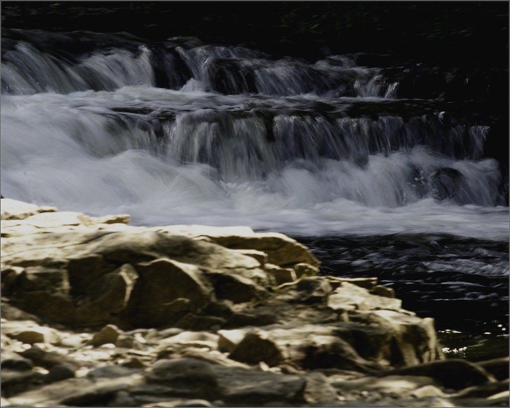
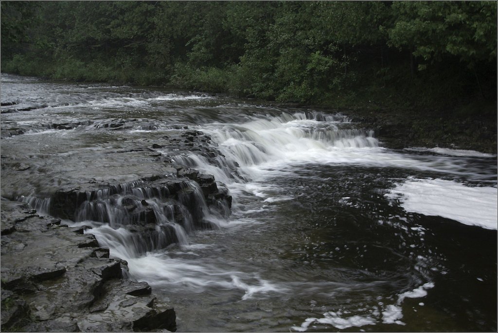
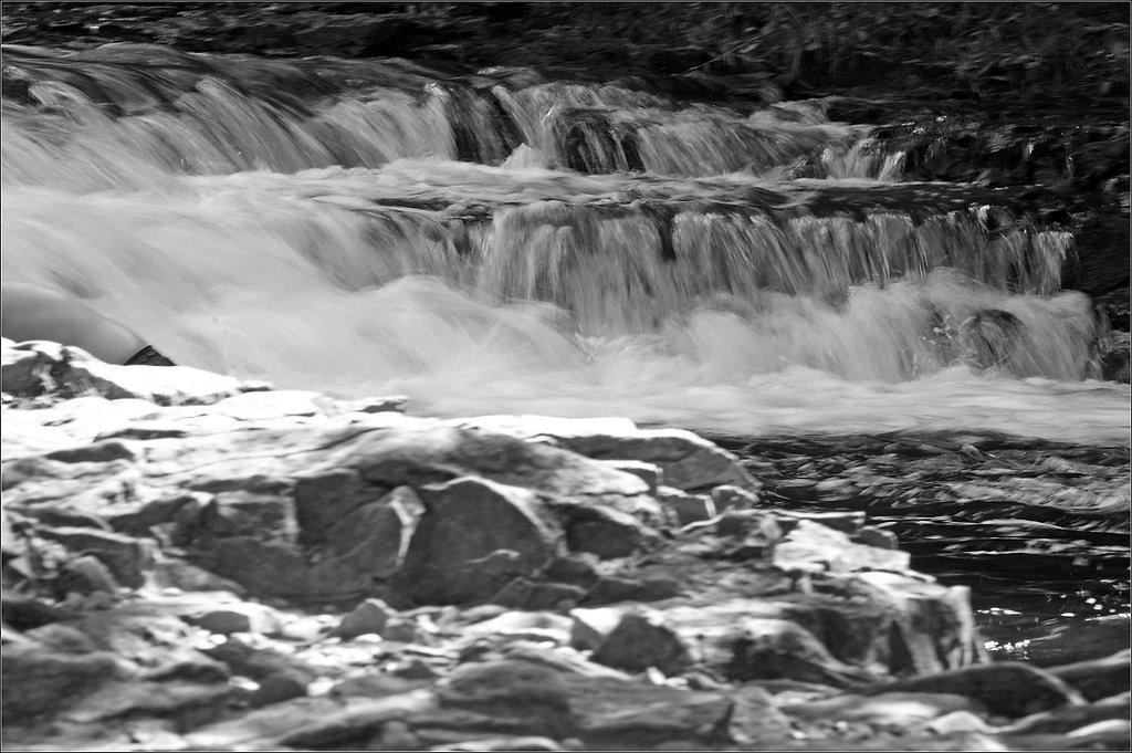
About Ocqueoc Falls
Ocqueoc Falls (pronounced AH-key-ock) is a series of rapids and waterfalls on the Ocqueoc River in Presque Isle County and holds the distinction of being the largest — and only named — waterfall in Michigan’s Lower Peninsula. The falls are remarkably accessible: a short walk delivers you to broad, shallow cascades and inviting pools where visitors commonly wade or sit on the rocks to enjoy the sound of flowing water. The setting is framed by the mixed northern hardwoods of the region, offering photogenic views in every season. The falls sit within the Atlanta Unit of the Mackinaw State Forest (Atlanta State Forest Area) and are on land owned by SDNR, with day-to-day site management handled by nearby Hoeft State Park. Adjacent to the falls is the Ocqueoc Falls Bicentennial Pathway, a 6.3-mile route that gives hikers the option to extend their outing into the surrounding forest. Whether you’re stopping by for a quick photo, a family picnic, or a gentle stretch of trail, Ocqueoc Falls is an inviting, easy-to-reach natural highlight of Michigan’s Lower Peninsula.
The Setting
Ocqueoc Falls sits at 682 feet within Atlanta State Forest Area, fed by the Pigeon River, in the foothills of Michigan.
Trail & Hike Details
The Approach
The easy 0.4-mile out-and-back trail gains 50 feet of elevation on the way to the falls.
Trail Description
This is a short, out-and-back trail of approximately 0.4 miles with about 50 feet of elevation gain, rated easy. The path is well-maintained and primarily gravel, with a gentle average grade (roughly 50 feet of gain spread over the short distance), making it suitable for families and most ability levels. Benches and picnic areas are found near the parking and viewing areas, and the trail leads directly to wide, shallow cascades and pools at the river’s edge. For a longer hike, the nearby Ocqueoc Falls Bicentennial Pathway (6.3 miles) departs from the area and explores more of the Atlanta Unit of the Mackinaw State Forest.
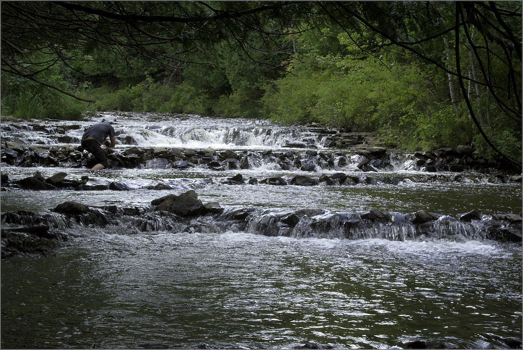
What to Expect
Swimming is permitted. Dogs are welcome.
Accessibility
The trail is short and relatively flat, but the surface may be uneven. Contact the managing agency for accessibility details.
Frequently Asked Questions
🐶 Are Dogs Allowed at Ocqueoc Falls?
✅ Dogs are allowed
Are There Any Fees or Permits Required?
🤑 Fee: $5.00
🏊 Is There Swimming at Ocqueoc Falls?
✅ Swimming is allowed
When to Visit
Spring and summer are ideal for enjoying the flowing water and lush surroundings, while fall offers stunning foliage. Winter provides a unique opportunity to see the falls frozen.
Seasonal Access
The best time to visit is Spring, Summer, Fall, and Winter.
Safety Information
Rocks near the falls can be slippery, so wear appropriate footwear and exercise caution. During winter, icy conditions may make the area hazardous.
Current Water Conditions
Based on a USGS gauge 25.9 miles away
82 ft³/s
Current discharge — how much water is flowing
Higher than usual for this time of year
Based on 75 years of record
2.34 ft
Water depth at gauge
7-Day Discharge Trend
What does this mean for your visit?
The water is flowing higher than usual for this time of year.
About This Gauge
This gauge is on a regional waterway. Conditions at the falls may differ, especially after local rain.
7-Day Flow Outlook
Based on the USGS gauge PIGEON RIVER NEAR VANDERBILT, MI (42 km away).
Today
Moderate
93 cfs
4/10Tomorrow
Moderate
91 cfs
5/10Fri
Moderate
93 cfs
4/10Sat
Moderate
89 cfs
5/10Sun
Moderate
87 cfs
5/10Mon
Moderate
89 cfs
5/10Tue
Moderate
81 cfs
8/10Best window: Tue — moderate flow, sunny (trip score 8/10).
Best time of year: this gauge typically runs highest from mid March to mid May, peaking in April.
How we calculate this
This is a transparent outlook, not a precise forecast. We take the waterfall's current flow strength (how it ranks against its historical normal for today, from the nearest USGS stream gauge), carry that ranking forward along the gauge's seasonal curve, and nudge it for forecast rain. Confidence is highest for the next day or two and falls further out. Always check official conditions and your own judgment before visiting — high flows can be dangerous.
Know when to go.
Get a free email alert when waterfalls near Millersburg hit peak flow. We only send when conditions are worth the trip — no weekly newsletters, no spam.
Weather Forecast
Location & Access
Getting There
Ocqueoc Falls is located off M-68, approximately 11 miles west of Rogers City, Michigan. The falls are easily accessible via a short walk from the parking area.
Get Directions on Google MapsParking
There is a designated parking area near the trailhead, which provides easy access to the falls.
Elevation
682 feet above sea level
Coordinates
45.396123° N, -84.058063° W
Land Management
Managed by SDNR
Visitor Tips & Gear
Arrive early during peak seasons to secure parking. Bring water shoes if you plan to wade in the water, as the rocks can be slippery. Bug spray is recommended during summer months.
As an Amazon Associate, we earn from qualifying purchases.
For this easy 0.4 miles trail, lightweight trail shoes and a water bottle are usually sufficient. Icy conditions are common in winter — traction cleats are a smart addition.

Columbia Watertight II Rain Jacket
Packs into its own pocket, seam-sealed, and keeps you dry from spray and surprise rain.

Polarized Sunglasses (Knockaround)
Cuts glare off the water so you actually see the falls — and your photos turn out better too.

Earth Pak Waterproof Dry Bag
Keeps your phone and gear dry when waterfall mist soaks everything else.

Waterproof Phone Pouch (AiRunTech)
Cheap insurance — take photos right next to the falls without killing your phone.

Kahtoola MICROspikes
Cult-favorite traction cleats that grip ice and wet rock — essential for winter waterfall hikes.

JOBY GorillaPod Starter Kit
Wraps around railings and rocks for long-exposure waterfall shots — no flat surface needed.
Where to Stay

Enchanted Lake Huron Cottage w/ Beach Access!

Waterway Inn

Hometown Inn Indian River

Star Gate Motel
Browse vacation cabins and private rentals nearby
Unique outdoor stays — tents, yurts, and treehouses
Rent a campervan or RV for your waterfall road trip
Some links are affiliate links. We may earn a commission at no extra cost to you.
Additional Information
Nearby Attractions
Rogers City, Lake Huron, and the Huron National Forest are nearby attractions worth exploring.
Wildlife
The area is home to various bird species, deer, and other small wildlife. Be mindful of insects during warmer months.
Cities near Ocqueoc Falls
Writing about Ocqueoc Falls? Embed this waterfall on your site for free.