
Photo Credits (5)
Difficulty
Moderate
Trail Length
2.0 miles
Trail Type
Out And Back
Elevation Gain
300 ft
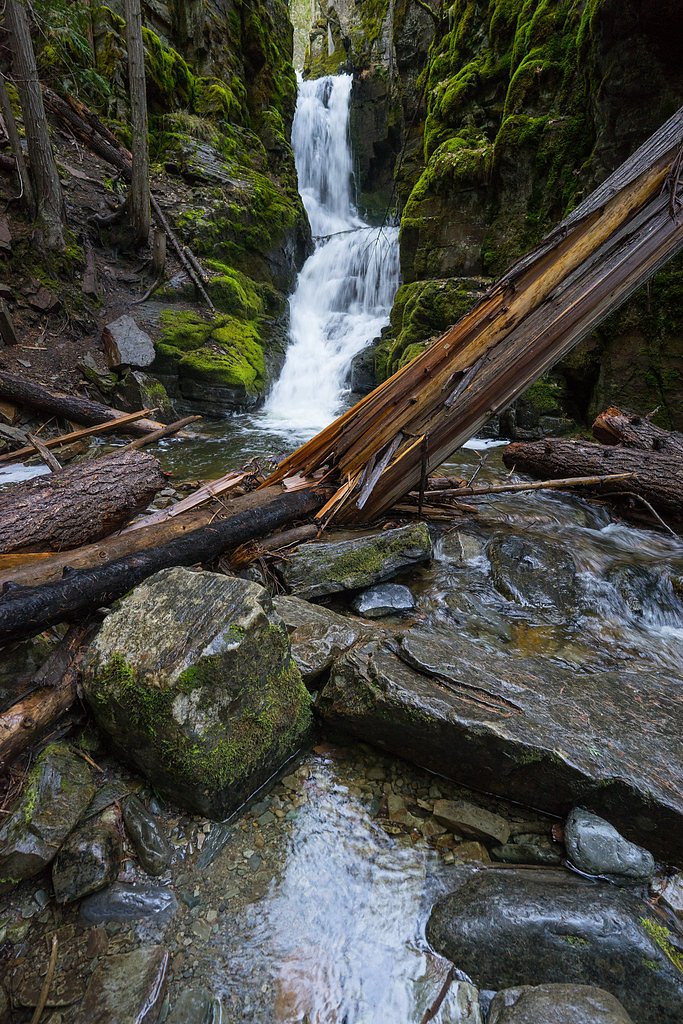
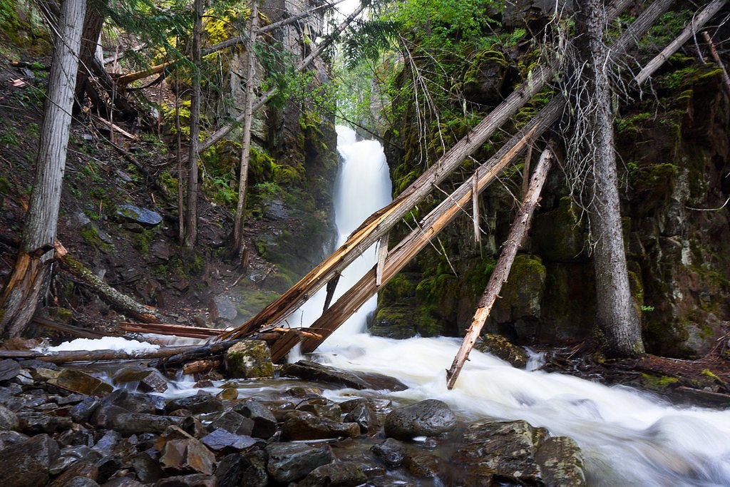
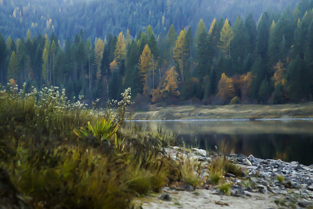
About North Fork Falls
North Fork Falls is a peaceful cascade tucked into the forested slopes of Lolo National Forest, managed by the U.S. Forest Service. Hikers reach the falls via the USFS EAST FORK (OF NORTH FORK) Trail #481, a short but rewarding route that threads through dense spruce and fir and opens onto a scenic plunge pool where the creek tumbles over bedrock. The setting has a backcountry feel despite the relatively short approach, making it a favorite for hikers looking for a quiet, wooded outing. The hike is an accessible day trip for most fit hikers: the full outing is about 2.0 miles round-trip with roughly 300 feet of elevation gain and is commonly rated moderate. Expect a native-surface singletrack with some steeper pitches—the trail’s official data note typical grades between 12–20%—so wear sturdy shoes and be ready for a few rocky or uneven sections as you close in on the falls.
The Setting
North Fork Falls sits at 5,407 feet within Lolo National Forest, in the high mountains of Montana.
Trail & Hike Details
The Approach
The moderate hike follows East Fork (Of North Fork) (#481), a 2.0-mile out-and-back trail over natural surface. Expect 300 feet of elevation gain with grades of 12-20%. The trail is developed (Class 3).
USFS Trail
EAST FORK (OF NORTH FORK) #481
Trail Class
Developed
Surface
Avg Grade
USFS Segment
0.90 miTrail Description
Out-and-back route, approximately 2.0 miles round-trip with ~300 ft elevation gain; difficulty: moderate. USFS Trail: EAST FORK (OF NORTH FORK) Trail #481 (GIS length 0.9 miles one-way). Surface: native material; typical grade: 12–20%; trail class: 3. The tread is a native-material singletrack that’s generally well-defined but includes short steep pitches and some rocky or uneven sections—careful footwork recommended on the steeper segments.
What to Expect
Dogs are welcome.
Accessibility
The trail is not wheelchair accessible. Uneven terrain and elevation changes require steady footing.
Frequently Asked Questions
🐶 Are Dogs Allowed at North Fork Falls?
✅ Dogs are allowed
Are There Any Fees or Permits Required?
🆖 No fees required
🏊 Is There Swimming at North Fork Falls?
❌ Swimming is not allowed
When to Visit
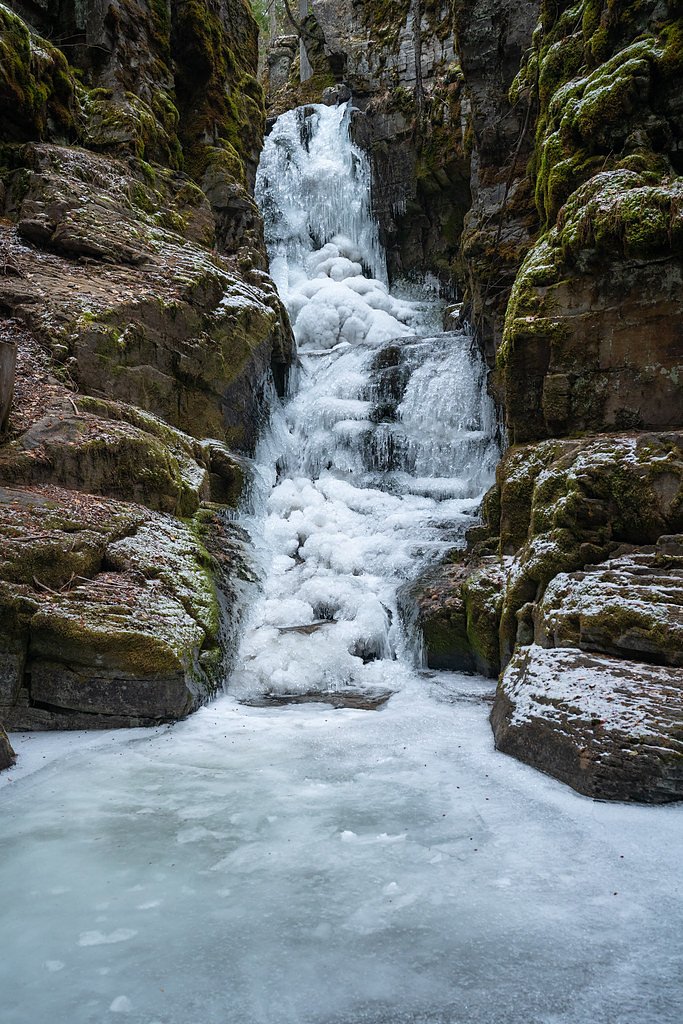
Late spring to early fall is the best time to visit, as the trail is typically clear, and the waterfall flow is strongest during this period.
Seasonal Access
The best time to visit is Spring, Summer, and Fall. Access roads and trails may close during winter due to snow. Check with Lolo National Forest for seasonal road closures.
Safety Information
Be cautious of slippery rocks near the waterfall. Carry bear spray and make noise while hiking to avoid surprising wildlife. Check weather conditions before visiting, as the trail may become hazardous during rain or snow.
Current Water Conditions
Based on a USGS gauge 17.5 miles away
628 ft³/s
Current discharge — how much water is flowing
About average for this time of year
Based on 26 years of record
5.43 ft
Water depth at gauge
7-Day Discharge Trend
What does this mean for your visit?
Flow is about average for this time of year.
About This Gauge
This gauge is on a regional waterway. Conditions at the falls may differ, especially after local rain.
7-Day Flow Outlook
Based on the USGS gauge NF Blackfoot R ab Dry Gulch nr Ovando MT (28 km away).
Today
Moderate
716 cfs
4/10Tomorrow
Moderate
751 cfs
4/10Sun
Moderate
712 cfs
5/10Mon
Moderate
662 cfs
5/10Tue
Moderate
635 cfs
5/10Wed
Moderate
590 cfs
5/10Thu
Moderate
583 cfs
4/10Best window: Sun — moderate flow, rain showers (trip score 5/10).
Best time of year: this gauge typically runs highest from mid April to mid July, peaking in May.
How we calculate this
This is a transparent outlook, not a precise forecast. We take the waterfall's current flow strength (how it ranks against its historical normal for today, from the nearest USGS stream gauge), carry that ranking forward along the gauge's seasonal curve, and nudge it for forecast rain. Confidence is highest for the next day or two and falls further out. Always check official conditions and your own judgment before visiting — high flows can be dangerous.
Know when to go.
Get a free email alert when waterfalls near Helmville hit peak flow. We only send when conditions are worth the trip — no weekly newsletters, no spam.
Weather Forecast
Location & Access
Getting There
North Fork Falls is located in the Flathead National Forest, Montana. Access typically involves driving to a trailhead near the North Fork area, with signage available to guide visitors.
Get Directions on Google MapsParking
Parking is available at the trailhead, but spaces may be limited during peak seasons.
Elevation
5,407 feet above sea level
Coordinates
47.194109° N, -112.894769° W
Land Management
Managed by USFS
Visitor Tips & Gear
Arrive early to secure parking, especially during summer weekends. Bring water, snacks, and sturdy hiking shoes. Check trail conditions before visiting, as snow or mud may impact accessibility in spring or fall.
This trail sits at 5,407 ft above sea level
Elevated TrailUV radiation is roughly 22% stronger at this elevation than at sea level, and the dry air accelerates dehydration. Extra sun protection and fluids go a long way.
As an Amazon Associate, we earn from qualifying purchases.

Coppertone Sport SPF 50 Sunscreen
UV intensity jumps ~4% per 1,000 ft — at this elevation you can burn in half the time.

Sun Bum SPF 30 Lip Balm (3-Pack)
Lips have almost no natural UV protection and burn fast in thin, dry mountain air.

Liquid I.V. Electrolyte Packets
You lose moisture ~2x faster at elevation — electrolytes help you absorb water efficiently.

ROCKNIGHT Polarized UV400 Sunglasses
High-altitude glare off rock and water is intense — UV400 lenses block 99%+ of UVA/UVB.
As an Amazon Associate, we earn from qualifying purchases.
With 2.0 miles and 300 ft of elevation gain, sturdy boots and trekking poles will help on this moderate trail. Sun exposure on the trail makes good sun protection a must in summer.

Polarized Sunglasses (Knockaround)
Cuts glare off the water so you actually see the falls — and your photos turn out better too.

Columbia Watertight II Rain Jacket
Packs into its own pocket, seam-sealed, and keeps you dry from spray and surprise rain.

Earth Pak Waterproof Dry Bag
Keeps your phone and gear dry when waterfall mist soaks everything else.

Waterproof Phone Pouch (AiRunTech)
Cheap insurance — take photos right next to the falls without killing your phone.

Timberland Euro Sprint Mid Waterproof
Trusted waterproof boot with premium leather and grippy rubber sole — reliable on rocky, wet trails.

TrailBuddy Trekking Poles
Lightweight aluminum, cork grips, and flip-locks that actually hold — a best-seller for good reason.
Where to Stay

Orion Farmstead

Hot Tub-Mountain View-Secluded-Entire Private Floor

Hot Tub-Awesome View-Secluded Apartment

Silvertip Trailhead 2
Browse vacation cabins and private rentals nearby
Unique outdoor stays — tents, yurts, and treehouses
Rent a campervan or RV for your waterfall road trip
Some links are affiliate links. We may earn a commission at no extra cost to you.
Nearby Campground
MONTURE GUARD STATION CABIN
12.9 miles away · 1 sites
Overview Monture Guard Station sits in the Lolo National Forest in western Montana, offering a variety of excellent winter recreation for visitors. Recreation Monture Guard Station offers modern amenities and furnishings just like home, but it also provides access to a variety of outdoor winter recreation opportunities that can only be enjoyed in a National Forest. A system of groomed trails surrounds the cabin and the nearby Seeley Lake, leaving lots of land for exploration. The area also offers
Book on Recreation.govNearby Hot Springs
Hot springs near Helmville, Montana
Medicine (Sun River) Springs
Medicine Springs, also called Sun River Springs, flows at 86°F at 4,816 feet elevation in Teton County, Montana, near the bound...
Garrison Warm Springs
Garrison Warm Springs emerges at 77°F in Powell County, Montana, at 5,124 feet elevation, placing it in the warm-spring categor...
Bearmouth Warm Spring 2
Bearmouth Warm Spring 2 flows at 68°F in Granite County, Montana, at 3,977 feet elevation -- about 170 feet higher than its com...
Bearmouth Warm Spring 1
Bearmouth Warm Spring 1 surfaces at 68°F directly beside a road in Granite County, Montana, at 3,807 feet elevation. With only ...
Avon Warm Spring
Avon Warm Spring flows at 79°F in Powell County, Montana, at 4,876 feet elevation near Deer Lodge. At just 3.3 feet from the ro...
Nimrod Springs
Nimrod Springs flows at 70°F with hard, sulfate-rich water carrying 323 mg/L sulfate and 137 mg/L calcium at near-neutral pH 7....
Looking for a soak after your hike? Explore more hot springs near Helmville, Montana on SoakingSprings.
Explore Montana springsAdditional Information
Nearby Attractions
Flathead National Forest offers additional hiking trails, scenic drives, and opportunities for wildlife viewing.
Wildlife
The area is home to a variety of wildlife, including deer, birds, and occasionally bears. Visitors should exercise caution and carry bear spray.
Cities near North Fork Falls
Other waterfalls named North Fork Falls
5 other waterfalls share this name across the U.S.
Writing about North Fork Falls? Embed this waterfall on your site for free.