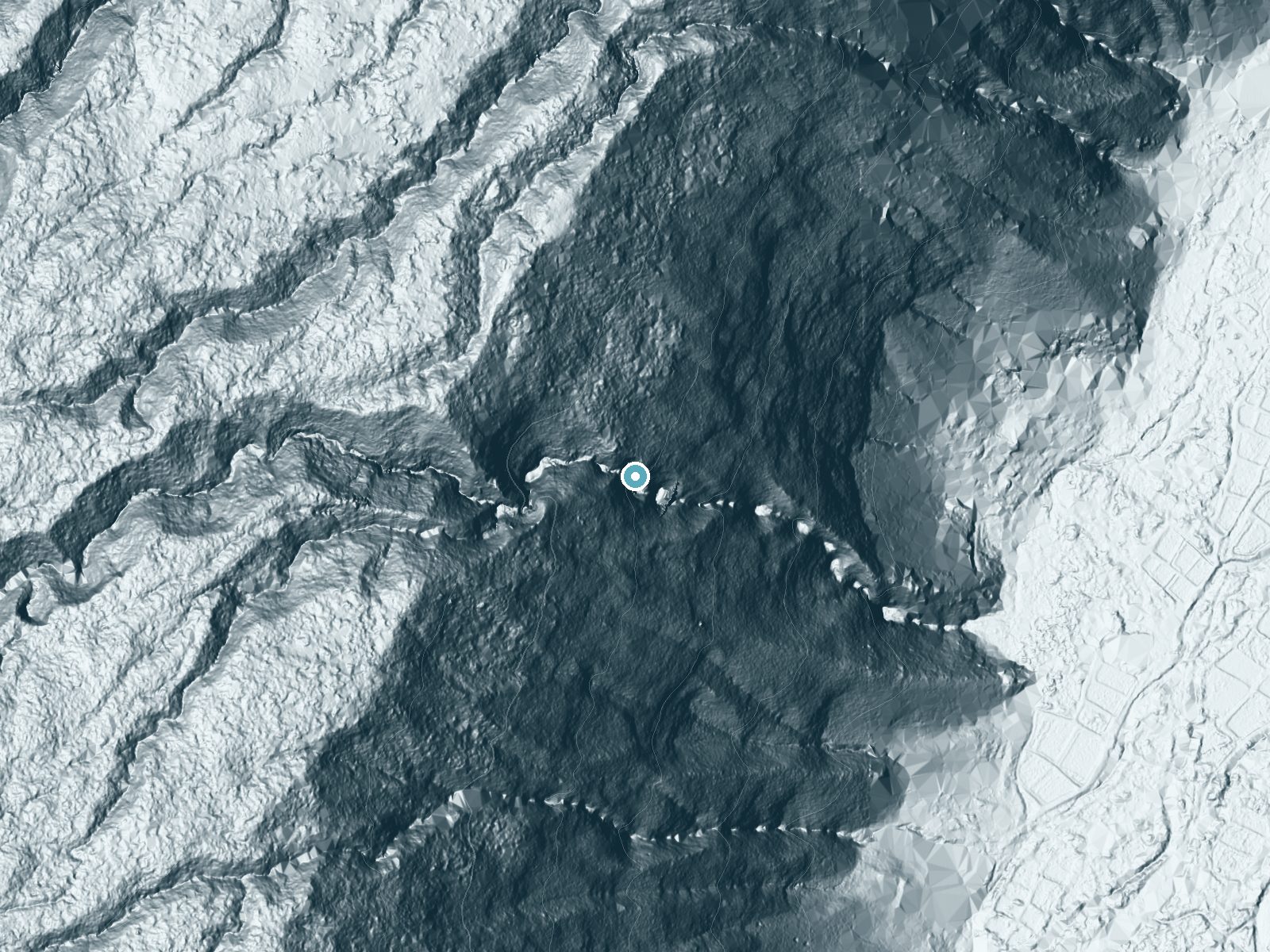
 LiDAR terrain view · USGS 3DEP
Nanaue Falls
By Armen Suny · Last verified Sep 2026
LiDAR & 3D terrainDifficulty
Moderate
Trail Length
1.0 miles
Trail Type
Out And Back
Elevation Gain
200 ft
About Nanaue Falls
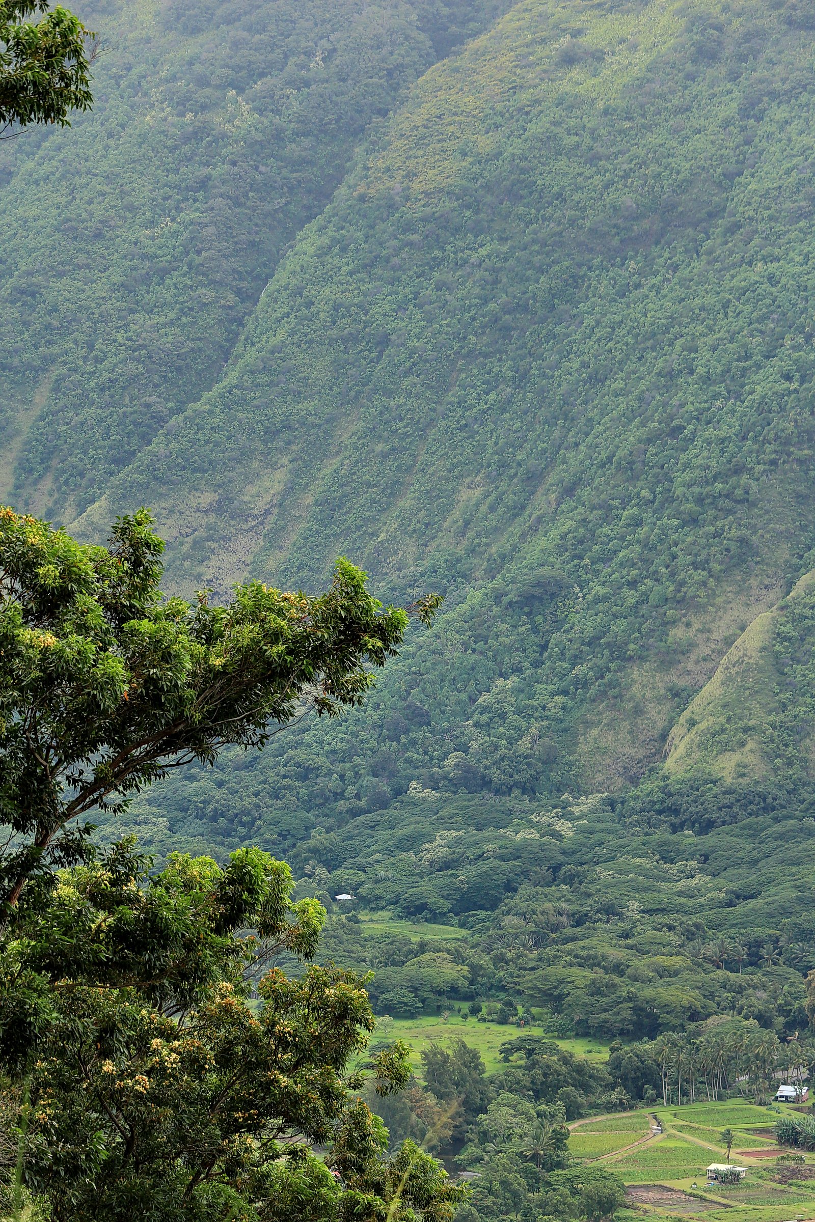
Nanaue Falls is a tucked-away cascade on the Big Island of Hawaii, set among the island’s lush, tropical rainforest. The falls drop along a small stream that threads through dense vegetation, offering a peaceful, secluded spot for hikers who enjoy verdant scenery and the sound of falling water. The site lies within the Kohala Forest Reserve and is managed by SDNR, with an SCA designation that underscores the area’s conservation value—respecting trail etiquette here helps protect the fragile habitat. The hike to the falls is short but rewarding: the route is an out-and-back roughly 1.0 mile in length with about 200 feet of elevation gain, rated moderate. Because the access path is not formally maintained and runs through rainforest terrain, expect muddy or slippery sections after rain and narrow single-track through heavy understory. It’s a great quick hike for those looking to pair a short walk with a quiet waterfall visit—come prepared with sturdy footwear, water, and leave-no-trace habits.
The Setting
Nanaue Falls sits at 1,263 feet within Kohala Forest Reserve, in the foothills of Hawaii.
Trail & Hike Details
The Approach
The moderate 1.0-mile out-and-back trail gains 200 feet of elevation on the way to the falls.
Trail Description
Trail type: out-and-back; length: 1.0 miles; elevation gain: ~200 feet; difficulty: moderate. The route follows an unmaintained, natural-surface footpath through dense rainforest within the Kohala Forest Reserve (managed by SDNR, SCA). Expect uneven footing, exposed roots and rocks, and sections that become muddy and slippery after rain; grade varies with short steeper pitches but no formal USFS trail class/number is available. Signage and infrastructure are minimal—hikers should wear sturdy shoes, watch footing, and be prepared for a rustic trail experience.
What to Expect
Visitors can expect a tranquil waterfall surrounded by lush greenery. The area is typically quiet and less crowded than other waterfalls on the island. However, access may involve navigating unmarked trails or private property, so visitors should proceed respectfully and cautiously.
Accessibility
The trail is not wheelchair accessible. Uneven terrain and elevation changes require steady footing.
Frequently Asked Questions
🐶 Are Dogs Allowed at Nanaue Falls?
❌ Dogs are not allowed
Are There Any Fees or Permits Required?
🆖 No fees required
🏊 Is There Swimming at Nanaue Falls?
❌ Swimming is not allowed
When to Visit
The falls can be visited year-round, but mornings during the dry season (spring and summer) are typically the best time to avoid rain and slippery conditions.
Seasonal Access
The best time to visit is Spring, Summer, Fall, and Winter. Heavy rains during wet season (November through March) bring higher flow but can make trails slippery.
Safety Information
Visitors should be cautious of slippery rocks, flash flooding during heavy rain, and potential hazards on unmaintained trails. Always check weather conditions before visiting.
Current Water Conditions
These readings come from the USGS gauge on Alakahi Stream, 4.4 miles away, not on Nanaue Falls's own stream. Use them as a sign of whether the area is running wet or dry.
14 ft³/s
Current discharge — how much water is flowing
Higher than usual for this time of year
Based on 60 years of record
2.47 ft
Water depth at gauge
7-Day Discharge Trend
What does this mean for your visit?
The water is flowing higher than usual for this time of year.
About This Gauge
7-Day Flow Outlook
Based on the USGS gauge Alakahi Stream near Kamuela, HI (7 km away).
Today
Roaring
15 cfs
6/10Tomorrow
Roaring
15 cfs
6/10Tue
Roaring
19 cfs
9/10Wed
Roaring
17 cfs
6/10Thu
Roaring
21 cfs
6/10Fri
Roaring
22 cfs
8/10Sat
Roaring
17 cfs
6/10Best window: Tue — roaring flow, mostly sunny (trip score 9/10).
Best time of year: this gauge typically runs highest from mid June to late July, peaking in July.
How we calculate this
This is a transparent outlook, not a precise forecast. We take the waterfall's current flow strength (how it ranks against its historical normal for today, from the nearest USGS stream gauge), carry that ranking forward along the gauge's seasonal curve, and nudge it for forecast rain. Confidence is highest for the next day or two and falls further out. Always check official conditions and your own judgment before visiting — high flows can be dangerous.
Know when to go.
Get a free email alert when waterfalls near Kukuihaele hit peak flow. We only send when conditions are worth the trip — no weekly newsletters, no spam.
Weather Forecast
The Terrain, Seen by LiDAR
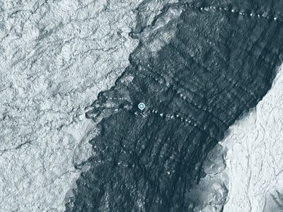
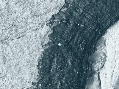
Aircraft-mounted lasers measured this ground to within inches. Trees and buildings are digitally stripped away, leaving the bare shape of the land the water has carved.
The laser survey finds one clean step here: roughly 515 feet of drop concentrated at the brink. Elevation at the pin is about 1,275 feet.
Steep ground runs through the entire stretch: about 383 feet of descent in the 500 feet above the pin and 463 feet in the 500 feet below it. Facing east, the falls catch soft morning light.
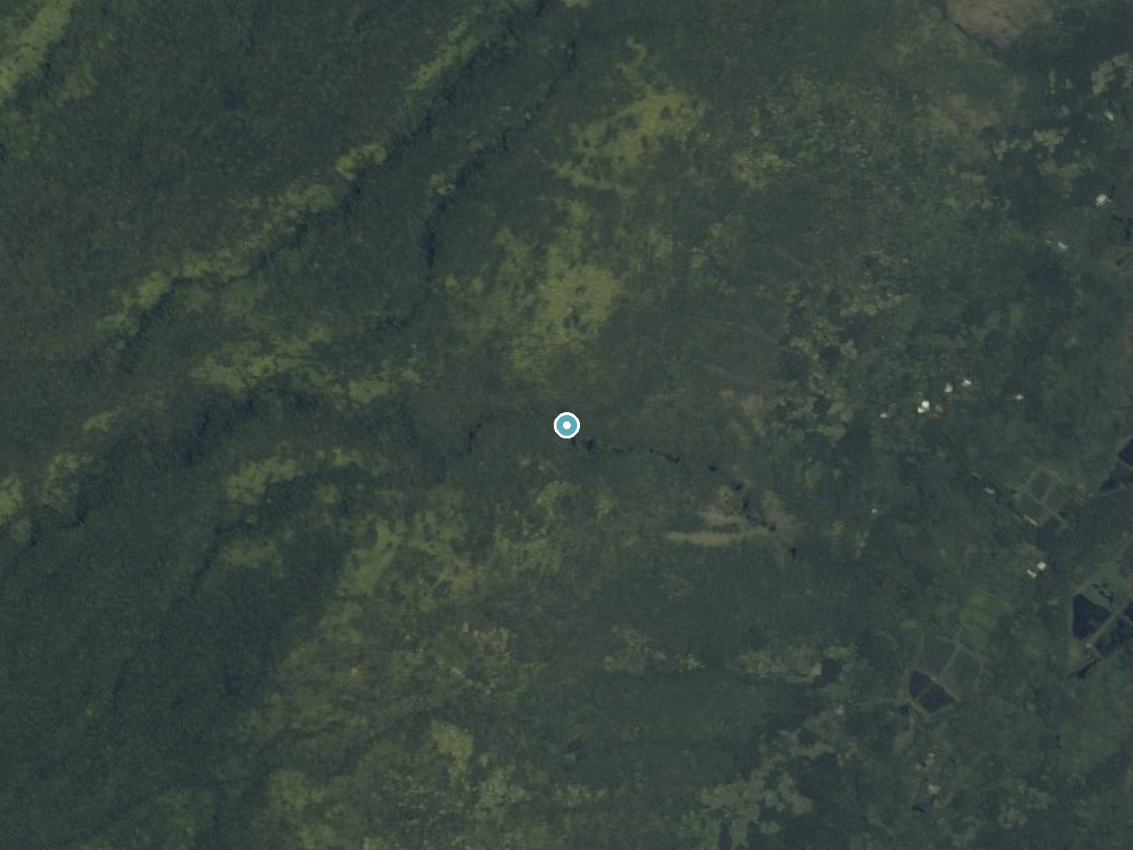
Drag to compare. The dot marks the waterfall. The frame is about a mile across.
- Ground elevation
- 1,275 feet
- Measured by 1-meter lidar
- Drop at the falls
- About 515 feet
- Change in ground height within ~250 feet of the falls
- Faces
- East
- Catches soft morning light.
A slice through the lidar ground surface, from above the falls to downstream (heading east).
Elevation data: USGS 3D Elevation Program. Aerial imagery: USGS The National Map. Public domain.
Location & Access
Getting There
Nanaue Falls is located near the town of Honomu on the Big Island of Hawaii. Access to the falls may require navigating private property or less-maintained trails, so visitors should research access routes carefully.
Get Directions on Google MapsParking
Parking availability is unclear and may depend on the specific access point used. Visitors should plan ahead and be prepared for limited or informal parking options.
Elevation
1,263 feet above sea level
Coordinates
20.106278° N, -155.613663° W
Land Management
Managed by SDNR
Visitor Tips & Gear
Wear sturdy, waterproof footwear as the trail can be muddy and slippery. Bring insect repellent to protect against mosquitoes. Check weather conditions before visiting, as heavy rain can make the trail hazardous.
As an Amazon Associate, we earn from qualifying purchases.
With 1.0 miles and 200 ft of elevation gain, sturdy boots and trekking poles will help on this moderate trail. Icy conditions are common in winter — traction cleats are a smart addition.

Columbia Watertight II Rain Jacket
Packs into its own pocket, seam-sealed, and keeps you dry from spray and surprise rain.

Earth Pak Waterproof Dry Bag
Keeps your phone and gear dry when waterfall mist soaks everything else.

Waterproof Phone Pouch (AiRunTech)
Cheap insurance — take photos right next to the falls without killing your phone.

Timberland Euro Sprint Mid Waterproof
Trusted waterproof boot with premium leather and grippy rubber sole — reliable on rocky, wet trails.

TrailBuddy Trekking Poles
Lightweight aluminum, cork grips, and flip-locks that actually hold — a best-seller for good reason.

Kahtoola MICROspikes
Cult-favorite traction cleats that grip ice and wet rock — essential for winter waterfall hikes.
Where to Stay

The Westin Hapuna Beach Resort

Fairway Villas Waikoloa by OUTRIGGER

Palm Villas 2 Bed/2 Bath Loft #F22

Hilton Waikoloa Village
Browse vacation cabins and private rentals nearby
Unique outdoor stays — tents, yurts, and treehouses
Rent a campervan or RV for your waterfall road trip
Some links are affiliate links. We may earn a commission at no extra cost to you.
Nearby Hot Springs
Hot springs near Nanaue Falls, Hawaii

Steam Vents
Steam vents at 13,426 feet on Mauna Loa represent some of Hawaii's most remote geothermal features, requiring a substantial hik...
Steam Vents
These steam vents occupy the high alpine zone at 12,526 feet on Mauna Loa, where volcanic heat creates dramatic fumarolic activ...

Steam Vents
Steam vents emerge where volcanic heat meets restricted military lands on Hawaii's Big Island. These fumaroles sit at 4,003 fee...

Steam Vents
Steam vents at 3,559 feet emerge on Kilauea's slopes where volcanic heat intersects abundant rainfall to create dramatic fumaro...

Steam Vents
Steam vents at 3,620 feet emerge within Hawai'i Volcanoes National Park where volcanic heat creates dramatic fumarolic activity...
Akins Spring
Akins Spring flows 84°F water on Hawaii's Big Island, 11 degrees warmer than the tropical 73°F ambient, requiring a short walk ...
Looking for a soak after your hike? Explore more hot springs near Nanaue Falls, Hawaii on SoakingSprings.
Explore Hawaii springsAdditional Information
Nearby Attractions
Akaka Falls State Park, Honomu town, and other waterfalls in the area.
Wildlife
The area is home to various tropical birds, insects, and other rainforest wildlife. Visitors should be mindful of their surroundings.
Nearby Waterfalls
 LiDAR
LiDAR
 LiDAR
LiDAR
Writing about Nanaue Falls? Embed this waterfall on your site for free.