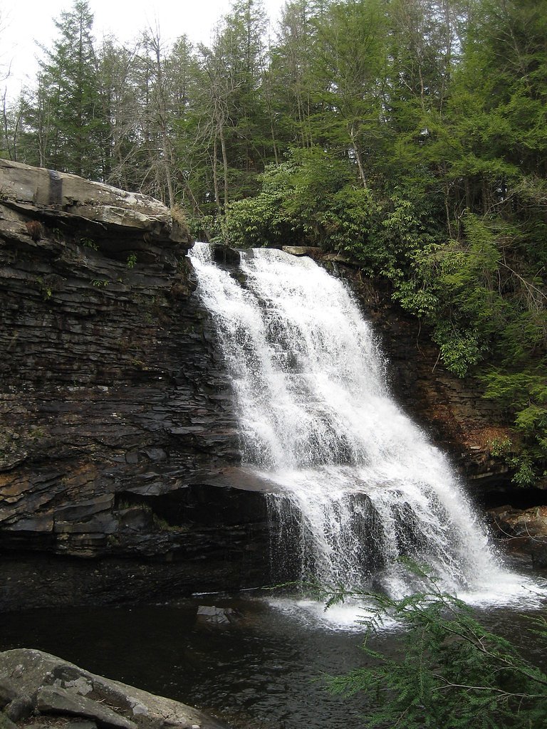
Muddy Creek Falls
Maryland • 53 ft
By Armen Suny · Last verified Mar 2026
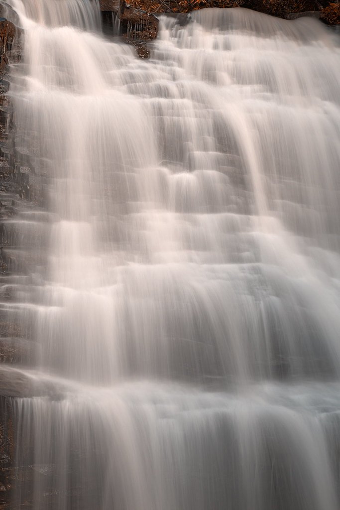
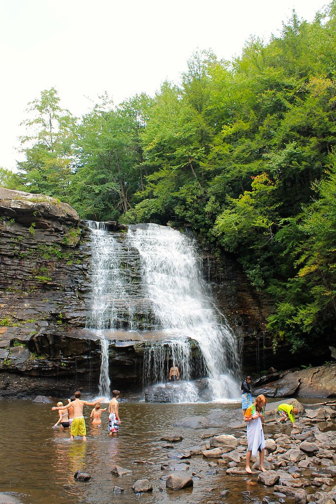
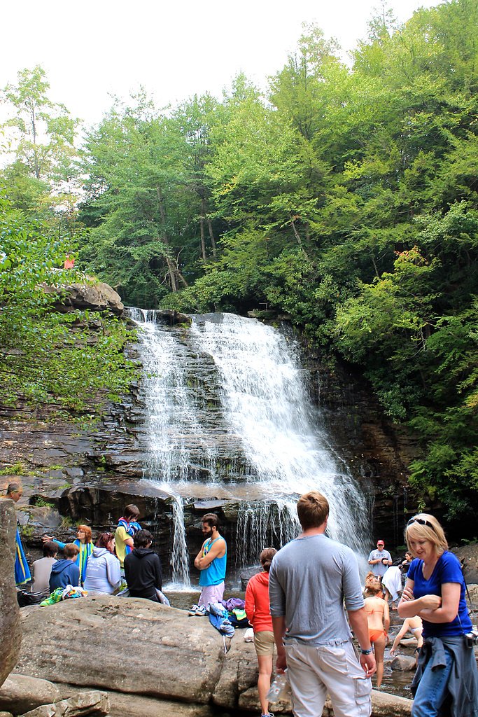
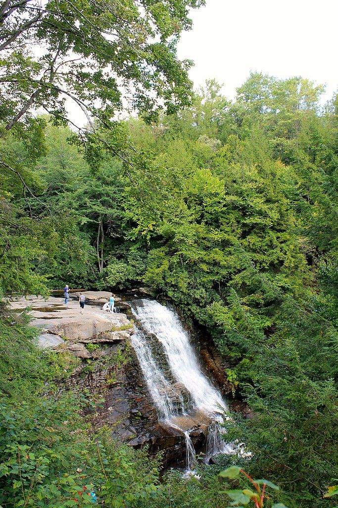

Photo Credits (5)
Difficulty
Moderate
Trail Length
2.4 miles
Trail Type
Out And Back
Elevation Gain
350 ft
About Muddy Creek Falls
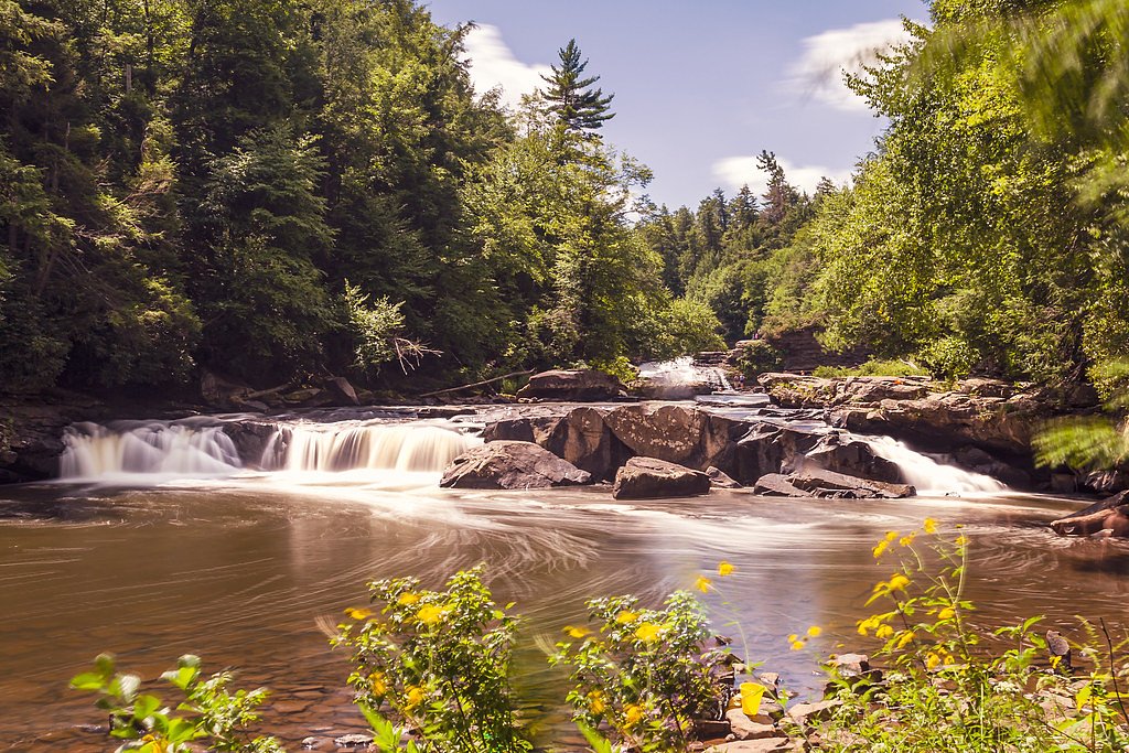
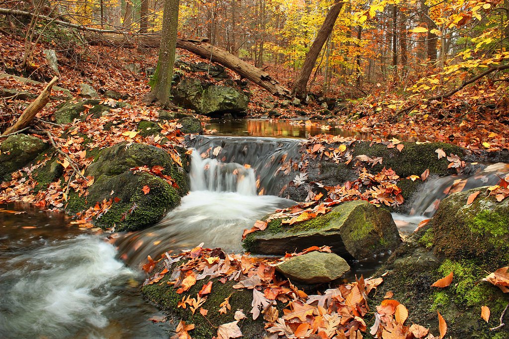
Muddy Creek Falls plunges 53 feet through mossy rock into a shaded gorge — Maryland’s highest free‑falling waterfall — tucked into Swallow Falls State Park on the west bank of the Youghiogheny River in Garrett County. The falls sit within a stand of old‑growth hemlock and white pine that gives the canyon a cathedral‑like feel; Swallow Falls is a public recreation area roughly nine miles (14 km) northwest of Oakland and is managed by the state DNR (SDNR). The park also contains smaller cascades along the Youghiogheny River and Tolivar Creek, so the drive and short hike reward you with multiple water features and scenic overlooks. The setting is ideal for a day hike and photos — the roar of the falls, fern‑lined rock, and towering conifers make for an easy, dramatic outing. If you’re planning to stay overnight, the nearest developed campground is Mill Run Recreation Area about 24.0 km away, but Swallow Falls itself is most often enjoyed as a day‑use destination.
The Setting
Muddy Creek Falls sits at 2,297 feet within Swallow Falls Sp, fed by the Youghiogheny River, in the hills of Maryland. The falls drop 53 feet.
Height: 53 feet
Trail & Hike Details
The Approach
The moderate 2.4-mile out-and-back trail gains 350 feet of elevation on the way to the falls.
Trail Description
The trail to Muddy Creek Falls follows the Swallow Falls Canyon Trail and is typically done as a 2.4‑mile out‑and‑back with about 350 feet of elevation gain; it’s rated moderate. The path is a well‑marked foot trail that passes through mixed hardwood and hemlock forest and includes several boardwalk sections and some uneven, root‑and‑rocky tread, so good footwear is recommended. The grade is moderate overall, with short uphill pitches between viewpoints; along the route you’ll pass multiple waterfall vistas before reaching the main 53‑foot plunge. Expect a maintained natural surface rather than paved trail — family‑friendly but with typical backcountry footing.
What to Expect
The falls drop 53 feet. Dogs are welcome.
Accessibility
The trail is not wheelchair accessible. Uneven terrain and elevation changes require steady footing.
Frequently Asked Questions
🐶 Are Dogs Allowed at Muddy Creek Falls?
✅ Dogs are allowed
Are There Any Fees or Permits Required?
🤑 Fee: $3.00
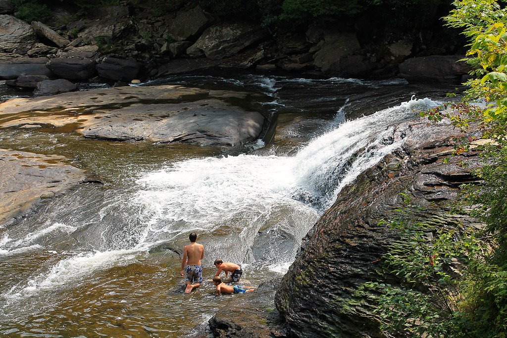
🏊 Is There Swimming at Muddy Creek Falls?
❌ Swimming is not allowed
When to Visit
Muddy Creek Falls is beautiful year-round, but spring and early summer are ideal for viewing the falls at their fullest flow. Fall offers vibrant foliage, and winter provides a unique view of the falls partially frozen.
Seasonal Access
The best time to visit is Spring, Summer, Fall, and Winter.
Safety Information
Exercise caution near the falls, as rocks can be slippery. Stay on designated trails and viewing platforms to avoid accidents. Be aware of changing weather conditions, as rain can make the trail muddy and more challenging.
Current Water Conditions
190 ft³/s
Current discharge — how much water is flowing
Much lower than usual for this time of year
Based on 2 years of record
2.68 ft
Water depth at gauge
7-Day Discharge Trend
What does this mean for your visit?
Flow is well below normal for this time of year, so the waterfall may be a trickle.
About This Gauge
7-Day Flow Outlook
Based on the USGS gauge YOUGHIOGHENY RIVER NEAR SWALLOW FALLS PARK, MD (1 km away).
Today
Barely Flowing
190 cfs
4/10Tomorrow
Barely Flowing
234 cfs
4/10Tue
Barely Flowing
172 cfs
4/10Wed
Barely Flowing
197 cfs
5/10Thu
Barely Flowing
236 cfs
5/10Fri
Low
172 cfs
3/10Sat
Moderate
145 cfs
4/10Best window: Wed — barely flowing flow, sunny (trip score 5/10).
Best time of year: this gauge typically runs highest from mid February to late February, peaking in May.
How we calculate this
This is a transparent outlook, not a precise forecast. We take the waterfall's current flow strength (how it ranks against its historical normal for today, from the nearest USGS stream gauge), carry that ranking forward along the gauge's seasonal curve, and nudge it for forecast rain. Confidence is highest for the next day or two and falls further out. Always check official conditions and your own judgment before visiting — high flows can be dangerous.
Know when to go.
Get a free email alert when waterfalls near Oakland hit peak flow. We only send when conditions are worth the trip — no weekly newsletters, no spam.
Weather Forecast
Location & Access
Getting There
Muddy Creek Falls is located within Swallow Falls State Park, approximately 9 miles north of Oakland, Maryland. The park is accessible via Swallow Falls Road, and clear signage directs visitors to the parking area.
Get Directions on Google MapsParking
There is a designated parking lot at Swallow Falls State Park near the trailhead. Parking is typically ample, but it can fill up during peak seasons or weekends.
Elevation
2,297 feet above sea level
Coordinates
39.501202° N, -79.417821° W
Land Management
Managed by UNK
Visitor Tips & Gear
Arrive early during weekends or holidays to secure parking and avoid crowds. Wear sturdy shoes as the trail may have muddy or slippery sections, especially after rain. Bring a camera to capture the scenic views.
As an Amazon Associate, we earn from qualifying purchases.
With 2.4 miles and 350 ft of elevation gain, sturdy boots and trekking poles will help on this moderate trail. Icy conditions are common in winter — traction cleats are a smart addition.

Columbia Watertight II Rain Jacket
Packs into its own pocket, seam-sealed, and keeps you dry from spray and surprise rain.

Polarized Sunglasses (Knockaround)
Cuts glare off the water so you actually see the falls — and your photos turn out better too.

Earth Pak Waterproof Dry Bag
Keeps your phone and gear dry when waterfall mist soaks everything else.

Waterproof Phone Pouch (AiRunTech)
Cheap insurance — take photos right next to the falls without killing your phone.

Timberland Euro Sprint Mid Waterproof
Trusted waterproof boot with premium leather and grippy rubber sole — reliable on rocky, wet trails.

TrailBuddy Trekking Poles
Lightweight aluminum, cork grips, and flip-locks that actually hold — a best-seller for good reason.
Where to Stay

The Garrett Inn

Stunning Pet Friendly New Construction Hot Tub Fire Pit

Still Meadows

Recreational Therapy- Private 2 Bedroom with Hot Tub and Firepit
Browse vacation cabins and private rentals nearby
Unique outdoor stays — tents, yurts, and treehouses
Rent a campervan or RV for your waterfall road trip
Some links are affiliate links. We may earn a commission at no extra cost to you.
Nearby Campground
MILL RUN RECREATION AREA
14.9 miles away · 30 sites
Overview The Mill Run Camping Area is located on Youghiogheny River Lake in the heart of the Laurel Highlands. The lake spans the Mason-Dixon Line between Pennsylvania and Maryland. Clean waters, forested mountains and steep-sided valleys provide an unsurpassed setting for recreational opportunities.Recreation Camping, fishing, boating, water skiing, hiking, biking, picnicking and sightseeing are the area's most popular activities. Boaters consider Youghiogheny River Lake, with its 16-mile length
Book on Recreation.govAdditional Information
Nearby Attractions
Other waterfalls in Swallow Falls State Park, such as Tolliver Falls and the Youghiogheny River rapids. Deep Creek Lake is also nearby, offering additional recreational opportunities.
Wildlife
The area is home to various wildlife, including deer, birds, and small mammals. Keep an eye out for native flora and fauna along the trail.
Cities near Muddy Creek Falls
Nearby Waterfalls
Writing about Muddy Creek Falls? Embed this waterfall on your site for free.