Moxie Falls
Maine • 90 ft
By Armen Suny · Last verified Mar 2026
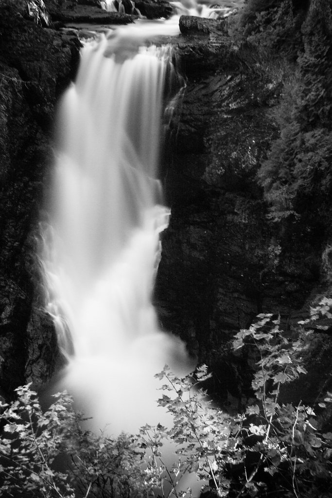
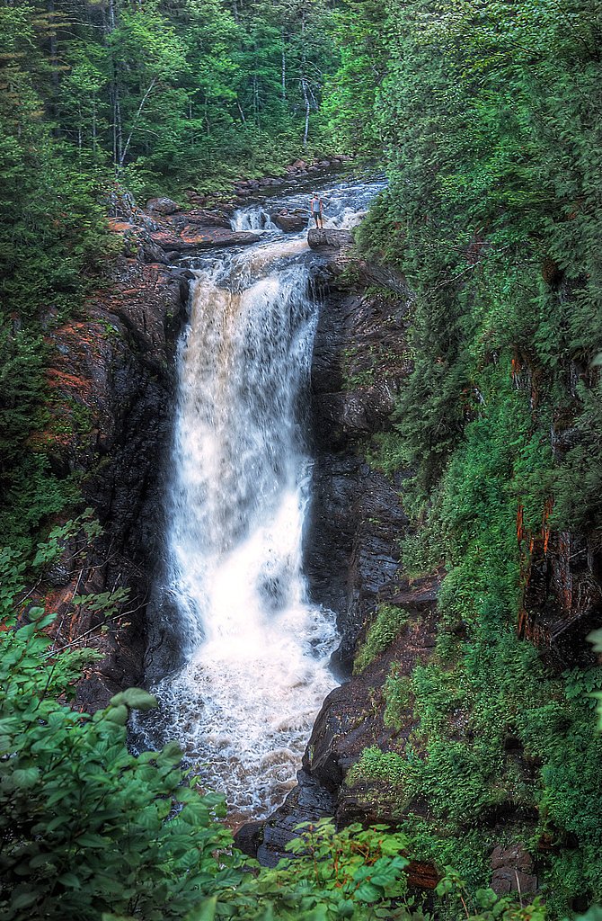
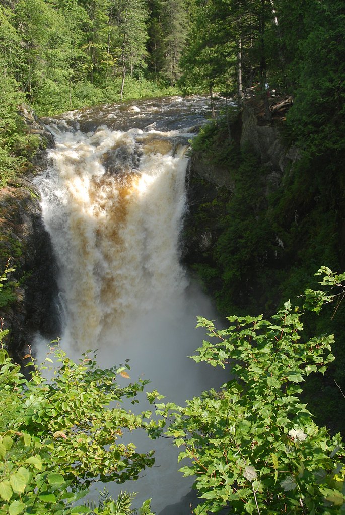
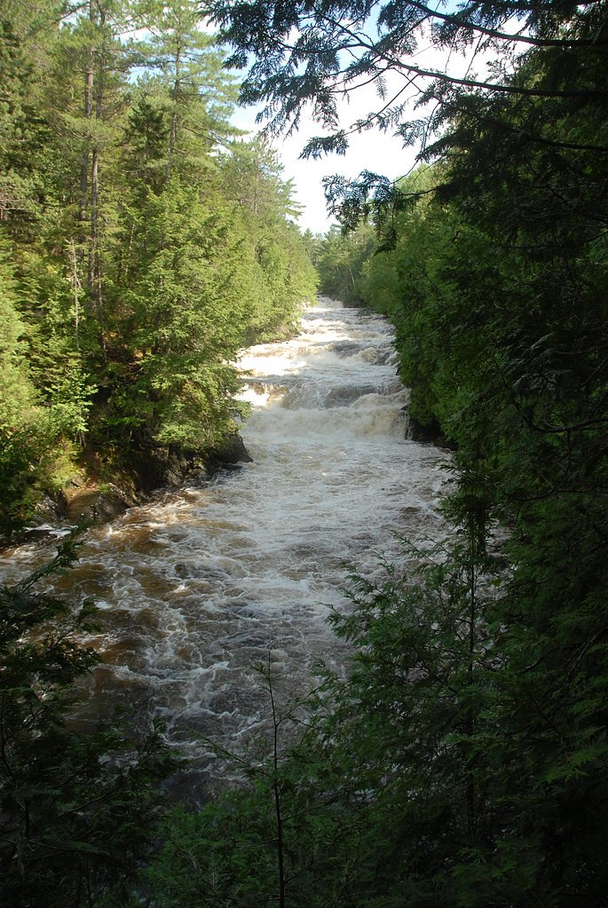

Photo Credits (5)
Difficulty
Easy
Trail Length
2.0 miles
Trail Type
Out And Back
Elevation Gain
200 ft
About Moxie Falls
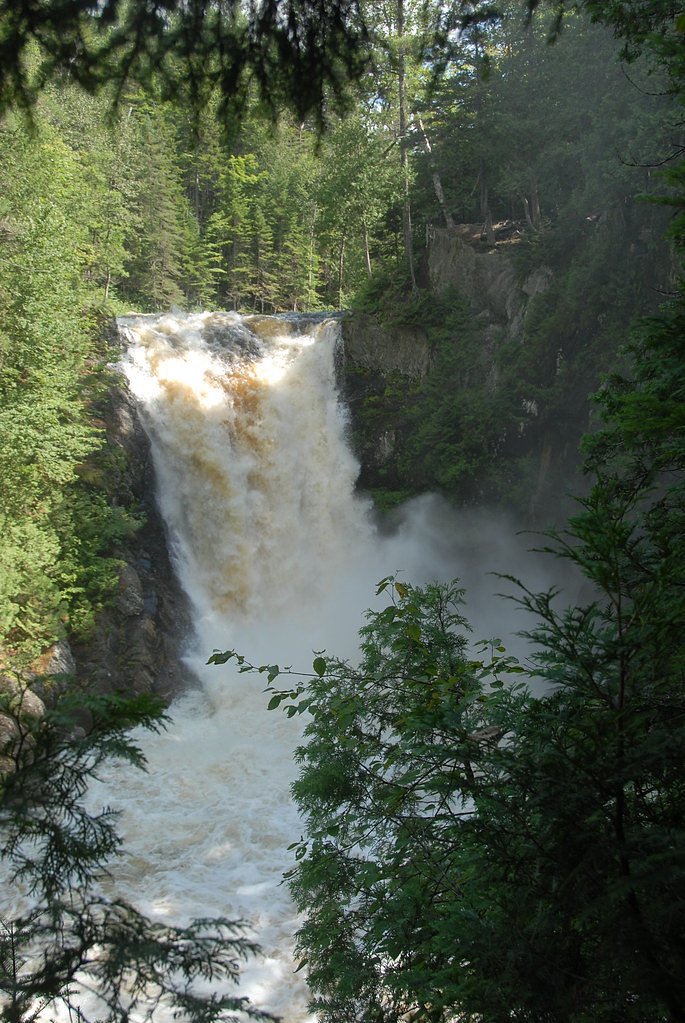
Moxie Falls is one of Maine's tallest and most picturesque waterfalls, featuring a dramatic 90-foot vertical drop surrounded by lush forest. It is a popular destination for hikers and nature enthusiasts.
The Setting
Moxie Falls sits at 761 feet within Moxie Falls, fed by the Kennebec River, in the foothills of Maine. The falls drop 90 feet.
Height: 90 feet
Trail & Hike Details
The Approach
The easy 2.0-mile out-and-back trail gains 200 feet of elevation on the way to the falls.
Trail Description
The trail to Moxie Falls is well-maintained and relatively flat, making it accessible for most visitors. It winds through a beautiful forested area before reaching the falls. There are wooden viewing platforms that provide safe and excellent views of the waterfall.
What to Expect
The falls cascade 90 feet. Dogs are welcome.
Accessibility
The trail is not wheelchair accessible. Uneven terrain and elevation changes require steady footing.
Frequently Asked Questions
🐶 Are Dogs Allowed at Moxie Falls?
✅ Dogs are allowed
Are There Any Fees or Permits Required?
🆖 No fees required
🏊 Is There Swimming at Moxie Falls?
❌ Swimming is not allowed
When to Visit
The best time to visit is during late spring through early fall when the trail is clear and the water flow is strong. Winter visits are possible but may require snowshoes or traction devices.
Seasonal Access
The best time to visit is Spring, Summer, and Fall. Winter access may be limited.
Safety Information
Stay on marked trails and viewing platforms, as the rocks near the falls can be slippery and dangerous. Exercise caution during wet or icy conditions.
Current Water Conditions
5,010 ft³/s
Current discharge — how much water is flowing
Higher than usual for this time of year
Based on 122 years of record
4.82 ft
Water depth at gauge
7-Day Discharge Trend
What does this mean for your visit?
The water is flowing higher than usual for this time of year.
About This Gauge
7-Day Flow Outlook
Based on the USGS gauge Kennebec River at The Forks, Maine (3 km away).
Today
Moderate
5711 cfs
4/10Tomorrow
Moderate
5768 cfs
6/10Mon
Moderate
4941 cfs
8/10Tue
Moderate
5775 cfs
4/10Wed
Moderate
5762 cfs
5/10Thu
Moderate
5339 cfs
5/10Fri
Moderate
5234 cfs
5/10Best window: Mon — moderate flow, sunny (trip score 8/10).
Best time of year: this gauge typically runs highest from late April to mid June, peaking in May.
How we calculate this
This is a transparent outlook, not a precise forecast. We take the waterfall's current flow strength (how it ranks against its historical normal for today, from the nearest USGS stream gauge), carry that ranking forward along the gauge's seasonal curve, and nudge it for forecast rain. Confidence is highest for the next day or two and falls further out. Always check official conditions and your own judgment before visiting — high flows can be dangerous.
Know when to go.
Get a free email alert when waterfalls near North Anson hit peak flow. We only send when conditions are worth the trip — no weekly newsletters, no spam.
Weather Forecast
Location & Access
Getting There
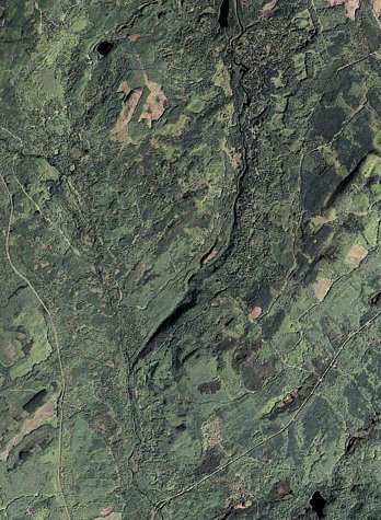
Moxie Falls is located near The Forks, Maine. From Route 201, take Lake Moxie Road and follow signs to the trailhead parking area.
Get Directions on Google MapsParking
There is a designated parking lot at the trailhead, which is free to use. It can fill up during peak seasons, so arriving early is recommended.
Elevation
761 feet above sea level
Coordinates
45.364773° N, -69.939784° W
Land Management
Managed by SPR
Visitor Tips & Gear
Wear sturdy footwear, as the trail can be muddy after rain. Bug spray is recommended during the summer months. Arrive early during peak seasons to secure parking and enjoy the falls with fewer crowds.
As an Amazon Associate, we earn from qualifying purchases.
This easy 2.0 miles hike is straightforward — comfortable trail shoes and plenty of water should do. Sun exposure on the trail makes good sun protection a must in summer.

Polarized Sunglasses (Knockaround)
Cuts glare off the water so you actually see the falls — and your photos turn out better too.

Columbia Watertight II Rain Jacket
Packs into its own pocket, seam-sealed, and keeps you dry from spray and surprise rain.

Earth Pak Waterproof Dry Bag
Keeps your phone and gear dry when waterfall mist soaks everything else.

Waterproof Phone Pouch (AiRunTech)
Cheap insurance — take photos right next to the falls without killing your phone.

JOBY GorillaPod Starter Kit
Wraps around railings and rocks for long-exposure waterfall shots — no flat surface needed.

Osprey Daylite Daypack
Light, organized, and just the right size for a day hike — fits water, snacks, and layers.
Where to Stay

Unity Sky Lodge

Abbot Trailside Lodging

All-Season Sanctuary: Steps to Moosehead Lake

Leisure Life
Browse vacation cabins and private rentals nearby
Unique outdoor stays — tents, yurts, and treehouses
Rent a campervan or RV for your waterfall road trip
Some links are affiliate links. We may earn a commission at no extra cost to you.
Additional Information
Nearby Attractions
The Forks area offers additional outdoor activities such as whitewater rafting on the Kennebec River and hiking trails in the surrounding forests.
Wildlife
The area is home to a variety of wildlife, including birds, deer, and occasionally moose. Keep an eye out for animals along the trail.
Cities near Moxie Falls
Nearby Waterfalls
Writing about Moxie Falls? Embed this waterfall on your site for free.