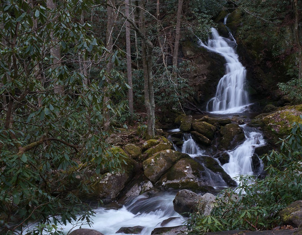
Mouse Creek Falls
North Carolina • 45 ft
By Armen Suny · Last verified Mar 2026
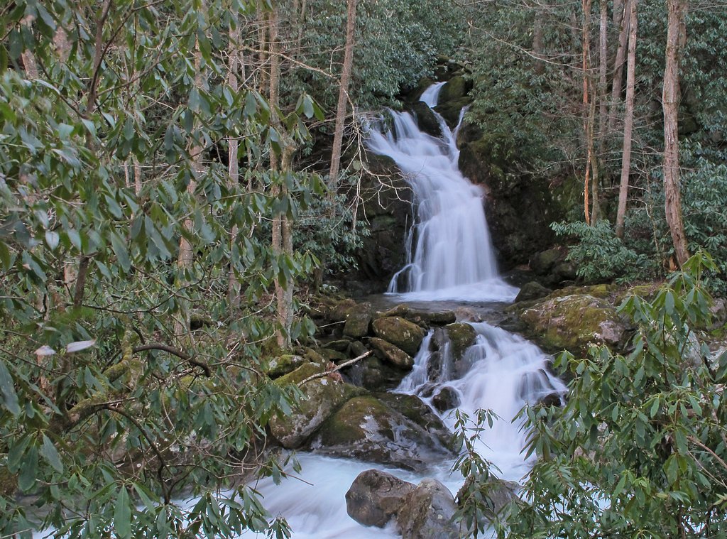
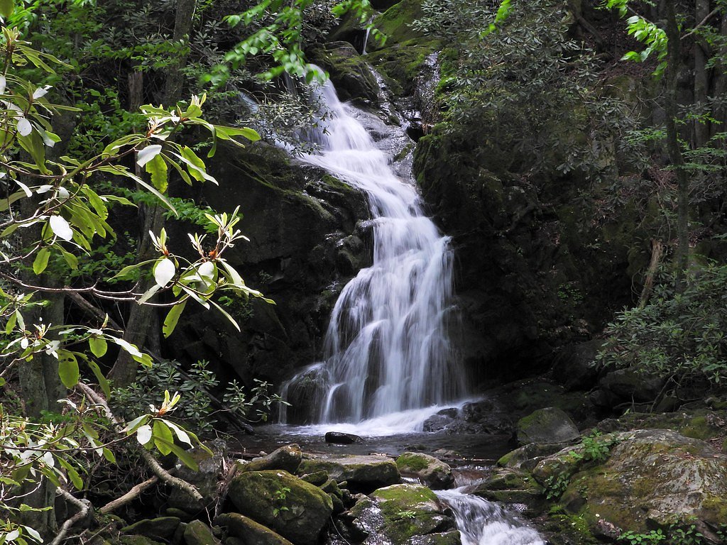
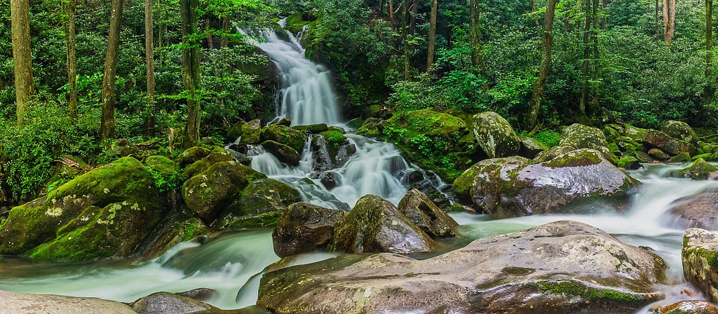
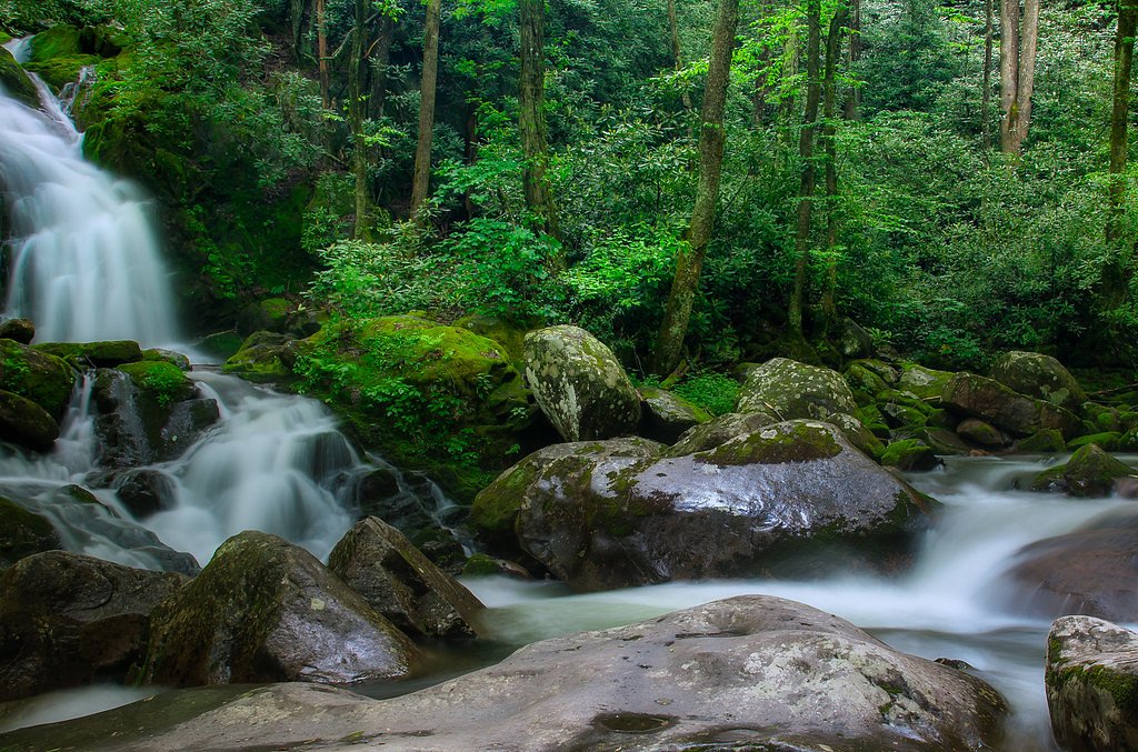

Photo Credits (5)
Difficulty
Moderate
Trail Length
4.2 miles
Trail Type
Out And Back
Elevation Gain
600 ft
About Mouse Creek Falls
Mouse Creek Falls is a picturesque 45-foot waterfall located along Big Creek Trail in the Great Smoky Mountains National Park, North Carolina. The waterfall is surrounded by lush forest and is a popular destination for hikers seeking a serene and scenic experience.
The Setting
Mouse Creek Falls sits at 2,352 feet within Great Smoky Mountains National Park, in the hills of North Carolina. The falls drop 45 feet.
Height: 45 feet
Trail & Hike Details
The Approach
The moderate 4.2-mile out-and-back trail gains 600 feet of elevation on the way to the falls.
Trail Description
The trail to Mouse Creek Falls follows the Big Creek Trail, a well-maintained path that runs alongside Big Creek. The trail is relatively wide and features a gradual incline, making it suitable for most hikers. Along the way, visitors will pass Midnight Hole, a popular swimming spot, before reaching the falls.
What to Expect
The falls drop 45 feet. Swimming is permitted. Dogs are welcome.
Accessibility
The trail is not wheelchair accessible. Uneven terrain and elevation changes require steady footing.
Frequently Asked Questions
🐶 Are Dogs Allowed at Mouse Creek Falls?
✅ Dogs are allowed
Are There Any Fees or Permits Required?
🆖 No fees required
🏊 Is There Swimming at Mouse Creek Falls?
✅ Swimming is allowed
When to Visit
Spring and early summer are ideal for visiting Mouse Creek Falls, as the water flow is typically stronger due to seasonal rainfall. Fall offers beautiful foliage, while winter provides a quieter experience with fewer visitors.
Seasonal Access
The best time to visit is Spring, Summer, Fall, and Winter. Check the National Park Service website for current conditions.
Safety Information
Be cautious of slippery rocks near the waterfall and along the creek. Watch for wildlife, including bears, and follow park guidelines for safety. Check weather conditions before hiking, as heavy rain can make the trail muddy and slippery.
Current Water Conditions
814 ft³/s
Current discharge — how much water is flowing
About average for this time of year
Based on 29 years of record
8.33 ft
Water depth at gauge
69°F
CoolRefreshing for swimming
7-Day Discharge Trend
What does this mean for your visit?
Flow is about average for this time of year. Water temperature is a refreshing 69 degrees F, good for a quick swim. Expect excellent dissolved oxygen levels.
Water Quality
Dissolved Oxygen
ExcellentSupports aquatic life
About This Gauge
7-Day Flow Outlook
Based on the USGS gauge PIGEON R BL POWER PLANT NR WATERVILLE, NC (6 km away).
Today
Roaring
928 cfs
6/10Tomorrow
Roaring
1142 cfs
6/10Tue
Roaring
1098 cfs
6/10Wed
Roaring
1151 cfs
6/10Thu
Roaring
1161 cfs
6/10Fri
Roaring
1055 cfs
6/10Sat
Roaring
1067 cfs
6/10Best window: Today — roaring flow, chance showers and thunderstorms (trip score 6/10).
Best time of year: this gauge typically runs highest from late February to mid March, peaking in March.
How we calculate this
This is a transparent outlook, not a precise forecast. We take the waterfall's current flow strength (how it ranks against its historical normal for today, from the nearest USGS stream gauge), carry that ranking forward along the gauge's seasonal curve, and nudge it for forecast rain. Confidence is highest for the next day or two and falls further out. Always check official conditions and your own judgment before visiting — high flows can be dangerous.
Know when to go.
Get a free email alert when waterfalls near Cosby hit peak flow. We only send when conditions are worth the trip — no weekly newsletters, no spam.
Weather Forecast
Location & Access
Getting There
Mouse Creek Falls is accessed via the Big Creek Trail, which begins at the Big Creek Campground in the Great Smoky Mountains National Park. The trailhead is located off Interstate 40, near the Tennessee-North Carolina border.
Get Directions on Google MapsParking
Parking is available at the Big Creek Campground parking area. Spaces may be limited during peak seasons, so arriving early is recommended.
Elevation
2,352 feet above sea level
Coordinates
35.734264° N, -83.133427° W
Land Management
Managed by NPS
Visitor Tips & Gear
Wear sturdy hiking shoes as the trail can be uneven in places. Bring water and snacks, especially during warmer months. Arrive early to secure parking and avoid crowds. Be cautious near the water as rocks can be slippery.
As an Amazon Associate, we earn from qualifying purchases.
With 4.2 miles and 600 ft of elevation gain, sturdy boots and trekking poles will help on this moderate trail. Icy conditions are common in winter — traction cleats are a smart addition.
America the Beautiful Annual Pass
Covers entrance fees at 2,000+ federal recreation sites — required at most National Parks.

Columbia Watertight II Rain Jacket
Packs into its own pocket, seam-sealed, and keeps you dry from spray and surprise rain.

Polarized Sunglasses (Knockaround)
Cuts glare off the water so you actually see the falls — and your photos turn out better too.

Earth Pak Waterproof Dry Bag
Keeps your phone and gear dry when waterfall mist soaks everything else.

Waterproof Phone Pouch (AiRunTech)
Cheap insurance — take photos right next to the falls without killing your phone.

Timberland Euro Sprint Mid Waterproof
Trusted waterproof boot with premium leather and grippy rubber sole — reliable on rocky, wet trails.

TrailBuddy Trekking Poles
Lightweight aluminum, cork grips, and flip-locks that actually hold — a best-seller for good reason.
Where to Stay

Little Bear Tiny Cabin

The Dapper Duck Log Cabin

Modern Mountain Cabin - Spectacular Views at 3100 ft

The Raven
Browse vacation cabins and private rentals nearby
Unique outdoor stays — tents, yurts, and treehouses
Rent a campervan or RV for your waterfall road trip
Some links are affiliate links. We may earn a commission at no extra cost to you.
Nearby Campground
BIG CREEK CAMPGROUND (GREAT SMOKY MOUNTAINS NATIONAL PARK)
1.7 miles away · 12 sites
Overview Big Creek Campground is located in a remote portion of Great Smoky Mountains National Park. Backcountry camping in a front country setting. There are flushing toilets and potable water. This is a tent only campground with a short walk from the parking area. The beautiful flowing waters of Big Creek parallel the campground offering the visitor a pleasant soundscape and peaceful beauty. Big Creek is an oasis for hiking, swimming, wildlife, fishing, and relaxation. Recreation Great Smoky M
Book on Recreation.govNearby Hot Springs
Hot springs near Cosby, North Carolina

Looking for a soak after your hike? Explore more hot springs near Cosby, North Carolina on SoakingSprings.
Explore North Carolina springsAdditional Information
Nearby Attractions
Midnight Hole, Big Creek Campground, and other trails in the Great Smoky Mountains National Park.
Wildlife
The area is home to a variety of wildlife, including black bears, deer, and numerous bird species. Visitors should practice bear safety and store food properly.
Cities near Mouse Creek Falls
Nearby Waterfalls
Writing about Mouse Creek Falls? Embed this waterfall on your site for free.