Moravian Falls
North Carolina • 35 ft
By Armen Suny · Last verified Sep 2026
LiDAR & 3D terrain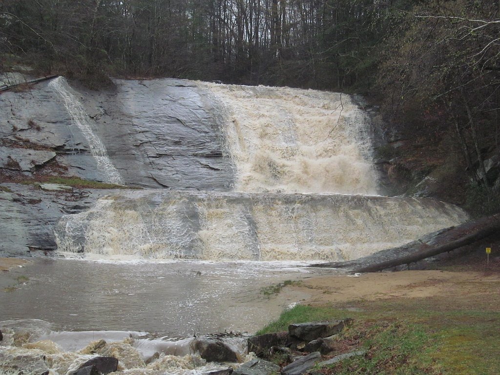
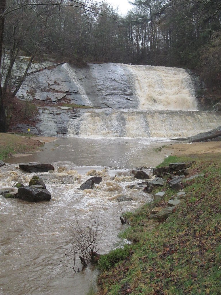
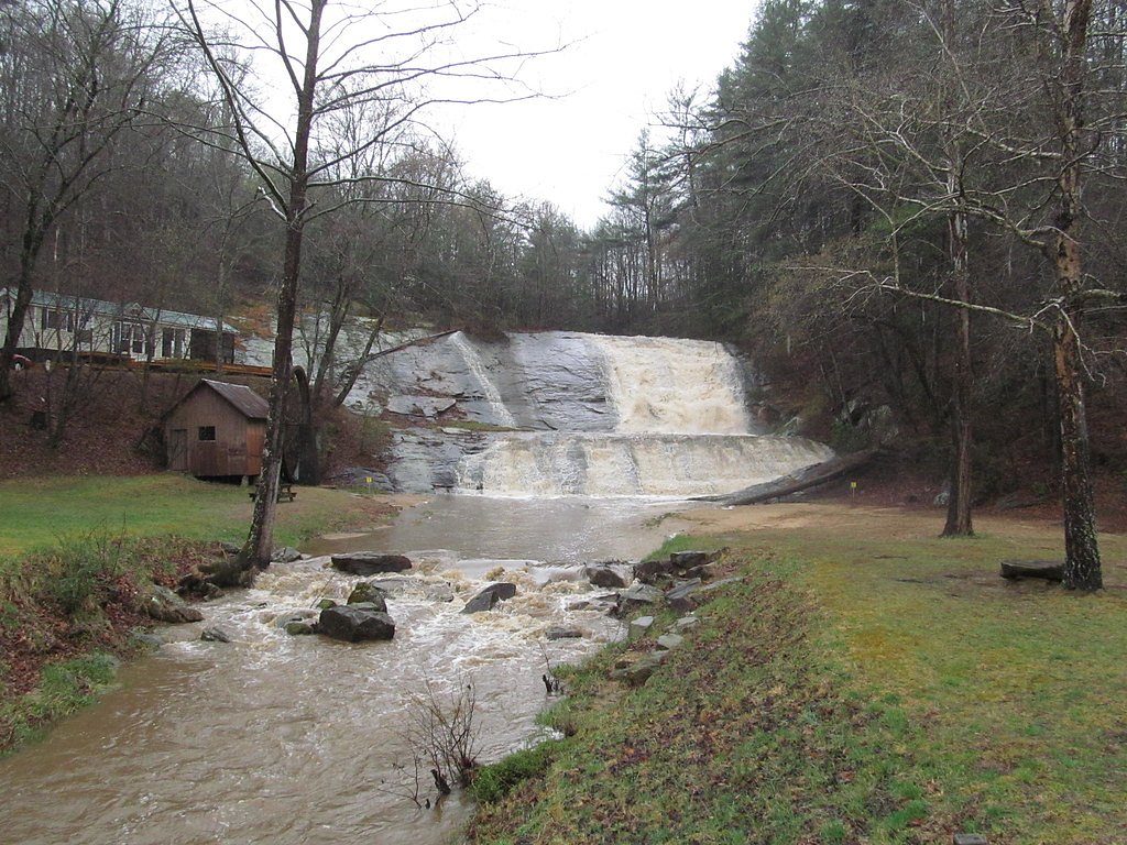
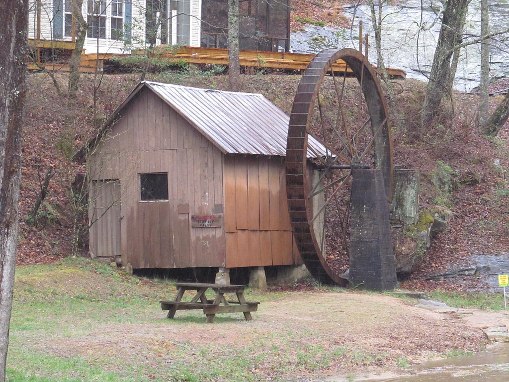
Photo Credits (5)
Difficulty
Drive Up
Trail Length
0.1 miles
Trail Type
Out And Back
Elevation Gain
50 ft
About Moravian Falls
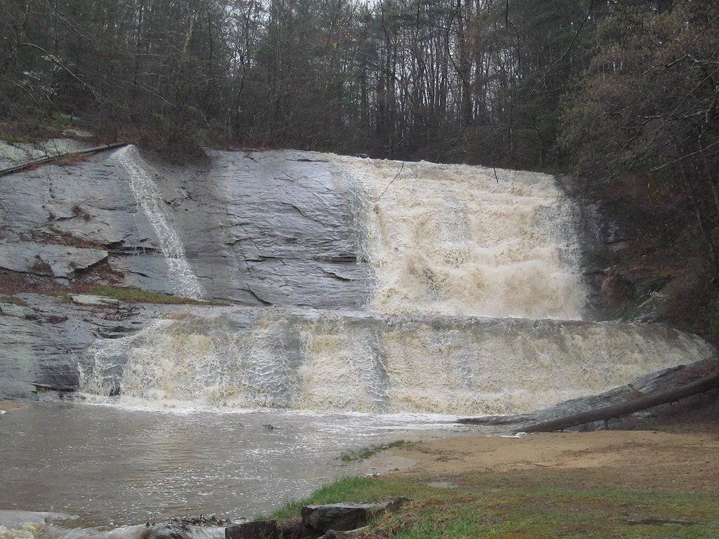
Moravian Falls is a charming roadside cascade on Moravian Creek in Wilkes County, North Carolina (per Wikipedia), where a roughly 35-foot drop creates a photogenic curtain of water framed by hardwoods. Though the falls sit on private property, they are one of those easy-to-enjoy sights that reward a brief stop — perfect for a quick picnic or photo break on a scenic drive through the foothills. Access is extremely simple: the falls can be viewed from the roadside and reached via a very short walk. If you’re planning an overnight stay nearby, the Berry Mountain Park Shelter is about 5.9 km (roughly 3.7 miles) away, offering campground access within easy striking distance of this quick, scenic stop. Please be respectful of private land and any posted signs while visiting.
The Setting
Moravian Falls sits at 1,112 feet along the Yadkin River, in the foothills of North Carolina. The falls drop 35 feet.
Height: 35 feet
Trail & Hike Details
The Approach
No hiking required. Moravian Falls is accessible by vehicle with a roadside viewing area.
Trail Description
Trail type: out-and-back. Length: ~0.1 miles round trip with about 50 feet of elevation gain. Difficulty: drive_up/minimal hike — most visitors view the falls from the roadside or take a very short, informal footpath down to a viewing area. Surface: roadside and short natural footpath (not a developed or maintained USFS trail). Waterfall height: approximately 35 feet. Note: the site is on private property and there is no official USFS trail name or number; exercise caution and respect private land boundaries when accessing viewing spots.
What to Expect
The falls drop 35 feet.
Accessibility
This waterfall is viewable from a vehicle-accessible area. No hiking is required.
Frequently Asked Questions
🐶 Are Dogs Allowed at Moravian Falls?
❌ Dogs are not allowed
Are There Any Fees or Permits Required?
🆖 No fees required
🏊 Is There Swimming at Moravian Falls?
❌ Swimming is not allowed
When to Visit
Spring and fall are ideal times to visit due to the pleasant weather and vibrant foliage. Summer is also a good time, but the area may be busier.
Seasonal Access
The best time to visit is Spring, Summer, and Fall. Winter access may be limited.
Safety Information
Be cautious when parking along the roadside, as traffic may be present. Do not attempt to climb on or near the waterfall as it is on private property.
Current Water Conditions
816 ft³/s
Current discharge — how much water is flowing
Higher than usual for this time of year
Based on 63 years of record
2.91 ft
Water depth at gauge
7-Day Discharge Trend
What does this mean for your visit?
The water is flowing higher than usual for this time of year.
About This Gauge
This gauge is on a nearby waterway and may not reflect exact conditions at the falls.
7-Day Flow Outlook
Based on the USGS gauge YADKIN RIVER AT WILKESBORO, NC (8 km away).
Today
Moderate
816 cfs
9/10Tomorrow
Moderate
825 cfs
9/10Tue
Moderate
876 cfs
9/10Wed
Moderate
861 cfs
9/10Thu
Moderate
823 cfs
9/10Fri
Strong
872 cfs
8/10Sat
Strong
918 cfs
8/10Best window: Today — moderate flow, sunny (trip score 9/10).
Best time of year: this gauge typically runs highest from late February to early April, peaking in March.
How we calculate this
This is a transparent outlook, not a precise forecast. We take the waterfall's current flow strength (how it ranks against its historical normal for today, from the nearest USGS stream gauge), carry that ranking forward along the gauge's seasonal curve, and nudge it for forecast rain. Confidence is highest for the next day or two and falls further out. Always check official conditions and your own judgment before visiting — high flows can be dangerous.
Know when to go.
Get a free email alert when waterfalls near Moravian Falls hit peak flow. We only send when conditions are worth the trip — no weekly newsletters, no spam.
Weather Forecast
The Terrain, Seen by LiDAR
Aircraft-mounted lasers measured this ground to within inches. Trees and buildings are digitally stripped away, leaving the bare shape of the land the water has carved.
Here the descent is spread out: 1-meter lidar measures about 130 feet of drop through Moravian Falls, stretched along the creek rather than stacked in one wall. That is more than the listed 35 feet because the gorge keeps dropping below the falls themselves. The brink sits at about 1,124 feet above sea level.
The ground changes about 98 feet in the 500 feet above the falls and 46 feet in the 500 feet below. Facing north, the falls stay mostly shaded, with soft, even light all day.
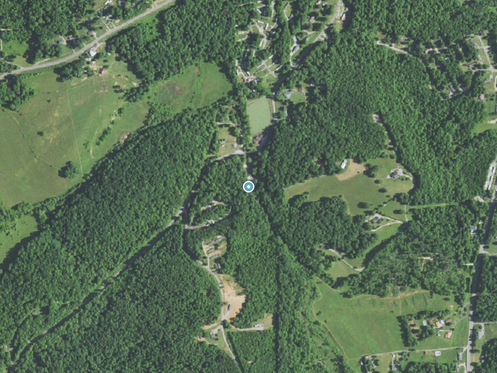
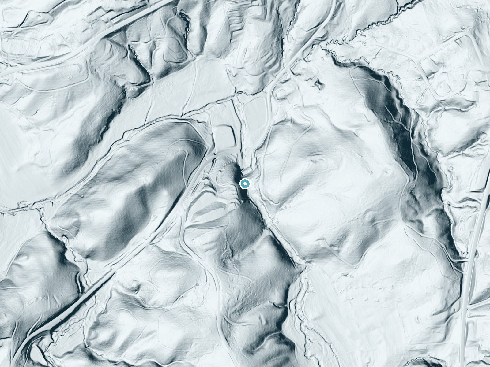
Drag to compare. The dot marks the waterfall. The frame is about a mile across.
- Ground elevation
- 1,124 feet
- Measured by 1-meter lidar
- Drop at the falls
- About 130 feet
- Change in ground height within ~250 feet of the falls
- Faces
- North
- Mostly shaded, so the light stays soft and even all day.
A slice through the lidar ground surface, from above the falls to downstream (heading north).
Elevation data: USGS 3D Elevation Program. Aerial imagery: USGS The National Map. Public domain.
Location & Access
Getting There
Moravian Falls is located near the town of Moravian Falls, North Carolina. It is easily accessible via NC Highway 16. The waterfall is situated on private property but is visible from the road.
Get Directions on Google MapsParking
There is limited roadside parking available near the waterfall. Visitors should park carefully to avoid blocking traffic or private driveways.
Elevation
1,112 feet above sea level
Coordinates
36.085837° N, -81.190175° W
Visitor Tips & Gear
Since the waterfall is on private property, visitors should respect the landowner's privacy and avoid trespassing. Be cautious when parking along the roadside.
As an Amazon Associate, we earn from qualifying purchases.
For this easy 0.1 miles trail, lightweight trail shoes and a water bottle are usually sufficient. Sun exposure on the trail makes good sun protection a must in summer.

Polarized Sunglasses (Knockaround)
Cuts glare off the water so you actually see the falls — and your photos turn out better too.

Columbia Watertight II Rain Jacket
Packs into its own pocket, seam-sealed, and keeps you dry from spray and surprise rain.

Earth Pak Waterproof Dry Bag
Keeps your phone and gear dry when waterfall mist soaks everything else.

Waterproof Phone Pouch (AiRunTech)
Cheap insurance — take photos right next to the falls without killing your phone.

JOBY GorillaPod Starter Kit
Wraps around railings and rocks for long-exposure waterfall shots — no flat surface needed.

OR Sombriolet Sun Hat
UPF 50+ sun protection with vents so your head doesn't cook on exposed trail sections.
Where to Stay

Hampton Inn Wilkesboro

Red Roof Inn & Suites Wilkesboro

Holiday Inn Express Wilkesboro By IHG

Quality Inn near Speedway
Browse vacation cabins and private rentals nearby
Unique outdoor stays — tents, yurts, and treehouses
Rent a campervan or RV for your waterfall road trip
Some links are affiliate links. We may earn a commission at no extra cost to you.
Nearby Campground
BERRY MOUNTAIN PARK SHELTER
3.7 miles away · 1 sites
Overview Berry Mountain Park Shelter is located in Berry Mountain Park at W. Kerr Scott Dam and Reservoir in northwestern North Carolina.Recreation The 1,475-acre reservoir offers excellent boating, canoeing, kayaking and swimming opportunities. Anglers will find channel catfish, large and smallmouth bass, bluegill, threadfin shad, spotted bass, striped bass, and hybrid striped bass.Facilities This ADA-accessible lakefront shelter offers six, 8-foot picnic tables. A water spigot can be found at t
Book on Recreation.govAdditional Information
Nearby Attractions
Nearby attractions include Stone Mountain State Park and the Blue Ridge Parkway, both offering additional scenic views and hiking opportunities.
Wildlife
The area around Moravian Falls may feature common North Carolina wildlife such as birds and small mammals.
Cities near Moravian Falls
Writing about Moravian Falls? Embed this waterfall on your site for free.