Mokowanis Cascade
Montana • Glacier National Park
By Armen Suny · Last verified Mar 2026
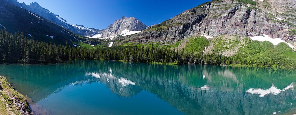
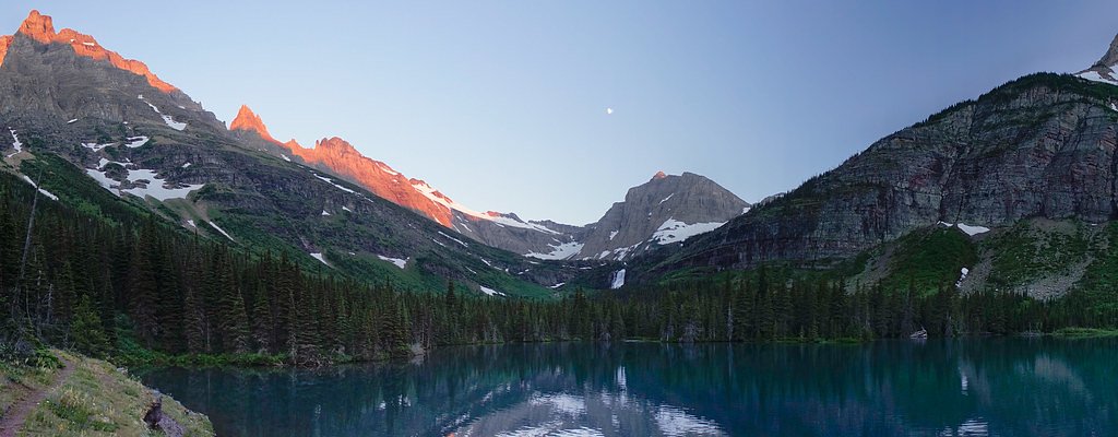
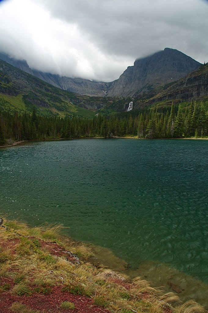
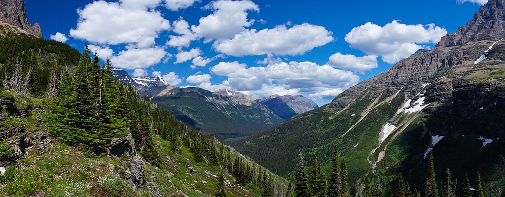

Photo Credits (5)
Difficulty
Moderate
Trail Length
2.4 miles
Trail Type
Out And Back
Elevation Gain
350 ft
About Mokowanis Cascade
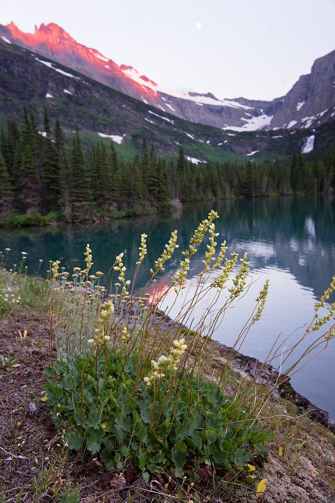
Mokowanis Cascade is a picturesque waterfall located in Glacier National Park, Montana. It is part of the Mokowanis River and is known for its serene surroundings and cascading waters, making it a popular spot for hikers exploring the park.
The Setting
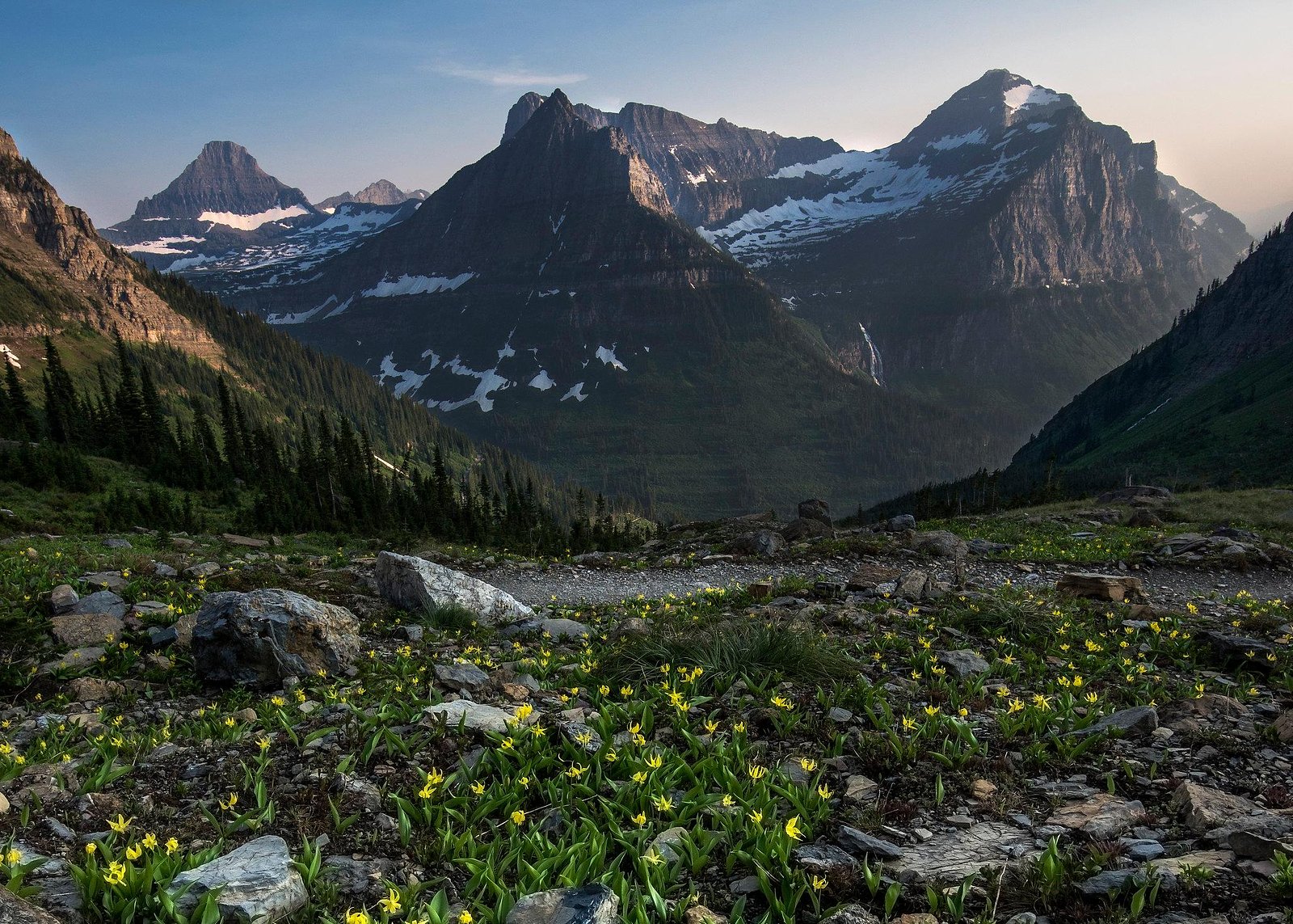
Mokowanis Cascade sits at 5,712 feet within Glacier National Park, fed by the Swiftcurrent Creek, in the high mountains of Montana.
Trail & Hike Details
The Approach
The moderate 2.4-mile out-and-back trail gains 350 feet of elevation on the way to the falls.
Trail Description
The trail to Mokowanis Cascade follows the Belly River Trail, which is a remote and scenic route through Glacier National Park. The trail passes through dense forests, open meadows, and alongside rivers, offering stunning views of the surrounding mountains. The cascade itself is located near the Mokowanis Lake area.
What to Expect
Visitors can expect a challenging but rewarding hike through pristine wilderness. The waterfall is surrounded by lush vegetation and offers a peaceful atmosphere. Wildlife sightings, including bears and moose, are common in this area.
Accessibility
The trail is not wheelchair accessible. Uneven terrain and elevation changes require steady footing.
Frequently Asked Questions
🐶 Are Dogs Allowed at Mokowanis Cascade?
❌ Dogs are not allowed
Are There Any Fees or Permits Required?
🤑 Fee: $35.00
Permit required
A backcountry camping permit is required for overnight stays in Glacier National Park. Reservations can be made through the park's official website.
🏊 Is There Swimming at Mokowanis Cascade?
❌ Swimming is not allowed
When to Visit
The best time to visit is during the summer and early fall when the trail is most accessible and the weather is favorable.
Seasonal Access
The best time to visit is Spring, Summer, and Fall. Access roads and trails may close during winter due to snow. Check with Glacier National Park for current conditions.
Safety Information
This is a remote area with potential wildlife encounters, including grizzly bears. Carry bear spray, make noise while hiking, and store food properly. Weather can change rapidly, so be prepared for rain, cold, or heat. Cell service is unreliable.
Current Water Conditions
1,300 ft³/s
Current discharge — how much water is flowing
Much higher than usual for this time of year
Based on 114 years of record
4.50 ft
Water depth at gauge
7-Day Discharge Trend
What does this mean for your visit?
The water is flowing much higher than usual, expect an impressive display.
About This Gauge
This gauge is on a nearby waterway and may not reflect exact conditions at the falls.
7-Day Flow Outlook
Based on the USGS gauge Swiftcurrent Creek at Many Glacier MT (16 km away).
Today
Roaring
1482 cfs
6/10Tomorrow
Roaring
1364 cfs
9/10Thu
Strong
1214 cfs
10/10Fri
Strong
1171 cfs
10/10Sat
Strong
1142 cfs
10/10Sun
Strong
1149 cfs
10/10Mon
Strong
1070 cfs
10/10Best window: Thu — strong flow, sunny (trip score 10/10).
Best time of year: this gauge typically runs highest from late April to late July, peaking in June.
How we calculate this
This is a transparent outlook, not a precise forecast. We take the waterfall's current flow strength (how it ranks against its historical normal for today, from the nearest USGS stream gauge), carry that ranking forward along the gauge's seasonal curve, and nudge it for forecast rain. Confidence is highest for the next day or two and falls further out. Always check official conditions and your own judgment before visiting — high flows can be dangerous.
Know when to go.
Get a free email alert when waterfalls near Babb hit peak flow. We only send when conditions are worth the trip — no weekly newsletters, no spam.
Weather Forecast
Location & Access
Getting There
Mokowanis Cascade is accessed via the Belly River Trail in Glacier National Park. The trailhead is located near the Chief Mountain Customs Trailhead, which is close to the U.S.-Canada border. Reaching the waterfall requires a multi-day backpacking trip.
Get Directions on Google MapsParking
Parking is available at the Chief Mountain Customs Trailhead. Visitors should ensure they have the appropriate permits for overnight parking.
Elevation
5,712 feet above sea level
Coordinates
48.876470° N, -113.841340° W
Land Management
Managed by NPS
Visitor Tips & Gear
Plan for a multi-day backpacking trip and ensure you have the necessary permits. Bring bear spray and be prepared for changing weather conditions. The trail is remote, so carry sufficient food, water, and emergency supplies.
This trail sits at 5,712 ft above sea level
Elevated TrailUV radiation is roughly 23% stronger at this elevation than at sea level, and the dry air accelerates dehydration. Extra sun protection and fluids go a long way.
As an Amazon Associate, we earn from qualifying purchases.

Coppertone Sport SPF 50 Sunscreen
UV intensity jumps ~4% per 1,000 ft — at this elevation you can burn in half the time.

Sun Bum SPF 30 Lip Balm (3-Pack)
Lips have almost no natural UV protection and burn fast in thin, dry mountain air.

Liquid I.V. Electrolyte Packets
You lose moisture ~2x faster at elevation — electrolytes help you absorb water efficiently.

ROCKNIGHT Polarized UV400 Sunglasses
High-altitude glare off rock and water is intense — UV400 lenses block 99%+ of UVA/UVB.
As an Amazon Associate, we earn from qualifying purchases.
With 2.4 miles and 350 ft of elevation gain, sturdy boots and trekking poles will help on this moderate trail. Sun exposure on the trail makes good sun protection a must in summer.
America the Beautiful Annual Pass
Covers entrance fees at 2,000+ federal recreation sites — required at most National Parks.

Polarized Sunglasses (Knockaround)
Cuts glare off the water so you actually see the falls — and your photos turn out better too.

Columbia Watertight II Rain Jacket
Packs into its own pocket, seam-sealed, and keeps you dry from spray and surprise rain.

Earth Pak Waterproof Dry Bag
Keeps your phone and gear dry when waterfall mist soaks everything else.

Waterproof Phone Pouch (AiRunTech)
Cheap insurance — take photos right next to the falls without killing your phone.

Timberland Euro Sprint Mid Waterproof
Trusted waterproof boot with premium leather and grippy rubber sole — reliable on rocky, wet trails.

TrailBuddy Trekking Poles
Lightweight aluminum, cork grips, and flip-locks that actually hold — a best-seller for good reason.
Where to Stay

Aspen Village

Waterton Lakes Lodge Resort

Prince of Wales Hotel

Bayshore Inn & Spa
Browse vacation cabins and private rentals nearby
Unique outdoor stays — tents, yurts, and treehouses
Rent a campervan or RV for your waterfall road trip
Some links are affiliate links. We may earn a commission at no extra cost to you.
Nearby Campground
MANY GLACIER CAMPGROUND
9.3 miles away · 110 sites
Overview The Many Glacier Campground is located on the east side of Glacier National Park, at an elevation of approximately 4,500 feet. The campground is located about 22 miles from the town of St. Mary and the east entrance to Glacier National Park. Babb, Montana, is the closest community to the Many Glacier Campground and is located approximately 12 miles east of the campground. Babb has a general store, gas station, several restaurants and an U.S. Post Office. Cell phone coverage is not availa
Book on Recreation.govAdditional Information
Nearby Attractions
Mokowanis Lake, Cosley Lake, and Glenns Lake are nearby attractions along the Belly River Trail.
Wildlife
The area is home to a variety of wildlife, including bears, moose, deer, and birds. Visitors should exercise caution and follow park guidelines for wildlife encounters.
Cities near Mokowanis Cascade
Nearby Waterfalls


Writing about Mokowanis Cascade? Embed this waterfall on your site for free.