Photo Credits (5)
Difficulty
Moderate
Trail Length
4.0 miles
Trail Type
Out And Back
Elevation Gain
800 ft
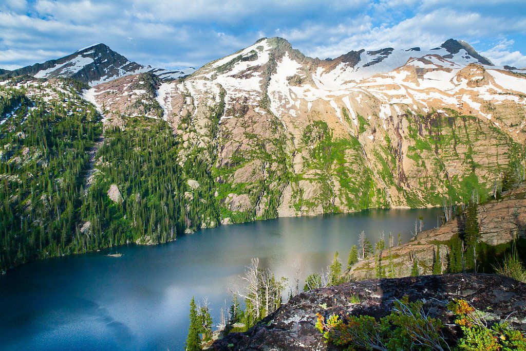
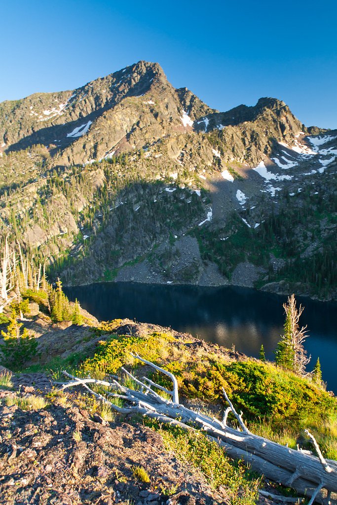
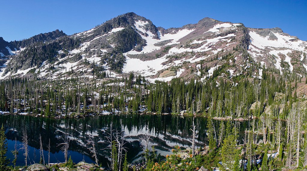
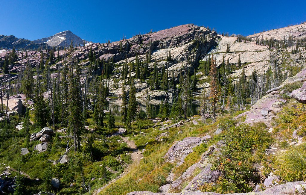
About Mission Falls
Mission Falls drops through the forested slopes of the Mission Mountains, offering a dramatic, photogenic cascade set inside the Mission Mountains Tribal Wilderness. The falls sit on tribal land within the Flathead Reservation (land owner: DESG; designation: TRIBL) and are managed by the Confederated Salish and Kootenai Tribes, so visitors should respect tribal rules and seasonal access considerations while enjoying the scenery. The hike to the falls threads through dense conifers and understory, rewarding hikers with close-up views of whitewater tumbling over rock ledges and a quiet pool at the base. With a moderate 4.0-mile out-and-back route and about 800 feet of elevation gain, Mission Falls is a satisfying half-day outing for hikers comfortable on uneven terrain and short scrambles.
The Setting
Mission Falls sits at 4,941 feet within Flathead Reservation, fed by the Mission Creek, in the mountains of Montana.
Trail & Hike Details
The Approach
The moderate 4.0-mile out-and-back trail gains 800 feet of elevation on the way to the falls.
Trail Description
Out-and-back, 4.0 miles round trip with roughly 800 feet of elevation gain; difficulty: moderate. The trail is a forest footpath that climbs with moderate grades and includes rocky, uneven sections—sturdy footwear is recommended. The final approach to the falls can involve some scrambling over rocks and exposed roots; expect typical backcountry trail conditions on tribal-designated land managed by the Confederated Salish and Kootenai Tribes.
What to Expect
Visitors can expect breathtaking views of the waterfall cascading down a rugged cliff face, surrounded by lush vegetation. The area is serene and offers opportunities for photography and wildlife observation.
Accessibility
The trail is not wheelchair accessible. Uneven terrain and elevation changes require steady footing.
Frequently Asked Questions
🐶 Are Dogs Allowed at Mission Falls?
❌ Dogs are not allowed
Are There Any Fees or Permits Required?
🤑 Fee: $0.00
Permit required
A tribal recreation permit is required to access the trail and Mission Falls. Permits can be purchased online or at designated locations in the area.
🏊 Is There Swimming at Mission Falls?
❌ Swimming is not allowed
When to Visit
The best time to visit Mission Falls is in late spring or early summer when the snowmelt enhances the flow of the waterfall. Fall is also a great time to visit for cooler temperatures and vibrant foliage.
Seasonal Access
The best time to visit is Spring, Summer, and Fall. Winter access may be limited.
Safety Information
Visitors should be aware of potential hazards, including slippery rocks near the falls, sudden weather changes, and wildlife encounters. Carry bear spray and know how to use it. Stay on marked trails to avoid getting lost.
Current Water Conditions
139 ft³/s
Current discharge — how much water is flowing
About average for this time of year
Based on 42 years of record
2.84 ft
Water depth at gauge
7-Day Discharge Trend
What does this mean for your visit?
Flow is about average for this time of year.
About This Gauge
7-Day Flow Outlook
Based on the USGS gauge Mission Creek ab reservoir nr St. Ignatius MT (4 km away).
Today
Roaring
153 cfs
6/10Tomorrow
Roaring
152 cfs
6/10Mon
Roaring
146 cfs
6/10Tue
Roaring
141 cfs
6/10Wed
Roaring
151 cfs
6/10Thu
Roaring
148 cfs
6/10Fri
Roaring
140 cfs
6/10Best window: Today — roaring flow, chance light rain then showers and thunderstorms (trip score 6/10).
Best time of year: this gauge typically runs highest from mid May to early August, peaking in June.
How we calculate this
This is a transparent outlook, not a precise forecast. We take the waterfall's current flow strength (how it ranks against its historical normal for today, from the nearest USGS stream gauge), carry that ranking forward along the gauge's seasonal curve, and nudge it for forecast rain. Confidence is highest for the next day or two and falls further out. Always check official conditions and your own judgment before visiting — high flows can be dangerous.
Know when to go.
Get a free email alert when waterfalls near St. Ignatius hit peak flow. We only send when conditions are worth the trip — no weekly newsletters, no spam.
Weather Forecast
Location & Access
Getting There
Mission Falls is located near the town of St. Ignatius, Montana. Access to the falls typically requires a hike starting from the Mission Falls Trailhead, which is on tribal land. Visitors must obtain a tribal recreation permit to access the area.
Get Directions on Google MapsParking
Parking is available at the trailhead, but spaces may be limited during peak seasons. Visitors should plan to arrive early to secure a spot.
Elevation
4,941 feet above sea level
Coordinates
47.336599° N, -113.939268° W
Land Management
Managed by TRIB
Visitor Tips & Gear
Bring plenty of water and snacks, as there are no facilities along the trail. Be prepared for changing weather conditions, as the area can be unpredictable. Respect tribal regulations and stay on designated trails.
As an Amazon Associate, we earn from qualifying purchases.
With 4.0 miles and 800 ft of elevation gain, sturdy boots and trekking poles will help on this moderate trail. Sun exposure on the trail makes good sun protection a must in summer.

Polarized Sunglasses (Knockaround)
Cuts glare off the water so you actually see the falls — and your photos turn out better too.

Columbia Watertight II Rain Jacket
Packs into its own pocket, seam-sealed, and keeps you dry from spray and surprise rain.

Earth Pak Waterproof Dry Bag
Keeps your phone and gear dry when waterfall mist soaks everything else.

Waterproof Phone Pouch (AiRunTech)
Cheap insurance — take photos right next to the falls without killing your phone.

Timberland Euro Sprint Mid Waterproof
Trusted waterproof boot with premium leather and grippy rubber sole — reliable on rocky, wet trails.

TrailBuddy Trekking Poles
Lightweight aluminum, cork grips, and flip-locks that actually hold — a best-seller for good reason.
Where to Stay

Ninepipes Lodge

Private Home With Amazing Mountain Views-Two Bedroom and Two Bath

Arlee Studio with Mountain Views 29 Mi to Missoula

Hot Tub-Mountain View-Secluded-Entire Private Floor
Browse vacation cabins and private rentals nearby
Unique outdoor stays — tents, yurts, and treehouses
Rent a campervan or RV for your waterfall road trip
Some links are affiliate links. We may earn a commission at no extra cost to you.
Nearby Campground
Lindbergh Lake Campground
11.3 miles away · 0 sites
Lindbergh Lake Campground has 11 designated campsites. Restrooms, fire rings, and food storage boxes are available. Drinking water is not provided; please bring your own source of water. This campground is wheelchair accessible. Fishing, swimming, and boating may be enjoyed on the lake. The maximum recommended trailer length for this area is 20 feet. Please pack out what you pack in-- no trash service is provided. There is a trail from the campground which leads part of the way around the west si
Book on Recreation.govNearby Hot Springs
Hot springs near St. Ignatius, Montana
Green Springs
Green Springs flows at 79°F on the Flathead Reservation in Sanders County, Montana, at 2,813 feet — one of the lower-elevation ...
Quinns Hot Springs
Quinns Hot Springs flows at 109 degrees Fahrenheit in the Clark Fork River valley of Sanders County, Montana, at a low elevatio...
Wild Horse Hot Springs
Wild Horse Hot Springs sits on the Flathead Reservation in Sanders County, Montana, near Plains, at 2,756 feet, one of the lowe...
Camas Hot Springs
Camas Hot Springs flows at 113°F on the Flathead Reservation in western Montana, managed as tribal land with restricted or unkn...
Nimrod Springs
Nimrod Springs flows at 70°F with hard, sulfate-rich water carrying 323 mg/L sulfate and 137 mg/L calcium at near-neutral pH 7....

Lolo Hot Springs, Granite Springs
Lolo Hot Springs registers 111°F with unusually alkaline water at pH 9.3 and very low mineral content, dominated by 52 mg/L sod...
Looking for a soak after your hike? Explore more hot springs near St. Ignatius, Montana on SoakingSprings.
Explore Montana springsAdditional Information
Nearby Attractions
Nearby attractions include the National Bison Range and the town of St. Ignatius, which is home to the historic St. Ignatius Mission.
Wildlife
The area is home to a variety of wildlife, including deer, black bears, and numerous bird species. Visitors should exercise caution and carry bear spray.
Cities near Mission Falls
Nearby Waterfalls
Other waterfalls named Mission Falls
2 other waterfalls share this name across the U.S.
Writing about Mission Falls? Embed this waterfall on your site for free.