
Photo Credits (2)
Difficulty
Moderate
Trail Length
2.4 miles
Trail Type
Out And Back
Elevation Gain
350 ft
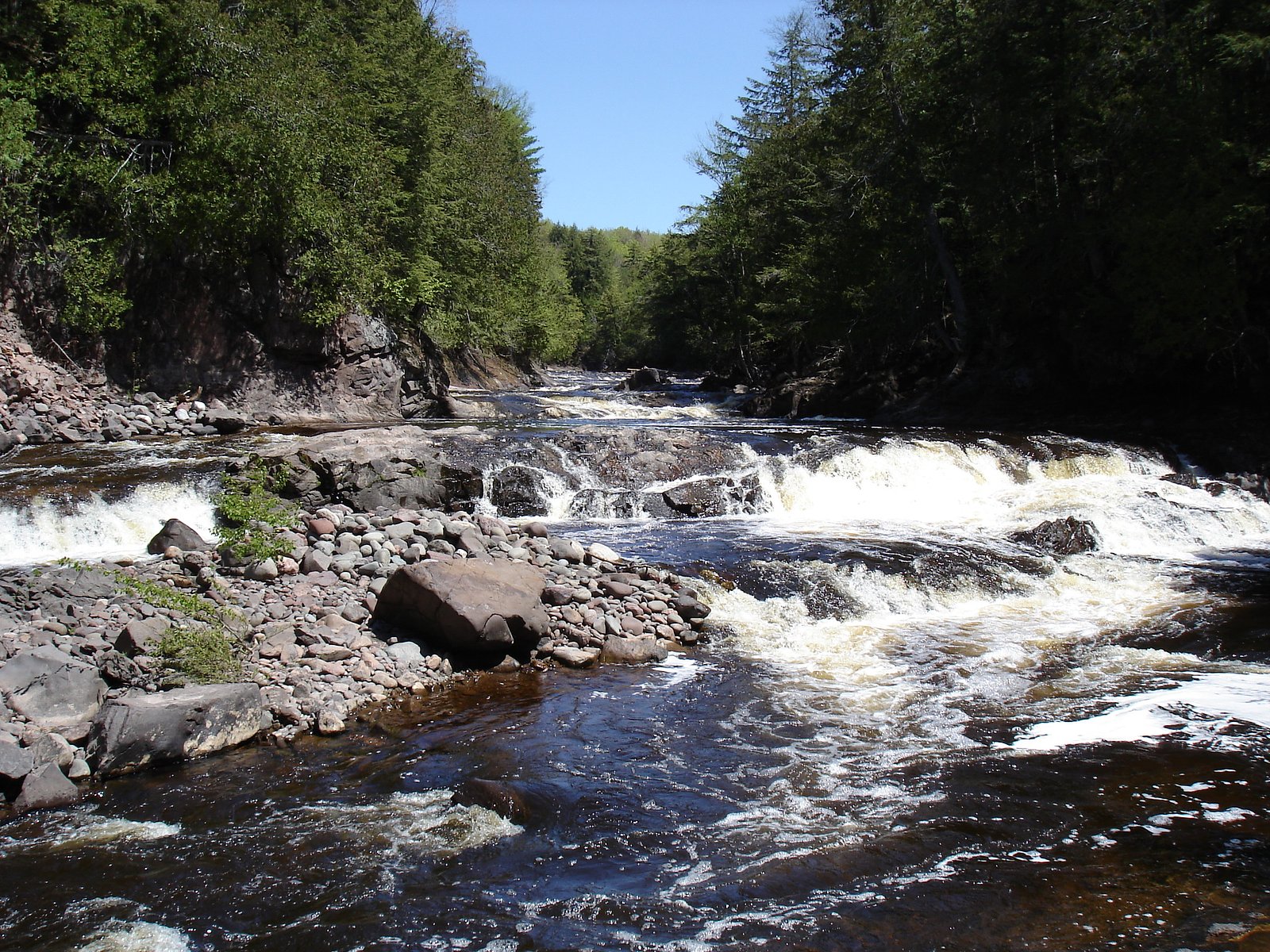
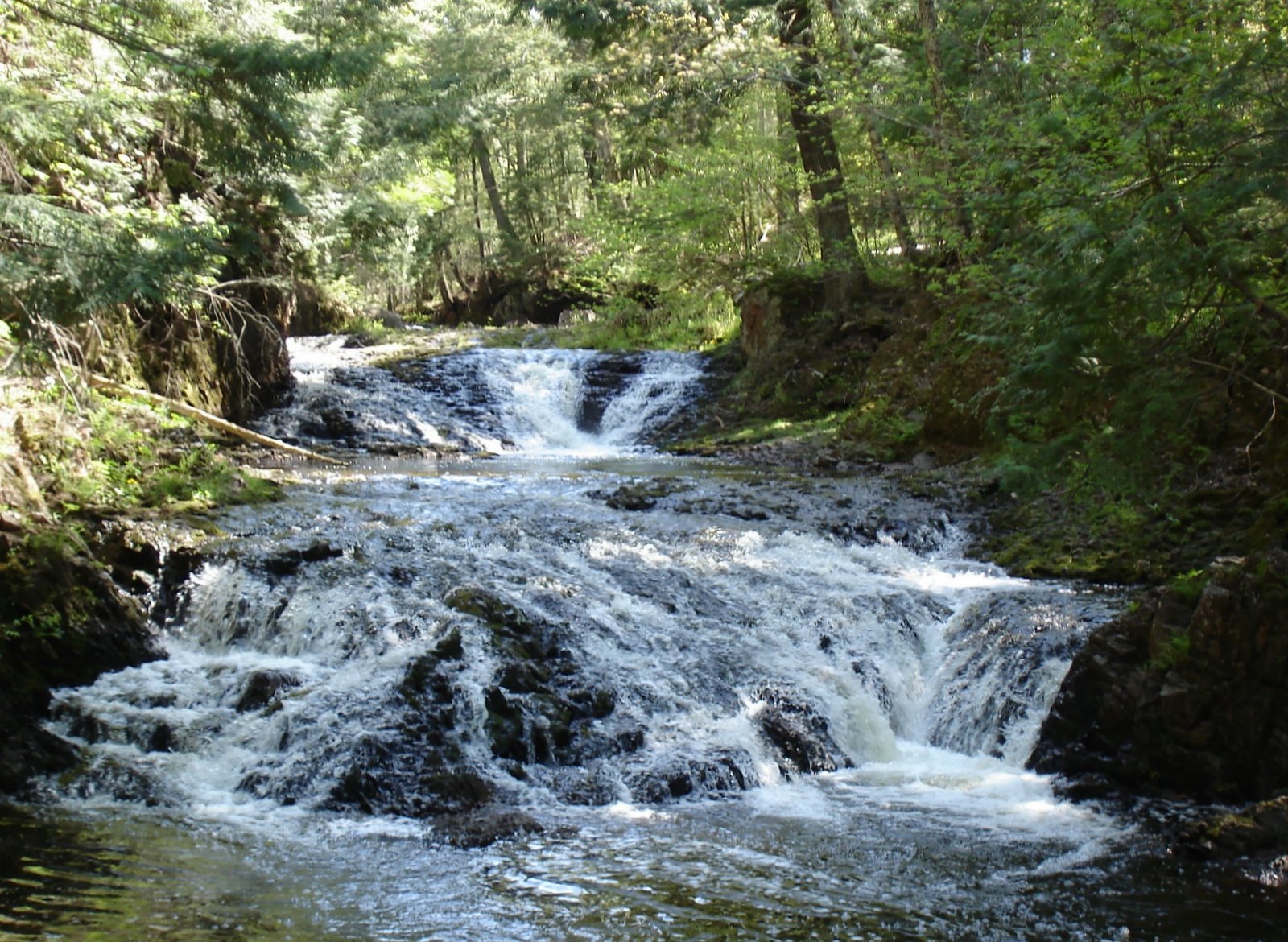
About Minnewawa Falls
Minnewawa Falls is a small, picturesque cascade tucked into Michigan’s Upper Peninsula and managed by the U.S. Forest Service. The falls sit on land owned by DESG and are part of the Presque Isle land unit associated with the Michigan Wild and Scenic River (WSR) designation, lending the area a protected, tranquil character. It’s a favorite stop for photographers and hikers looking for a peaceful woodland scene rather than a large, dramatic drop. Access to the falls is via a moderate out-and-back hike that gains about 350 feet over its length, making it rewarding for casual day hikers who don’t mind a bit of uphill. The setting feels remote and forested, and the USFS stewardship helps preserve the natural character of the stream corridor, so expect a quiet visit where the sound of flowing water is the main attraction.
The Setting
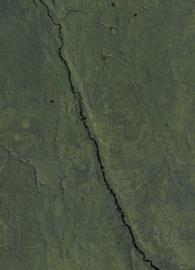
Minnewawa Falls sits at 1,230 feet within Presque Isle, Michigan Wild and Scenic River, fed by the Presque Isle River, in the foothills of Michigan.
Trail & Hike Details
The Approach
The moderate 2.4-mile out-and-back trail gains 350 feet of elevation on the way to the falls.
Trail Description
The trail to Minnewawa Falls is a 2.4-mile out-and-back with approximately 350 feet of elevation gain and is rated moderate. The route is generally well-marked and suitable for hikers comfortable with a moderate climb; conditions can become muddy after rain, so sturdy footwear is recommended. The USFS-managed approach emphasizes a natural tread (expect typical forest trail features), and while the path is accessible to many visitors, plan extra time for footing on steeper or wet sections.
What to Expect
Dogs are welcome.
Accessibility
The trail is not wheelchair accessible. Uneven terrain and elevation changes require steady footing.
Frequently Asked Questions
🐶 Are Dogs Allowed at Minnewawa Falls?
✅ Dogs are allowed
Are There Any Fees or Permits Required?
🆖 No fees required
🏊 Is There Swimming at Minnewawa Falls?
❌ Swimming is not allowed
When to Visit
Spring and early summer are ideal for visiting Minnewawa Falls, as water flow is typically higher during these seasons. Fall offers beautiful foliage, while winter provides a unique view of the frozen waterfall.
Seasonal Access
The best time to visit is Spring, Summer, and Fall. Winter access may be limited.
Safety Information
Be cautious of slippery rocks near the waterfall and muddy trails after rain. Always stay on marked trails to avoid getting lost or damaging the environment.
Current Water Conditions
82 ft³/s
Current discharge — how much water is flowing
About average for this time of year
Based on 3 years of record
5.47 ft
Water depth at gauge
73°F
ComfortablePleasant for swimming
7-Day Discharge Trend
What does this mean for your visit?
Flow is about average for this time of year. The water is a comfortable 73 degrees F, pleasant for swimming. Expect excellent dissolved oxygen levels. Mineral content is typical.
Water Quality
Dissolved Oxygen
ExcellentSupports aquatic life
Conductance
Dissolved minerals in the water
About This Gauge
This gauge is on a nearby waterway and may not reflect exact conditions at the falls.
7-Day Flow Outlook
Based on the USGS gauge PRESQUE ISLE RIVER NEAR CONNORVILLE, MI (15 km away).
Today
Barely Flowing
88 cfs
3/10Tomorrow
Low
96 cfs
3/10Tue
Low
99 cfs
3/10Wed
Low
99 cfs
3/10Thu
Low
99 cfs
3/10Fri
Low
99 cfs
3/10Sat
Low
99 cfs
3/10Best window: Today — barely flowing flow, slight chance rain showers (trip score 3/10).
How we calculate this
This is a transparent outlook, not a precise forecast. We take the waterfall's current flow strength (how it ranks against its historical normal for today, from the nearest USGS stream gauge), carry that ranking forward along the gauge's seasonal curve, and nudge it for forecast rain. Confidence is highest for the next day or two and falls further out. Always check official conditions and your own judgment before visiting — high flows can be dangerous.
Know when to go.
Get a free email alert when waterfalls near Wakefield hit peak flow. We only send when conditions are worth the trip — no weekly newsletters, no spam.
Weather Forecast
Location & Access
Getting There
Minnewawa Falls is located near the town of Munising, Michigan, within the Hiawatha National Forest. Access is typically via a short drive from Munising, and the falls are reached by a trail starting from a nearby parking area.
Get Directions on Google MapsParking
There is a small parking area near the trailhead, but availability may be limited during peak seasons.
Elevation
1,230 feet above sea level
Coordinates
46.597169° N, -89.849610° W
Land Management
Managed by USFS
Visitor Tips & Gear
Visit early in the day to avoid crowds, especially during the summer and fall. Bring insect repellent during warmer months, as mosquitoes can be present. Be cautious of slippery rocks near the waterfall.
As an Amazon Associate, we earn from qualifying purchases.
With 2.4 miles and 350 ft of elevation gain, sturdy boots and trekking poles will help on this moderate trail. Sun exposure on the trail makes good sun protection a must in summer.

Polarized Sunglasses (Knockaround)
Cuts glare off the water so you actually see the falls — and your photos turn out better too.

Columbia Watertight II Rain Jacket
Packs into its own pocket, seam-sealed, and keeps you dry from spray and surprise rain.

Earth Pak Waterproof Dry Bag
Keeps your phone and gear dry when waterfall mist soaks everything else.

Waterproof Phone Pouch (AiRunTech)
Cheap insurance — take photos right next to the falls without killing your phone.

Timberland Euro Sprint Mid Waterproof
Trusted waterproof boot with premium leather and grippy rubber sole — reliable on rocky, wet trails.

TrailBuddy Trekking Poles
Lightweight aluminum, cork grips, and flip-locks that actually hold — a best-seller for good reason.
Where to Stay

Snow Otter Haus - 2

Snow Otter Haus - 1

Quality Inn Ironwood

North Ironwood Acres - Black River Lodge
Browse vacation cabins and private rentals nearby
Unique outdoor stays — tents, yurts, and treehouses
Rent a campervan or RV for your waterfall road trip
Some links are affiliate links. We may earn a commission at no extra cost to you.
Nearby Campground
BLACK RIVER HARBOR CAMPGROUND
10.8 miles away · 40 sites
Overview Planning a trip to the Black River Harbor Campground? Watch for Alerts at the top of the page for any Alerts regarding this facility. Black River Campground is adjacent to the Black River Harbor Recreation Area. The recreation area includes a pavilion, harbor and a large picnic area. The area provides for many opportunities for fishing, boating, backpacking, hiking, bird watching, photography and beautiful scenery for relaxation in the outdoors. Recreation The campground is adjacent to
Book on Recreation.govAdditional Information
Nearby Attractions
Nearby attractions include Munising Falls, Pictured Rocks National Lakeshore, and Wagner Falls.
Wildlife
The area is home to a variety of wildlife, including birds, deer, and small mammals. Visitors may also encounter insects such as mosquitoes and ticks.
Cities near Minnewawa Falls
Nearby Waterfalls

Writing about Minnewawa Falls? Embed this waterfall on your site for free.