
Difficulty
Moderate
Trail Length
1.5 miles
Trail Type
Out And Back
Elevation Gain
300 ft
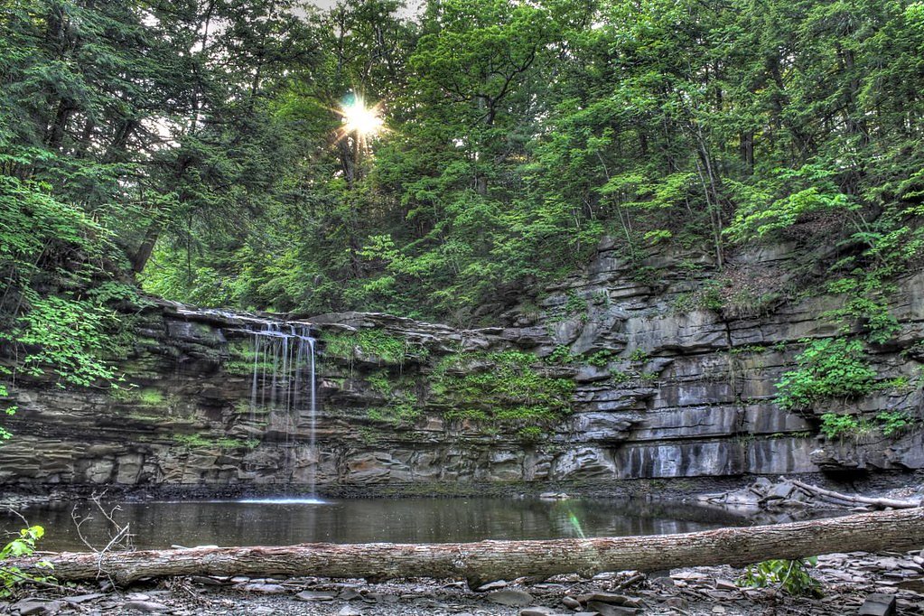
About Mine Lot Falls
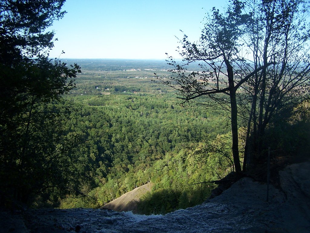
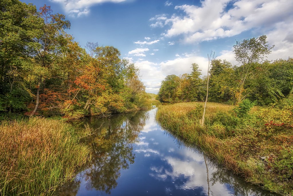
Mine Lot Falls is a tucked-away cascade nestled within John Boyd Thacher State Park, managed by New York State Parks (SPR). Set along the Helderberg Escarpment, the falls offer a peaceful woodland setting that complements the park’s well-known panoramic overlooks of the Hudson–Mohawk valleys and its notable geology and fossil-bearing strata. The combination of rocky outcrops and quiet forest makes Mine Lot Falls a rewarding stop for hikers and photographers exploring the park. The approach feels like a short escape from the more popular vista points: seasonal foliage frames the falls and the small pool below, creating attractive compositions in spring runoff and autumn color. Because the site is on park-managed land, trails are maintained by park staff—perfect for a half-day outing that pairs well with other short hikes in John Boyd Thacher State Park.
The Setting
Mine Lot Falls sits at 774 feet within John Boyd Thacher State Park, fed by the Normans Kill, in the foothills of New York.
Trail & Hike Details
The Approach
The moderate 1.5-mile out-and-back trail gains 300 feet of elevation on the way to the falls.
Trail Description
Out-and-back, 1.5 miles (approx. 2.4 km) round-trip with about 300 feet of cumulative elevation gain. Rated moderate, the trail follows natural tread with rocky and uneven sections; expect exposed roots, stone steps, and a generally moderate grade (roughly a 4% average incline over the route). There is no USFS trail number for this park-managed route; the path is maintained as a state park trail. Sturdy footwear and attention on footing are recommended, and trekking poles can help on the steeper or rockier stretches.
What to Expect
Dogs are welcome.
Accessibility
The trail is not wheelchair accessible. Uneven terrain and elevation changes require steady footing.
Frequently Asked Questions
🐶 Are Dogs Allowed at Mine Lot Falls?
✅ Dogs are allowed
Are There Any Fees or Permits Required?
🆖 No fees required
🏊 Is There Swimming at Mine Lot Falls?
❌ Swimming is not allowed
When to Visit
Spring and early summer are ideal times to visit, as the waterfall is typically at its fullest due to snowmelt and rainfall.
Seasonal Access
The best time to visit is Spring, Summer, and Fall. Winter access may be limited.
Safety Information
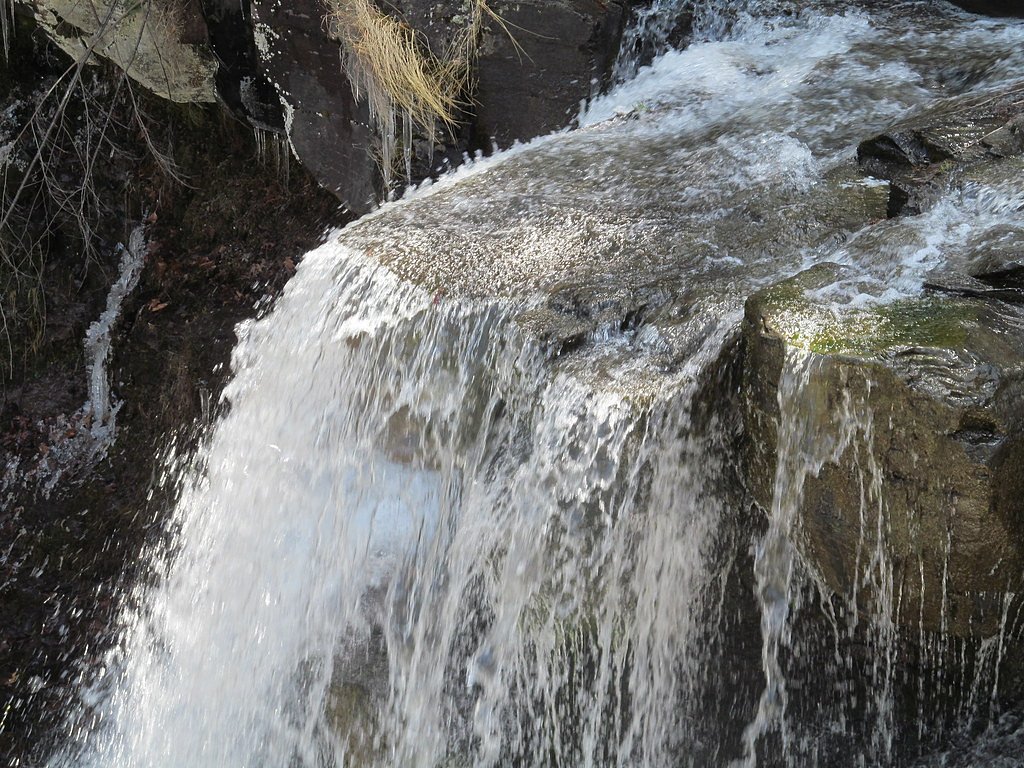
Be cautious of slippery rocks near the waterfall and along the trail, especially after rain. Always stay on marked trails to avoid getting lost.
Current Water Conditions
35 ft³/s
Current discharge — how much water is flowing
Lower than usual for this time of year
Based on 16 years of record
2.91 ft
Water depth at gauge
7-Day Discharge Trend
What does this mean for your visit?
Flow is lower than usual for this time of year.
About This Gauge
This gauge is on a nearby waterway and may not reflect exact conditions at the falls.
7-Day Flow Outlook
Based on the USGS gauge NORMANS KILL AT ALBANY NY (17 km away).
Today
Low
42 cfs
3/10Tomorrow
Low
54 cfs
3/10Thu
Barely Flowing
48 cfs
5/10Fri
Low
55 cfs
3/10Sat
Low
47 cfs
3/10Sun
Low
58 cfs
3/10Mon
Low
47 cfs
3/10Best window: Thu — barely flowing flow, sunny (trip score 5/10).
Best time of year: this gauge typically runs highest from late February to late April, peaking in April.
How we calculate this
This is a transparent outlook, not a precise forecast. We take the waterfall's current flow strength (how it ranks against its historical normal for today, from the nearest USGS stream gauge), carry that ranking forward along the gauge's seasonal curve, and nudge it for forecast rain. Confidence is highest for the next day or two and falls further out. Always check official conditions and your own judgment before visiting — high flows can be dangerous.
Know when to go.
Get a free email alert when waterfalls near Voorheesville hit peak flow. We only send when conditions are worth the trip — no weekly newsletters, no spam.
Weather Forecast
Location & Access
Getting There
Mine Lot Falls is located near the town of Hunter, New York, within the Catskill Forest Preserve. Access is typically via local roads, and the trailhead may be reached by car.
Get Directions on Google MapsParking
Parking is available near the trailhead, but spaces may be limited during peak seasons. Visitors should check for any parking restrictions or fees.
Elevation
774 feet above sea level
Coordinates
42.653411° N, -74.013183° W
Land Management
Managed by SPR
Visitor Tips & Gear
Arrive early to secure parking, especially during weekends or peak seasons. Bring plenty of water and wear sturdy hiking shoes. Be cautious of slippery rocks near the waterfall.
As an Amazon Associate, we earn from qualifying purchases.
With 1.5 miles and 300 ft of elevation gain, sturdy boots and trekking poles will help on this moderate trail. Sun exposure on the trail makes good sun protection a must in summer.

Polarized Sunglasses (Knockaround)
Cuts glare off the water so you actually see the falls — and your photos turn out better too.

Columbia Watertight II Rain Jacket
Packs into its own pocket, seam-sealed, and keeps you dry from spray and surprise rain.

Earth Pak Waterproof Dry Bag
Keeps your phone and gear dry when waterfall mist soaks everything else.

Waterproof Phone Pouch (AiRunTech)
Cheap insurance — take photos right next to the falls without killing your phone.

Timberland Euro Sprint Mid Waterproof
Trusted waterproof boot with premium leather and grippy rubber sole — reliable on rocky, wet trails.

TrailBuddy Trekking Poles
Lightweight aluminum, cork grips, and flip-locks that actually hold — a best-seller for good reason.
Where to Stay

Tru By Hilton Albany Airport, Ny

Comfort Inn & Suites Schenectady - Scotia

The Clocktower Hotel Latham - North Albany, an Ascend Collection Hotel

Hampton Inn & Suites Albany-Downtown
Browse vacation cabins and private rentals nearby
Unique outdoor stays — tents, yurts, and treehouses
Rent a campervan or RV for your waterfall road trip
Some links are affiliate links. We may earn a commission at no extra cost to you.
Nearby Hot Springs
Hot springs near Voorheesville, New York

Lebanon Spring
Lebanon Spring discharges at 72°F at 663 feet elevation in Columbia County, flowing 24 degrees above ambient air temperature ju...
Sand Spring
Sand Spring surfaces at 75°F in Williamstown, Massachusetts — one of the few thermal features in New England. At just 670 feet ...
Looking for a soak after your hike? Explore more hot springs near Voorheesville, New York on SoakingSprings.
Explore New York springsAdditional Information
Nearby Attractions
Nearby attractions include Kaaterskill Falls, Hunter Mountain, and the Catskill Scenic Trail.
Wildlife
The area is home to various wildlife, including deer, birds, and small mammals. Visitors should be cautious of ticks and other insects.
Cities near Mine Lot Falls
Nearby Waterfalls
Writing about Mine Lot Falls? Embed this waterfall on your site for free.