Mine Kill Falls
New York • 80 ft
By Armen Suny · Last verified Mar 2026
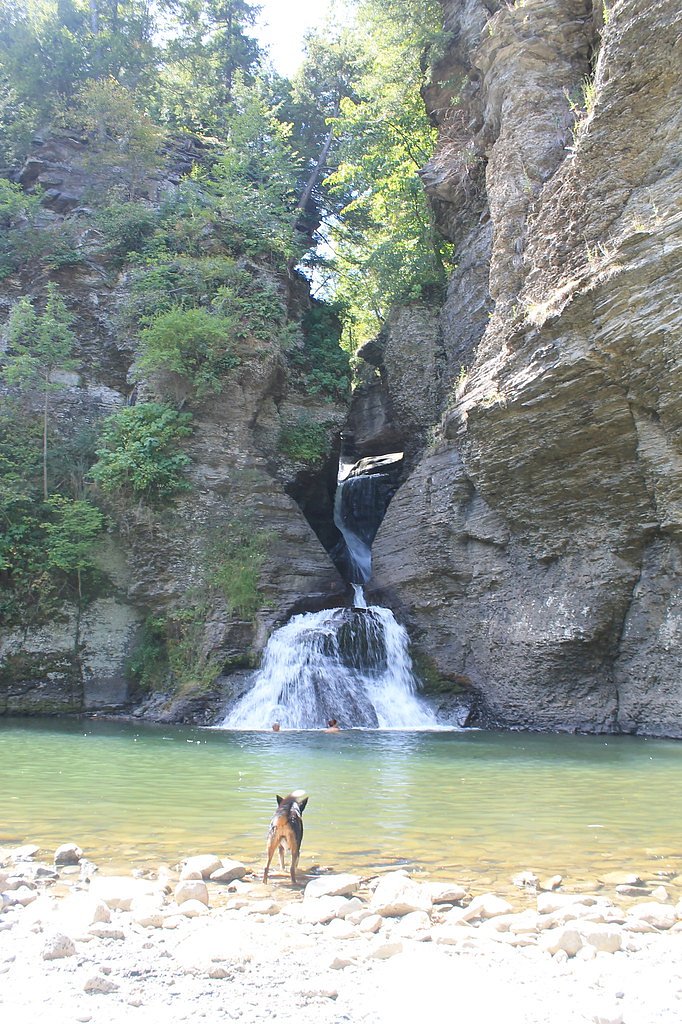
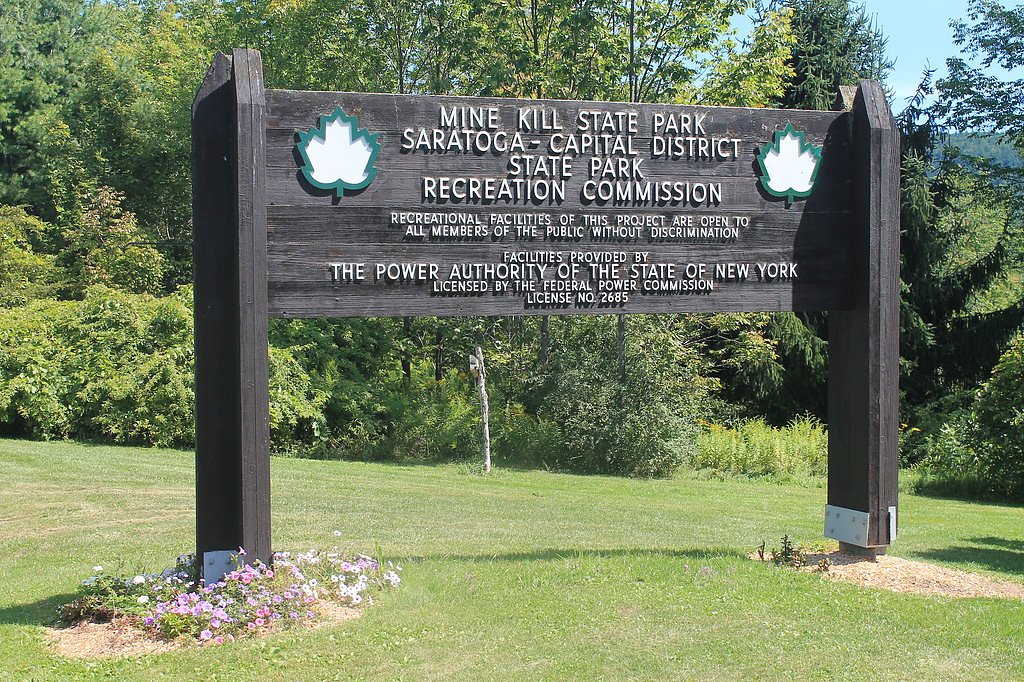
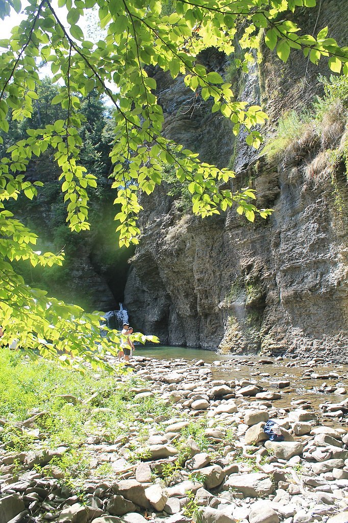
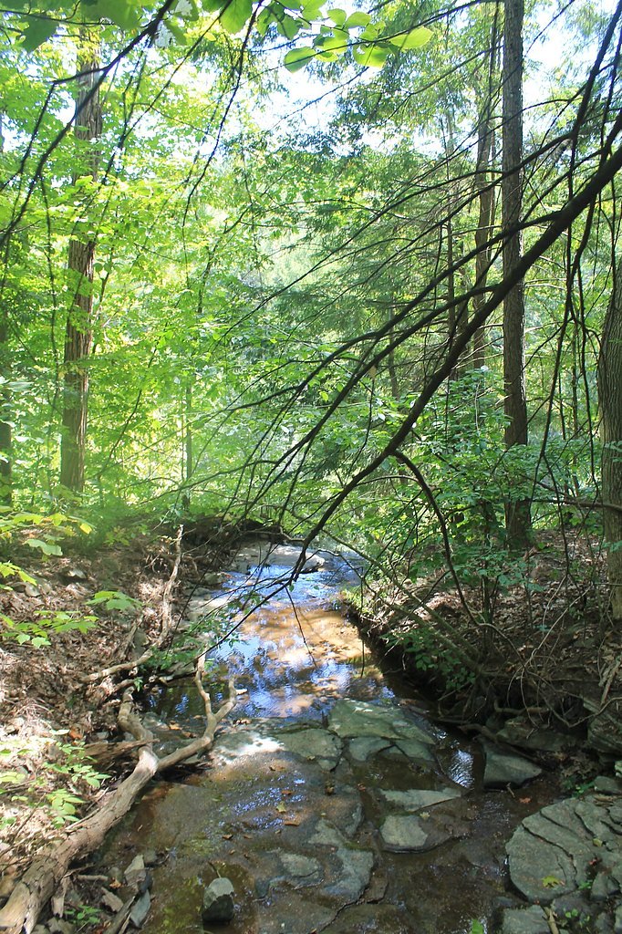

Photo Credits (5)
Difficulty
Moderate
Trail Length
2.4 miles
Trail Type
Out And Back
Elevation Gain
350 ft
About Mine Kill Falls
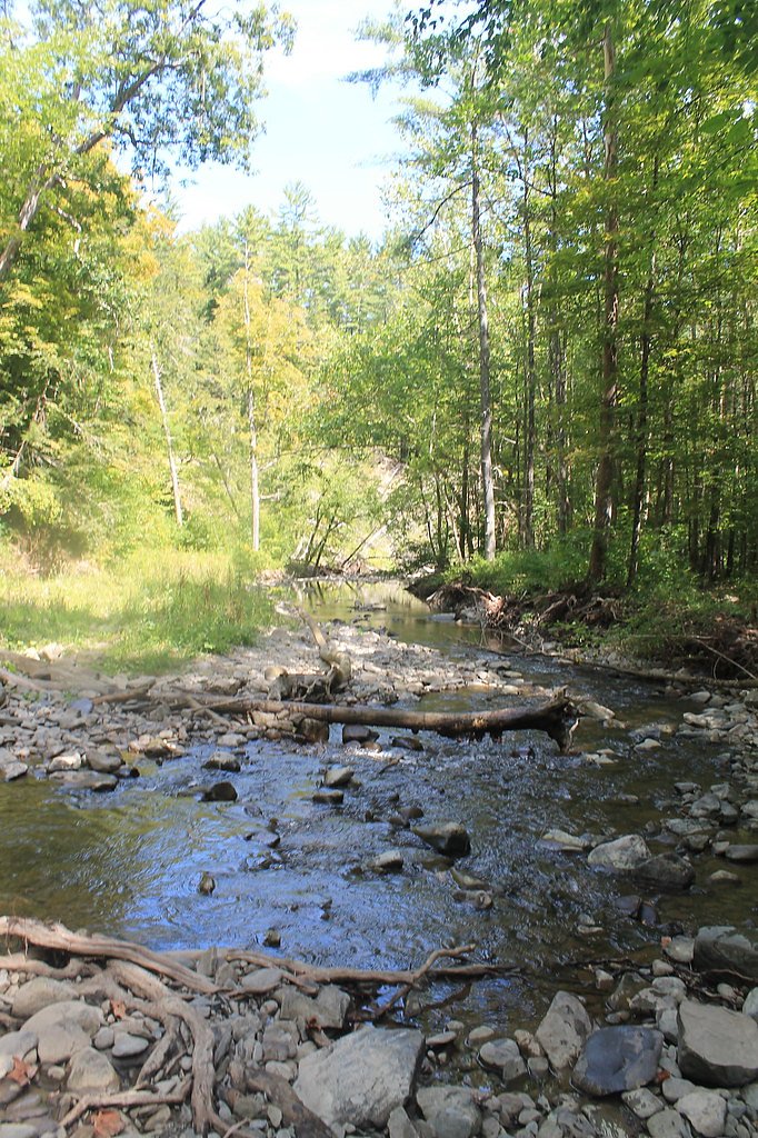
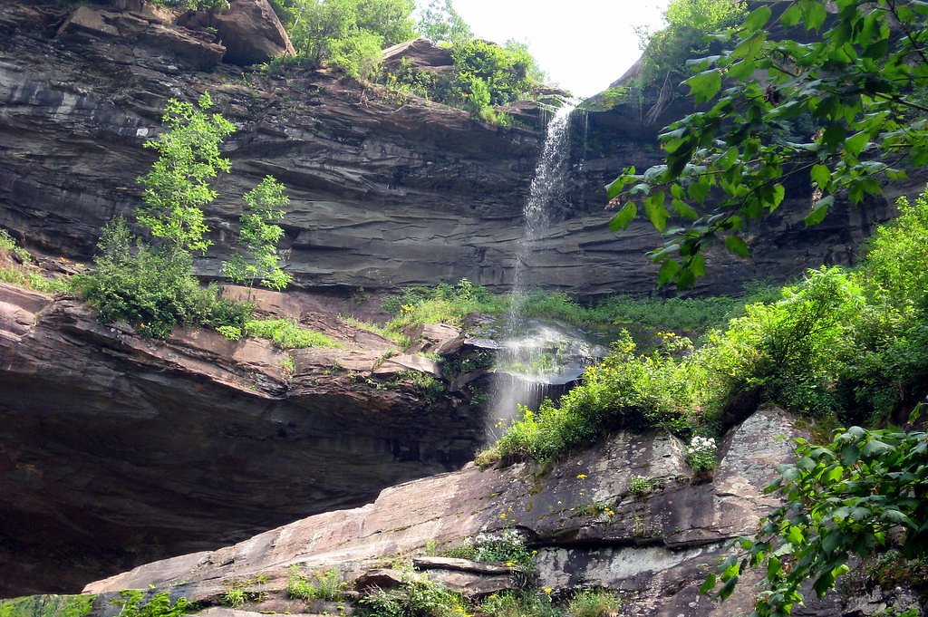
Mine Kill Falls is a picturesque multi-tiered waterfall located within Mine Kill State Park in New York. The falls cascade through a gorge and are a popular destination for visitors seeking scenic views and outdoor recreation.
The Setting
Mine Kill Falls sits at 1,040 feet within Mine Kill State Park, fed by the Mine Kill, in the foothills of New York. The falls drop 80 feet.
Height: 80 feet
Trail & Hike Details
The Approach
The moderate 2.4-mile out-and-back trail gains 350 feet of elevation on the way to the falls.
Trail Description
The trail to Mine Kill Falls is short and well-maintained, making it accessible for most visitors. It leads to a viewing platform that offers a clear view of the falls. The trail may include some uneven terrain, but it is generally easy to navigate.
What to Expect
The falls cascade 80 feet. Dogs are welcome.
Accessibility
The trail is not wheelchair accessible. Uneven terrain and elevation changes require steady footing.
Frequently Asked Questions
🐶 Are Dogs Allowed at Mine Kill Falls?
✅ Dogs are allowed
Are There Any Fees or Permits Required?
🤑 Fee: $6.00
🏊 Is There Swimming at Mine Kill Falls?
❌ Swimming is not allowed
When to Visit
Spring and early summer are ideal for visiting Mine Kill Falls, as the water flow is typically strongest during these seasons. Fall offers beautiful foliage, while winter provides a chance to see the falls partially frozen.
Seasonal Access
The best time to visit is Spring, Summer, Fall, and Winter.
Safety Information
Exercise caution near the edges of the gorge and stay on marked trails. The rocks near the falls can be slippery, especially after rain. Be aware of ticks and other insects in the area.
Current Water Conditions
2 ft³/s
Current discharge — how much water is flowing
Lower than usual for this time of year
Based on 51 years of record
1.80 ft
Water depth at gauge
7-Day Discharge Trend
What does this mean for your visit?
Flow is lower than usual for this time of year.
About This Gauge
7-Day Flow Outlook
Based on the USGS gauge MINE KILL NEAR NORTH BLENHEIM NY (0 km away).
Today
Low
3 cfs
6/10Tomorrow
Low
2 cfs
6/10Tue
Moderate
2 cfs
4/10Wed
Moderate
2 cfs
4/10Thu
Low
2 cfs
6/10Fri
Moderate
2 cfs
4/10Sat
Moderate
2 cfs
4/10Best window: Today — low flow, mostly sunny (trip score 6/10).
Best time of year: this gauge typically runs highest from late February to early May, peaking in April.
How we calculate this
This is a transparent outlook, not a precise forecast. We take the waterfall's current flow strength (how it ranks against its historical normal for today, from the nearest USGS stream gauge), carry that ranking forward along the gauge's seasonal curve, and nudge it for forecast rain. Confidence is highest for the next day or two and falls further out. Always check official conditions and your own judgment before visiting — high flows can be dangerous.
Know when to go.
Get a free email alert when waterfalls near North Blenheim hit peak flow. We only send when conditions are worth the trip — no weekly newsletters, no spam.
Weather Forecast
Location & Access
Getting There
Mine Kill Falls is located within Mine Kill State Park, near North Blenheim, New York. The falls can be accessed via Route 30, and signage within the park directs visitors to the trailhead and viewing areas.
Get Directions on Google MapsParking
Parking is available at designated areas within Mine Kill State Park, including near the trailhead for the falls.
Elevation
1,040 feet above sea level
Coordinates
42.428968° N, -74.472092° W
Land Management
Managed by SPR
Visitor Tips & Gear
Wear sturdy shoes, as the trail may have uneven sections. Visit after rainfall for a more dramatic flow. Bring water and snacks, and consider visiting other attractions within Mine Kill State Park, such as the swimming pool or hiking trails.
As an Amazon Associate, we earn from qualifying purchases.
With 2.4 miles and 350 ft of elevation gain, sturdy boots and trekking poles will help on this moderate trail. Icy conditions are common in winter — traction cleats are a smart addition.

Columbia Watertight II Rain Jacket
Packs into its own pocket, seam-sealed, and keeps you dry from spray and surprise rain.

Polarized Sunglasses (Knockaround)
Cuts glare off the water so you actually see the falls — and your photos turn out better too.

Earth Pak Waterproof Dry Bag
Keeps your phone and gear dry when waterfall mist soaks everything else.

Waterproof Phone Pouch (AiRunTech)
Cheap insurance — take photos right next to the falls without killing your phone.

Timberland Euro Sprint Mid Waterproof
Trusted waterproof boot with premium leather and grippy rubber sole — reliable on rocky, wet trails.

TrailBuddy Trekking Poles
Lightweight aluminum, cork grips, and flip-locks that actually hold — a best-seller for good reason.
Where to Stay

Rustic Catskills Cabin with Hot Tub and Mountain Views

Eastwind

The Perch Hotel

Ski In Ski Out Cabin on Hunter Mtn Seasonal Pool Access w Panoramic Views Hike Swim Fish Relax
Browse vacation cabins and private rentals nearby
Unique outdoor stays — tents, yurts, and treehouses
Rent a campervan or RV for your waterfall road trip
Some links are affiliate links. We may earn a commission at no extra cost to you.
Additional Information
Nearby Attractions
Nearby attractions include the Blenheim-Gilboa Visitors Center, the New York Power Authority's Lansing Manor, and other trails within Mine Kill State Park.
Wildlife
The area is home to various wildlife, including birds, deer, and small mammals. Visitors may also spot fish in the nearby Schoharie Creek.
Cities near Mine Kill Falls
Nearby Waterfalls
Writing about Mine Kill Falls? Embed this waterfall on your site for free.