Mina Sauk Falls
Missouri • 132 ft
By Armen Suny · Last verified Mar 2026
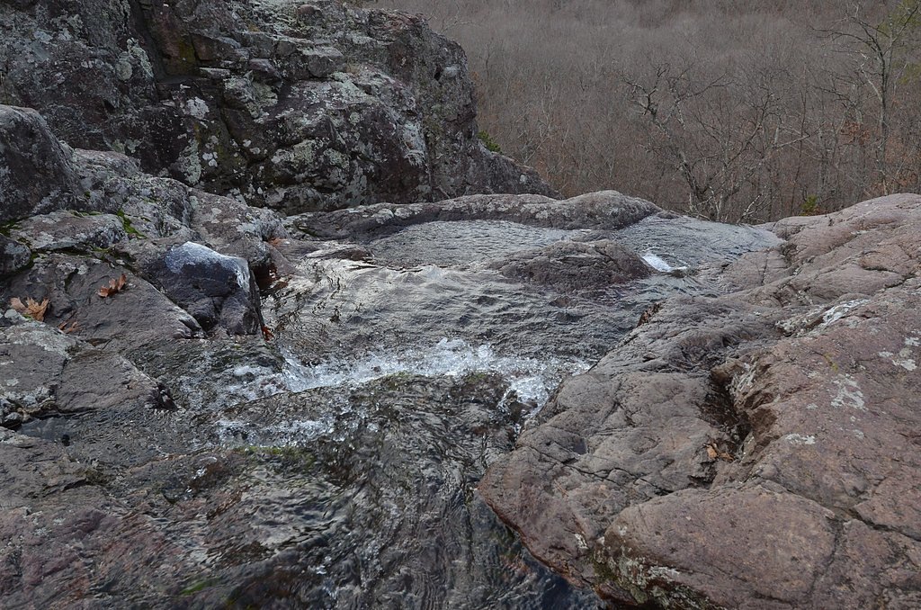
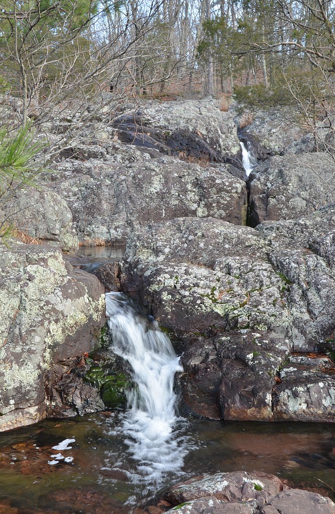
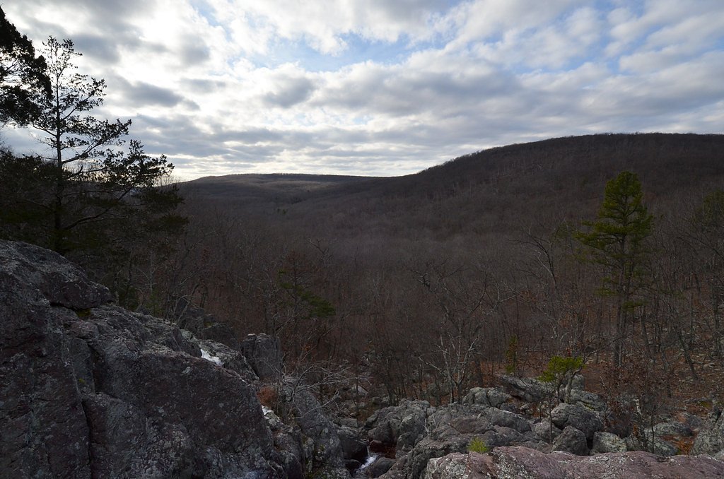
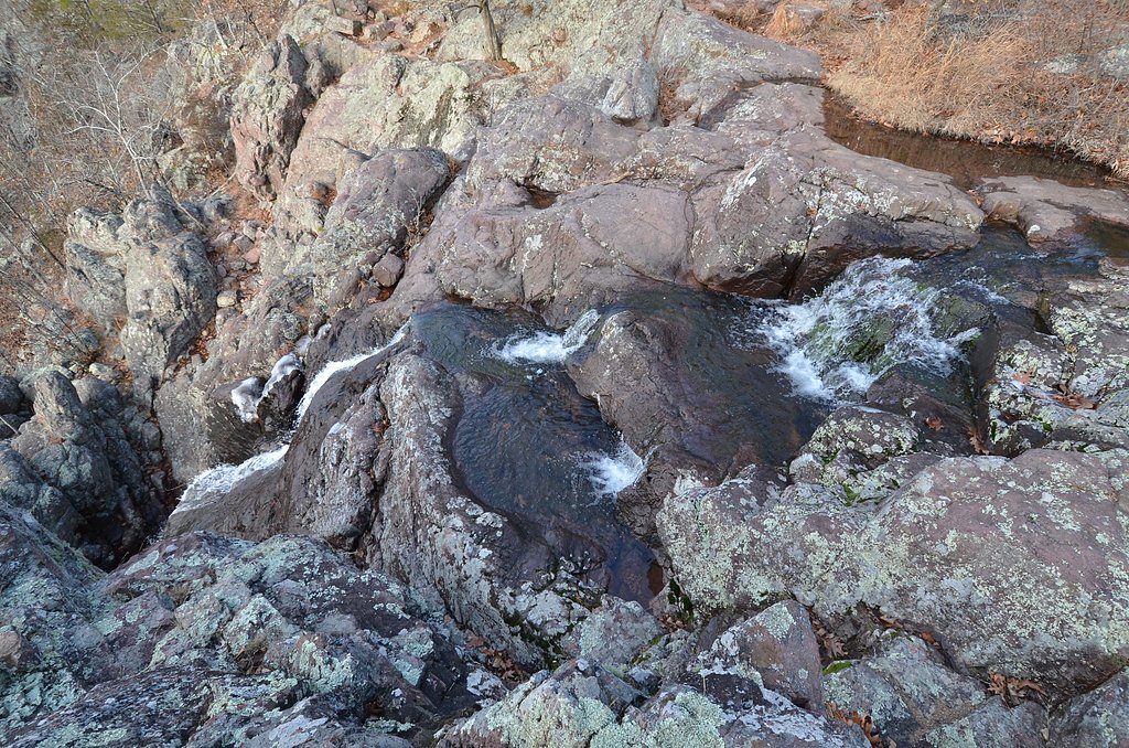

Photo Credits (5)
Difficulty
Moderate
Trail Length
3.0 miles
Trail Type
Loop
Elevation Gain
400 ft
About Mina Sauk Falls
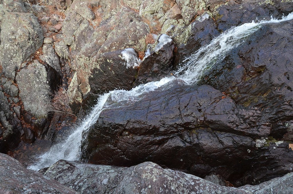
Mina Sauk Falls is Missouri’s tallest waterfall, plunging about 132 feet over rocky ledges on Taum Sauk Mountain. The falls sit within the Saint Francois Mountains Natural Area (designation: SCA) on land owned by OTHS, and they put on their best show after heavy rain when runoff thunders down the exposed bedrock. Taum Sauk itself is the highest natural point in Missouri at 1,772 ft (540 m), and its elongated ridge (NNW–SSE orientation) gives the area a rugged, ridge-and-gully character that frames sweeping views across the Saint Francois Mountains. The setting is classic Ozark hiking — forested slopes, exposed rhyolite outcrops and seasonal cascades — and the falls make a rewarding destination for a half-day outing. Hike thoughtfully: flows are highly seasonal, footing can be slick on the ledges, and the site’s remote, ridge-top terrain rewards visitors who come prepared for variable trail conditions and weather.
The Setting
Mina Sauk Falls sits at 1,283 feet within Saint Francois Mountains Natural Area, fed by the East Fork Black River, in the foothills of Missouri. At 132 feet, it is among the taller waterfalls in Missouri.
Height: 132 feet
Trail & Hike Details
The Approach
The moderate 3.0-mile loop trail gains 400 feet of elevation on the way to the falls.
Trail Description
Mina Sauk Falls Trail is a 3.0-mile loop with roughly 400 feet of elevation gain and is rated moderate. The route threads forested sections and rocky, uneven tread that lead to viewpoints and the base of the 132-foot cascade. Expect a mix of dirt and rock surfaces, moderate overall grades (400 ft gain over the loop) and some short, steeper stretches where footing requires attention. The loop delivers scenic overlooks of the Saint Francois Mountains and the Taum Sauk ridge; the waterfall is most impressive after heavy rainfall. Suitable for hikers comfortable on uneven terrain — bring sturdy footwear and water, and be prepared for intermittent slick rock near the falls.
What to Expect
The falls cascade 132 feet. Dogs are welcome.
Accessibility
The trail is not wheelchair accessible. Uneven terrain and elevation changes require steady footing.
Frequently Asked Questions
🐶 Are Dogs Allowed at Mina Sauk Falls?
✅ Dogs are allowed
Are There Any Fees or Permits Required?
🆖 No fees required
🏊 Is There Swimming at Mina Sauk Falls?
❌ Swimming is not allowed
When to Visit
Spring and after heavy rainfall are the best times to visit, as the waterfall is most active during these periods.
Seasonal Access
The best time to visit is Spring, Summer, Fall, and Winter.
Safety Information
The trail can be slippery after rain, and the rocky terrain requires careful footing. Be cautious near the waterfall, as the rocks can be unstable. Carry plenty of water, especially in warmer months.
Current Water Conditions
16 ft³/s
Current discharge — how much water is flowing
Much lower than usual for this time of year
Based on 23 years of record
1.19 ft
Water depth at gauge
64°F
CoolRefreshing for swimming
7-Day Discharge Trend
What does this mean for your visit?
Flow is well below normal for this time of year, so the waterfall may be a trickle. Water temperature is a refreshing 64 degrees F, good for a quick swim. Expect crystal clear visibility and excellent dissolved oxygen levels. PH is normal at 8.1 and mineral content is typical.
Water Quality
Dissolved Oxygen
ExcellentSupports aquatic life
pH
NormalWithin healthy range (6.5-8.5)
Water Clarity
Crystal clearExcellent visibility
Conductance
Dissolved minerals in the water
About This Gauge
This gauge is on a nearby waterway and may not reflect exact conditions at the falls.
Know when to go.
Get a free email alert when waterfalls near Arcadia hit peak flow. We only send when conditions are worth the trip — no weekly newsletters, no spam.
Weather Forecast
Location & Access
Getting There
Mina Sauk Falls is located in Taum Sauk Mountain State Park, near Ironton, Missouri. The trailhead begins at the main parking area for the park.
Get Directions on Google MapsParking
Parking is available at the Taum Sauk Mountain State Park trailhead. It is free and typically has ample space.
Elevation
1283 feet above sea level
Coordinates
37.562549° N, -90.741234° W
Land Management
Managed by UNK
Visitor Tips & Gear
Wear sturdy hiking shoes due to the rocky terrain. Bring water and snacks, as there are no facilities along the trail. Visit after recent rainfall for the best chance to see the waterfall flowing.
As an Amazon Associate, we earn from qualifying purchases.
With 3.0 miles and 400 ft of elevation gain, sturdy boots and trekking poles will help on this moderate trail. Icy conditions are common in winter — traction cleats are a smart addition.

Columbia Watertight II Rain Jacket
Packs into its own pocket, seam-sealed, and keeps you dry from spray and surprise rain.

Polarized Sunglasses (Knockaround)
Cuts glare off the water so you actually see the falls — and your photos turn out better too.

Earth Pak Waterproof Dry Bag
Keeps your phone and gear dry when waterfall mist soaks everything else.

Waterproof Phone Pouch (AiRunTech)
Cheap insurance — take photos right next to the falls without killing your phone.

Timberland Euro Sprint Mid Waterproof
Trusted waterproof boot with premium leather and grippy rubber sole — reliable on rocky, wet trails.

TrailBuddy Trekking Poles
Lightweight aluminum, cork grips, and flip-locks that actually hold — a best-seller for good reason.
Where to Stay

Baymont Inn and Suites by Wyndham Farmington, MO

Fort Davidson Hotel

Shepherd Mountain Inn & Suites

Plain & Fancy Bed & Breakfast
Browse vacation cabins and private rentals nearby
Unique outdoor stays — tents, yurts, and treehouses
Rent a campervan or RV for your waterfall road trip
Some links are affiliate links. We may earn a commission at no extra cost to you.
Nearby Campground
COUNCIL BLUFF RECREATION AREA
14.9 miles away · 57 sites
Overview The Council Bluff Recreation Area is perfect for anyone looking to enjoy the outdoors. The Wild Boar Campground and sheltered picnic area, available for individual families or large groups, is next to the largest lake in the Mark Twain National Forest. The area provides ample opportunities for camping, picnicking, hiking, fishing, swimming and more.Recreation Boating is a popular pastime on the lake, but all boats on the lake must operate at a no-wake speed. Visitors can access the water
Book on Recreation.govAdditional Information
Nearby Attractions
Taum Sauk Mountain, the highest point in Missouri, is located nearby. Johnson's Shut-Ins State Park is also a short drive away.
Wildlife
The area is home to a variety of wildlife, including deer, birds, and small mammals. Be cautious of snakes, especially in warmer months.
Cities near Mina Sauk Falls
Writing about Mina Sauk Falls? Embed this waterfall on your site for free.