Photo Credits (5)
Difficulty
Moderate
Trail Length
1.5 miles
Trail Type
Out And Back
Elevation Gain
300 ft
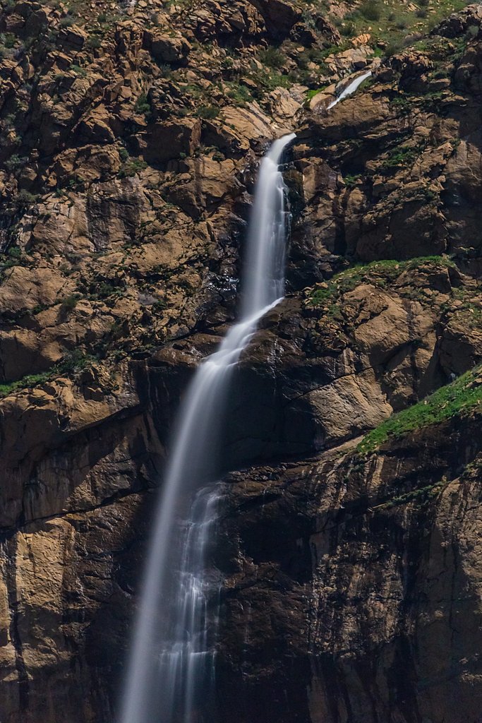
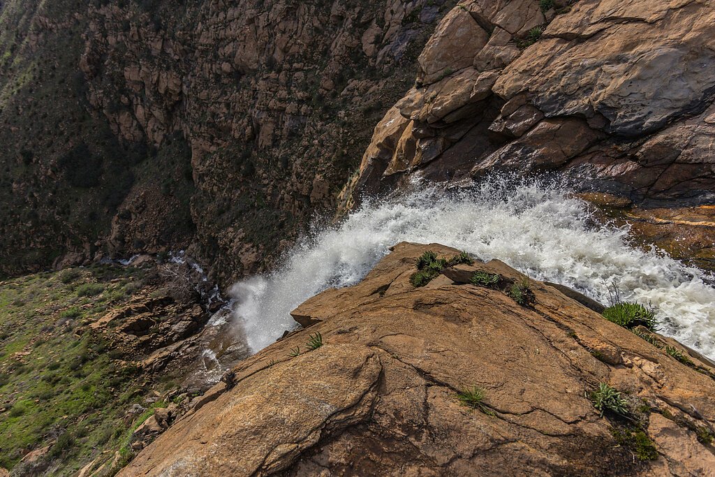
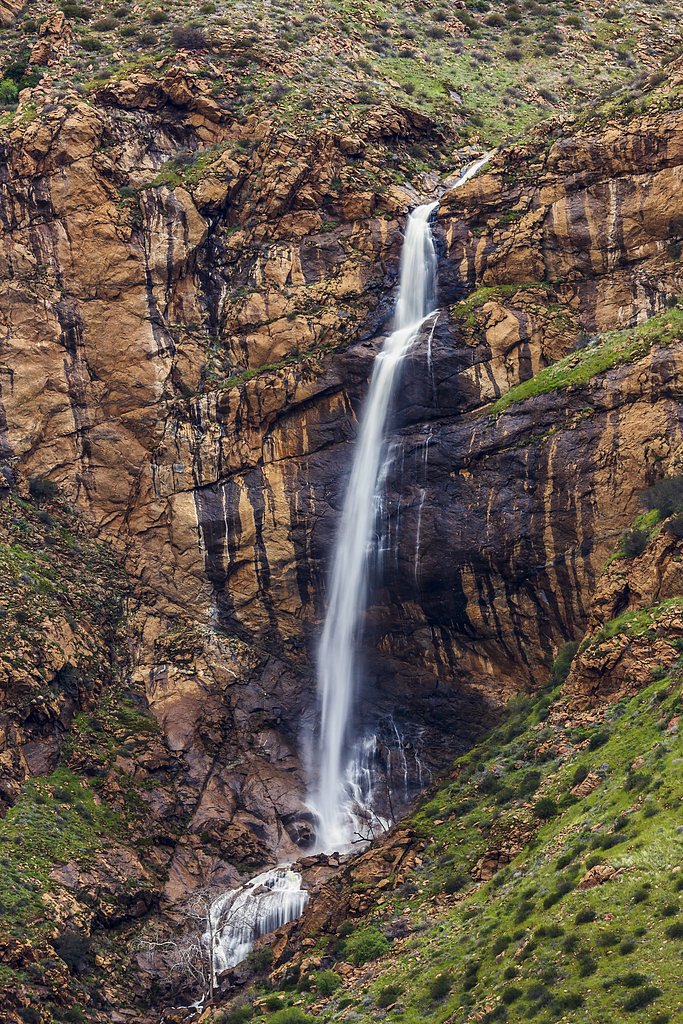
About Mildred Falls
Tucked into the rolling chaparral slopes east of Julian, Mildred Falls is a seasonal drop in the Cleveland National Forest that puts on its best show after heavy winter rains and the spring snowmelt. The cascade can be dramatic when water is flowing, but the falls are often reduced to a trickle or dry out through the late summer and fall — plan your visit for the wet season if you want to see it at its peak. The setting is intimate and a little wild, making it a rewarding short outing for hikers who enjoy quiet, off-the-beaten-path features in San Diego County. Access to the falls is via a short, 1.5-mile out-and-back route from the nearest trailhead, with about 300 feet of elevation gain. The hike is rated moderate: the trail is unimproved in spots with rocky, uneven tread and occasional overgrowth, so sturdy footwear and a bit of route-awareness go a long way. Because the area is managed by the Cleveland National Forest, expect a natural, low-impact experience rather than heavily developed amenities.
Nearby Falls Worth Visiting
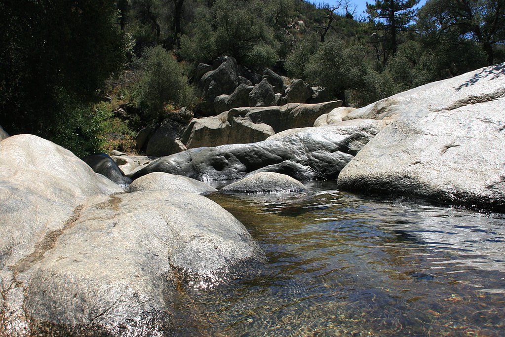
Cedar Creek Falls (80 ft) lies 1.9 miles to the southwest.
Trail & Hike Details
The Approach
The moderate 1.5-mile out-and-back trail gains 300 feet of elevation on the way to the falls.
Trail Description
Trail: 1.5 miles round-trip (out-and-back) with approximately 300 ft elevation gain; difficulty: moderate. The route follows a short natural dirt path that shifts between gentle grades and steeper pitches—an average grade that feels moderate given the overall gain. Surface is predominantly dirt with rocky sections, loose rock, and occasional brush; the tread is uneven in places and the path is not consistently maintained. No technical scrambling or climbing is required, but hikers should be prepared for rocky steps and short, steeper sections. Standard day-hike gear and sturdy footwear are recommended.
What to Expect
Dogs are welcome.
Accessibility
The trail is not wheelchair accessible. Uneven terrain and elevation changes require steady footing.
Frequently Asked Questions
🐶 Are Dogs Allowed at Mildred Falls?
✅ Dogs are allowed
Are There Any Fees or Permits Required?
🤑 Fee: $10.00
🏊 Is There Swimming at Mildred Falls?
❌ Swimming is not allowed
When to Visit
The best time to visit is during the winter and early spring, particularly after heavy rains or snowmelt.
Seasonal Access
The best time to visit is Winter and Spring.
Safety Information
The trail can be slippery after rain, and there is limited shade, so hikers should prepare for sun exposure. Always check weather conditions before visiting, as flash flooding can occur in the area.
Current Water Conditions
0 ft³/s
Current discharge — how much water is flowing
About average for this time of year
Based on 69 years of record
3.42 ft
Water depth at gauge
What does this mean for your visit?
Flow is about average for this time of year.
About This Gauge
This gauge is on a nearby waterway and may not reflect exact conditions at the falls.
7-Day Flow Outlook
Based on the USGS gauge SWEETWATER R NR DESCANSO CA (22 km away).
Best time of year: this gauge typically runs highest from late February to late April, peaking in April.
How we calculate this
This is a transparent outlook, not a precise forecast. We take the waterfall's current flow strength (how it ranks against its historical normal for today, from the nearest USGS stream gauge), carry that ranking forward along the gauge's seasonal curve, and nudge it for forecast rain. Confidence is highest for the next day or two and falls further out. Always check official conditions and your own judgment before visiting — high flows can be dangerous.
Know when to go.
Get a free email alert when waterfalls near San Diego Country Estates hit peak flow. We only send when conditions are worth the trip — no weekly newsletters, no spam.
Weather Forecast
Location & Access
Getting There
Mildred Falls can be accessed via a trailhead near the town of Julian. The trail begins near the Cedar Creek Falls trailhead, but visitors should confirm directions as signage may be limited.
Get Directions on Google MapsParking
Parking is available near the Cedar Creek Falls trailhead, but spaces may be limited during peak times. Visitors should check for any parking fees or restrictions.
Elevation
2,283 feet above sea level
Coordinates
33.014213° N, -116.714744° W
Visitor Tips & Gear
Visit after a period of rain for the best chance to see the waterfall flowing. Wear sturdy hiking shoes, as the trail can be rocky and uneven. Bring plenty of water, especially during warmer months, as shade is limited.
As an Amazon Associate, we earn from qualifying purchases.
With 1.5 miles and 300 ft of elevation gain, sturdy boots and trekking poles will help on this moderate trail. Icy conditions are common in winter — traction cleats are a smart addition.

Columbia Watertight II Rain Jacket
Packs into its own pocket, seam-sealed, and keeps you dry from spray and surprise rain.

Earth Pak Waterproof Dry Bag
Keeps your phone and gear dry when waterfall mist soaks everything else.

Waterproof Phone Pouch (AiRunTech)
Cheap insurance — take photos right next to the falls without killing your phone.

Timberland Euro Sprint Mid Waterproof
Trusted waterproof boot with premium leather and grippy rubber sole — reliable on rocky, wet trails.

TrailBuddy Trekking Poles
Lightweight aluminum, cork grips, and flip-locks that actually hold — a best-seller for good reason.

Kahtoola MICROspikes
Cult-favorite traction cleats that grip ice and wet rock — essential for winter waterfall hikes.
Where to Stay

Riviera Oaks Resort

Quiet Mind Mountain Lodge, Retreat & Spa

San Diego Country Estates

Julian Lodge
Browse vacation cabins and private rentals nearby
Unique outdoor stays — tents, yurts, and treehouses
Rent a campervan or RV for your waterfall road trip
Some links are affiliate links. We may earn a commission at no extra cost to you.
Nearby Campground
LAGUNA
17.9 miles away · 97 sites
Overview Laguna Campground is a great mountain getaway just one hour east of San Diego, California in the Laguna Mountain Recreation Area. Campers can enjoy cooler temperatures, unique natural areas and an extensive trail system at this mountain facility from summer through early fall.Recreation The Laguna Mountain Recreation Area is known for great horseback riding, mountain biking and hiking trails. Visitors can get their boots dusty on the Laguna Meadow Trail system or access a segment of the
Book on Recreation.govNearby Hot Springs
Hot springs near San Diego Country Estates, California

Vallecitos Spring
Vallecitos Spring flows at 79 degrees in San Diego County's Laguna Mountains, producing water only 10.8 degrees above ambient t...
Warner Hot Spring
Warner Hot Springs reaches 138°F in the mountains northeast of San Diego, among California's hottest documented springs. Sittin...

Agua Caliente Springs
Agua Caliente Springs flows at 101°F (38°C) in Anza-Borrego Desert State Park, a geothermal oasis that rises just 30 degrees ab...
Unnamed Spring Riverside County 1
This unnamed warm spring emerges on the Cahuilla Reservation in Riverside County near Anza at 3,600 feet elevation, representin...
Agua Tibia Spring
Agua Tibia Spring emerges at 92°F (33°C) near Rainbow in San Diego's foothills, where the name aptly means warm water in Spanis...

Jacumba Hot Springs
Jacumba Hot Springs emerges at 101 degrees Fahrenheit from the Mountain Empire region of southeastern San Diego County near the...
Looking for a soak after your hike? Explore more hot springs near San Diego Country Estates, California on SoakingSprings.
Explore California springsAdditional Information
Nearby Attractions
Cedar Creek Falls, Julian town center, Volcan Mountain Wilderness Preserve
Wildlife
The area is home to various wildlife, including birds, lizards, and occasionally deer. Be cautious of rattlesnakes, especially in warmer months.
Cities near Mildred Falls
Nearby Waterfalls
Writing about Mildred Falls? Embed this waterfall on your site for free.