
Photo Credits (4)
Difficulty
Moderate
Trail Length
2.4 miles
Trail Type
Out And Back
Elevation Gain
700 ft
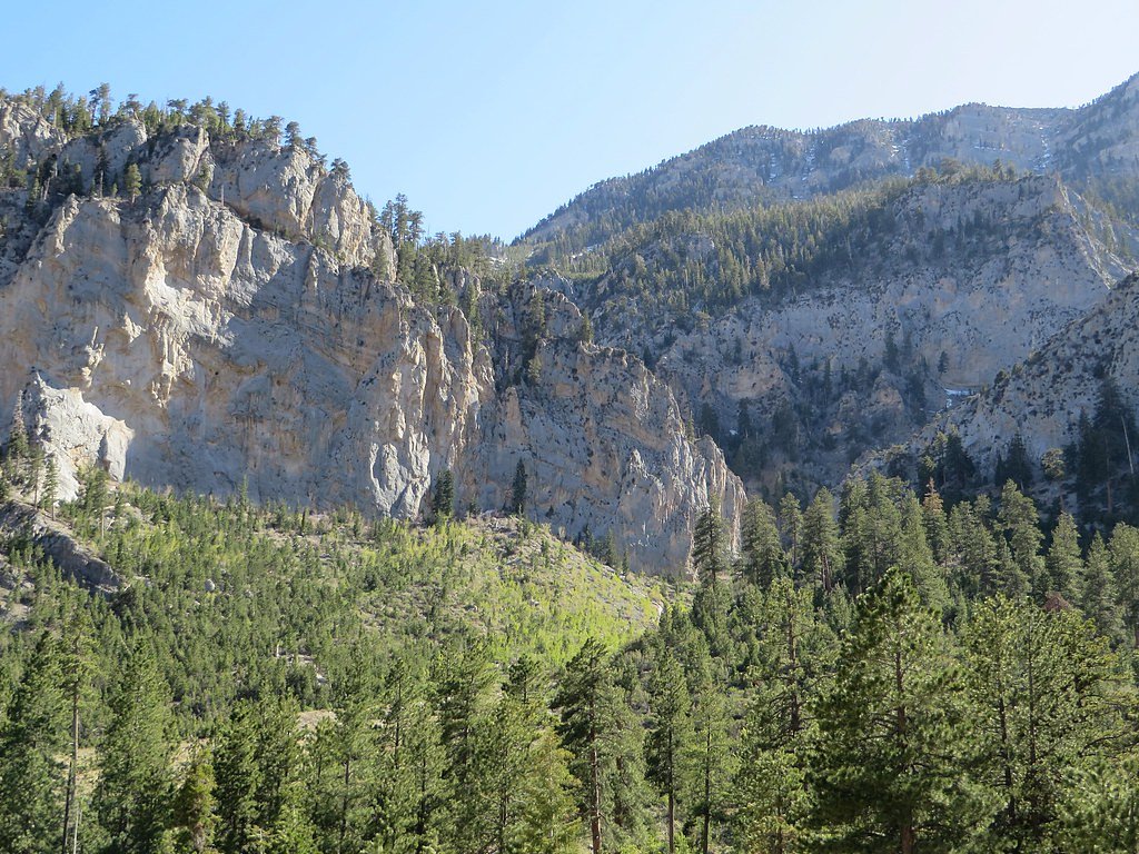
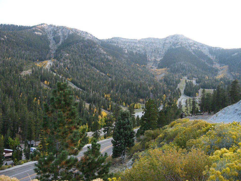
About Mary Jane Falls
Mary Jane Falls is a popular waterfall located in the Spring Mountains near Las Vegas, Nevada. The falls are fed by snowmelt and are most prominent in the spring and early summer. The area offers scenic views, cooler temperatures compared to the Las Vegas valley, and a rewarding hike to the falls.
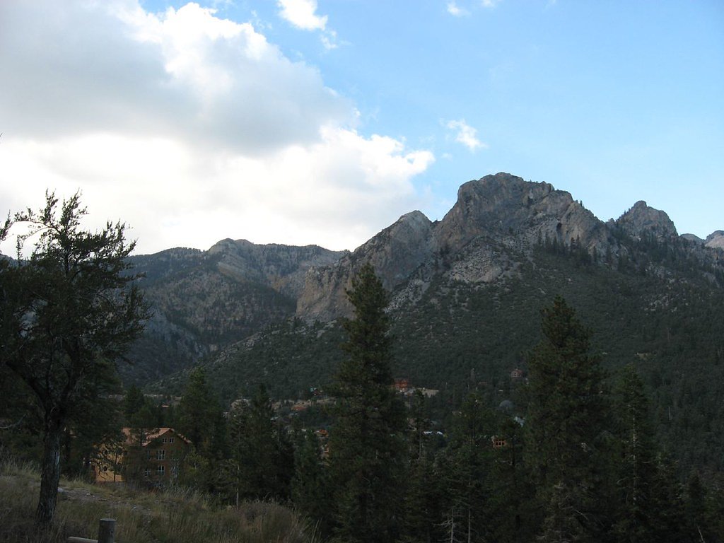
The Setting
Mary Jane Falls sits at 8,986 feet within Toiyabe National Forest, in the high alpine of Nevada.
Trail & Hike Details
The Approach
The moderate hike follows Mary Jane Falls (#25159), a 2.4-mile out-and-back trail over natural surface. Expect 700 feet of elevation gain with grades of +12-20%. The trail is developed (Class 3).
USFS Trail
MARY JANE FALLS #25159
Trail Class
Developed
Surface
Avg Grade
USFS Segment
1.52 miTrail Description
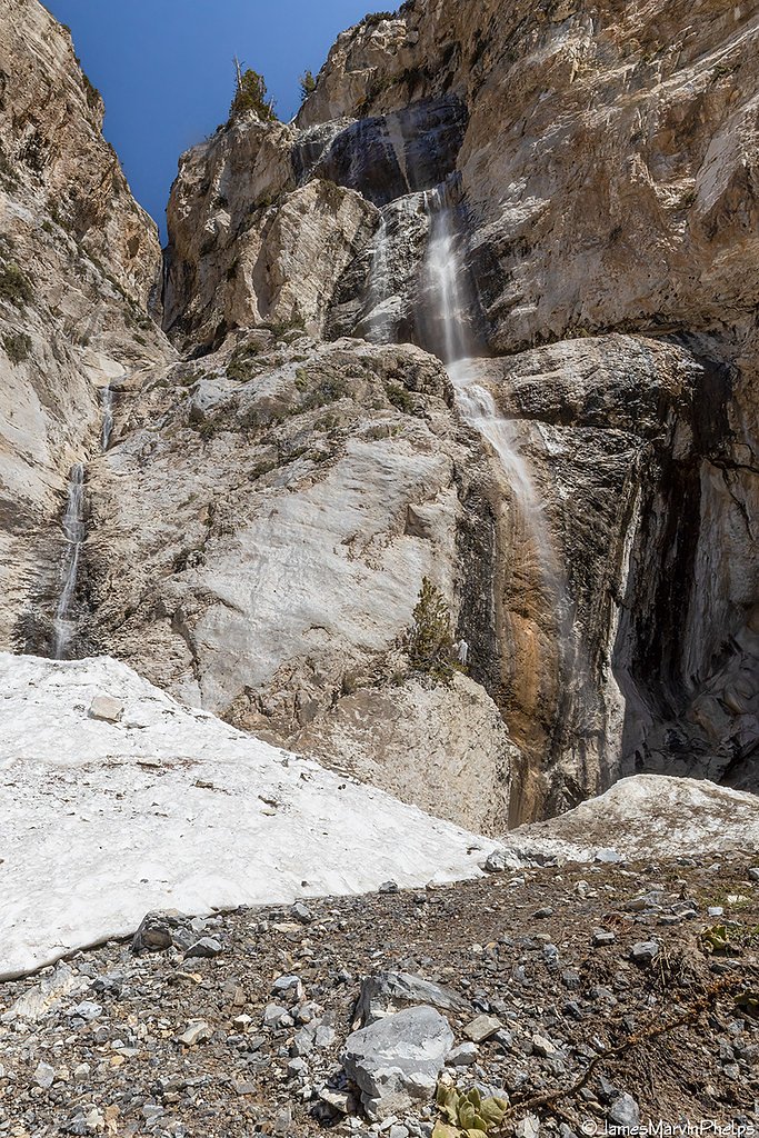
The trail to Mary Jane Falls is a well-maintained path that begins with a gradual incline through a forested area. After about a mile, the trail becomes steeper with switchbacks leading to the falls. The waterfall is seasonal and may be reduced to a trickle in late summer or fall. The area around the falls features a small cave and offers stunning views of the surrounding mountains.
What to Expect
Dogs are welcome.
Accessibility
The trail is not wheelchair accessible. Uneven terrain and elevation changes require steady footing.
Frequently Asked Questions
🐶 Are Dogs Allowed at Mary Jane Falls?
✅ Dogs are allowed
Are There Any Fees or Permits Required?
🆖 No fees required
🏊 Is There Swimming at Mary Jane Falls?
❌ Swimming is not allowed
When to Visit
The best time to visit Mary Jane Falls is in the spring or early summer when the snowmelt creates a stronger waterfall flow. Fall is also a good time to visit for cooler temperatures and fewer crowds.
Seasonal Access
The best time to visit is Spring, Summer, and Fall. Access roads and trails may close during winter due to snow. Watch for flash flood warnings during monsoon season (July through September). Check with Toiyabe National Forest for seasonal road closures.
Safety Information
The trail can be steep and rocky, so proper footwear is essential. Be cautious of loose rocks and uneven surfaces. During winter, snow and ice can make the trail hazardous. Always carry enough water and avoid hiking during the hottest part of the day in summer.
Current Water Conditions
Based on a USGS gauge 20.6 miles away
0 ft³/s
Current discharge — how much water is flowing
About average for this time of year
Based on 38 years of record
2.60 ft
Water depth at gauge
7-Day Discharge Trend
What does this mean for your visit?
Flow is about average for this time of year.
About This Gauge
This gauge is on a regional waterway. Conditions at the falls may differ, especially after local rain.
7-Day Flow Outlook
Based on the USGS gauge CORN CK SPGS AT NATIONAL FISH & WILDLIFE HDQRS, NV (33 km away).
Today
Barely Flowing
0 cfs
5/10Tomorrow
Barely Flowing
0 cfs
5/10Sun
Barely Flowing
0 cfs
5/10Mon
Barely Flowing
0 cfs
5/10Tue
Barely Flowing
0 cfs
5/10Wed
Barely Flowing
0 cfs
5/10Thu
Barely Flowing
0 cfs
5/10Best window: Today — barely flowing flow, partly sunny (trip score 5/10).
Best time of year: this gauge typically runs highest from mid September to late January, peaking in January.
How we calculate this
This is a transparent outlook, not a precise forecast. We take the waterfall's current flow strength (how it ranks against its historical normal for today, from the nearest USGS stream gauge), carry that ranking forward along the gauge's seasonal curve, and nudge it for forecast rain. Confidence is highest for the next day or two and falls further out. Always check official conditions and your own judgment before visiting — high flows can be dangerous.
Know when to go.
Get a free email alert when waterfalls near Mount Charleston hit peak flow. We only send when conditions are worth the trip — no weekly newsletters, no spam.
Weather Forecast
Location & Access
Getting There
Mary Jane Falls is located in the Spring Mountains National Recreation Area, about an hour's drive from Las Vegas. From Las Vegas, take US-95 North to State Route 157 (Kyle Canyon Road) and follow it to the Mary Jane Falls trailhead.
Get Directions on Google MapsParking
There is a designated parking lot at the Mary Jane Falls trailhead. Parking is free, but it can fill up quickly on weekends and holidays.
Elevation
8,986 feet above sea level
Coordinates
36.279480° N, -115.671249° W
Land Management
Managed by USFS
Visitor Tips & Gear
Start early in the day to avoid crowds and bring plenty of water, as the trail can be exposed to the sun. Wear sturdy hiking shoes, as the trail can be rocky and steep in sections. Check weather conditions before visiting, especially in winter, as snow and ice may make the trail more difficult.
This trail sits at 8,986 ft — the air is noticeably thinner
High AltitudeSome visitors experience headaches, fatigue, or shortness of breath at this elevation. Take it slow, stay hydrated, and consider supplemental oxygen if you're coming from a lower altitude.
As an Amazon Associate, we earn from qualifying purchases.

Coppertone Sport SPF 50 Sunscreen
UV intensity jumps ~4% per 1,000 ft — at this elevation you can burn in half the time.

Sun Bum SPF 30 Lip Balm (3-Pack)
Lips have almost no natural UV protection and burn fast in thin, dry mountain air.

Liquid I.V. Electrolyte Packets
You lose moisture ~2x faster at elevation — electrolytes help you absorb water efficiently.

ROCKNIGHT Polarized UV400 Sunglasses
High-altitude glare off rock and water is intense — UV400 lenses block 99%+ of UVA/UVB.

Boost Oxygen 10L Canister (2-Pack)
Portable supplemental oxygen for quick relief from headaches and shortness of breath.

Altitude Rx OxyBoost Complex
Antioxidant formula designed to support your body's natural altitude acclimation.
As an Amazon Associate, we earn from qualifying purchases.
With 2.4 miles and 700 ft of elevation gain, sturdy boots and trekking poles will help on this moderate trail. Sun exposure on the trail makes good sun protection a must in summer.

Polarized Sunglasses (Knockaround)
Cuts glare off the water so you actually see the falls — and your photos turn out better too.

Columbia Watertight II Rain Jacket
Packs into its own pocket, seam-sealed, and keeps you dry from spray and surprise rain.

Earth Pak Waterproof Dry Bag
Keeps your phone and gear dry when waterfall mist soaks everything else.

Waterproof Phone Pouch (AiRunTech)
Cheap insurance — take photos right next to the falls without killing your phone.

Timberland Euro Sprint Mid Waterproof
Trusted waterproof boot with premium leather and grippy rubber sole — reliable on rocky, wet trails.

TrailBuddy Trekking Poles
Lightweight aluminum, cork grips, and flip-locks that actually hold — a best-seller for good reason.
Where to Stay

Holiday Inn Express & Suites Pahrump by IHG

The Retreat on Charleston Peak

Pahrump Nugget Hotel & Casino

Best Western Pahrump Oasis
Browse vacation cabins and private rentals nearby
Unique outdoor stays — tents, yurts, and treehouses
Rent a campervan or RV for your waterfall road trip
Some links are affiliate links. We may earn a commission at no extra cost to you.
Nearby Campground
FOXTAIL GRP PICNIC AREA
2 miles away · 7 sites
Overview Foxtail Group Picnic Area is located in the Spring Mountains National Recreation Area, just 47 miles from downtown Las Vegas. Visitors enjoy hiking, mountain biking, scenic driving, and winter snowplay in this forested desert oasis.Recreation Hiking and mountain biking are popular activities on the 1.3-mile Sawmill Trail and the 6.2-mile Bristlecone Trail. Both begin just a short drive from Foxtail. When there is at least 12 inches of snow on the ground, Foxtail becomes a winter playgrou
Book on Recreation.govNearby Hot Springs
Hot springs near Mount Charleston, Nevada
White Rock Spring
White Rock Spring produces 78-degree water from 4,835 feet elevation on Bureau of Land Management public lands in Clark County,...
Indian Springs
Indian Springs near Pahrump produces 78-degree water at 3,183 feet elevation with unusually dilute chemistry showing just 210 m...

Manse Ranch Spring
This 75°F spring flows roadside near Pahrump at 2,779 feet elevation, producing water just 7 degrees warmer than ambient air in...
Spring
An unnamed 79-degree spring emerges on BLM land in Nye County near Pahrump at 3,180 feet elevation. The spring sits 152.5 meter...

Pahrump (Bennetts) Spring
Pahrump Spring, also known as Bennetts Spring, flows at 77°F along Firebird Circle in the town of Pahrump at 2,680 feet elevati...
Browns Spring
Browns Spring emerges at 75°F in Nye County near Pahrump at 3,020 feet elevation, flowing just 6 meters from the nearest road. ...
Looking for a soak after your hike? Explore more hot springs near Mount Charleston, Nevada on SoakingSprings.
Explore Nevada springsAdditional Information
Nearby Attractions
Other nearby attractions include Cathedral Rock, Fletcher Canyon, and the Mount Charleston Scenic Byway.
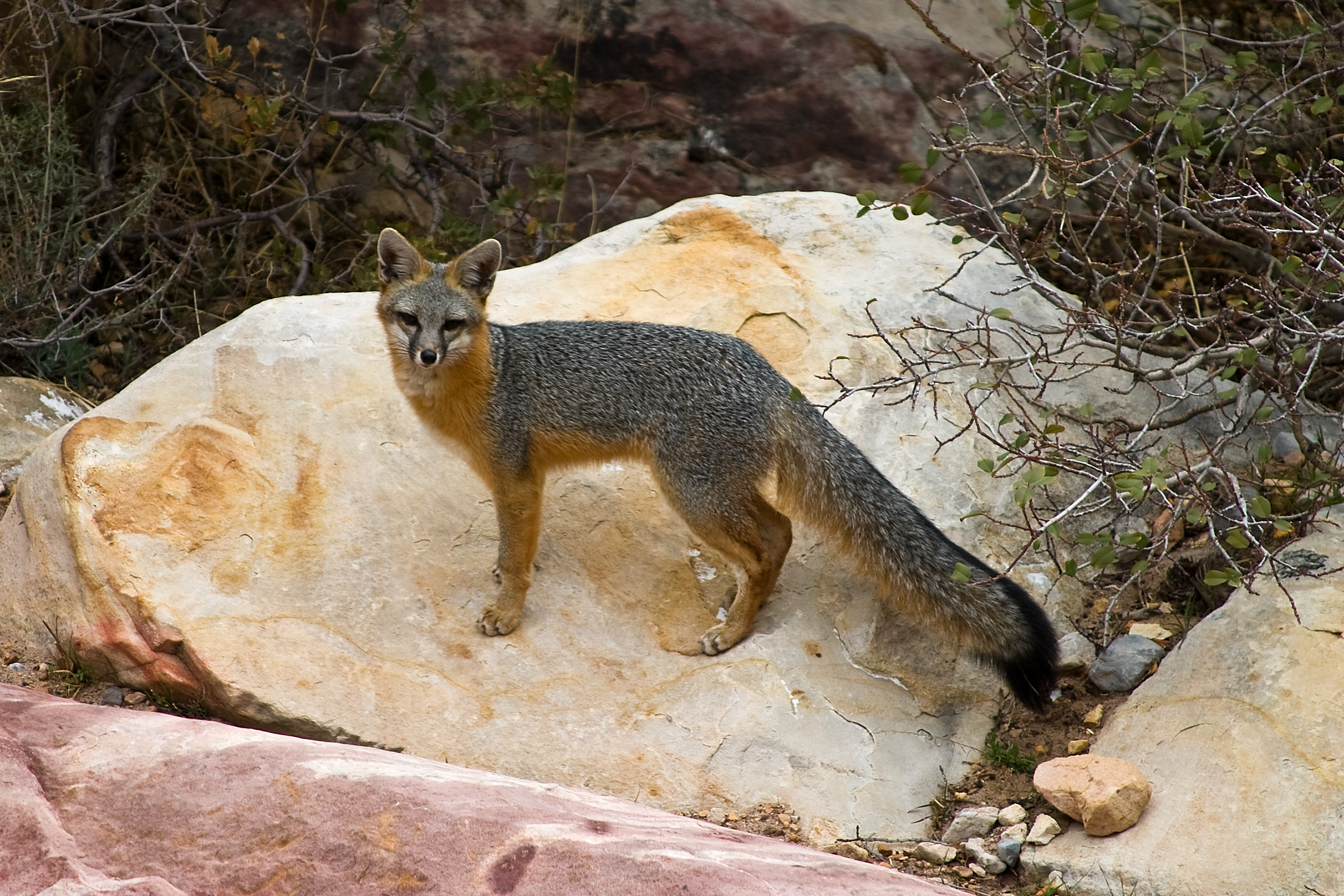
Wildlife
The area is home to wildlife such as mule deer, squirrels, and a variety of birds. Be cautious of snakes and other desert wildlife.
Cities near Mary Jane Falls
Nearby Waterfalls
Writing about Mary Jane Falls? Embed this waterfall on your site for free.