Photo Credits (5)
About Martin Falls
Martin Falls is a quietly scenic cascade tucked into the Steamboat Rock land unit (Designation: SP) and managed by SPR. Framed by densely wooded slopes, the falls offer a peaceful retreat for photographers and hikers who prefer less-crowded spots. Water flow is seasonal — expect the most dramatic runoff in spring and early summer from snowmelt — but even in lower flows the setting is worth the visit for its mossy rockwork and forest ambiance. Reaching the falls requires a moderate hike: the route is a 2.4-mile out-and-back with roughly 350 feet of elevation gain. That modest climb makes Martin Falls a rewarding half-day outing for most fit day-hikers who enjoy quiet trails and a bit of scrambling near the water. As the site is managed by SPR within the Steamboat Rock unit, visitors should follow any posted rules and respect the natural surroundings.
The Setting
Martin Falls sits at 1,890 feet within Steamboat Rock, fed by the Wilson Creek, in the hills of Washington.
Trail & Hike Details
Trail Description
Trail to Martin Falls is a 2.4-mile out-and-back with approximately 350 feet of elevation gain and is rated moderate. Specific USFS/SPR trail surface, grade class, and official trail number/name are not provided in the available data, so expect a typical natural-surface forest trail and plan for uneven footing; bring a map or GPS for navigation. The route’s moderate grade and modest ascent make it accessible to most hikers comfortable on non-paved, singletrack-style trails.
What to Expect
Expect a tranquil and remote experience surrounded by dense forest. The waterfall may be seasonal, with higher flow during spring and early summer.
Accessibility
Accessibility information is not available. The trail may not be suitable for those with mobility challenges.
Frequently Asked Questions
🐶 Are Dogs Allowed at Martin Falls?
❌ Dogs are not allowed
Are There Any Fees or Permits Required?
🆖 No fees required
🏊 Is There Swimming at Martin Falls?
❌ Swimming is not allowed
When to Visit
Spring and early summer are the best times to visit, as the waterfall is likely to have the most water flow during these seasons.
Seasonal Access
The best time to visit is Spring, Summer, and Fall. Winter access may be limited.
Safety Information
The trail may be unmarked and rugged. Visitors should carry navigation tools, be prepared for changing weather, and inform someone of their plans. Cell service may be limited.
7-Day Flow Outlook
Based on the USGS gauge WILSON CREEK BELOW CORBETT DRAW NEAR ALMIRA, WA (25 km away).
Today
Barely Flowing
0 cfs
5/10Tomorrow
Barely Flowing
0 cfs
5/10Sun
Barely Flowing
0 cfs
5/10Mon
Barely Flowing
0 cfs
5/10Tue
Barely Flowing
0 cfs
4/10Wed
Barely Flowing
0 cfs
5/10Thu
Barely Flowing
0 cfs
5/10Best window: Today — barely flowing flow, patchy blowing dust (trip score 5/10).
Best time of year: this gauge typically runs highest from early March to late May, peaking in April.
How we calculate this
This is a transparent outlook, not a precise forecast. We take the waterfall's current flow strength (how it ranks against its historical normal for today, from the nearest USGS stream gauge), carry that ranking forward along the gauge's seasonal curve, and nudge it for forecast rain. Confidence is highest for the next day or two and falls further out. Always check official conditions and your own judgment before visiting — high flows can be dangerous.
Know when to go.
Get a free email alert when waterfalls near Electric City hit peak flow. We only send when conditions are worth the trip — no weekly newsletters, no spam.
Weather Forecast
The Terrain, Seen by LiDAR
Aircraft-mounted lasers measured this ground to within inches. Trees and buildings are digitally stripped away, leaving the bare shape of the land the water has carved.
The laser survey finds one clean step here: roughly 443 feet of drop concentrated at the brink. Elevation at the pin is about 1,698 feet.
Steep ground runs through the entire stretch: about 315 feet of descent in the 500 feet above the pin and 117 feet in the 500 feet below it. Facing west, the falls glow in afternoon and evening light.
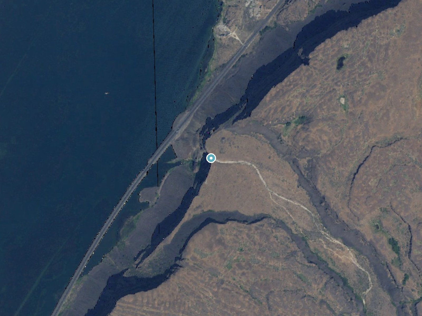
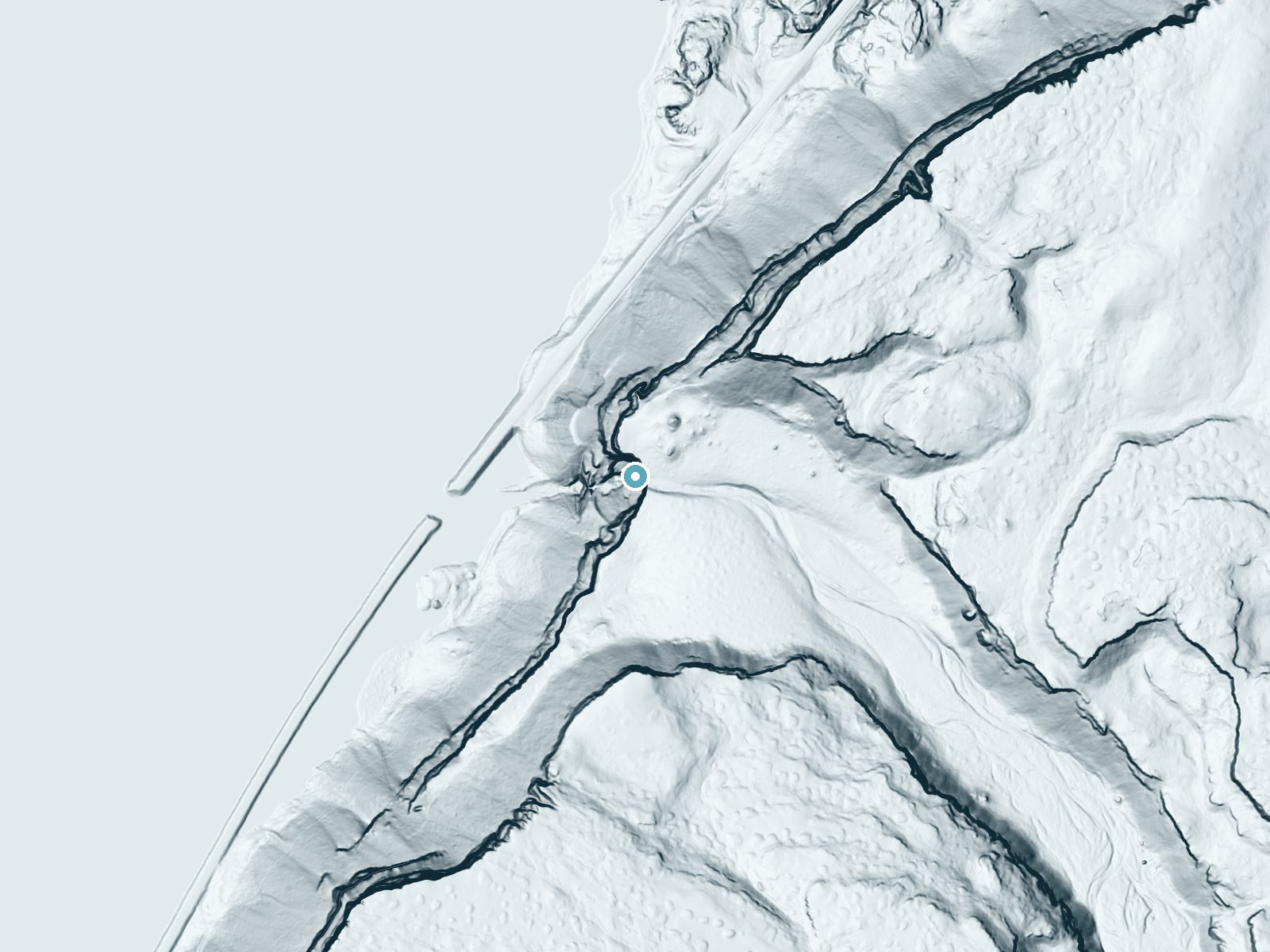
Drag to compare. The dot marks the waterfall. The frame is about a mile across.
- Ground elevation
- 1,698 feet
- Measured by 1-meter lidar
- Drop at the falls
- About 430 feet
- Change in ground height within ~250 feet of the falls
- Faces
- West
- Glows in afternoon and evening light.
A slice through the lidar ground surface, from above the falls to downstream (heading west).
Elevation data: USGS 3D Elevation Program. Aerial imagery: USGS The National Map. Public domain.
Location & Access
Getting There
The exact location of Martin Falls is not widely documented, but it is believed to be accessible via forest service roads in a remote area of Washington. Visitors should consult local maps or guides for precise directions.
Get Directions on Google MapsParking
Parking availability is unclear, but visitors may need to park along forest roads or at a nearby trailhead. Ensure your vehicle is parked safely and does not block access.
Elevation
1,890 feet above sea level
Coordinates
47.845494° N, -119.116937° W
Land Management
Managed by SPR
Visitor Tips & Gear
Bring a detailed map or GPS device as the area may lack clear signage. Wear sturdy hiking boots and be prepared for uneven terrain. Check weather conditions before your visit.
Where to Stay

The Willows Motel

Ala Cozy Motel

Eight Bar B Motel
Cozy Grand Coulee Home w/ Deck & Views!
Browse vacation cabins and private rentals nearby
Unique outdoor stays — tents, yurts, and treehouses
Rent a campervan or RV for your waterfall road trip
Some links are affiliate links. We may earn a commission at no extra cost to you.
Nearby Campground
SPRING CANYON GROUP SITE
10.2 miles away · 2 sites
Overview Spring Canyon Group Site is perfect for large families and groups of boaters or fishermen. Located on the shoreline of Lake Roosevelt, it offers ample opportunity to get out on the water or relax on the beach and take in the gorgeous lakeside scenery. The 130-mile long lake is a feature of the Columbia River created by the nearby Grand Coulee Dam. The lake is named after President Franklin D. Roosevelt and is part of the Lake Roosevelt National Recreation Area, managed by the National Pa
Book on Recreation.govAdditional Information
Nearby Attractions
Nearby attractions are not well-documented, but the surrounding forest may offer additional hiking opportunities.
Wildlife
The area may host typical Pacific Northwest wildlife, including deer, birds, and small mammals. Be cautious of bears and other larger animals.
Cities near Martin Falls
Other waterfalls named Martin Falls
3 other waterfalls share this name across the U.S.
Writing about Martin Falls? Embed this waterfall on your site for free.