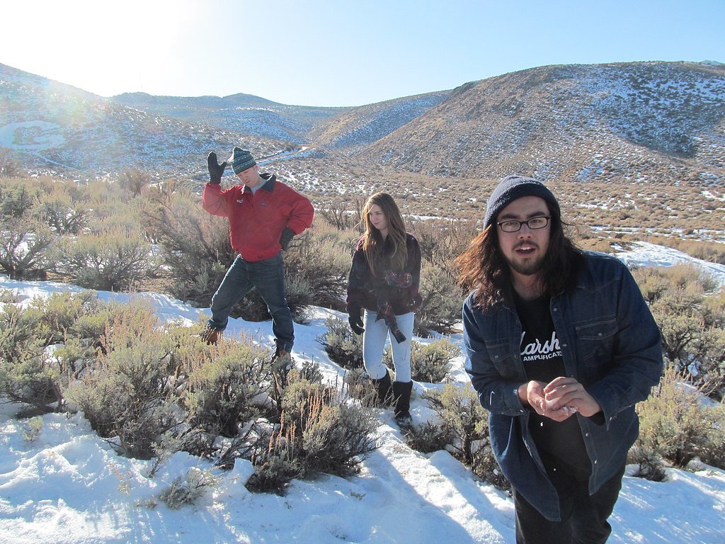
Photo Credits (5)
Difficulty
Moderate
Trail Length
2.4 miles
Trail Type
Out And Back
Elevation Gain
350 ft
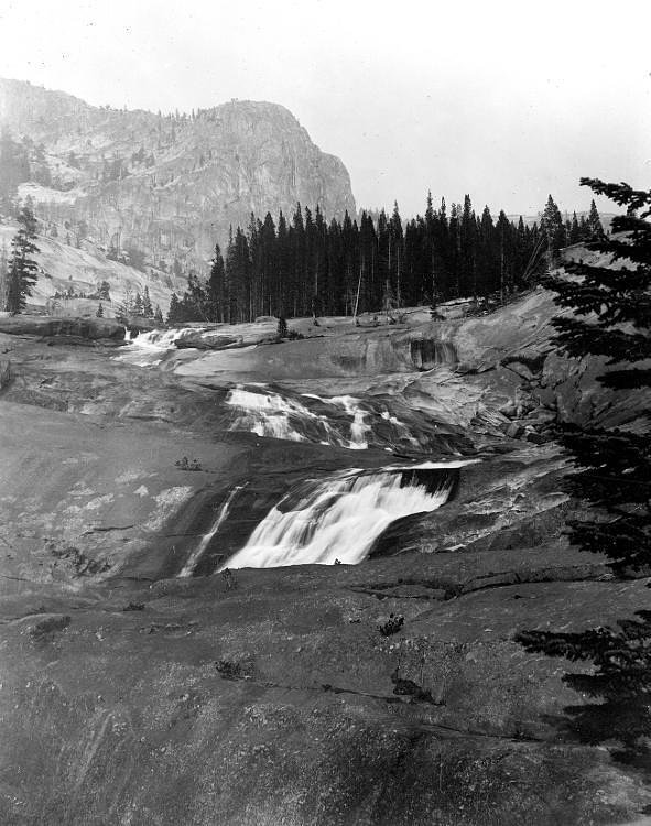
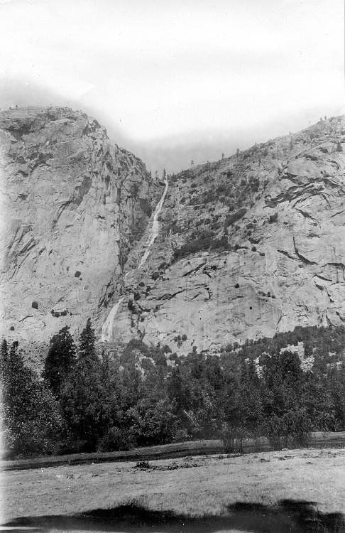
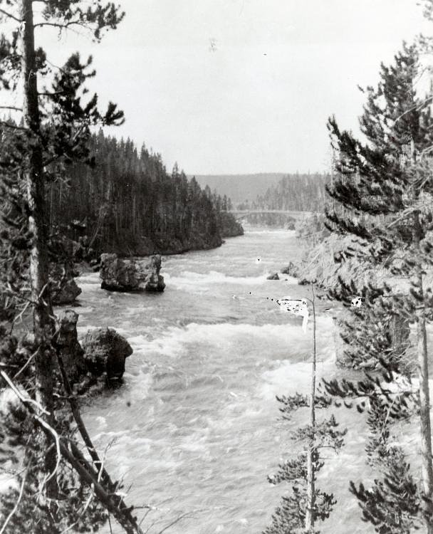
About Marshall Falls
Marshall Falls is a quiet, seasonal cascade tucked into the high desert of Nevada within the Toiyabe National Forest, managed by the U.S. Forest Service (USFS). The falls typically come alive with spring snowmelt and early-summer rains, offering a refreshing reward after a short hike. Access is primarily via the Pony Canyon Downhill (Trail #23007), making this a great choice for hikers seeking a lesser-known, scenic stop in a forested setting. The most common approach is a moderate out-and-back route of about 2.4 miles round trip with roughly 350 feet of elevation gain. Pony Canyon Downhill is recorded by the USFS with a GIS length of 1.23 miles for the trail segment; the trail surface is native material and is rated Class 2, with typical grades of +12–20%. The Austin Ranger District Office campground is nearby (about 2.07 km), so overnight camping is convenient for hikers who want to turn the visit into a longer exploration of the Toiyabe NF.
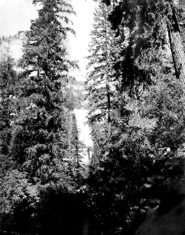
The Setting
Marshall Falls sits at 6,401 feet within Toiyabe National Forest, in the high mountains of Nevada.
Trail & Hike Details
The Approach
The moderate hike follows Pony Canyon Downhill (#23007), a 2.4-mile out-and-back trail over natural surface. Expect 350 feet of elevation gain with grades of +12-20%. The trail is moderately developed (Class 2).
USFS Trail
PONY CANYON DOWNHILL #23007
Trail Class
Moderately Developed
Surface
Avg Grade
USFS Segment
1.23 miTrail Description
Pony Canyon Downhill — Trail #23007 (USFS) is a native-surface, Class 2 trail that serves as the primary route to Marshall Falls. The USFS records a GIS length of 1.23 miles for the trail segment; the commonly used approach to the falls is an out-and-back totaling about 2.4 miles with approximately 350 feet of elevation gain. Expect a natural single-track or worn-native surface with sustained moderate grades, typically between +12% and +20% in steeper sections. Difficulty is rated moderate: the Class 2 designation indicates non-technical hiking but some steeper pitches and uneven footing. Trail users should be prepared for native-material tread, short steeper stretches, and basic field navigation; the Austin Ranger District Office campground sits roughly 2.07 km away for those planning an overnight stay.
What to Expect
Expect a peaceful and remote setting with a seasonal waterfall. The flow of the waterfall may vary depending on the time of year and recent weather conditions.
Accessibility
The trail is not wheelchair accessible. Uneven terrain and elevation changes require steady footing.
Frequently Asked Questions
🐶 Are Dogs Allowed at Marshall Falls?
❌ Dogs are not allowed
Are There Any Fees or Permits Required?
🆖 No fees required
🏊 Is There Swimming at Marshall Falls?
❌ Swimming is not allowed
When to Visit
The best time to visit is during the spring or early summer when the waterfall is most likely to be flowing due to snowmelt.
Seasonal Access
The best time to visit is Spring, Summer, and Fall. Access roads and trails may close during winter due to snow. Watch for flash flood warnings during monsoon season (July through September). Check with Toiyabe National Forest for seasonal road closures.
Safety Information
The area may have uneven terrain, limited cell service, and potential wildlife encounters. Visitors should prepare for remote conditions and inform someone of their plans before visiting.
Know when to go.
Get a free email alert when waterfalls near Austin hit peak flow. We only send when conditions are worth the trip — no weekly newsletters, no spam.
Weather Forecast
Location & Access
Getting There
The exact location of Marshall Falls is not widely documented, but it is believed to be accessible via a trail in a remote area of Nevada. Visitors should research local maps and trail guides for precise directions.
Get Directions on Google MapsParking
Parking availability is unclear. Visitors should plan to park in designated areas or along the roadside where permitted.
Elevation
6,401 feet above sea level
Coordinates
39.483259° N, -117.084535° W
Land Management
Managed by USFS
Visitor Tips & Gear
Bring plenty of water, wear sturdy hiking shoes, and check weather conditions before visiting. Cell service may be limited in the area.
This trail sits at 6,401 ft above sea level
Elevated TrailUV radiation is roughly 26% stronger at this elevation than at sea level, and the dry air accelerates dehydration. Extra sun protection and fluids go a long way.
As an Amazon Associate, we earn from qualifying purchases.

Coppertone Sport SPF 50 Sunscreen
UV intensity jumps ~4% per 1,000 ft — at this elevation you can burn in half the time.

Sun Bum SPF 30 Lip Balm (3-Pack)
Lips have almost no natural UV protection and burn fast in thin, dry mountain air.

Liquid I.V. Electrolyte Packets
You lose moisture ~2x faster at elevation — electrolytes help you absorb water efficiently.

ROCKNIGHT Polarized UV400 Sunglasses
High-altitude glare off rock and water is intense — UV400 lenses block 99%+ of UVA/UVB.
As an Amazon Associate, we earn from qualifying purchases.
With 2.4 miles and 350 ft of elevation gain, sturdy boots and trekking poles will help on this moderate trail. Sun exposure on the trail makes good sun protection a must in summer.

Polarized Sunglasses (Knockaround)
Cuts glare off the water so you actually see the falls — and your photos turn out better too.

Columbia Watertight II Rain Jacket
Packs into its own pocket, seam-sealed, and keeps you dry from spray and surprise rain.

Earth Pak Waterproof Dry Bag
Keeps your phone and gear dry when waterfall mist soaks everything else.

Waterproof Phone Pouch (AiRunTech)
Cheap insurance — take photos right next to the falls without killing your phone.

Timberland Euro Sprint Mid Waterproof
Trusted waterproof boot with premium leather and grippy rubber sole — reliable on rocky, wet trails.

TrailBuddy Trekking Poles
Lightweight aluminum, cork grips, and flip-locks that actually hold — a best-seller for good reason.
Where to Stay
Browse vacation cabins and private rentals nearby
Unique outdoor stays — tents, yurts, and treehouses
Rent a campervan or RV for your waterfall road trip
Some links are affiliate links. We may earn a commission at no extra cost to you.
Nearby Campground
Austin Ranger District Office
1.3 miles away · 0 sites
The Austin Ranger District is located 170 miles east of Reno in north-central Nevada. The District’s over 1 million acres are located near what has been dubbed the loneliest highway in America, U.S. Hwy 50. Highway 50 runs through the town of Austin, population approximately 250, and home to the Austin Ranger District Office.Please contact the Austin Ranger District with any questions or comments @ 775-964-2671
Book on Recreation.govNearby Hot Springs
Hot springs near Austin, Nevada

Spencer Hot Springs
Spencer Hot Springs emerges at 162 degrees on BLM land in Eureka County, Nevada, where volunteer-built soaking pools allow mixi...
Petersons Mill Hot Spring
Petersons Mill Hot Spring emerges at 6,344 feet elevation in Lander County near Battle Mountain, classified historically as hot...

Unnamed Spring Eureka County
This unnamed thermal spring emerges on BLM Mount Lewis Field Office land in Eureka County with temperature designated only as '...
Mcleod Ranch Hot Spring
This spring erupts at 180°F on BLM land in Nye County, flowing 127 degrees warmer than the 53°F annual average air temperature ...
Charnock (Big Blue) Springs
Charnock Springs, also called Big Blue Springs, flows at 80°F on Bureau of Land Management property in Nye County, emerging 27 ...
Big Blue (A) Spring
Big Blue (A) Spring emerges at 90°F on open BLM public land near Tonopah, running 37 degrees warmer than the surrounding high d...
Looking for a soak after your hike? Explore more hot springs near Austin, Nevada on SoakingSprings.
Explore Nevada springsAdditional Information
Nearby Attractions
Nearby attractions are not well-documented. Visitors may explore other natural areas in Nevada.
Wildlife
The area may host typical Nevada wildlife, including birds, small mammals, and reptiles. Be cautious of potential encounters with snakes.
Cities near Marshall Falls
Other waterfalls named Marshall Falls
2 other waterfalls share this name across the U.S.
Writing about Marshall Falls? Embed this waterfall on your site for free.