Photo Credits (5)
Difficulty
Moderate
Trail Length
6.5 miles
Trail Type
Out And Back
Elevation Gain
800 ft
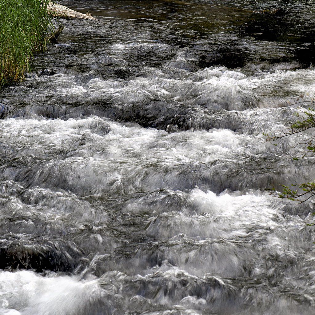
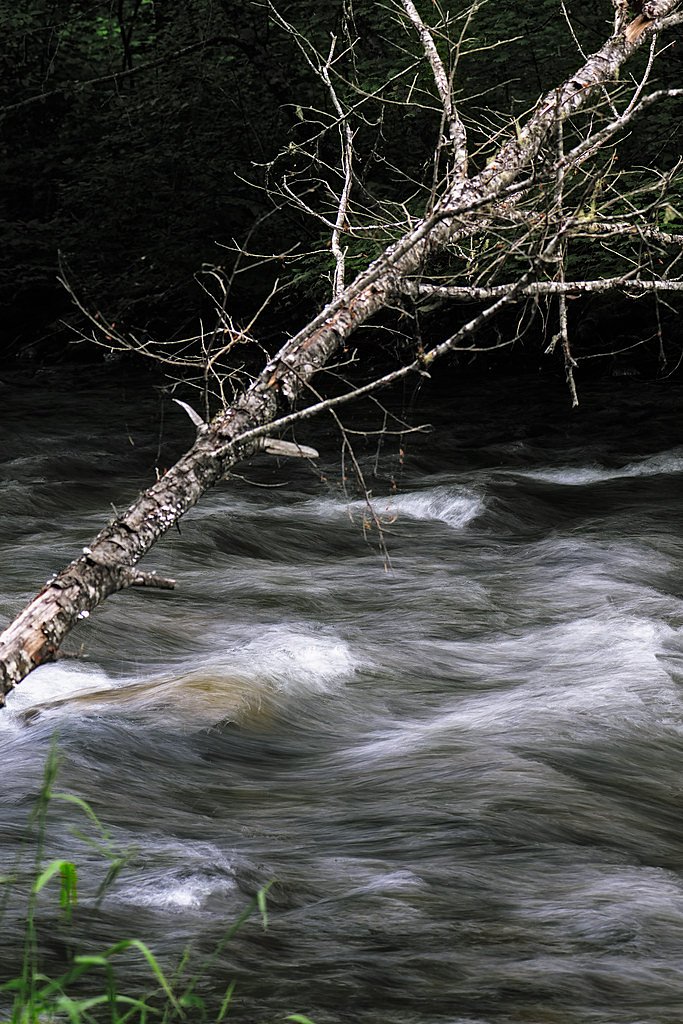
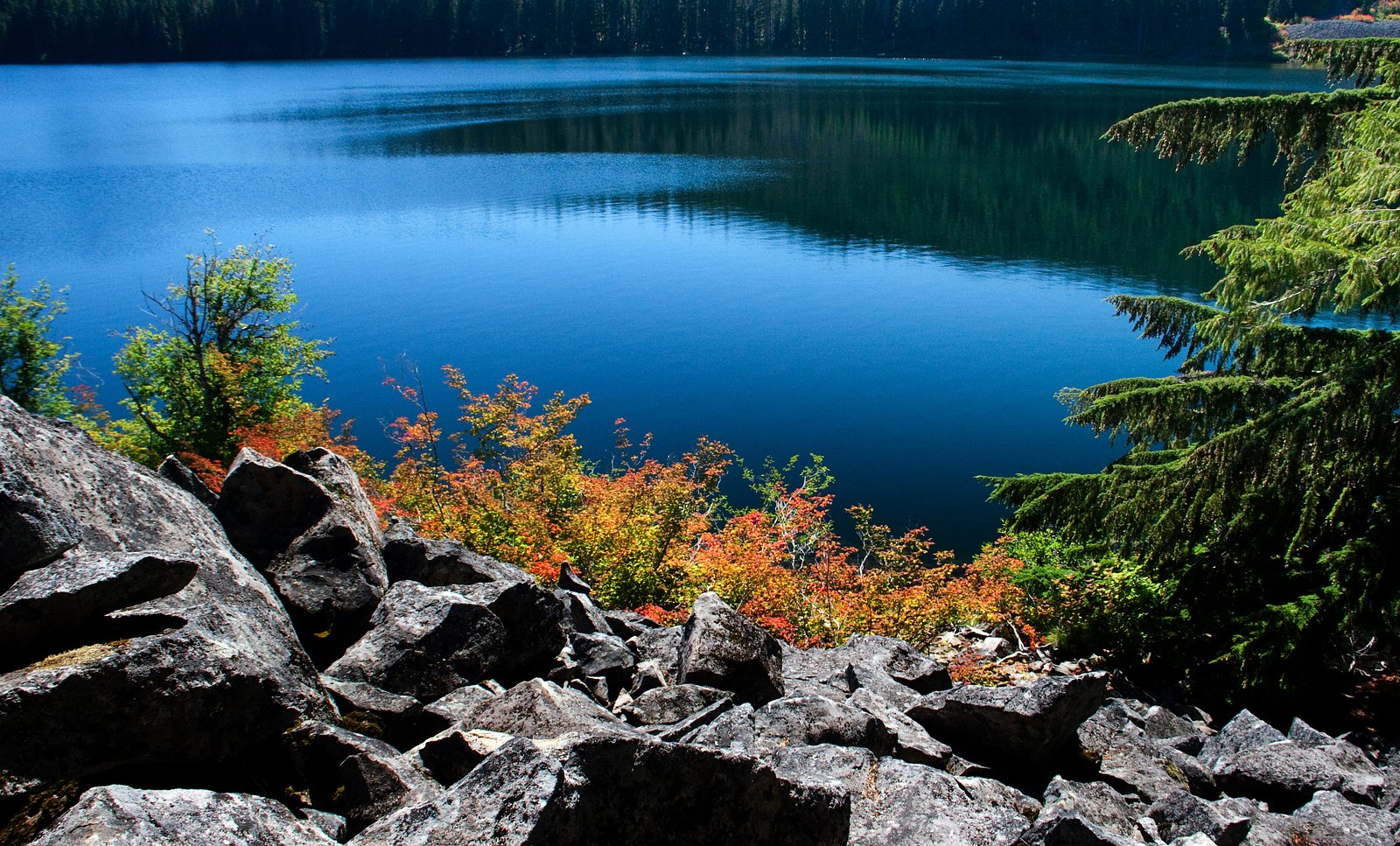
About Marion Falls
Marion Falls is a picturesque waterfall located in the Willamette National Forest in Oregon. It is part of the Marion Creek drainage and is known for its serene surroundings and lush forested setting. The waterfall is often visited alongside nearby Gatch Falls, as they are located close to each other.
The Setting
Marion Falls sits at 3,999 feet within Willamette National Forest, fed by the Blowout Creek, in the mountains of Oregon.
Trail & Hike Details
The Approach
The moderate hike follows Marion Mountain (#3435), a 6.5-mile out-and-back trail over natural surface. Expect 800 feet of elevation gain with grades of 12-20%. The trail is moderately developed (Class 2).
USFS Trail
MARION MOUNTAIN #3435
Trail Class
Moderately Developed
Surface
Avg Grade
USFS Segment
0.84 miTrail Description
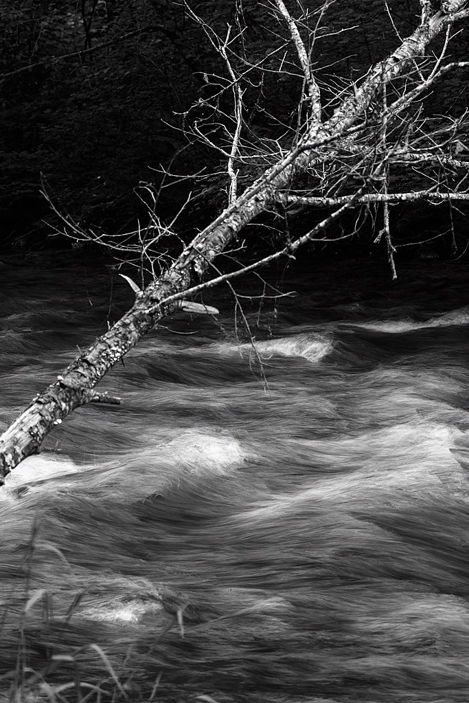
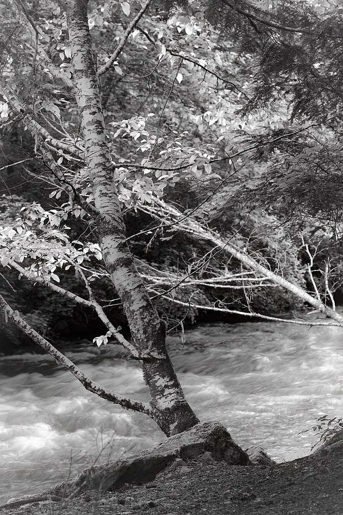
The trail to Marion Falls begins at the Marion Lake Trailhead and follows a well-maintained path through old-growth forest. The trail is relatively gentle at first but includes some moderate elevation gain as you approach the falls. A side trail leads to a viewpoint for Marion Falls, offering a stunning view of the cascading water surrounded by dense greenery.
What to Expect
Dogs are welcome.
Accessibility
The trail is not wheelchair accessible. Uneven terrain and elevation changes require steady footing.
Frequently Asked Questions
🐶 Are Dogs Allowed at Marion Falls?
✅ Dogs are allowed
Are There Any Fees or Permits Required?
🤑 Fee: $5.00
Permit required
A Northwest Forest Pass or equivalent parking pass is required for parking at the trailhead.
🏊 Is There Swimming at Marion Falls?
❌ Swimming is not allowed
When to Visit
Spring and early summer are ideal times to visit, as the waterfall is typically at its fullest due to snowmelt. Fall offers beautiful foliage, while summer provides warmer weather for hiking.
Seasonal Access
The best time to visit is Spring, Summer, and Fall. Winter access may be limited. Check with Willamette National Forest for seasonal road closures.
Safety Information
Be cautious of slippery rocks near the waterfall. Check weather and trail conditions before your visit, as snow or rain can make the trail more challenging. Carry a map or GPS device, as cell service may be limited.
Current Water Conditions
13 ft³/s
Current discharge — how much water is flowing
Lower than usual for this time of year
Based on 27 years of record
2.97 ft
Water depth at gauge
57°F
ColdBracing — limit time in water
7-Day Discharge Trend
What does this mean for your visit?
Flow is lower than usual for this time of year. Water temperature is a bracing 57 degrees F, limit your time in the water.
About This Gauge
This gauge is on a nearby waterway and may not reflect exact conditions at the falls.
7-Day Flow Outlook
Based on the USGS gauge BLOWOUT CREEK NEAR DETROIT, OR (22 km away).
Today
Barely Flowing
13 cfs
4/10Tomorrow
Low
13 cfs
4/10Sat
Low
14 cfs
4/10Sun
Low
13 cfs
4/10Mon
Low
12 cfs
4/10Tue
Low
11 cfs
4/10Wed
Low
11 cfs
4/10Best window: Today — barely flowing flow, mostly cloudy (trip score 4/10).
Best time of year: this gauge typically runs highest from mid March to late April, peaking in January.
How we calculate this
This is a transparent outlook, not a precise forecast. We take the waterfall's current flow strength (how it ranks against its historical normal for today, from the nearest USGS stream gauge), carry that ranking forward along the gauge's seasonal curve, and nudge it for forecast rain. Confidence is highest for the next day or two and falls further out. Always check official conditions and your own judgment before visiting — high flows can be dangerous.
Know when to go.
Get a free email alert when waterfalls near Camp Sherman hit peak flow. We only send when conditions are worth the trip — no weekly newsletters, no spam.
Weather Forecast
Location & Access
Getting There
Marion Falls is accessed via the Marion Lake Trailhead, which is located off Marion Creek Road (Forest Road 2255). The trailhead is approximately 16 miles from the town of Detroit, Oregon. Visitors should follow the Marion Lake Trail and then take a side trail to reach the falls.
Get Directions on Google MapsParking
Parking is available at the Marion Lake Trailhead. A Northwest Forest Pass or equivalent parking pass is typically required.
Elevation
3,999 feet above sea level
Coordinates
44.566410° N, -121.875506° W
Land Management
Managed by USFS
Visitor Tips & Gear
Wear sturdy hiking shoes, as the trail can be muddy or slippery, especially after rain. Bring plenty of water and snacks, as there are no facilities along the trail. Check trail conditions before visiting, particularly in winter or early spring when snow may be present.
As an Amazon Associate, we earn from qualifying purchases.
With 6.5 miles and 800 ft of elevation gain, sturdy boots and trekking poles will help on this moderate trail. Sun exposure on the trail makes good sun protection a must in summer.

Polarized Sunglasses (Knockaround)
Cuts glare off the water so you actually see the falls — and your photos turn out better too.

Columbia Watertight II Rain Jacket
Packs into its own pocket, seam-sealed, and keeps you dry from spray and surprise rain.

Earth Pak Waterproof Dry Bag
Keeps your phone and gear dry when waterfall mist soaks everything else.

Waterproof Phone Pouch (AiRunTech)
Cheap insurance — take photos right next to the falls without killing your phone.

Timberland Euro Sprint Mid Waterproof
Trusted waterproof boot with premium leather and grippy rubber sole — reliable on rocky, wet trails.

TrailBuddy Trekking Poles
Lightweight aluminum, cork grips, and flip-locks that actually hold — a best-seller for good reason.
Where to Stay

Dog-friendly house with pool hot tub fitness room fireplace grill & deck

Rushing River Retreat

The Suttle Lodge & Boathouse

Family-Friendly Home with Fireplaces Firepit Gas Grill Free WiFi Central AC
Browse vacation cabins and private rentals nearby
Unique outdoor stays — tents, yurts, and treehouses
Rent a campervan or RV for your waterfall road trip
Some links are affiliate links. We may earn a commission at no extra cost to you.
Nearby Campground
BLUE BAY
12.3 miles away · 25 sites
Overview Blue Bay Campground is situated in a diverse forest of pine and fir on the south shore of Suttle Lake in Deschutes National Forest. Its proximity to high alpine lakes, lush forests and towering peaks in nearby wilderness areas make it a popular destination for individual and group camping excursions.Recreation Popular activities in the area include hiking, fishing and motorized boating in the summer months, as well as cross-country skiing and snowshoeing in the winter.Numerous non-motori
Book on Recreation.govNearby Hot Springs
Hot springs near Camp Sherman, Oregon

Breitenbush Hot Springs
Breitenbush Hot Springs emerges at 198°F along the Breitenbush River, ranking as one of Oregon's hottest thermal features with ...

Bigelow Hot Springs
Bigelow Hot Springs, also called Deer Creek Hot Springs, emerges at 142°F just 400 feet from Deer Creek Road in the Willamette ...
Belknap Springs
Belknap Springs flows at 160°F along the McKenzie River in the Cascade Range, emerging just 510 feet from North Belknap Springs...

Austin Hot Springs
Austin Hot Springs discharges at 186°F along the Clackamas River at 1,680 feet elevation, emerging just 310 feet from Clackamas...
Foley Springs
Foley Springs emerges at 178°F in the Cascade Range of Lane County, making it one of Oregon's hottest thermal features with rec...

Bagby Hot Springs
Bagby Hot Springs flows at 136°F deep in Mount Hood National Forest at 2,272 feet elevation, requiring a 3,720-foot hike from F...
Looking for a soak after your hike? Explore more hot springs near Camp Sherman, Oregon on SoakingSprings.
Explore Oregon springsAdditional Information
Nearby Attractions
Nearby attractions include Gatch Falls, Marion Lake, and the surrounding Willamette National Forest, which offers additional hiking and camping opportunities.
Wildlife
The area is home to a variety of wildlife, including deer, birds, and small mammals. Visitors may also see fish in the creek.
Cities near Marion Falls
Nearby Waterfalls
Writing about Marion Falls? Embed this waterfall on your site for free.