Mānoa Falls
Hawaii • 150 ft
By Armen Suny · Last verified Mar 2026
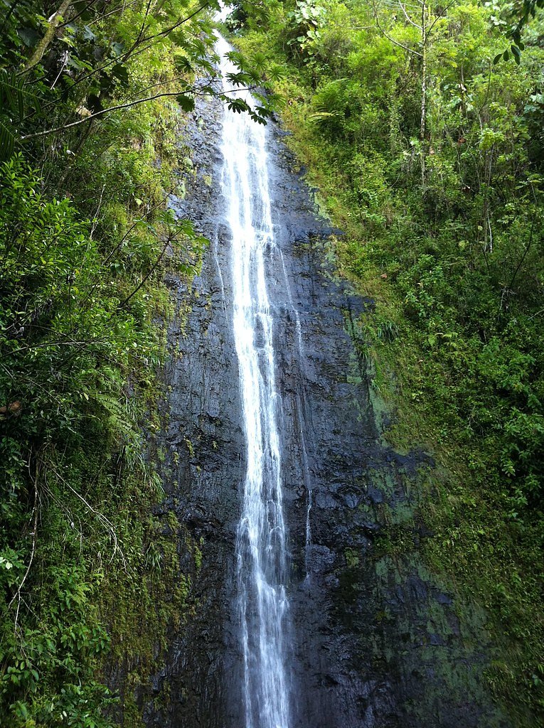
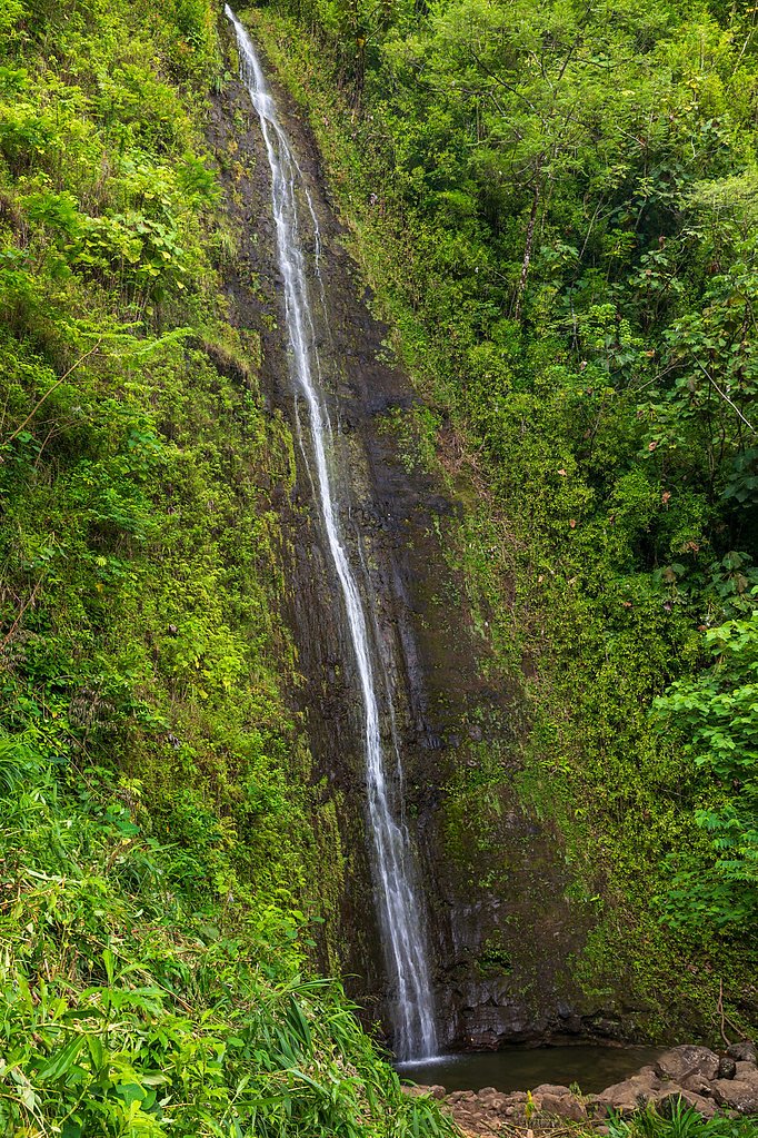
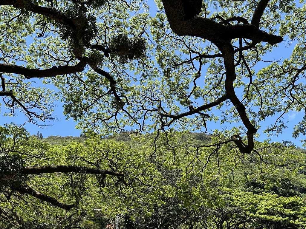
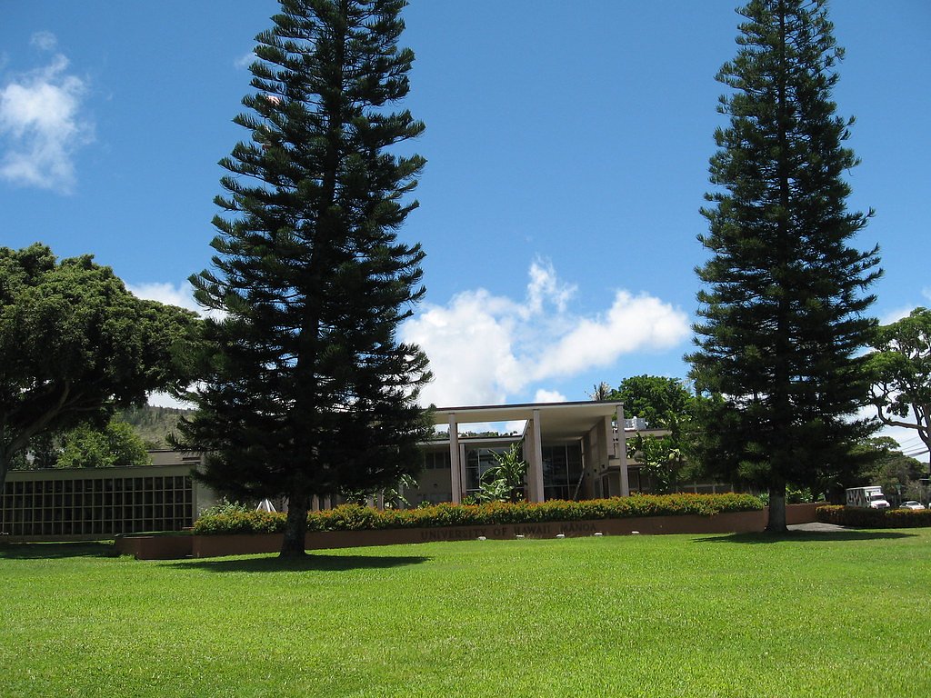

Photo Credits (5)
Difficulty
Easy
Trail Length
1.6 miles
Trail Type
Out And Back
Elevation Gain
633 ft
About Mānoa Falls
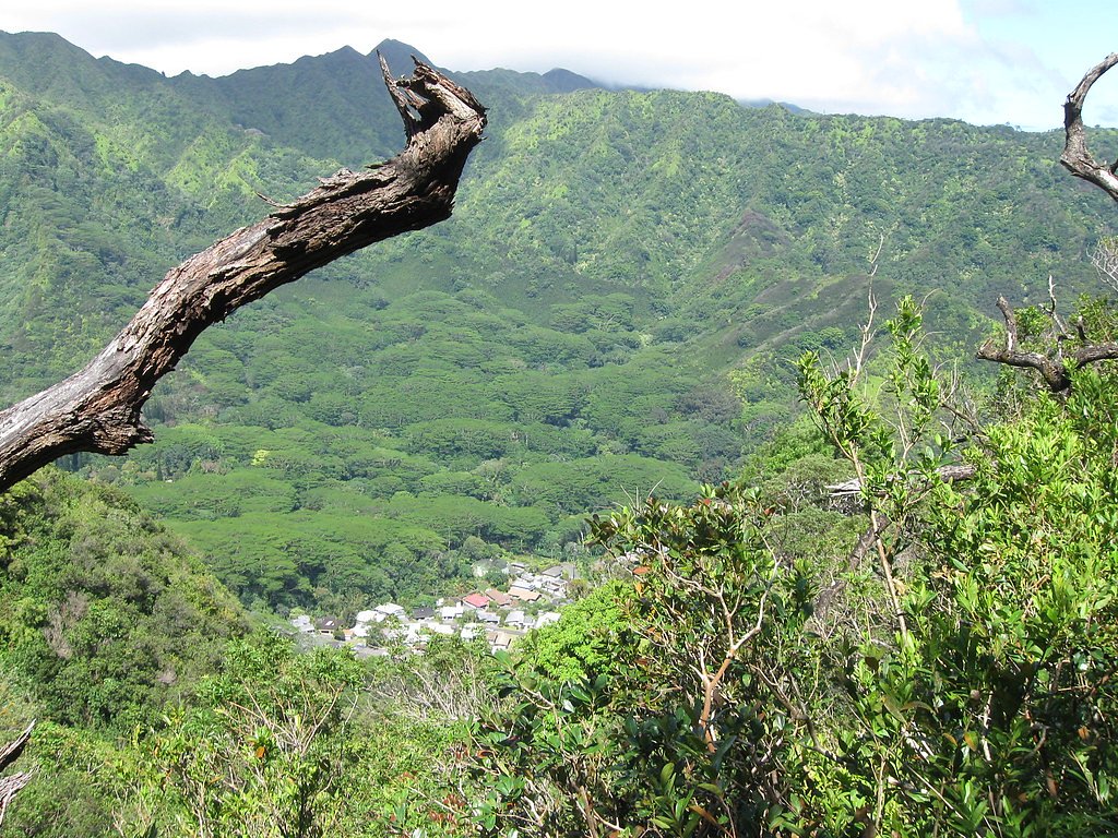
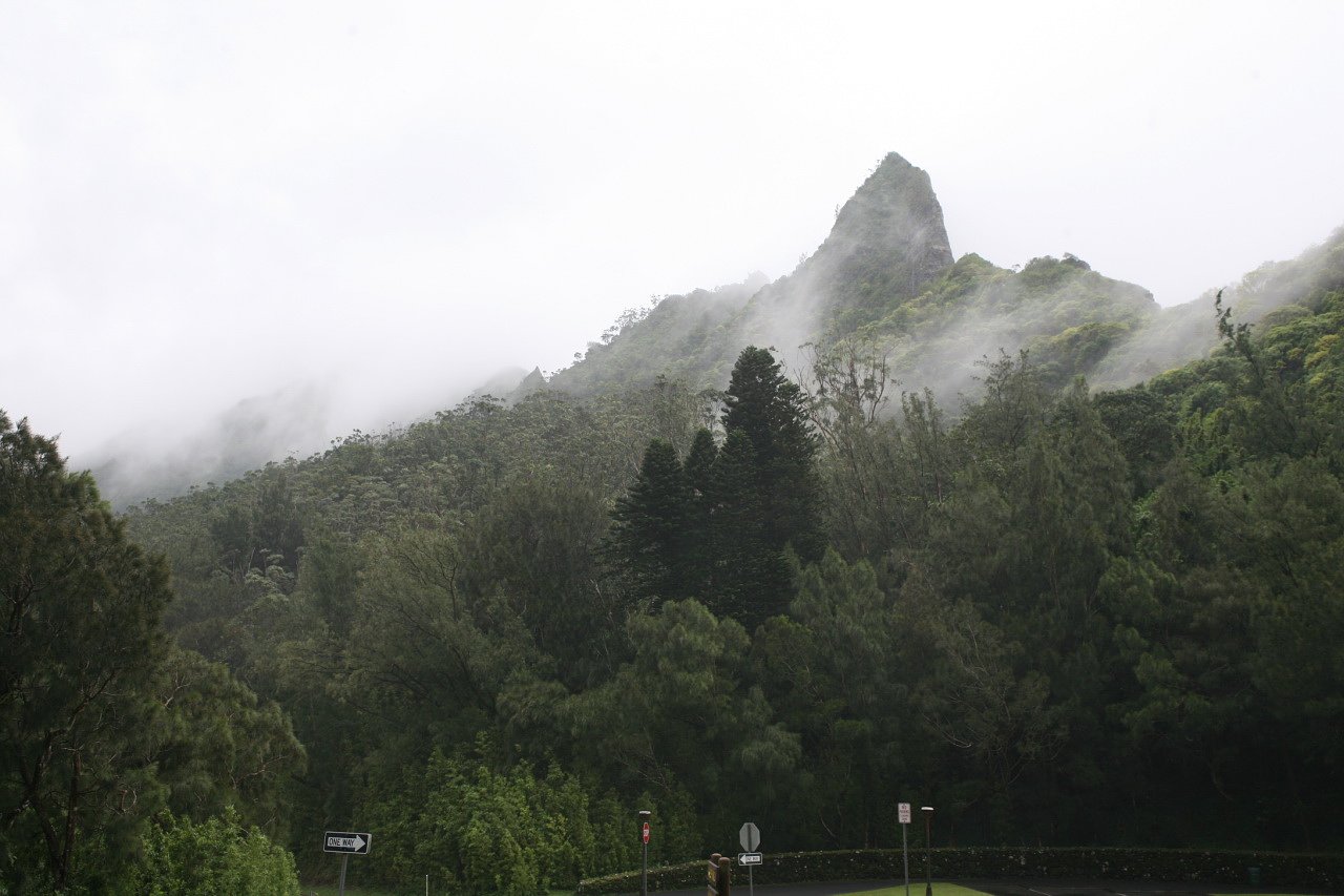
Mānoa Falls is a striking 150-foot (46 m) cascade tucked into the lush, tropical rainforest of Mānoa Valley on the island of Oʻahu, within the City and County of Honolulu. The setting—a corridor of bamboo, towering trees and vibrant understory plants—makes the short hike to the falls one of the most popular outings on the island. Many visitors are drawn by the dramatic plunge of the falls and the verdant scenery along the Manoa Falls Trail, but be aware that swimming in the pool below is highly discouraged because of the risk of leptospirosis, a bacterial disease that can cause flu-like symptoms lasting one to two weeks. This hike is a friendly option for most visitors: the trail is an easy out-and-back that climbs through a classic Hawaiian rainforest, rewarding hikers with close-up views of the waterfall at the end. Expect muddy, slippery sections—especially after rain—so bring good footwear and plan for wet conditions. The trail’s popularity means year-round visitation; go early if you prefer a quieter experience and take care to leave no trace on this beautiful natural corridor.
The Setting
Mānoa Falls sits at 1,198 feet along the Waihi Stream, in the foothills of Hawaii. At 150 feet, it is among the taller waterfalls in Hawaii.
Height: 150 feet
Trail & Hike Details
The Approach
The easy 1.6-mile out-and-back trail gains 633 feet of elevation on the way to the falls.
Trail Description
Trail type: out-and-back; length: 1.6 miles; elevation gain: 633 ft; difficulty: easy. The Manoa Falls Trail is a well-worn, unpaved footpath that winds through dense rainforest and stands of bamboo. Surface conditions are often muddy and slick after rain, so sturdy, grippy shoes are recommended. Over the 1.6-mile route the average grade is roughly 7.5%, with some short steeper pitches and occasional root- and rock-exposed sections; overall the trail is classified as easy but can be slippery. The trail terminates at the base of the 150-foot waterfall where there is a viewing area; visitors are strongly discouraged from entering the pool due to the risk of leptospirosis. Because the route is short and popular, expect other hikers and plan accordingly for parking, timing, and leaving no trace.
What to Expect
The falls cascade 150 feet. Dogs are welcome.
Accessibility
The trail is not wheelchair accessible. Uneven terrain and elevation changes require steady footing.
Frequently Asked Questions
🐶 Are Dogs Allowed at Mānoa Falls?
✅ Dogs are allowed
Are There Any Fees or Permits Required?
🤑 Fee: $7.00
🏊 Is There Swimming at Mānoa Falls?
❌ Swimming is not allowed
When to Visit
The waterfall is typically flowing year-round, but it is most impressive after rainfall. Morning visits are recommended to avoid crowds and enjoy cooler temperatures.
Seasonal Access
The best time to visit is Spring, Summer, Fall, and Winter. Heavy rains during wet season (November through March) bring higher flow but can make trails slippery.
Safety Information
The trail can be slippery and muddy, especially after rain. Visitors should stay on the marked trail to avoid damaging the environment and for their own safety. Falling rocks near the waterfall are a hazard, so avoid standing directly under the falls.
Current Water Conditions
1 ft³/s
Current discharge — how much water is flowing
About average for this time of year
Based on 80 years of record
1.77 ft
Water depth at gauge
7-Day Discharge Trend
What does this mean for your visit?
Flow is about average for this time of year.
About This Gauge
7-Day Flow Outlook
Based on the USGS gauge Waihi Stream at Honolulu, Oahu, HI (2 km away).
Today
Barely Flowing
2 cfs
3/10Tomorrow
Low
2 cfs
4/10Wed
Low
2 cfs
4/10Thu
Low
2 cfs
4/10Fri
Low
2 cfs
4/10Sat
Low
2 cfs
4/10Sun
Low
2 cfs
4/10Best window: Tomorrow — low flow, chance rain showers (trip score 4/10).
Best time of year: this gauge typically runs highest from early July to late July, peaking in May.
How we calculate this
This is a transparent outlook, not a precise forecast. We take the waterfall's current flow strength (how it ranks against its historical normal for today, from the nearest USGS stream gauge), carry that ranking forward along the gauge's seasonal curve, and nudge it for forecast rain. Confidence is highest for the next day or two and falls further out. Always check official conditions and your own judgment before visiting — high flows can be dangerous.
Know when to go.
Get a free email alert when waterfalls near Maunawili hit peak flow. We only send when conditions are worth the trip — no weekly newsletters, no spam.
Weather Forecast
Location & Access
Getting There
Mānoa Falls is located about 5 miles from downtown Honolulu. Visitors can reach the trailhead by car or public transportation. The trailhead is at the end of Mānoa Road, near the Mānoa Falls parking lot.
Get Directions on Google MapsParking
Parking is available at the Mānoa Falls parking lot for a fee of approximately $7. Alternatively, limited free street parking may be available nearby, but it can fill up quickly.
Elevation
1,198 feet above sea level
Coordinates
21.343186° N, -157.798716° W
Visitor Tips & Gear
Arrive early to avoid crowds, especially on weekends. Wear sturdy, waterproof shoes as the trail can be muddy. Bring insect repellent to protect against mosquitoes. Be cautious near the waterfall, as rocks can be slippery and falling debris is a hazard.
As an Amazon Associate, we earn from qualifying purchases.
This easy 1.6 miles hike is straightforward — comfortable trail shoes and plenty of water should do. Icy conditions are common in winter — traction cleats are a smart addition.

Columbia Watertight II Rain Jacket
Packs into its own pocket, seam-sealed, and keeps you dry from spray and surprise rain.

Polarized Sunglasses (Knockaround)
Cuts glare off the water so you actually see the falls — and your photos turn out better too.

Earth Pak Waterproof Dry Bag
Keeps your phone and gear dry when waterfall mist soaks everything else.

Waterproof Phone Pouch (AiRunTech)
Cheap insurance — take photos right next to the falls without killing your phone.

Kahtoola MICROspikes
Cult-favorite traction cleats that grip ice and wet rock — essential for winter waterfall hikes.

JOBY GorillaPod Starter Kit
Wraps around railings and rocks for long-exposure waterfall shots — no flat surface needed.
Where to Stay

Hilton Hawaiian Village Waikiki Beach Resort

Hilton Garden Inn Waikiki Beach

Pacific Monarch Hotel

OUTRIGGER Waikiki Beachcomber Hotel
Browse vacation cabins and private rentals nearby
Unique outdoor stays — tents, yurts, and treehouses
Rent a campervan or RV for your waterfall road trip
Some links are affiliate links. We may earn a commission at no extra cost to you.
Additional Information
Nearby Attractions
Nearby attractions include Lyon Arboretum, a botanical garden with additional trails and tropical plants, and the University of Hawaii at Mānoa campus.
Wildlife
The area is home to various tropical birds, insects, and small mammals. Visitors may also encounter native plants and flowers along the trail.
Cities near Mānoa Falls
Nearby Waterfalls
Writing about Mānoa Falls? Embed this waterfall on your site for free.