Photo Credits (5)
Difficulty
Moderate
Trail Length
2.4 miles
Trail Type
Out And Back
Elevation Gain
350 ft
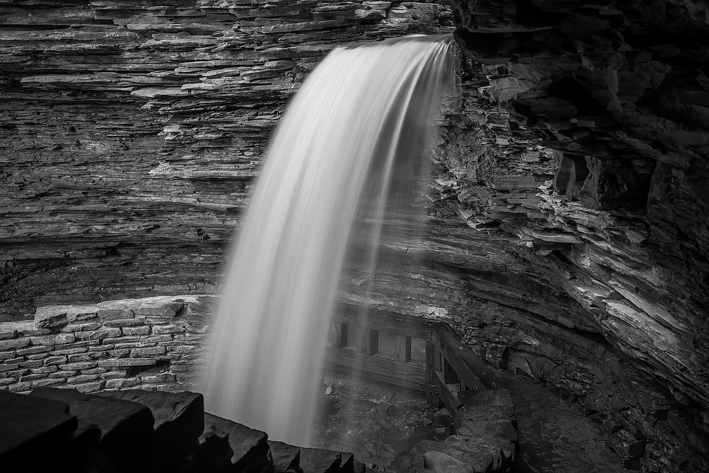
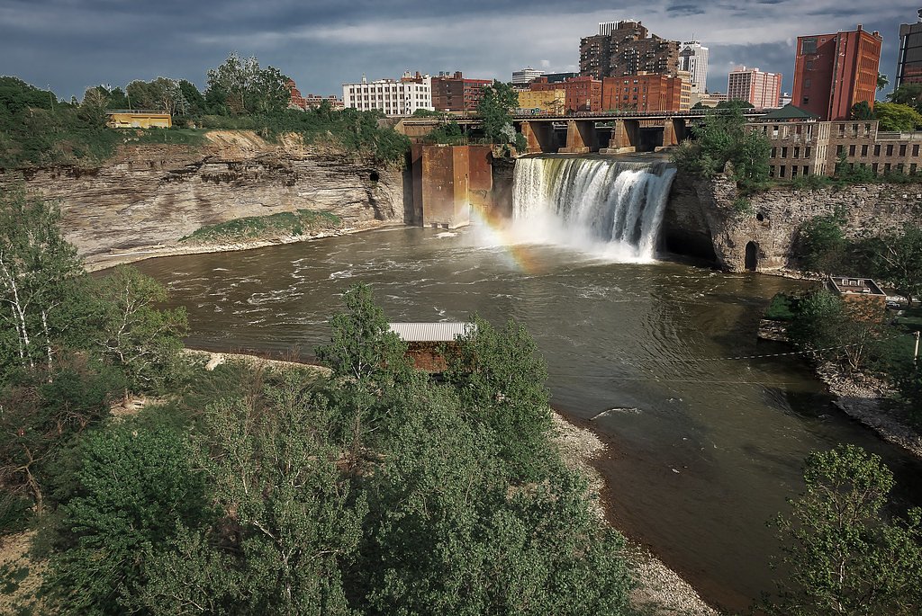
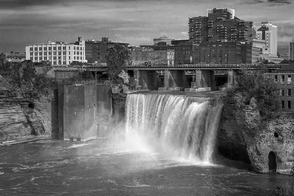
About Lower High Falls
Lower High Falls is a picturesque waterfall located in New York, known for its scenic beauty and accessibility. It is part of the High Falls area, which features multiple cascades along a river, making it a popular destination for nature enthusiasts and photographers.
The Setting
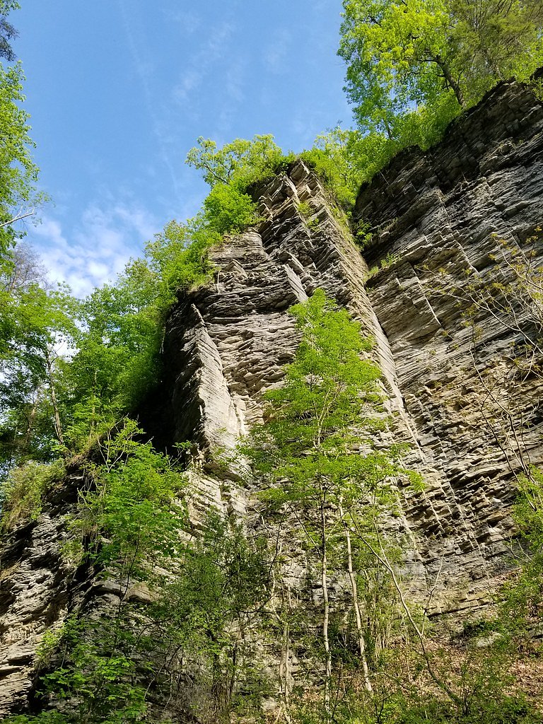
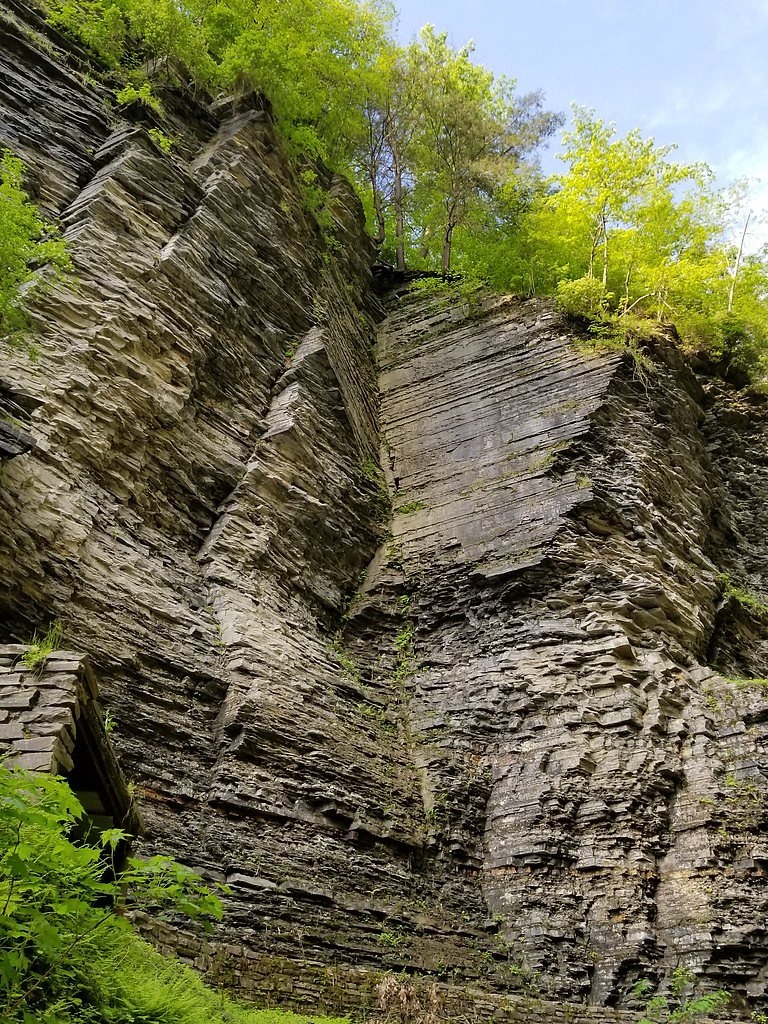
Lower High Falls sits at 879 feet along the Cincinnati Creek, in the foothills of New York.
Trail & Hike Details
The Approach
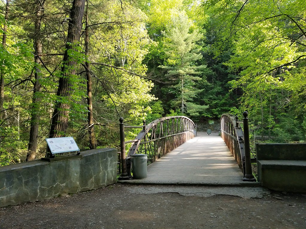
The moderate 2.4-mile out-and-back trail gains 350 feet of elevation on the way to the falls.
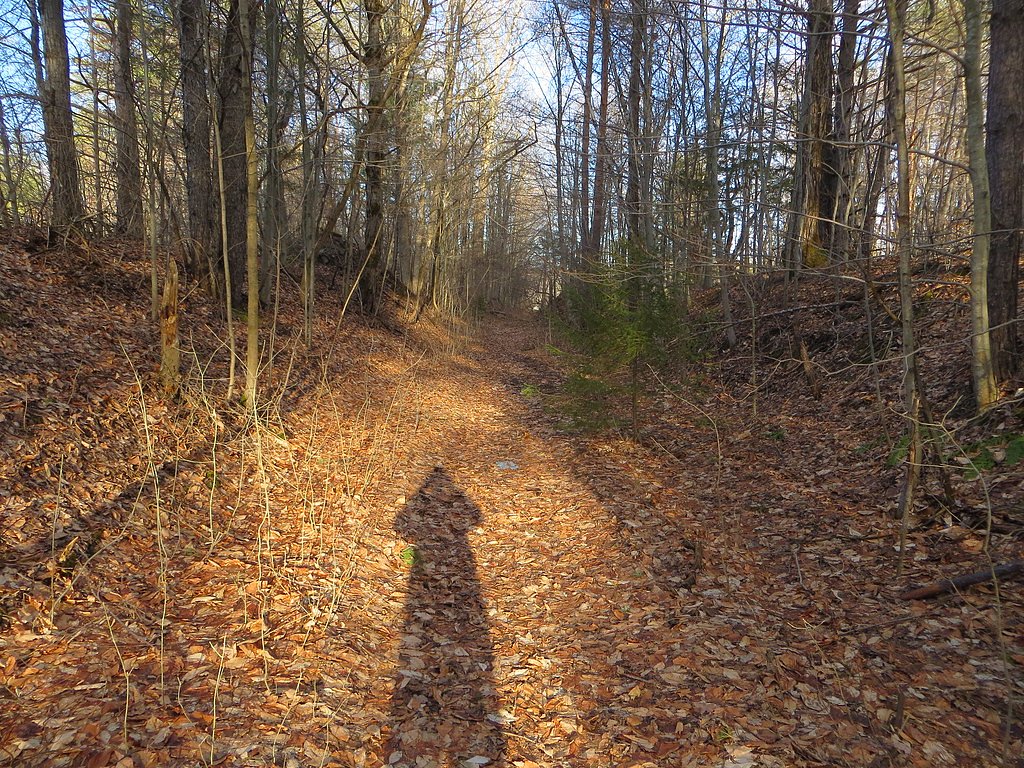
Trail Description
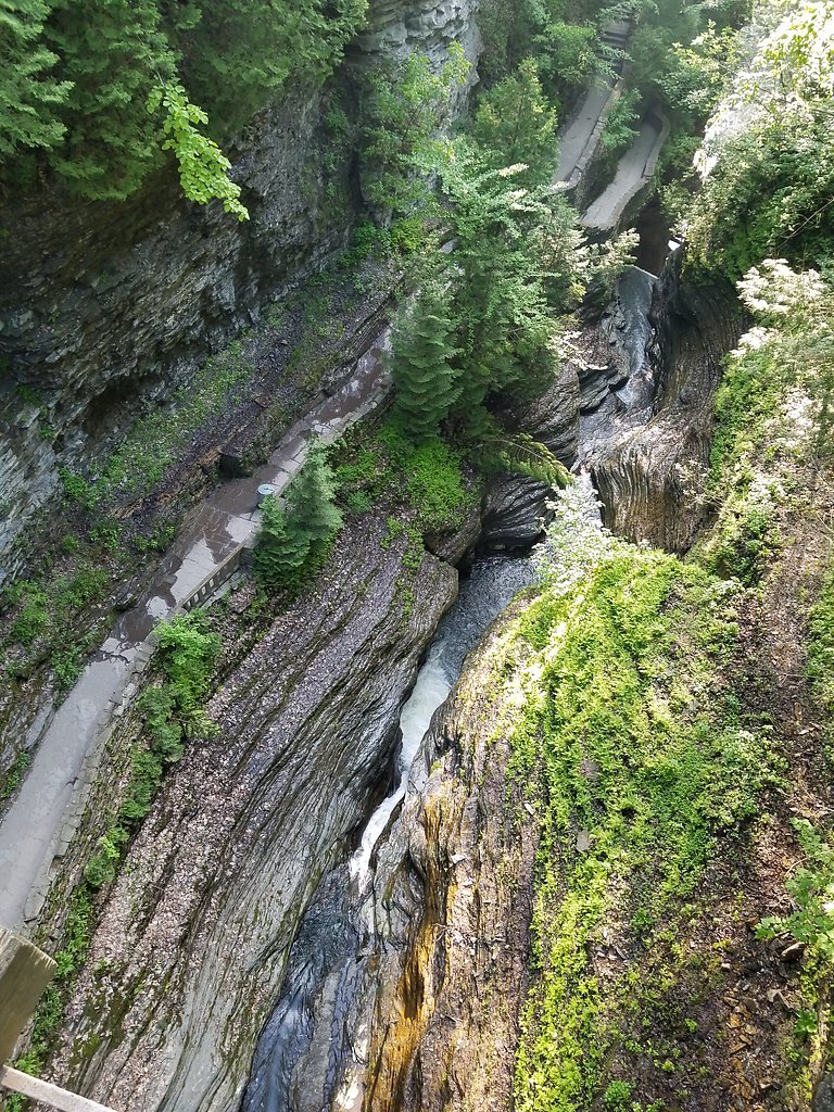
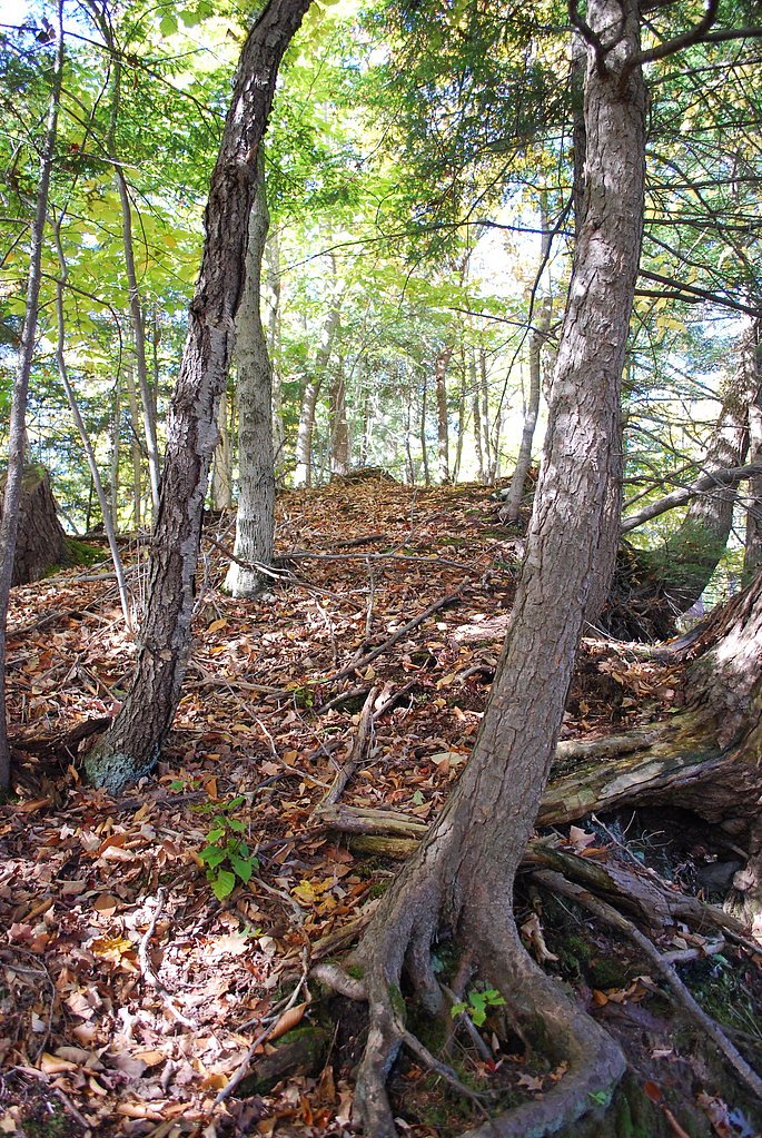
The trail to Lower High Falls is relatively short and easy, with well-maintained paths leading to scenic viewpoints. The route may include paved sections and overlooks, making it accessible for most visitors.
What to Expect
Dogs are welcome.
Accessibility
The trail is not wheelchair accessible. Uneven terrain and elevation changes require steady footing.
Frequently Asked Questions
🐶 Are Dogs Allowed at Lower High Falls?
✅ Dogs are allowed
Are There Any Fees or Permits Required?
🆖 No fees required
🏊 Is There Swimming at Lower High Falls?
❌ Swimming is not allowed
When to Visit
Spring and early summer are ideal for visiting, as the water flow is typically strongest during these seasons. Fall offers beautiful foliage, while winter may provide unique frozen waterfall views.
Seasonal Access
The best time to visit is Spring, Summer, and Fall. Winter access may be limited.
Safety Information
Exercise caution near the water's edge, as rocks can be slippery. Stay on designated trails and viewing areas to avoid accidents. Check weather conditions before visiting, as heavy rain can make trails muddy or hazardous.
Current Water Conditions
19 ft³/s
Current discharge — how much water is flowing
About average for this time of year
Based on 3 years of record
0.92 ft
Water depth at gauge
7-Day Discharge Trend
What does this mean for your visit?
Flow is about average for this time of year.
About This Gauge
7-Day Flow Outlook
Based on the USGS gauge CINCINNATI CREEK AT BARNEVELD NY (3 km away).
Today
Roaring
22 cfs
6/10Tomorrow
Strong
27 cfs
10/10Fri
Strong
17 cfs
10/10Sat
Roaring
15 cfs
6/10Sun
Roaring
11 cfs
6/10Mon
Roaring
10 cfs
6/10Tue
Roaring
9 cfs
6/10Best window: Tomorrow — strong flow, sunny (trip score 10/10).
Best time of year: this gauge typically runs highest from early March to mid April, peaking in March.
How we calculate this
This is a transparent outlook, not a precise forecast. We take the waterfall's current flow strength (how it ranks against its historical normal for today, from the nearest USGS stream gauge), carry that ranking forward along the gauge's seasonal curve, and nudge it for forecast rain. Confidence is highest for the next day or two and falls further out. Always check official conditions and your own judgment before visiting — high flows can be dangerous.
Know when to go.
Get a free email alert when waterfalls near Prospect hit peak flow. We only send when conditions are worth the trip — no weekly newsletters, no spam.
Weather Forecast
Location & Access
Getting There
Lower High Falls is located near the town of Rochester, New York, within the Genesee River area. Visitors can access the falls via local roads and trails leading to the viewing areas.
Get Directions on Google MapsParking
Parking is available near the falls, typically in designated lots or nearby street parking. Availability may vary depending on the season and time of day.
Elevation
879 feet above sea level
Coordinates
43.281135° N, -75.153234° W
Visitor Tips & Gear
Arrive early to secure parking and enjoy the falls without crowds. Wear sturdy shoes, as some sections of the trail may be uneven or slippery. Check weather conditions before visiting.
As an Amazon Associate, we earn from qualifying purchases.
With 2.4 miles and 350 ft of elevation gain, sturdy boots and trekking poles will help on this moderate trail. Sun exposure on the trail makes good sun protection a must in summer.

Polarized Sunglasses (Knockaround)
Cuts glare off the water so you actually see the falls — and your photos turn out better too.

Columbia Watertight II Rain Jacket
Packs into its own pocket, seam-sealed, and keeps you dry from spray and surprise rain.

Earth Pak Waterproof Dry Bag
Keeps your phone and gear dry when waterfall mist soaks everything else.

Waterproof Phone Pouch (AiRunTech)
Cheap insurance — take photos right next to the falls without killing your phone.

Timberland Euro Sprint Mid Waterproof
Trusted waterproof boot with premium leather and grippy rubber sole — reliable on rocky, wet trails.

TrailBuddy Trekking Poles
Lightweight aluminum, cork grips, and flip-locks that actually hold — a best-seller for good reason.
Where to Stay

Hampton Inn Rome

Fairfield Inn & Suites by Marriott Utica

Burrstone Inn, an Ascend Collection Hotel

TownePlace Suites by Marriott New Hartford
Browse vacation cabins and private rentals nearby
Unique outdoor stays — tents, yurts, and treehouses
Rent a campervan or RV for your waterfall road trip
Some links are affiliate links. We may earn a commission at no extra cost to you.
Additional Information
Nearby Attractions
Other waterfalls in the High Falls area, local parks, and the city of Rochester with its museums and dining options.
Wildlife
Visitors may encounter birds, small mammals, and other wildlife typical of the region.
Cities near Lower High Falls
Nearby Waterfalls
Writing about Lower High Falls? Embed this waterfall on your site for free.