Lower Falls Little Minam River
By Armen Suny · Last verified May 2026
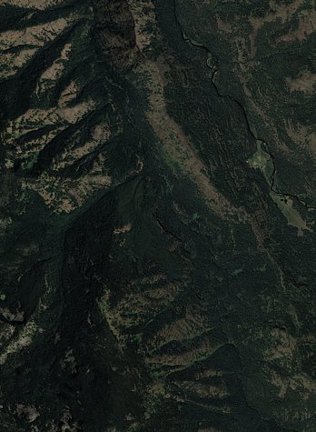

Photo Credits (3)
Difficulty
Moderate
Trail Length
2.4 miles
Trail Type
Out And Back
Elevation Gain
350 ft
About Lower Falls Little Minam River
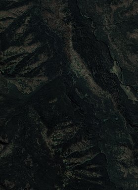
Lower Falls on the Little Minam River is a scenic waterfall located in the Wallowa-Whitman National Forest in Oregon. It is a remote and less-visited destination, offering a serene experience for those willing to make the trek.
The Setting
Lower Falls Little Minam River sits at 3,819 feet within Whitman National Forest, fed by the Minam River, in the mountains of Oregon.
Trail & Hike Details
The Approach
The moderate 2.4-mile out-and-back trail gains 350 feet of elevation on the way to the falls.
Trail Description
The trail to Lower Falls on the Little Minam River is a challenging hike through the Wallowa-Whitman National Forest. The path winds through dense forests, open meadows, and along the river, offering stunning views of the surrounding wilderness. The trail may be overgrown in sections and requires good navigation skills.
What to Expect
Dogs are welcome.
Accessibility
The trail is not wheelchair accessible. Uneven terrain and elevation changes require steady footing.
Frequently Asked Questions
🐶 Are Dogs Allowed at Lower Falls Little Minam River?
✅ Dogs are allowed
Are There Any Fees or Permits Required?
🆖 No fees required
🏊 Is There Swimming at Lower Falls Little Minam River?
❌ Swimming is not allowed
When to Visit
Spring and early summer are ideal for visiting, as the waterfall flow is strongest during this time. Fall offers beautiful foliage, while summer provides warmer weather for hiking.
Seasonal Access
The best time to visit is Spring, Summer, and Fall. Winter access may be limited. Check with Whitman National Forest for seasonal road closures.
Safety Information
The trail is remote, and cell service is unreliable. Be prepared for emergencies and let someone know your plans. Watch for wildlife and be cautious of slippery rocks near the waterfall.
Current Water Conditions
Based on a USGS gauge 19.4 miles away
298 ft³/s
Current discharge — how much water is flowing
Much lower than usual for this time of year
Based on 61 years of record
1.83 ft
Water depth at gauge
52°F
ColdBracing — limit time in water
7-Day Discharge Trend
What does this mean for your visit?
Flow is well below normal for this time of year, so the waterfall may be a trickle. Water temperature is a bracing 52 degrees F, limit your time in the water.
About This Gauge
This gauge is on a regional waterway. Conditions at the falls may differ, especially after local rain.
7-Day Flow Outlook
Based on the USGS gauge MINAM RIVER AT MINAM, OR (31 km away).
Today
Barely Flowing
322 cfs
3/10Tomorrow
Low
340 cfs
4/10Tue
Low
355 cfs
4/10Wed
Barely Flowing
310 cfs
5/10Thu
Barely Flowing
310 cfs
3/10Fri
Low
315 cfs
4/10Sat
Barely Flowing
245 cfs
5/10Best window: Wed — barely flowing flow, sunny (trip score 5/10).
Best time of year: this gauge typically runs highest from mid April to mid July, peaking in June.
How we calculate this
This is a transparent outlook, not a precise forecast. We take the waterfall's current flow strength (how it ranks against its historical normal for today, from the nearest USGS stream gauge), carry that ranking forward along the gauge's seasonal curve, and nudge it for forecast rain. Confidence is highest for the next day or two and falls further out. Always check official conditions and your own judgment before visiting — high flows can be dangerous.
Know when to go.
Get a free email alert when waterfalls near Cove hit peak flow. We only send when conditions are worth the trip — no weekly newsletters, no spam.
Weather Forecast
Location & Access
Getting There
The waterfall is located in a remote area of the Wallowa-Whitman National Forest. Access typically requires hiking or horseback riding along trails leading into the Little Minam River area. The trailhead is most commonly accessed via the Moss Springs Trailhead, which is reachable by forest roads. These roads may be rough and require a high-clearance vehicle.
Get Directions on Google MapsParking
Parking is available at the Moss Springs Trailhead, but space may be limited. Ensure your vehicle is parked in designated areas.
Elevation
3,819 feet above sea level
Coordinates
45.344355° N, -117.652446° W
Land Management
Managed by USFS
Visitor Tips & Gear
Bring a detailed map or GPS device, as the trail can be difficult to follow in some areas. Wear sturdy hiking boots and be prepared for changing weather conditions. Carry plenty of water and snacks, as there are no facilities nearby.
As an Amazon Associate, we earn from qualifying purchases.
With 2.4 miles and 350 ft of elevation gain, sturdy boots and trekking poles will help on this moderate trail. Sun exposure on the trail makes good sun protection a must in summer.

Polarized Sunglasses (Knockaround)
Cuts glare off the water so you actually see the falls — and your photos turn out better too.

Columbia Watertight II Rain Jacket
Packs into its own pocket, seam-sealed, and keeps you dry from spray and surprise rain.

Earth Pak Waterproof Dry Bag
Keeps your phone and gear dry when waterfall mist soaks everything else.

Waterproof Phone Pouch (AiRunTech)
Cheap insurance — take photos right next to the falls without killing your phone.

Timberland Euro Sprint Mid Waterproof
Trusted waterproof boot with premium leather and grippy rubber sole — reliable on rocky, wet trails.

TrailBuddy Trekking Poles
Lightweight aluminum, cork grips, and flip-locks that actually hold — a best-seller for good reason.
Where to Stay

Hampton Inn & Suites La Grande, Or

Eagle Cap Chalets

Serendipity Cottage

Prairie Creek Condo
Browse vacation cabins and private rentals nearby
Unique outdoor stays — tents, yurts, and treehouses
Rent a campervan or RV for your waterfall road trip
Some links are affiliate links. We may earn a commission at no extra cost to you.
Nearby Campground
Moss Springs Campground
5 miles away · 0 sites
Located above Cove, Oregon, the Moss Springs Campground lies on a ridgeline within view of the Eagle Cap Wilderness and is next to Moss Springs Trailhead. This popular campground was constructed to accommodate visitors with packstock, riding stock and campers bound for the wilderness. The site also has 3 accessible campsites and toilets. Trails from the campground drop steeply into the Minam River drainage or follow Grande Ronde Ridge.
Book on Recreation.govNearby Hot Springs
Hot springs near Cove, Oregon

Warm Spring
Warm Spring flows at 85°F at 2,953 feet in Union County near the town of Union, creating a 36.7-degree differential above ambie...
Medical Hot Springs
Medical Hot Springs emerges at 140°F in Union County's forested mountains, requiring a 289-meter walk from Medical Springs High...
Union Station Hot Springs
Union Station Hot Springs emerges near the town of Union in the Grande Ronde Valley at 2,728 feet elevation, 44 meters from Hot...

Hot Lake Springs
Hot Lake Springs emerges at 176°F in Union County near the town of Union, creating one of Oregon's hottest thermal features 44 ...
Unnamed Spring Union County
A warm spring at 2,702 feet elevation near Elgin in Union County, Oregon, classified as 'W' in historical records without speci...
Kropp Hot Spring
Kropp Hot Spring emerges at 109°F, flowing 61 degrees above ambient at 3,227 feet elevation in Union County's Blue Mountains. T...
Looking for a soak after your hike? Explore more hot springs near Cove, Oregon on SoakingSprings.
Explore Oregon springsAdditional Information
Nearby Attractions
The Wallowa Mountains and Eagle Cap Wilderness offer additional hiking and outdoor opportunities.
Wildlife
The area is home to deer, elk, black bears, and a variety of bird species. Be prepared for potential wildlife encounters.
Cities near Lower Falls Little Minam River
Nearby Waterfalls
Writing about Lower Falls Little Minam River? Embed this waterfall on your site for free.