Lower Disaster Falls
By Armen Suny · Last verified May 2026
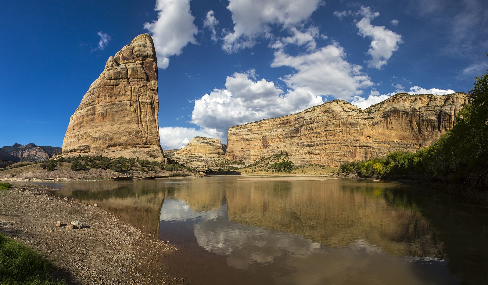
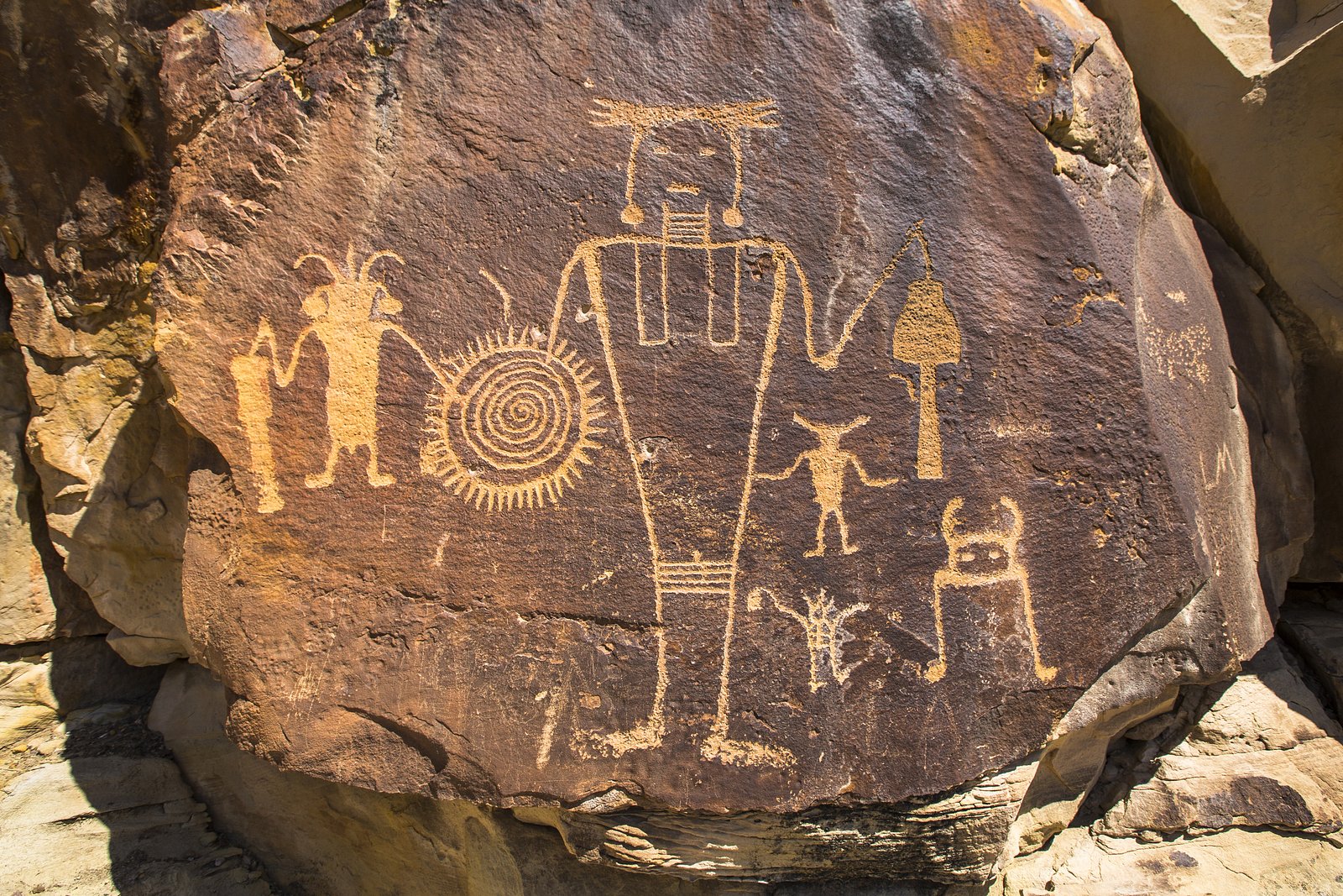
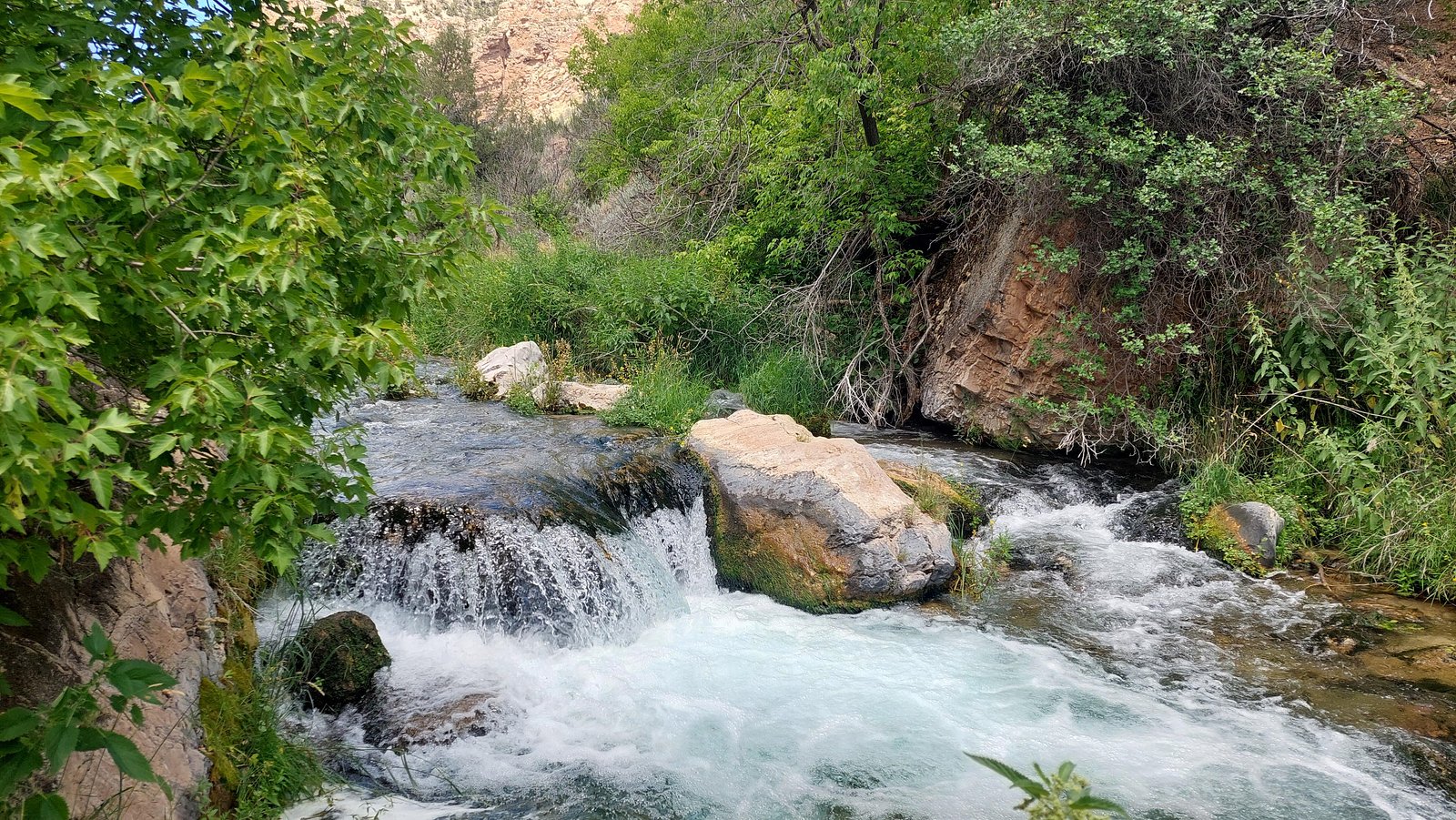
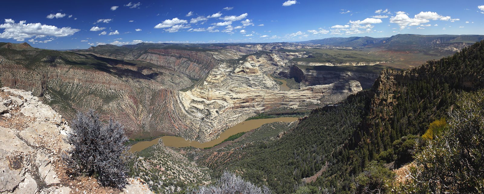
Photo Credits (5)
Difficulty
Moderate
Trail Length
2.4 miles
Trail Type
Out And Back
Elevation Gain
350 ft
About Lower Disaster Falls
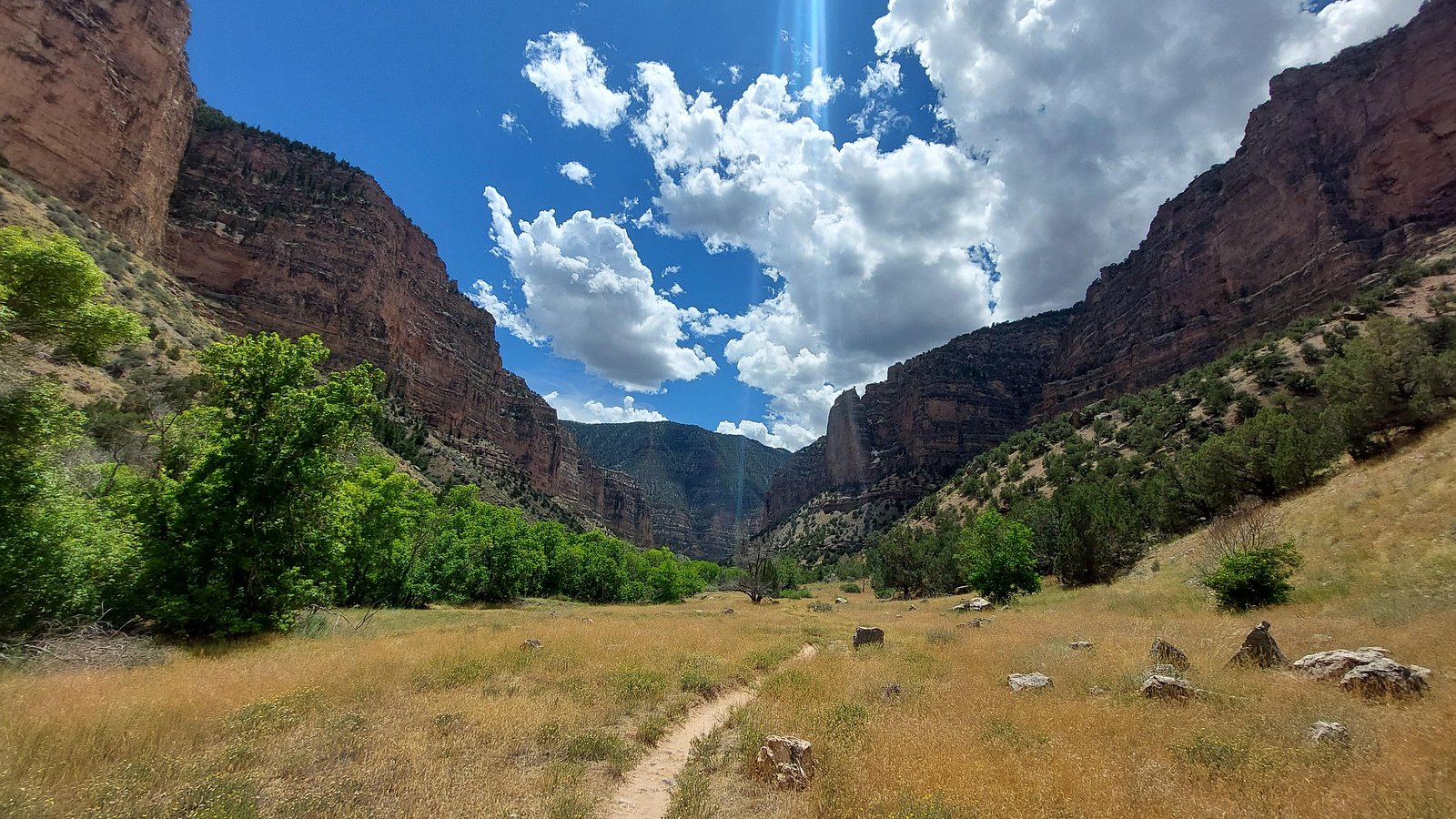
Lower Disaster Falls is a remote and scenic waterfall located in the Dinosaur National Monument area of Colorado. It is part of the Green River and is known for its historical significance during early river expeditions. The waterfall is more of a rapid or cascade rather than a traditional vertical drop.
The Setting
Lower Disaster Falls sits at 5,246 feet within Dinosaur National Monument, fed by the Yampa River, in the high mountains of Colorado.
Trail & Hike Details
The Approach
The moderate 2.4-mile out-and-back trail gains 350 feet of elevation on the way to the falls.
Trail Description
There is no traditional hiking trail to Lower Disaster Falls. The site is reached via a rafting trip on the Green River, which involves navigating through rapids and remote wilderness areas.
What to Expect
Visitors can expect a remote and rugged experience, with views of the cascading rapids of Lower Disaster Falls surrounded by dramatic canyon scenery. The area is rich in history and natural beauty, but it is only accessible by watercraft.
Accessibility
The trail is not wheelchair accessible. Uneven terrain and elevation changes require steady footing.
Frequently Asked Questions
🐶 Are Dogs Allowed at Lower Disaster Falls?
❌ Dogs are not allowed
Are There Any Fees or Permits Required?
🤑 Fee: $0.00
Permit required
A permit is required for rafting trips on the Green River within Dinosaur National Monument. Permits can be obtained through the National Park Service.
🏊 Is There Swimming at Lower Disaster Falls?
❌ Swimming is not allowed
When to Visit
The best time to visit is during late spring through early fall when water levels are suitable for rafting trips.
Seasonal Access
The best time to visit is Spring, Summer, and Fall. Access roads and trails may close during winter due to snow. Check the National Park Service website for current conditions.
Safety Information
The rapids at Lower Disaster Falls can be dangerous and require technical rafting skills. Always wear appropriate safety gear and travel with experienced guides. Be prepared for remote wilderness conditions.
Current Water Conditions
Based on a USGS gauge 25.2 miles away
346 ft³/s
Current discharge — how much water is flowing
Much lower than usual for this time of year
Based on 41 years of record
2.28 ft
Water depth at gauge
63°F
CoolRefreshing for swimming
7-Day Discharge Trend
What does this mean for your visit?
Flow is well below normal for this time of year, so the waterfall may be a trickle. Water temperature is a refreshing 63 degrees F, good for a quick swim.
About This Gauge
This gauge is on a regional waterway. Conditions at the falls may differ, especially after local rain.
7-Day Flow Outlook
Based on the USGS gauge YAMPA RIVER AT DEERLODGE PARK, CO (41 km away).
Today
Barely Flowing
354 cfs
5/10Tomorrow
Barely Flowing
327 cfs
5/10Mon
Barely Flowing
316 cfs
3/10Tue
Barely Flowing
279 cfs
5/10Wed
Barely Flowing
238 cfs
5/10Thu
Barely Flowing
253 cfs
5/10Fri
Barely Flowing
238 cfs
5/10Best window: Today — barely flowing flow, sunny (trip score 5/10).
Best time of year: this gauge typically runs highest from early April to early July, peaking in June.
How we calculate this
This is a transparent outlook, not a precise forecast. We take the waterfall's current flow strength (how it ranks against its historical normal for today, from the nearest USGS stream gauge), carry that ranking forward along the gauge's seasonal curve, and nudge it for forecast rain. Confidence is highest for the next day or two and falls further out. Always check official conditions and your own judgment before visiting — high flows can be dangerous.
Know when to go.
Get a free email alert when waterfalls near Dinosaur hit peak flow. We only send when conditions are worth the trip — no weekly newsletters, no spam.
Weather Forecast
Location & Access
Getting There
Access to Lower Disaster Falls typically requires a rafting trip along the Green River within Dinosaur National Monument. It is not accessible by road or hiking trails, making it a destination primarily for experienced river rafters.
Get Directions on Google MapsParking
Parking is available at designated river access points within Dinosaur National Monument, such as the Gates of Lodore launch site.
Elevation
5,246 feet above sea level
Coordinates
40.643852° N, -108.932895° W
Land Management
Managed by NPS
Visitor Tips & Gear
Plan your trip with an experienced rafting guide or outfitter, as the rapids can be challenging and require technical skill. Be prepared for remote conditions and pack all necessary supplies, including safety gear.
As an Amazon Associate, we earn from qualifying purchases.
With 2.4 miles and 350 ft of elevation gain, sturdy boots and trekking poles will help on this moderate trail. Sun exposure on the trail makes good sun protection a must in summer.
America the Beautiful Annual Pass
Covers entrance fees at 2,000+ federal recreation sites — required at most National Parks.

Polarized Sunglasses (Knockaround)
Cuts glare off the water so you actually see the falls — and your photos turn out better too.

Columbia Watertight II Rain Jacket
Packs into its own pocket, seam-sealed, and keeps you dry from spray and surprise rain.

Earth Pak Waterproof Dry Bag
Keeps your phone and gear dry when waterfall mist soaks everything else.

Waterproof Phone Pouch (AiRunTech)
Cheap insurance — take photos right next to the falls without killing your phone.

Timberland Euro Sprint Mid Waterproof
Trusted waterproof boot with premium leather and grippy rubber sole — reliable on rocky, wet trails.

TrailBuddy Trekking Poles
Lightweight aluminum, cork grips, and flip-locks that actually hold — a best-seller for good reason.
Where to Stay

Browse vacation cabins and private rentals nearby
Unique outdoor stays — tents, yurts, and treehouses
Rent a campervan or RV for your waterfall road trip
Some links are affiliate links. We may earn a commission at no extra cost to you.
Nearby Campground
Gates of Lodore Campground
6.2 miles away · 21 sites
Overview Gates of Lodore Campground is located on the Green River, near the boat ramp at the head of Lodore Canyon. It is at the north end of the monument, 137 miles (220 km) from the Quarry Visitor Center and 106 miles (170 km) from the Canyon Visitor Center. It is a long drive to the area and the wild, remote country adds to its sense of isolation. The campground is popular with river rafters who often stay here before launching on the Green River. There are 19 sites, some with shade. The site
Book on Recreation.govNearby Hot Springs
Hot springs near Dinosaur, Colorado
Warm Springs (Moffat County, Colorado)
Warm Springs in Rio Blanco County flows at 70 degrees Fahrenheit within the protected boundaries of Dinosaur National Monument ...
Split Mountain Warm Springs
Split Mountain Warm Springs flows at 86°F within Dinosaur National Monument, emerging near the Green River at 4,920 feet in Uin...
Looking for a soak after your hike? Explore more hot springs near Dinosaur, Colorado on SoakingSprings.
Explore Colorado springsAdditional Information
Nearby Attractions
Other notable sites within Dinosaur National Monument include the Gates of Lodore, Echo Park, and the Quarry Exhibit Hall featuring dinosaur fossils.
Wildlife
The area is home to diverse wildlife, including bighorn sheep, deer, and various bird species. Be cautious of wildlife encounters.
Cities near Lower Disaster Falls
Nearby Waterfalls
Writing about Lower Disaster Falls? Embed this waterfall on your site for free.