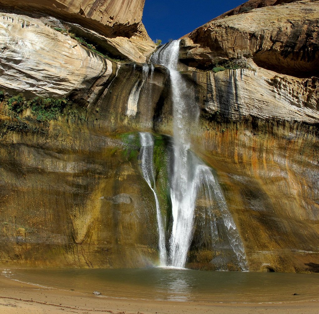
Lower Calf Creek Falls
Utah • Capitol Reef National Park • 126 ft
By Armen Suny · Last verified Mar 2026

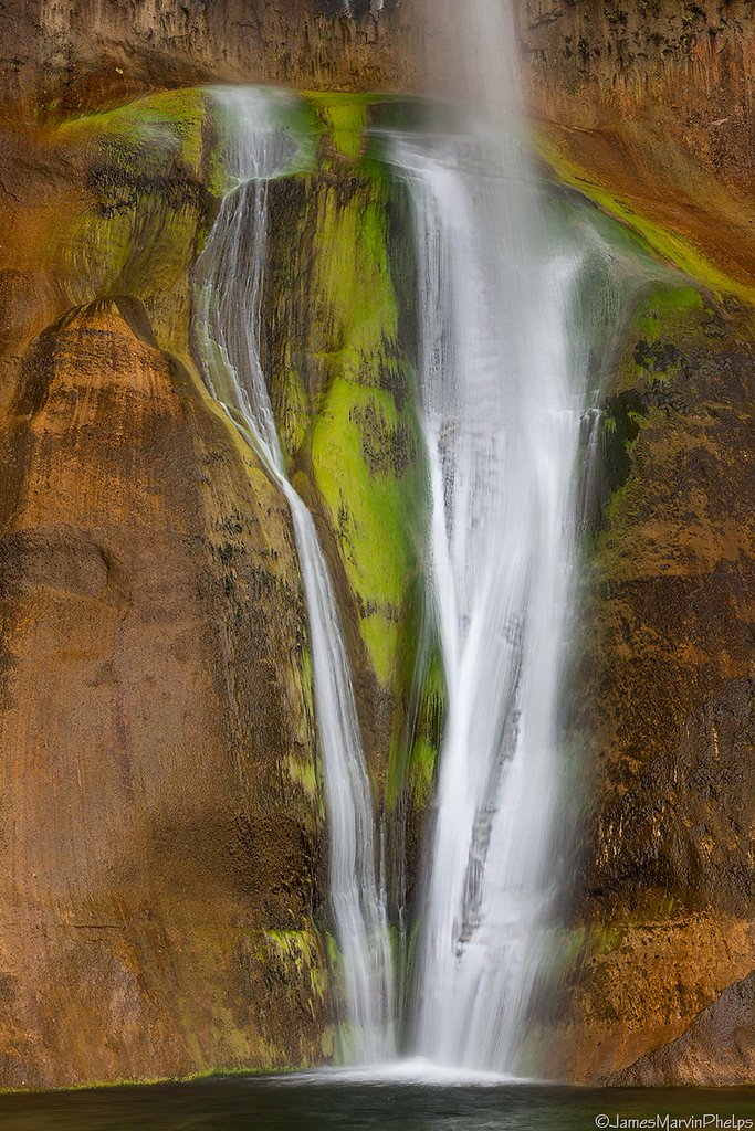
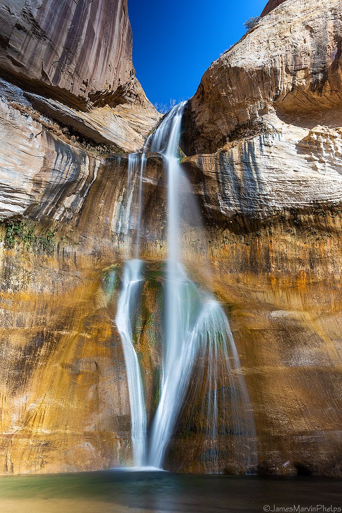
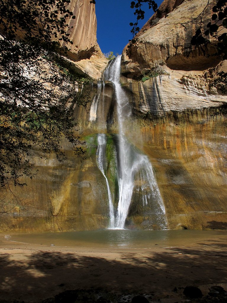

Photo Credits (5)
Difficulty
Moderate
Trail Length
6.0 miles
Trail Type
Out And Back
Elevation Gain
500 ft
About Lower Calf Creek Falls
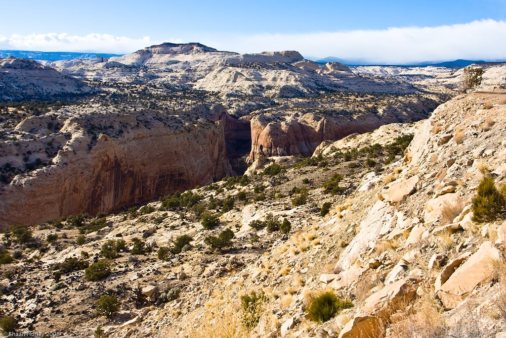
Lower Calf Creek Falls is the dramatic lower tier of a pair of perennial waterfalls on Calf Creek in central Garfield County, Utah. The lower drop plunges about 126 feet off a sandstone cliff into a clear plunge pool, while the two falls together total roughly 214 feet, according to Wikipedia. The falls sit within the Grand Staircase–Escalante National Monument on BLM-managed public lands (National Public Lands), and the setting—towering red-rock canyon walls and a ribbon of year-round water—makes it one of the monument’s most photographed spots. The hike to the falls is welcoming for day-trippers and families and rewards moderate effort with a cool swimming pool and scenic canyon views. If you’re camping, Deer Creek Campground lies about 6.34 km (under 10 km) away, making an overnight stay a convenient option for early starts or sunset views. Because the site is on Bureau of Land Management lands, visitors should follow Leave No Trace practices and current BLM guidance for access and parking.
The Setting
Lower Calf Creek Falls sits at 5,545 feet within Capitol Reef National Park, fed by the Escalante River, in the high mountains of Utah. At 126 feet, it is among the taller waterfalls in Utah.
Height: 126 feet
Nearby Falls Worth Visiting
Upper Calf Creek Falls (126 ft) lies 2.5 miles to the northwest.
Trail & Hike Details
The Approach
The moderate 6.0-mile out-and-back trail gains 500 feet of elevation on the way to the falls.
Trail Description
The trail to Lower Calf Creek Falls is an out-and-back route of about 6.0 miles round trip with roughly 500 feet of cumulative elevation gain; it’s rated moderate in difficulty. The path largely follows Calf Creek through a desert canyon and is mostly sandy underfoot, which can make the relatively gentle grade feel more strenuous than the numbers suggest. Interpretive signs along the way provide context on the area’s natural and human history, and the final approach opens into the cliff-walled alcove where the 126-foot lower fall plunges into a pool. Expect a classic desert-canyon trail: soft sand, exposed sections with direct sun, and stretches of easy walking between viewpoints. There’s no USFS trail number listed for this route; it’s managed as part of BLM public lands. Pack extra water, sun protection, and sturdy footwear for sandy conditions, and plan your timing if you intend to combine the hike with a stay at nearby Deer Creek Campground (≈6.34 km away).
What to Expect
The falls cascade 126 feet. Swimming is permitted. Dogs are welcome.
Accessibility
The trail is not wheelchair accessible. Uneven terrain and elevation changes require steady footing.
Frequently Asked Questions
🐶 Are Dogs Allowed at Lower Calf Creek Falls?
✅ Dogs are allowed
Are There Any Fees or Permits Required?
🤑 Fee: $5.00
🏊 Is There Swimming at Lower Calf Creek Falls?
✅ Swimming is allowed
When to Visit
The best time to visit is in the spring or fall when temperatures are milder. Summer can be very hot, and winter may bring icy conditions on the trail.
Seasonal Access
The best time to visit is Spring, Summer, and Fall. Access roads and trails may close during winter due to snow. Watch for flash flood warnings during monsoon season (July through September). Check with Capitol Reef National Park for current conditions.
Safety Information
Carry plenty of water and be prepared for hot, dry conditions. Watch for slippery rocks near the waterfall and be cautious of flash floods during rainy periods. Check weather conditions before your visit.
Current Water Conditions
0 ft³/s
Current discharge — how much water is flowing
Much lower than usual for this time of year
Based on 67 years of record
1.22 ft
Water depth at gauge
7-Day Discharge Trend
What does this mean for your visit?
Flow is well below normal for this time of year, so the waterfall may be a trickle.
About This Gauge
This gauge is on a nearby waterway and may not reflect exact conditions at the falls.
7-Day Flow Outlook
Based on the USGS gauge ESCALANTE RIVER NEAR ESCALANTE, UT (15 km away).
Today
Barely Flowing
0 cfs
5/10Tomorrow
Barely Flowing
0 cfs
5/10Mon
Barely Flowing
0 cfs
5/10Tue
Barely Flowing
0 cfs
5/10Wed
Barely Flowing
0 cfs
5/10Thu
Barely Flowing
0 cfs
5/10Fri
Barely Flowing
0 cfs
5/10Best window: Today — barely flowing flow, sunny then areas of blowing dust (trip score 5/10).
Best time of year: this gauge typically runs highest from late January to early April, peaking in March.
How we calculate this
This is a transparent outlook, not a precise forecast. We take the waterfall's current flow strength (how it ranks against its historical normal for today, from the nearest USGS stream gauge), carry that ranking forward along the gauge's seasonal curve, and nudge it for forecast rain. Confidence is highest for the next day or two and falls further out. Always check official conditions and your own judgment before visiting — high flows can be dangerous.
Know when to go.
Get a free email alert when waterfalls near Boulder hit peak flow. We only send when conditions are worth the trip — no weekly newsletters, no spam.
Weather Forecast
Location & Access
Getting There
Lower Calf Creek Falls is located off Highway 12 in the Grand Staircase-Escalante National Monument. The trailhead is at the Calf Creek Recreation Area, which is well-marked and accessible by car.
Get Directions on Google MapsParking
Parking is available at the Calf Creek Recreation Area. There is a designated parking lot, but it can fill up quickly during peak seasons. Arrive early to secure a spot.
Elevation
5,545 feet above sea level
Coordinates
37.829130° N, -111.419924° W
Land Management
Managed by BLM
Visitor Tips & Gear
Start early in the day to avoid the heat, especially in summer. Bring plenty of water, sunscreen, and a hat, as the trail offers little shade. Wear sturdy shoes suitable for sandy terrain. Be prepared for the possibility of encountering other hikers, as this is a popular trail.
This trail sits at 5,545 ft above sea level
Elevated TrailUV radiation is roughly 22% stronger at this elevation than at sea level, and the dry air accelerates dehydration. Extra sun protection and fluids go a long way.
As an Amazon Associate, we earn from qualifying purchases.

Coppertone Sport SPF 50 Sunscreen
UV intensity jumps ~4% per 1,000 ft — at this elevation you can burn in half the time.

Sun Bum SPF 30 Lip Balm (3-Pack)
Lips have almost no natural UV protection and burn fast in thin, dry mountain air.

Liquid I.V. Electrolyte Packets
You lose moisture ~2x faster at elevation — electrolytes help you absorb water efficiently.

ROCKNIGHT Polarized UV400 Sunglasses
High-altitude glare off rock and water is intense — UV400 lenses block 99%+ of UVA/UVB.
As an Amazon Associate, we earn from qualifying purchases.
With 6.0 miles and 500 ft of elevation gain, sturdy boots and trekking poles will help on this moderate trail. Sun exposure on the trail makes good sun protection a must in summer.

Polarized Sunglasses (Knockaround)
Cuts glare off the water so you actually see the falls — and your photos turn out better too.

Columbia Watertight II Rain Jacket
Packs into its own pocket, seam-sealed, and keeps you dry from spray and surprise rain.

Earth Pak Waterproof Dry Bag
Keeps your phone and gear dry when waterfall mist soaks everything else.

Waterproof Phone Pouch (AiRunTech)
Cheap insurance — take photos right next to the falls without killing your phone.

Timberland Euro Sprint Mid Waterproof
Trusted waterproof boot with premium leather and grippy rubber sole — reliable on rocky, wet trails.

TrailBuddy Trekking Poles
Lightweight aluminum, cork grips, and flip-locks that actually hold — a best-seller for good reason.
Where to Stay

Ponderosa Inn

Escalante Escapes Prickly Pear- Bunk Escape

Escalante Escapes Barrel Cactus - Loft Escape

The Padre Motel
Browse vacation cabins and private rentals nearby
Unique outdoor stays — tents, yurts, and treehouses
Rent a campervan or RV for your waterfall road trip
Some links are affiliate links. We may earn a commission at no extra cost to you.
Nearby Campground
Deer Creek Campground
3.9 miles away · 0 sites
Deer Creek Campground is a small cozy campground nestled in Deer Creek Canyon at 5800 ft. There are 7 campsites and potable water is not available. This small campground is located along the scenic Burr Trail Road in the Grand Staircase/Escalante National Monument. The campground does not accommodate travel trailers due to site limitations.
Book on Recreation.govAdditional Information
Nearby Attractions
Other attractions in the area include Upper Calf Creek Falls, Escalante Petrified Forest State Park, and the Hole-in-the-Rock Road for additional hiking and exploration.
Wildlife
Wildlife in the area includes birds such as peregrine falcons, lizards, and occasionally deer. Be mindful of snakes, especially during warmer months.
Cities near Lower Calf Creek Falls
Nearby Waterfalls
Writing about Lower Calf Creek Falls? Embed this waterfall on your site for free.