
Little Illinois River Falls
By Armen Suny · Last verified Oct 2026
LiDAR & 3D terrain
Photo Credits (2)
Difficulty
Easy
Trail Length
1.0 miles
Trail Type
Loop
About Little Illinois River Falls
Little Illinois River Falls is a set of cataracts where the Illinois River narrows at a bend, at the western end of the river's Wild and Scenic section in the Rogue River-Siskiyou National Forest near Kerby. The drops are low, and at very high water they are nearly drowned out. A one-mile loop from the Little Falls Trailhead on Eight Dollar Mountain Road leads down to a rocky bluff above the falls, in the Eight Dollar Mountain Botanical Area known for spring wildflowers.
The Setting
Little Illinois River Falls sits at 1,198 feet within Siskiyou National Forest, fed by the Illinois River, in the foothills of Oregon.
Trail & Hike Details
Trail Description
From the Little Falls Trailhead, a loop of about one mile drops to the Illinois River, switchbacking down a rubbly trail to a rocky bluff above the cataracts, then climbs back to a miner's ditch and the trailhead. A short scramble reaches riverside boulders for a closer view. A longer 3.8-mile option starts at the Jeffrey Pine Trailhead and follows the Little Falls Trail along an old mining ditch.
What to Expect
Swimming is permitted. Dogs are welcome.
Accessibility
The trail is not wheelchair accessible. Uneven terrain and elevation changes require steady footing.
Frequently Asked Questions
🐶 Are Dogs Allowed at Little Illinois River Falls?
✅ Dogs are allowed
Dogs are allowed on national forest trails; in developed recreation sites such as trailheads they must be on a leash no longer than 6 feet.
Are There Any Fees or Permits Required?
🆖 No fees required
🏊 Is There Swimming at Little Illinois River Falls?
✅ Swimming is allowed
When to Visit
Spring and early summer are ideal for visiting, as the water flow is typically strongest during these seasons.
Seasonal Access
The best time to visit is Spring, Summer, and Fall. Winter access may be limited. Check with Siskiyou National Forest for seasonal road closures.
Safety Information
Poison oak is common along the trails, and rattlesnakes and ticks are present. Use care on the boulders by the river, especially at high water.
Current Water Conditions
35 ft³/s
Current discharge — how much water is flowing
Much lower than usual for this time of year
Based on 65 years of record
0.70 ft
Water depth at gauge
55°F
ColdBracing — limit time in water
7-Day Discharge Trend
What does this mean for your visit?
Flow is well below normal for this time of year, so the waterfall may be a trickle. Water temperature is a bracing 55 degrees F, limit your time in the water.
About This Gauge
7-Day Flow Outlook
Based on the USGS gauge ILLINOIS RIVER NEAR KERBY, OR (2 km away).
Today
Strong
35 cfs
10/10Tomorrow
Strong
34 cfs
10/10Sun
Strong
37 cfs
8/10Mon
Strong
38 cfs
8/10Tue
Strong
38 cfs
10/10Wed
Strong
38 cfs
10/10Thu
Strong
54 cfs
8/10Best window: Today — strong flow, sunny (trip score 10/10).
Best time of year: this gauge typically runs highest from early January to early February, peaking in January.
How we calculate this
This is a transparent outlook, not a precise forecast. We take the waterfall's current flow strength (how it ranks against its historical normal for today, from the nearest USGS stream gauge), carry that ranking forward along the gauge's seasonal curve, and nudge it for forecast rain. Confidence is highest for the next day or two and falls further out. Always check official conditions and your own judgment before visiting — high flows can be dangerous.
Know when to go.
Get a free email alert when waterfalls near Kerby hit peak flow. We only send when conditions are worth the trip — no weekly newsletters, no spam.
Weather Forecast
The Terrain, Seen by LiDAR
Aircraft-mounted lasers measured this ground to within inches. Trees and buildings are digitally stripped away, leaving the bare shape of the land the water has carved.
The bare-earth surface loses about 86 feet through the falls, but gradually, the profile of a cascade rather than a plunge. The ground at the falls is roughly 1,182 feet above sea level.
The whole reach is steep: about 70 feet of descent in the 500 feet above the falls and another 133 feet in the 500 feet below. The falls face west and glow in afternoon and evening light.
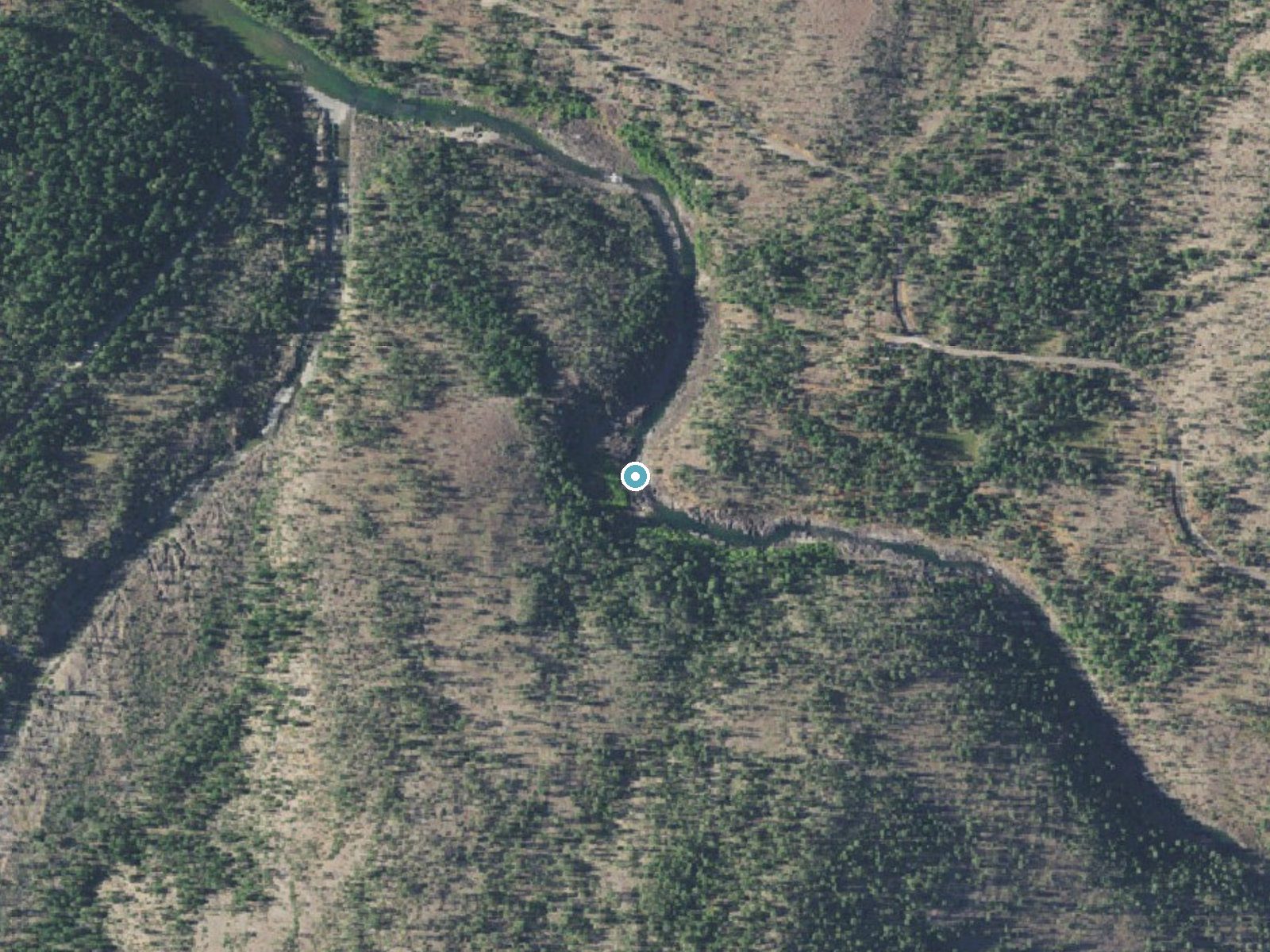
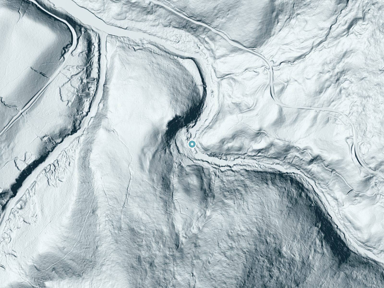
Drag to compare. The dot marks the waterfall. The frame is about a mile across.
- Ground elevation
- 1,182 feet
- Measured by 1-meter lidar
- Drop at the falls
- About 86 feet
- Change in ground height within ~250 feet of the falls
- Faces
- West
- Glows in afternoon and evening light.
A slice through the lidar ground surface, from above the falls to downstream (heading west).
Elevation data: USGS 3D Elevation Program. Aerial imagery: USGS The National Map. Public domain.
Location & Access
Getting There
From Grants Pass, take Highway 199 south 33.6 miles and turn right onto Eight Dollar Mountain Road (FR 4201). Drive 2.0 miles on the paved road to the Little Falls Trailhead, turn left and park in the day-use area above the restroom.
Get Directions on Google MapsParking
The Little Falls Trailhead has a day-use parking area with a vault toilet and a campground nearby.
Hours
Elevation
1,198 feet above sea level
Coordinates
42.239249° N, -123.680046° W
Land Management
Managed by USFS
Visitor Tips & Gear
Trails can be sticky and muddy when wet. Stay on the main trail near the falls, where several user paths branch off. Spring is best for wildflowers.
Where to Stay

Hampton Inn & Suites Grants Pass

Holiday Inn Express Grants Pass by IHG

Cozy Wild West Covered Wagon next to River

Best Western Grants Pass Inn
Browse vacation cabins and private rentals nearby
Unique outdoor stays — tents, yurts, and treehouses
Rent a campervan or RV for your waterfall road trip
Some links are affiliate links. We may earn a commission at no extra cost to you.
Nearby Campground
River Bench Campground
4.9 miles away · 0 sites
Several walk in campsites along the Illinois River. River Bench Day Use and Campground are located on a lower river terrace, within a forested setting. Must hike down one of two access trails to use.Facilities8 walk in campsites with picnic tables, and fire pitsNo drinking waterVault toilet within walking distanceNo garbage disposal - Please pack it out
Book on Recreation.govNearby Hot Springs
Hot springs near Medford, Oregon
Jackson Hot Springs
Jackson Hot Springs registers 95°F with highly alkaline chemistry, posting pH 9.3 in sodium-dominated waters containing 95 mg/L...
Sulphur Springs
Sulphur Springs flows at a impressive 84°F in Siskiyou County's temperate forest, reaching 29.5 degrees above the cool ambient ...
Looking for a soak after your hike? Explore more hot springs near Medford, Oregon on SoakingSprings.
Explore Oregon springsAdditional Information
Nearby Attractions
The Jeffrey Pine Loop and Eight Dollar Mountain Botanical Area, on the same road, and the Wild and Scenic Illinois River corridor upstream.
Wildlife
The area is home to a variety of wildlife, including birds, deer, and small mammals. Keep an eye out for native flora and fauna.
Cities near Little Illinois River Falls
Writing about Little Illinois River Falls? Embed this waterfall on your site for free.