Photo Credits (5)
Difficulty
Moderate
Trail Length
2.5 miles
Trail Type
Out And Back
Elevation Gain
300 ft
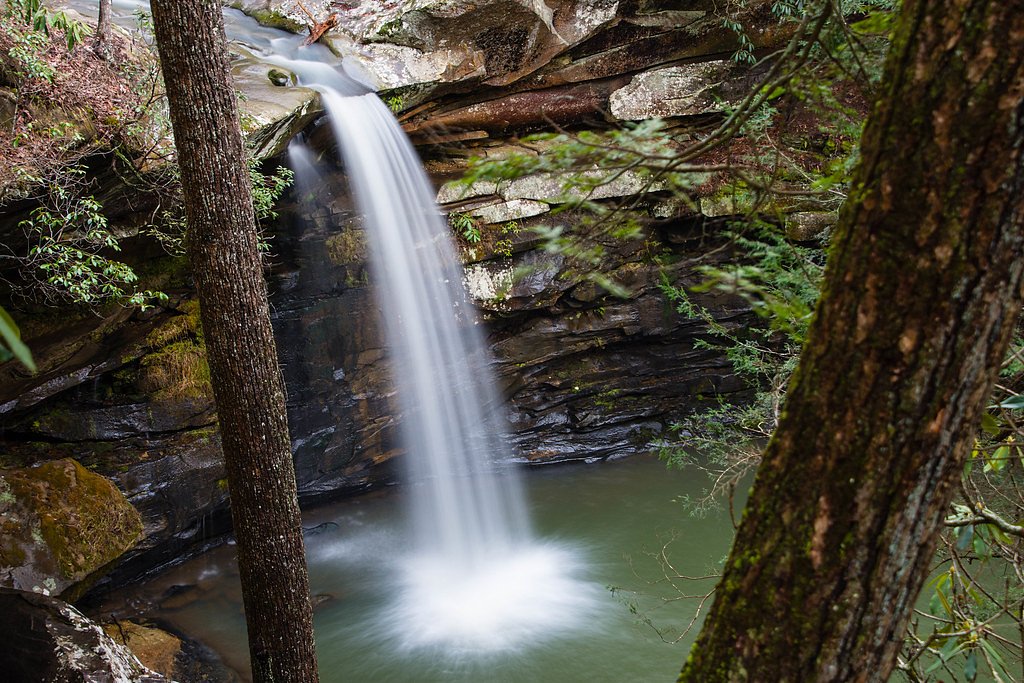
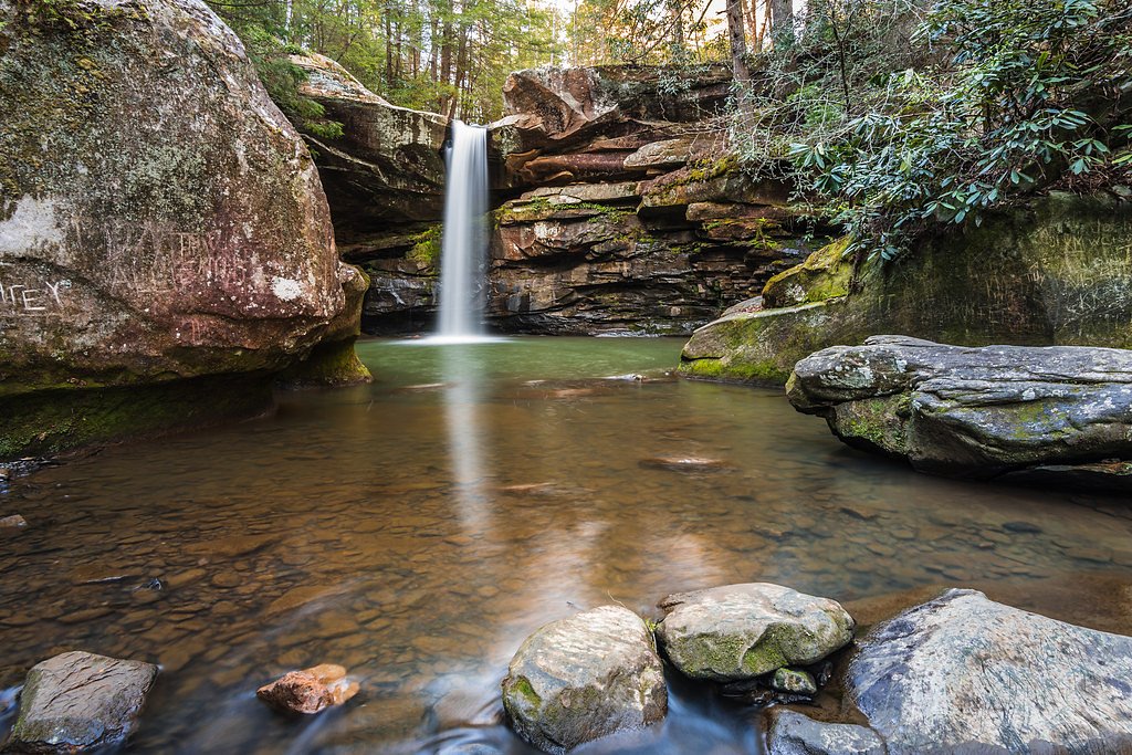
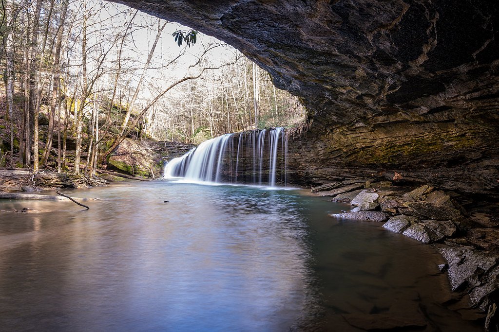
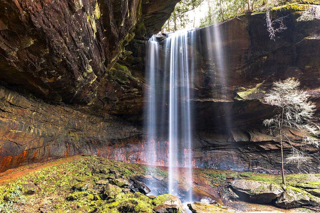
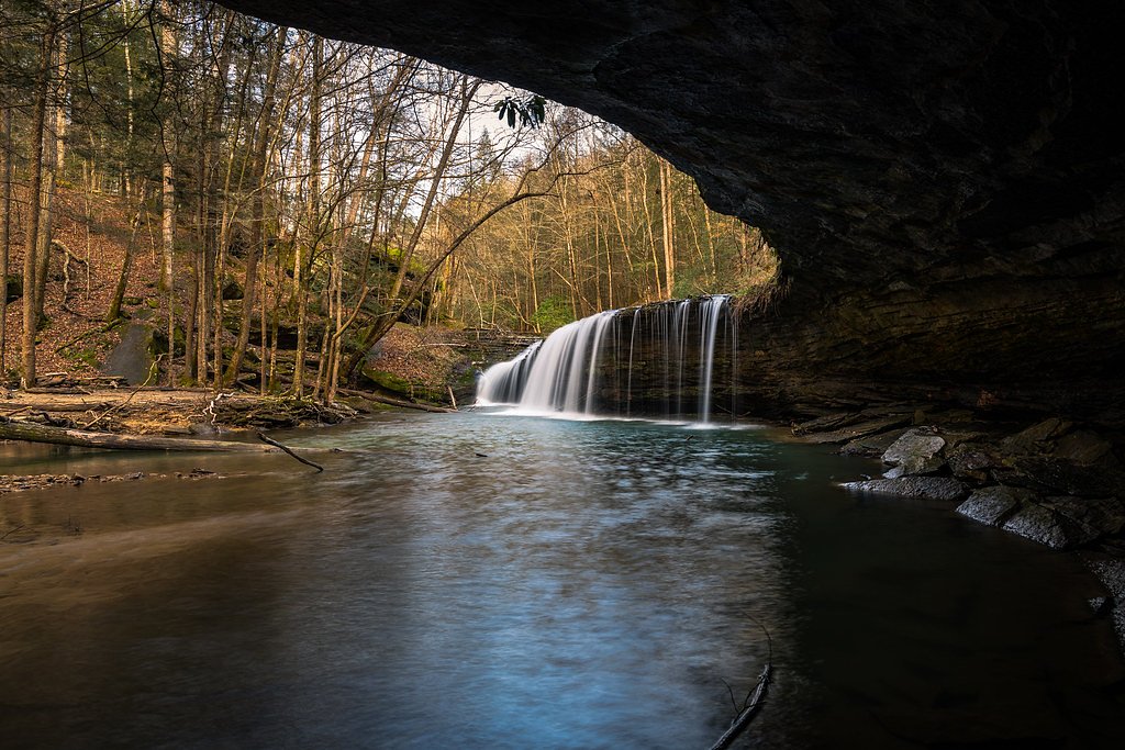
About Lick Falls
Lick Falls is a quietly scenic cascade tucked into the Grayson Recreation Area in Kentucky, a recreation unit managed by the U.S. Army Corps of Engineers. Framed by mature hardwoods and a peaceful, wooded setting, the falls are a favorite for hikers and photographers looking for a short, rejuvenating outing. Flow can be seasonal, with the stream most impressive after heavy rains and during the spring melt, so timing your visit after wet weather will usually yield the best display. The approach keeps things pleasantly wild without being remote: the established out-and-back trail covers about 2.5 miles with roughly 300 feet of elevation gain and is rated moderate. If you want to make a night of it, Grayson Lake Damsite Shelters are nearby—about 8.1 km from the trailhead—making Lick Falls an easy day trip from local camping within the Grayson Recreation Area.
The Setting
Lick Falls sits at 702 feet within Grayson Recreation Area, fed by the Little Sandy River, in the foothills of Kentucky.
Trail & Hike Details
The Approach
The moderate 2.5-mile out-and-back trail gains 300 feet of elevation on the way to the falls.
Trail Description
Out-and-back trail, approximately 2.5 miles total with about 300 feet of elevation gain; difficulty: moderate. The route winds through forested terrain with moderate elevation changes and natural, unpaved tread that can become uneven and muddy after rain. Hikers will pass lush greenery and small stream crossings before arriving at the waterfall, which sits in a peaceful wooded clearing. Managed within the Grayson Recreation Area by the U.S. Army Corps of Engineers; nearby camping available at Grayson Lake Damsite Shelters (~8.14 km).
What to Expect
Dogs are welcome.
Accessibility
The trail is not wheelchair accessible. Uneven terrain and elevation changes require steady footing.
Frequently Asked Questions
🐶 Are Dogs Allowed at Lick Falls?
✅ Dogs are allowed
Are There Any Fees or Permits Required?
🆖 No fees required
🏊 Is There Swimming at Lick Falls?
❌ Swimming is not allowed
When to Visit
The best time to visit Lick Falls is during the spring or after periods of heavy rain, when the waterfall is most likely to have a strong flow. Fall is also a great time to visit for the colorful foliage.
Seasonal Access
The best time to visit is Spring, Summer, and Fall. Winter access may be limited.
Safety Information
The trail can be slippery and muddy, especially after rain. Visitors should wear appropriate footwear and exercise caution near the waterfall. Cell phone reception may be limited in the area, so plan accordingly.
Current Water Conditions
50 ft³/s
Current discharge — how much water is flowing
About average for this time of year
Based on 28 years of record
86.34 ft
Water depth at gauge
61°F
CoolRefreshing for swimming
7-Day Discharge Trend
What does this mean for your visit?
Flow is about average for this time of year. Water temperature is a refreshing 61 degrees F, good for a quick swim.
About This Gauge
7-Day Flow Outlook
Based on the USGS gauge LITTLE SANDY RIVER BELOW GRAYSON DAM NEAR LEON, KY (8 km away).
Today
Roaring
58 cfs
6/10Tomorrow
Roaring
51 cfs
9/10Tue
Strong
48 cfs
10/10Wed
Strong
49 cfs
10/10Thu
Strong
49 cfs
10/10Fri
Roaring
56 cfs
6/10Sat
Roaring
55 cfs
6/10Best window: Tue — strong flow, sunny (trip score 10/10).
Best time of year: this gauge typically runs highest from mid January to late March, peaking in February.
How we calculate this
This is a transparent outlook, not a precise forecast. We take the waterfall's current flow strength (how it ranks against its historical normal for today, from the nearest USGS stream gauge), carry that ranking forward along the gauge's seasonal curve, and nudge it for forecast rain. Confidence is highest for the next day or two and falls further out. Always check official conditions and your own judgment before visiting — high flows can be dangerous.
Know when to go.
Get a free email alert when waterfalls near Sandy Hook hit peak flow. We only send when conditions are worth the trip — no weekly newsletters, no spam.
Weather Forecast
Location & Access
Getting There
Lick Falls is located within the Daniel Boone National Forest. The trailhead can be accessed via Forest Service roads, but specific directions may vary depending on your starting location. Visitors are advised to check local maps or consult the forest service for the most accurate directions.
Get Directions on Google MapsParking
Parking is available near the trailhead, but spaces may be limited. Visitors should plan to arrive early, especially during peak seasons.
Elevation
702 feet above sea level
Coordinates
38.197896° N, -83.046111° W
Land Management
Managed by USACE
Visitor Tips & Gear
Wear sturdy hiking shoes as the trail can be uneven and muddy. Bring plenty of water and snacks, as there are no facilities along the trail. Check the weather forecast before your visit, as the trail may become slippery after rain.
As an Amazon Associate, we earn from qualifying purchases.
With 2.5 miles and 300 ft of elevation gain, sturdy boots and trekking poles will help on this moderate trail. Sun exposure on the trail makes good sun protection a must in summer.

Polarized Sunglasses (Knockaround)
Cuts glare off the water so you actually see the falls — and your photos turn out better too.

Columbia Watertight II Rain Jacket
Packs into its own pocket, seam-sealed, and keeps you dry from spray and surprise rain.

Earth Pak Waterproof Dry Bag
Keeps your phone and gear dry when waterfall mist soaks everything else.

Waterproof Phone Pouch (AiRunTech)
Cheap insurance — take photos right next to the falls without killing your phone.

Timberland Euro Sprint Mid Waterproof
Trusted waterproof boot with premium leather and grippy rubber sole — reliable on rocky, wet trails.

TrailBuddy Trekking Poles
Lightweight aluminum, cork grips, and flip-locks that actually hold — a best-seller for good reason.
Where to Stay

SureStay by Best Western Grayson

Holiday Inn Express Hotel & Suites Ashland by IHG

Delta Hotels by Marriott Ashland Downtown

Carter Caves State Resort Park
Browse vacation cabins and private rentals nearby
Unique outdoor stays — tents, yurts, and treehouses
Rent a campervan or RV for your waterfall road trip
Some links are affiliate links. We may earn a commission at no extra cost to you.
Nearby Campground
GRAYSON LAKE DAMSITE SHELTERS
5.1 miles away · 4 sites
Overview Grayson Lake Dam Site Shelters are just seven miles south of Grayson, Kentucky on state Route 7 on Grayson Lake. Recreational activities abound on and around this 20-mile long lake. Boating, fishing, hiking, horseback riding and hunting are the area's most popular draws.Recreation Visitors flock to Grayson Lake for its numerous recreational opportunities, including boating, canoeing, swimming, and fishing for bass, crappie, catfish and bluegill. A marina is located at the dam site for co
Book on Recreation.govAdditional Information
Nearby Attractions
Other attractions in the Daniel Boone National Forest include Natural Bridge State Resort Park, Red River Gorge, and Cumberland Falls.
Wildlife
The area is home to a variety of wildlife, including deer, birds, and small mammals. Visitors should be cautious of snakes and other potentially hazardous animals.
Cities near Lick Falls
Writing about Lick Falls? Embed this waterfall on your site for free.