
Difficulty
Easy
Trail Length
0.6 miles
Trail Type
Out And Back
Elevation Gain
80 ft
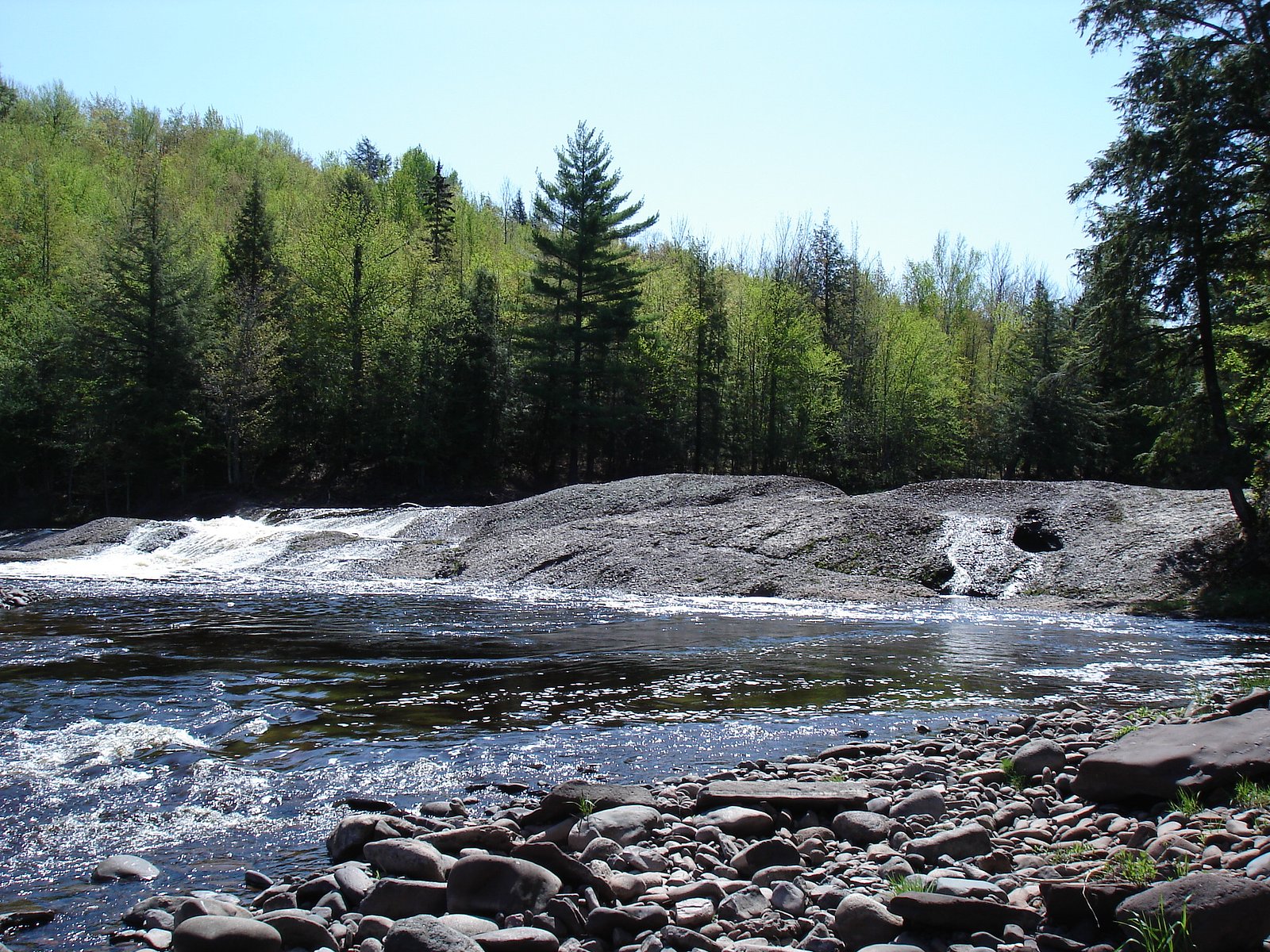
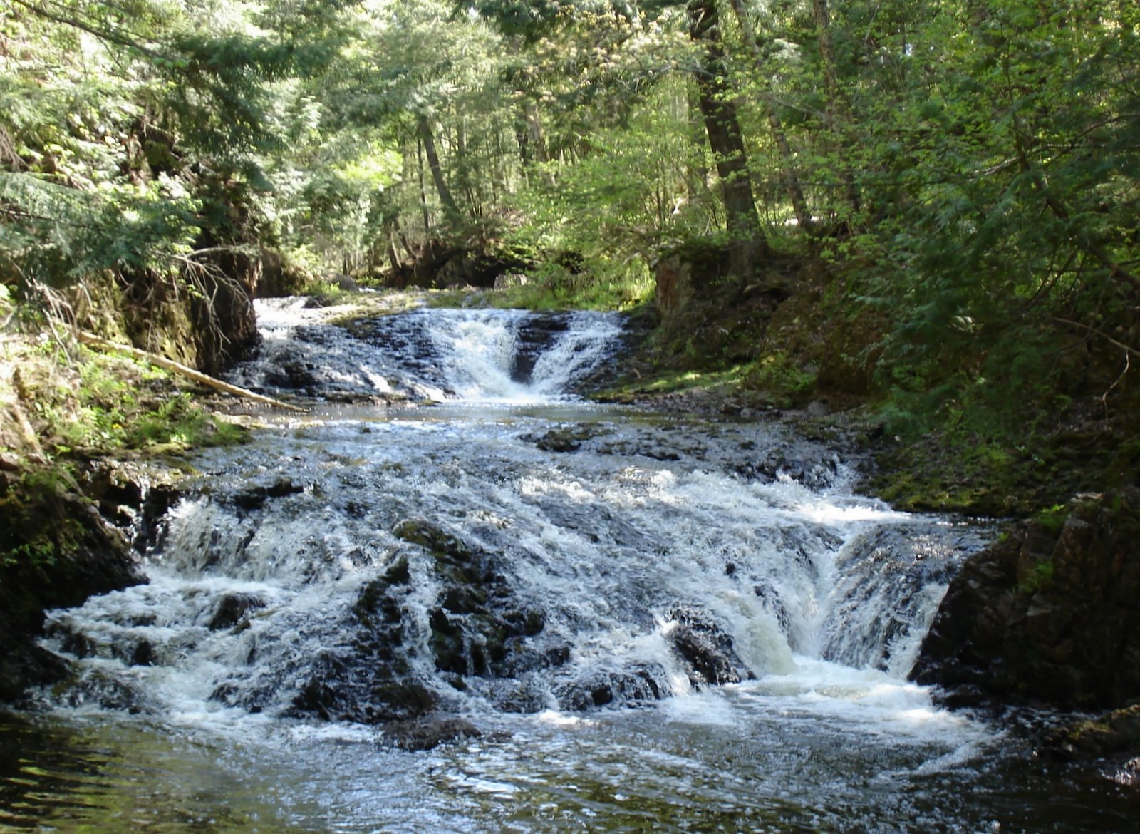
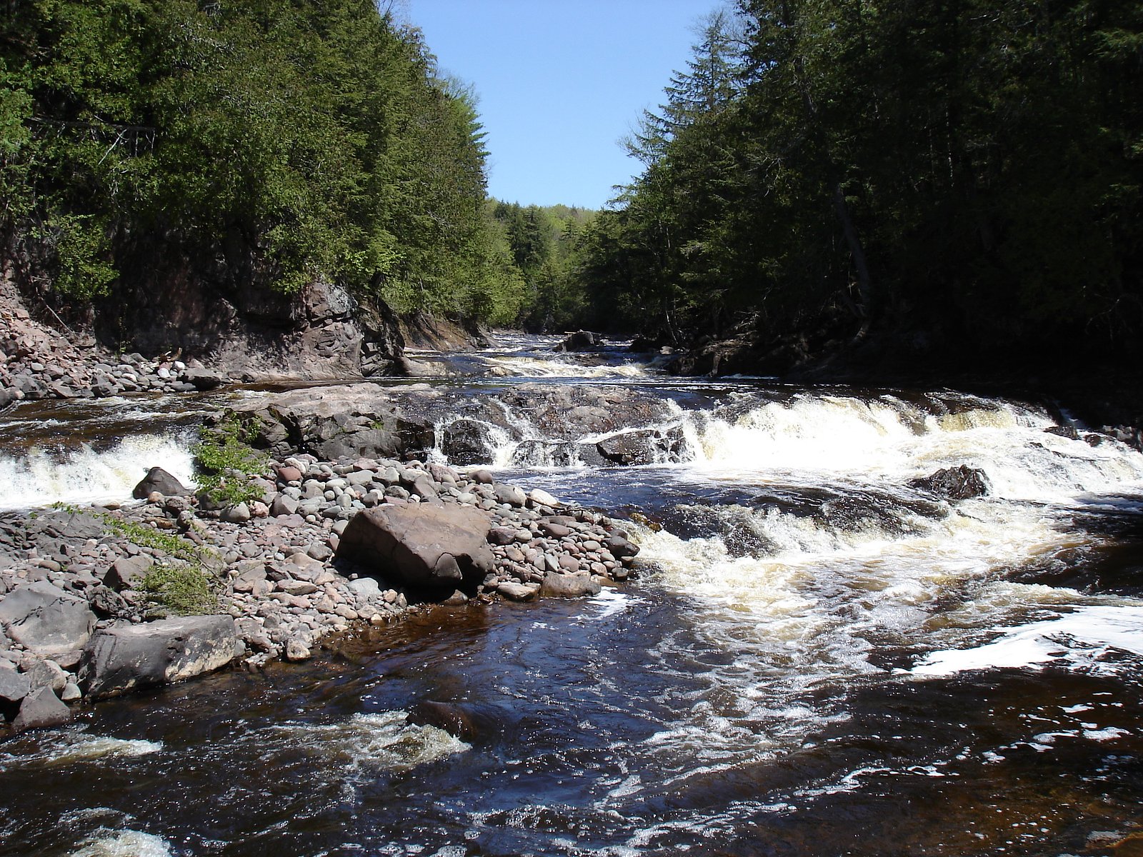
About Lepisto Falls
Lepisto Falls is a small, scenic cascade tucked into the forested interior of Porcupine Mountains Wilderness State Park (land owner: SDNR; designation: SP; manager: SPR) in Michigan’s Upper Peninsula. The falls offer a peaceful spot for reflection away from the busier tourist sites, surrounded by old-growth hemlock and hardwoods that typify the park’s rugged Lake Superior shoreline country. The Porcupine Mountains and the nearby Presque Isle River — a 42.1-mile waterway that flows through both the Ottawa National Forest and Porcupine Mountains Wilderness State Park before emptying into Lake Superior and draining roughly 300 square miles — form a waterfall-rich landscape, and Lepisto is one of the quieter cascades visitors discover while exploring the park. Access is easy for most visitors, making Lepisto a great short outing or a pleasant stop on a longer day of hiking. For overnight options, Black River Harbor Campground lies about 8.43 km away and provides a convenient base for exploring the Porcupine Mountains and its network of rivers and falls.
The Setting
Lepisto Falls sits at 879 feet within Porcupine Mountains Wilderness State Park, fed by the Presque Isle River, in the foothills of Michigan.
Trail & Hike Details
The Approach
The easy 0.6-mile out-and-back trail gains 80 feet of elevation on the way to the falls.
Trail Description
The official trail to Lepisto Falls is an easy 0.6-mile out-and-back with about 80 feet of elevation gain, making it accessible to most hikers. The path winds through forested terrain and follows the local stream corridor described in visitor accounts; the tread is relatively gentle but can be uneven or muddy after rain, so stout footwear is recommended. This short, straightforward route is ideal for a quick scenic stop or a family-friendly walk while touring Porcupine Mountains Wilderness State Park.
What to Expect
Dogs are welcome.
Accessibility
The trail is short and relatively flat, but the surface may be uneven. Contact the managing agency for accessibility details.
Frequently Asked Questions
🐶 Are Dogs Allowed at Lepisto Falls?
✅ Dogs are allowed
Are There Any Fees or Permits Required?
🆖 No fees required
🏊 Is There Swimming at Lepisto Falls?
❌ Swimming is not allowed
When to Visit
Spring and early summer are the best times to visit, as the water flow is usually strongest during these seasons.
Seasonal Access
The best time to visit is Spring, Summer, and Fall. Winter access may be limited.
Safety Information
Be cautious of slippery rocks near the falls, especially after rain. Cell phone service may be limited in the area, so plan accordingly.
Current Water Conditions
88 ft³/s
Current discharge — how much water is flowing
About average for this time of year
Based on 3 years of record
5.49 ft
Water depth at gauge
69°F
CoolRefreshing for swimming
7-Day Discharge Trend
What does this mean for your visit?
Flow is about average for this time of year. Water temperature is a refreshing 69 degrees F, good for a quick swim. Expect adequate dissolved oxygen levels. Mineral content is typical.
Water Quality
Dissolved Oxygen
GoodAdequate oxygen levels
Conductance
Dissolved minerals in the water
About This Gauge
7-Day Flow Outlook
Based on the USGS gauge PRESQUE ISLE RIVER NEAR CONNORVILLE, MI (5 km away).
Today
Barely Flowing
88 cfs
5/10Tomorrow
Barely Flowing
88 cfs
5/10Sun
Low
95 cfs
4/10Mon
Low
103 cfs
3/10Tue
Low
106 cfs
3/10Wed
Low
106 cfs
3/10Thu
Low
106 cfs
3/10Best window: Today — barely flowing flow, partly sunny (trip score 5/10).
How we calculate this
This is a transparent outlook, not a precise forecast. We take the waterfall's current flow strength (how it ranks against its historical normal for today, from the nearest USGS stream gauge), carry that ranking forward along the gauge's seasonal curve, and nudge it for forecast rain. Confidence is highest for the next day or two and falls further out. Always check official conditions and your own judgment before visiting — high flows can be dangerous.
Know when to go.
Get a free email alert when waterfalls near Wakefield hit peak flow. We only send when conditions are worth the trip — no weekly newsletters, no spam.
Weather Forecast
Location & Access
Getting There
Lepisto Falls is located near L'Anse, Michigan, in Baraga County. Access typically involves driving on forest roads, which may be unpaved and rough in some areas. Visitors should use a reliable map or GPS to locate the trailhead.
Get Directions on Google MapsParking
Parking is available near the trailhead, but it may be limited and unpaved. Visitors should be prepared for rustic conditions.
Elevation
879 feet above sea level
Coordinates
46.658866° N, -89.940550° W
Land Management
Managed by SPR
Visitor Tips & Gear
Wear sturdy shoes, as the trail may be muddy or uneven. Bring bug spray during the warmer months to protect against mosquitoes. Consider visiting in the spring when water flow is typically higher.
As an Amazon Associate, we earn from qualifying purchases.
For this easy 0.6 miles trail, lightweight trail shoes and a water bottle are usually sufficient. Sun exposure on the trail makes good sun protection a must in summer.

Polarized Sunglasses (Knockaround)
Cuts glare off the water so you actually see the falls — and your photos turn out better too.

Columbia Watertight II Rain Jacket
Packs into its own pocket, seam-sealed, and keeps you dry from spray and surprise rain.

Earth Pak Waterproof Dry Bag
Keeps your phone and gear dry when waterfall mist soaks everything else.

Waterproof Phone Pouch (AiRunTech)
Cheap insurance — take photos right next to the falls without killing your phone.

JOBY GorillaPod Starter Kit
Wraps around railings and rocks for long-exposure waterfall shots — no flat surface needed.

Osprey Daylite Daypack
Light, organized, and just the right size for a day hike — fits water, snacks, and layers.
Where to Stay

Snow Otter Haus - 2

Snow Otter Haus - 1

Quality Inn Ironwood

North Ironwood Acres - Black River Lodge
Browse vacation cabins and private rentals nearby
Unique outdoor stays — tents, yurts, and treehouses
Rent a campervan or RV for your waterfall road trip
Some links are affiliate links. We may earn a commission at no extra cost to you.
Nearby Campground
BLACK RIVER HARBOR CAMPGROUND
5.2 miles away · 40 sites
Overview Planning a trip to the Black River Harbor Campground? Watch for Alerts at the top of the page for any Alerts regarding this facility. Black River Campground is adjacent to the Black River Harbor Recreation Area. The recreation area includes a pavilion, harbor and a large picnic area. The area provides for many opportunities for fishing, boating, backpacking, hiking, bird watching, photography and beautiful scenery for relaxation in the outdoors. Recreation The campground is adjacent to
Book on Recreation.govAdditional Information
Nearby Attractions
Other waterfalls in the area include Slate River Falls and Canyon Falls. The town of L'Anse offers dining and lodging options.
Wildlife
The area is home to a variety of wildlife, including birds, deer, and small mammals. Visitors should be cautious of ticks and other insects.
Cities near Lepisto Falls
Nearby Waterfalls

Writing about Lepisto Falls? Embed this waterfall on your site for free.