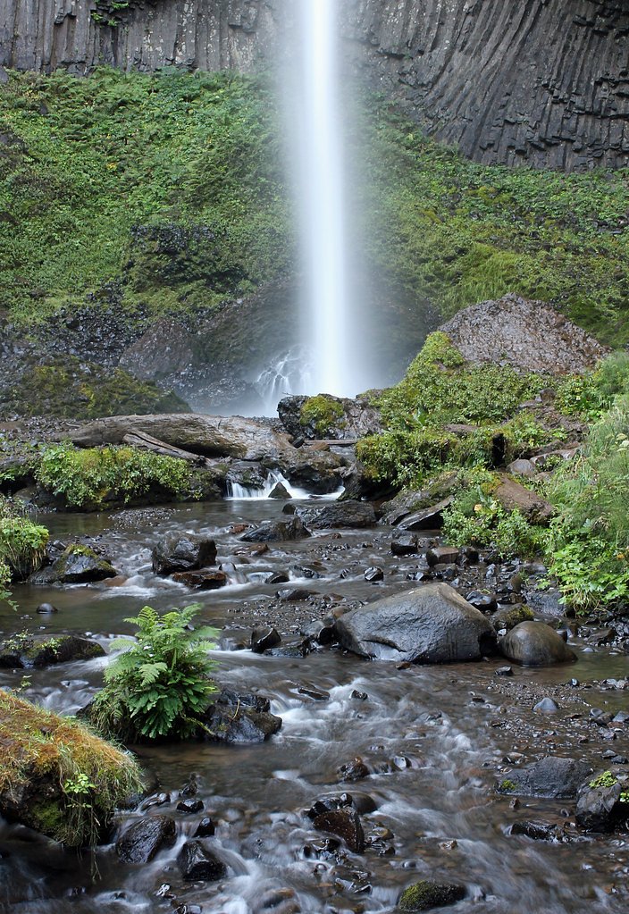
Latourell Falls
Oregon • 224 ft
By Armen Suny · Last verified Mar 2026
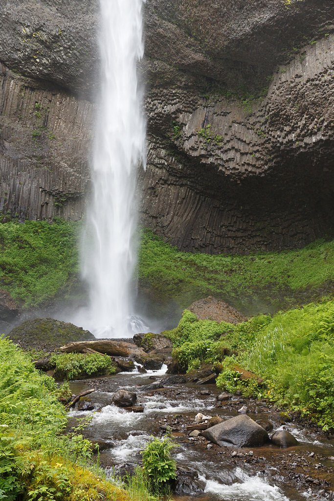
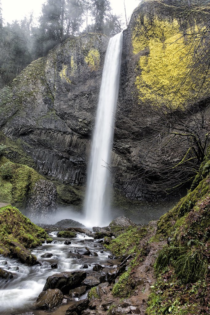
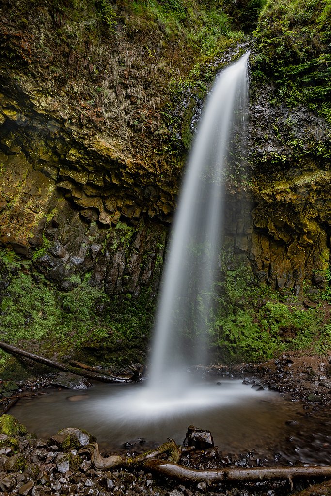
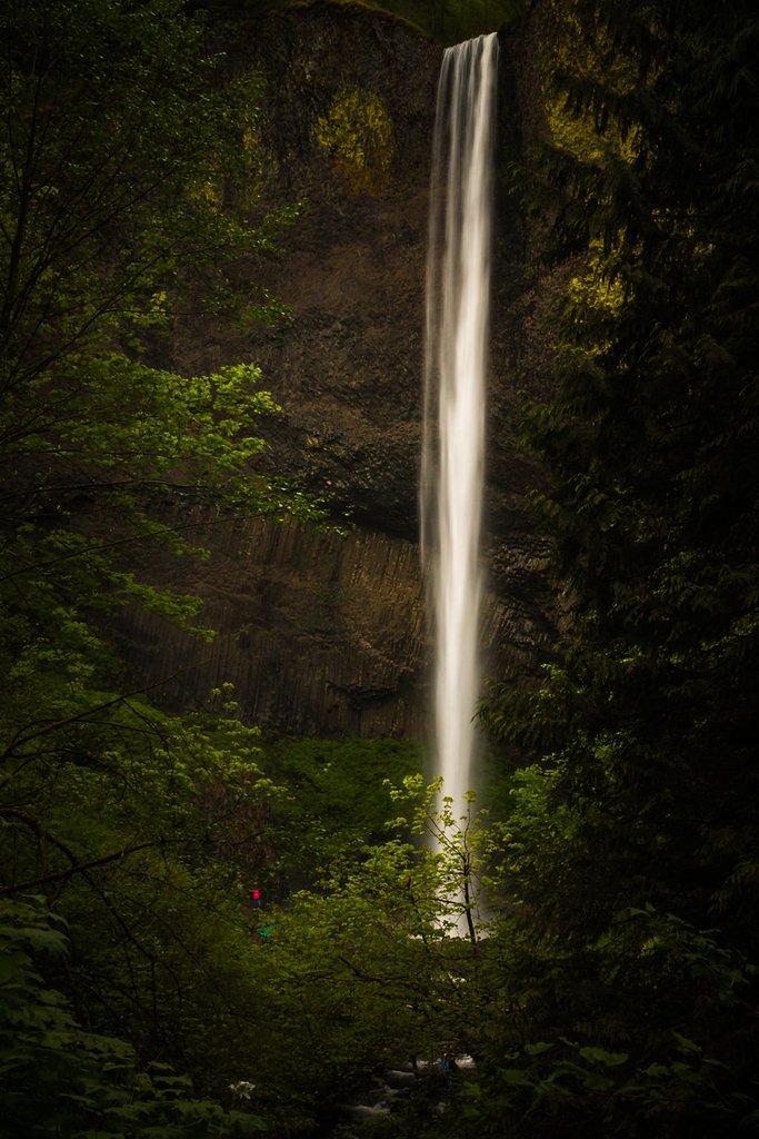

Photo Credits (5)
Difficulty
Moderate
Trail Length
2.4 miles
Trail Type
Loop
Elevation Gain
620 ft
About Latourell Falls
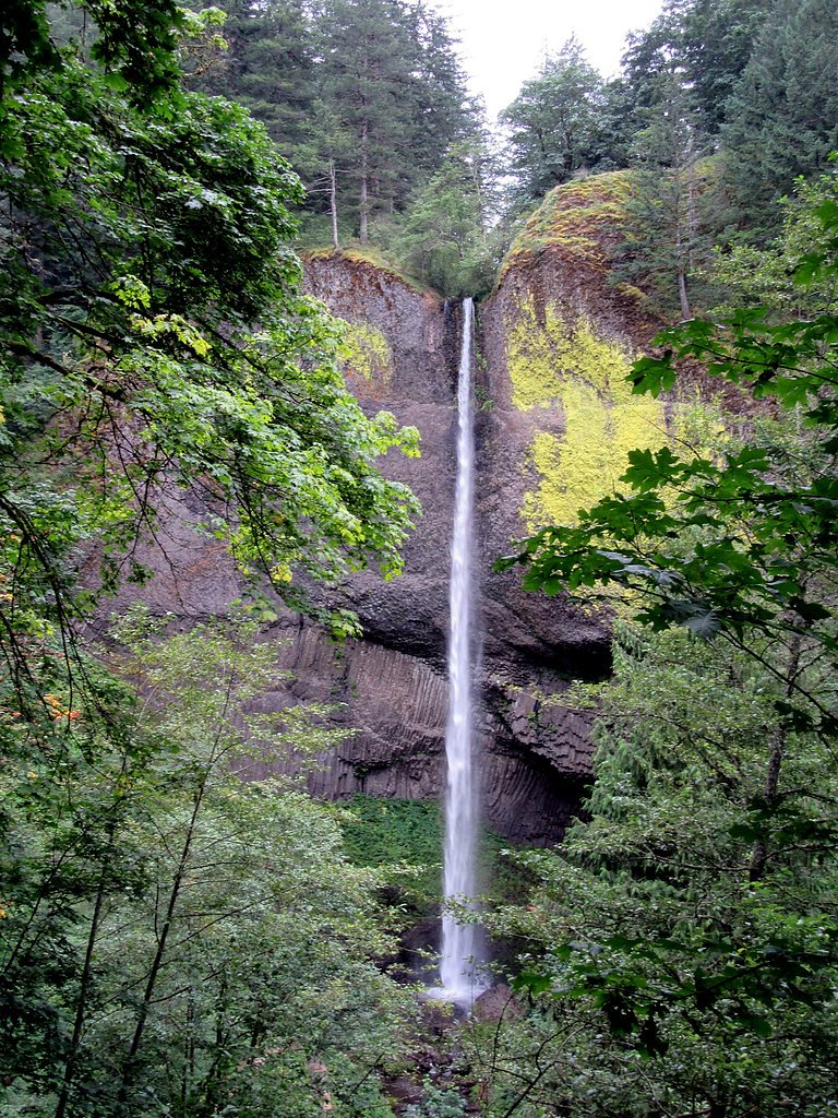
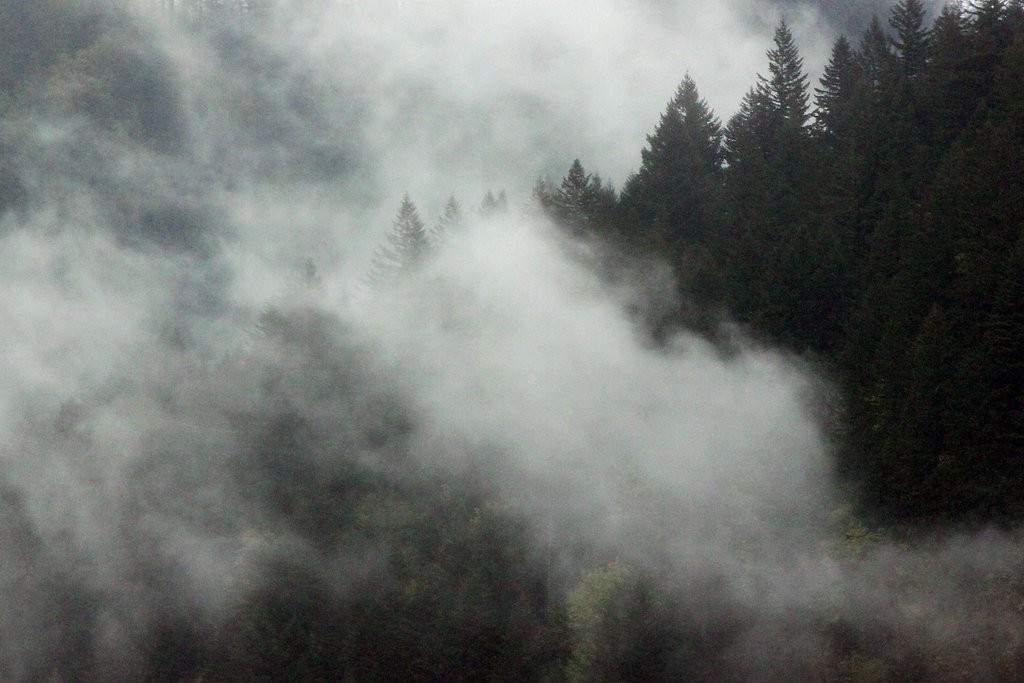
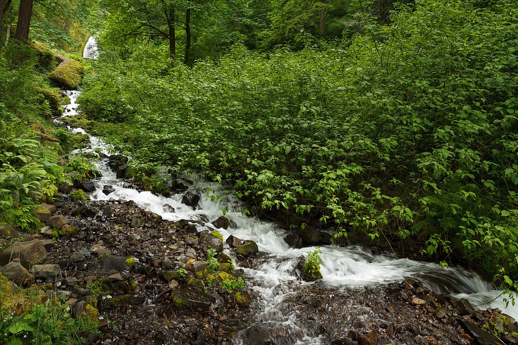
Latourell Falls is a stunning waterfall located in the Columbia River Gorge in Oregon. It is known for its dramatic plunge of water over a basalt cliff, surrounded by lush greenery and moss-covered rocks. The waterfall is part of Guy W. Talbot State Park and is one of the most accessible waterfalls in the area.
The Setting
Latourell Falls sits at 367 feet within Guy W. Talbot State Park, fed by the Sandy River, in the coastal lowlands of Oregon. At 224 feet, it is among the taller waterfalls in Oregon.
Height: 224 feet
Nearby Falls Worth Visiting
Wahkeena Falls (242 ft) lies 5.1 miles to the east. Also nearby: Coopey Falls (150 ft, 3.1 mi) and Bridal Veil Falls (120 ft, 2.2 mi).
Trail & Hike Details
The Approach
The moderate 2.4-mile loop trail gains 620 feet of elevation on the way to the falls.
Trail Description
The trail to Latourell Falls offers a scenic loop that takes visitors to both the lower and upper falls. The path is well-maintained but includes some steep sections and uneven terrain. The lower falls are visible near the parking area, while the upper falls require a moderate hike through a forested area.
What to Expect
The falls plunge 224 feet. Dogs are welcome.
Accessibility
The trail is not wheelchair accessible. Uneven terrain and elevation changes require steady footing.
Frequently Asked Questions
🐶 Are Dogs Allowed at Latourell Falls?
✅ Dogs are allowed
Are There Any Fees or Permits Required?
🆖 No fees required
🏊 Is There Swimming at Latourell Falls?
❌ Swimming is not allowed
When to Visit
Spring and early summer are ideal for visiting, as the waterfall flow is at its peak due to snowmelt. Fall offers beautiful foliage, while winter provides a quieter experience with potential icy conditions.
Seasonal Access
The best time to visit is Spring, Summer, Fall, and Winter.
Safety Information
The trail can be slippery, especially after rain. Stay on marked paths and avoid getting too close to the edge of the waterfall. Be cautious of falling rocks and debris.
Current Water Conditions
526 ft³/s
Current discharge — how much water is flowing
Much lower than usual for this time of year
Based on 81 years of record
8.08 ft
Water depth at gauge
60°F
ColdBracing — limit time in water
7-Day Discharge Trend
What does this mean for your visit?
Flow is well below normal for this time of year, so the waterfall may be a trickle. Water temperature is a bracing 60 degrees F, limit your time in the water.
About This Gauge
This gauge is on a nearby waterway and may not reflect exact conditions at the falls.
7-Day Flow Outlook
Based on the USGS gauge SANDY RIVER BLW BULL RUN RIVER, NR BULL RUN, OR (10 km away).
Today
Strong
600 cfs
7/10Tomorrow
Strong
588 cfs
8/10Mon
Strong
545 cfs
8/10Tue
Strong
532 cfs
8/10Wed
Strong
521 cfs
8/10Thu
Strong
509 cfs
8/10Fri
Strong
511 cfs
8/10Best window: Tomorrow — strong flow, rain showers (trip score 8/10).
Best time of year: this gauge typically runs highest from late March to mid May, peaking in April.
How we calculate this
This is a transparent outlook, not a precise forecast. We take the waterfall's current flow strength (how it ranks against its historical normal for today, from the nearest USGS stream gauge), carry that ranking forward along the gauge's seasonal curve, and nudge it for forecast rain. Confidence is highest for the next day or two and falls further out. Always check official conditions and your own judgment before visiting — high flows can be dangerous.
Know when to go.
Get a free email alert when waterfalls near Troutdale hit peak flow. We only send when conditions are worth the trip — no weekly newsletters, no spam.
Weather Forecast
Location & Access
Getting There
Latourell Falls is located along the Historic Columbia River Highway, approximately 30 miles east of Portland, Oregon. The trailhead is well-marked and easily accessible by car.
Get Directions on Google MapsParking
There is a parking lot near the trailhead, but it can fill up quickly during peak times. Arrive early to secure a spot.
Elevation
367 feet above sea level
Coordinates
45.536854° N, -122.218135° W
Land Management
Managed by CITY
Visitor Tips & Gear
Wear sturdy shoes as the trail can be muddy, especially after rain. Arrive early to avoid crowds and secure parking. Bring a camera to capture the stunning scenery.
As an Amazon Associate, we earn from qualifying purchases.
With 2.4 miles and 620 ft of elevation gain, sturdy boots and trekking poles will help on this moderate trail. Icy conditions are common in winter — traction cleats are a smart addition.

Columbia Watertight II Rain Jacket
Packs into its own pocket, seam-sealed, and keeps you dry from spray and surprise rain.

Polarized Sunglasses (Knockaround)
Cuts glare off the water so you actually see the falls — and your photos turn out better too.

Earth Pak Waterproof Dry Bag
Keeps your phone and gear dry when waterfall mist soaks everything else.

Waterproof Phone Pouch (AiRunTech)
Cheap insurance — take photos right next to the falls without killing your phone.

Timberland Euro Sprint Mid Waterproof
Trusted waterproof boot with premium leather and grippy rubber sole — reliable on rocky, wet trails.

TrailBuddy Trekking Poles
Lightweight aluminum, cork grips, and flip-locks that actually hold — a best-seller for good reason.
Where to Stay

Mount Hood Village

Comfort Inn Troutdale-Portland East

Mt Air Motel

Courtyard by Marriott Portland East
Browse vacation cabins and private rentals nearby
Unique outdoor stays — tents, yurts, and treehouses
Rent a campervan or RV for your waterfall road trip
Some links are affiliate links. We may earn a commission at no extra cost to you.
Nearby Campground
EAGLE CREEK OVERLOOK GRP SITE
15.7 miles away · 1 sites
Overview Eagle Creek Overlook Group Site is set on a forested bluff above the Columbia River, providing an ideal setting for family gatherings and group events. Developed by the Civilian Conservation Corps (CCC) in the 1930s as a place to view construction of the Bonneville Dam, this site features CCC masonry and offers expansive views of the Columbia River and mountains rising from the gorge.Recreation The Eagle Recreation Area, just a short walk or bike ride away, provides visitors with opportu
Book on Recreation.govNearby Hot Springs
Hot springs near Troutdale, Oregon
Moffetts (Bonneville) Hot Springs
Moffetts Hot Springs, also called Bonneville Hot Springs, flows at 97 degrees in the Gifford Pinchot National Forest at just 75...
Rock Creek Hot Springs
Rock Creek Hot Springs emerges in the Columbia River Gorge in Skamania County, Washington, with water documented as 'hot' witho...
St Martins Hot Springs
St. Martins Hot Springs flows at 120 degrees Fahrenheit at just 432 feet elevation in the Columbia River Gorge near Carson in S...

Collins Hot Springs
Collins Hot Springs emerges at 122 degrees just 127 feet above sea level in the Columbia River Gorge, producing water 68.4 degr...

Mount Hood Fumaroles
Mount Hood Fumaroles vent at 194°F from the flanks of Oregon's highest peak, among the state's most extreme geothermal features...

Bagby Hot Springs
Bagby Hot Springs flows at 136°F deep in Mount Hood National Forest at 2,272 feet elevation, requiring a 3,720-foot hike from F...
Looking for a soak after your hike? Explore more hot springs near Troutdale, Oregon on SoakingSprings.
Explore Oregon springsAdditional Information
Nearby Attractions
Other waterfalls in the Columbia River Gorge, such as Multnomah Falls and Bridal Veil Falls, are located nearby. The Historic Columbia River Highway offers scenic viewpoints and picnic areas.
Wildlife
Visitors may encounter birds, squirrels, and other small forest animals. Keep an eye out for native plants and wildflowers along the trail.
Cities near Latourell Falls
Nearby Waterfalls
Writing about Latourell Falls? Embed this waterfall on your site for free.