Photo Credits (5)
Difficulty
Moderate
Trail Length
5.0 miles
Trail Type
Out And Back
Elevation Gain
300 ft
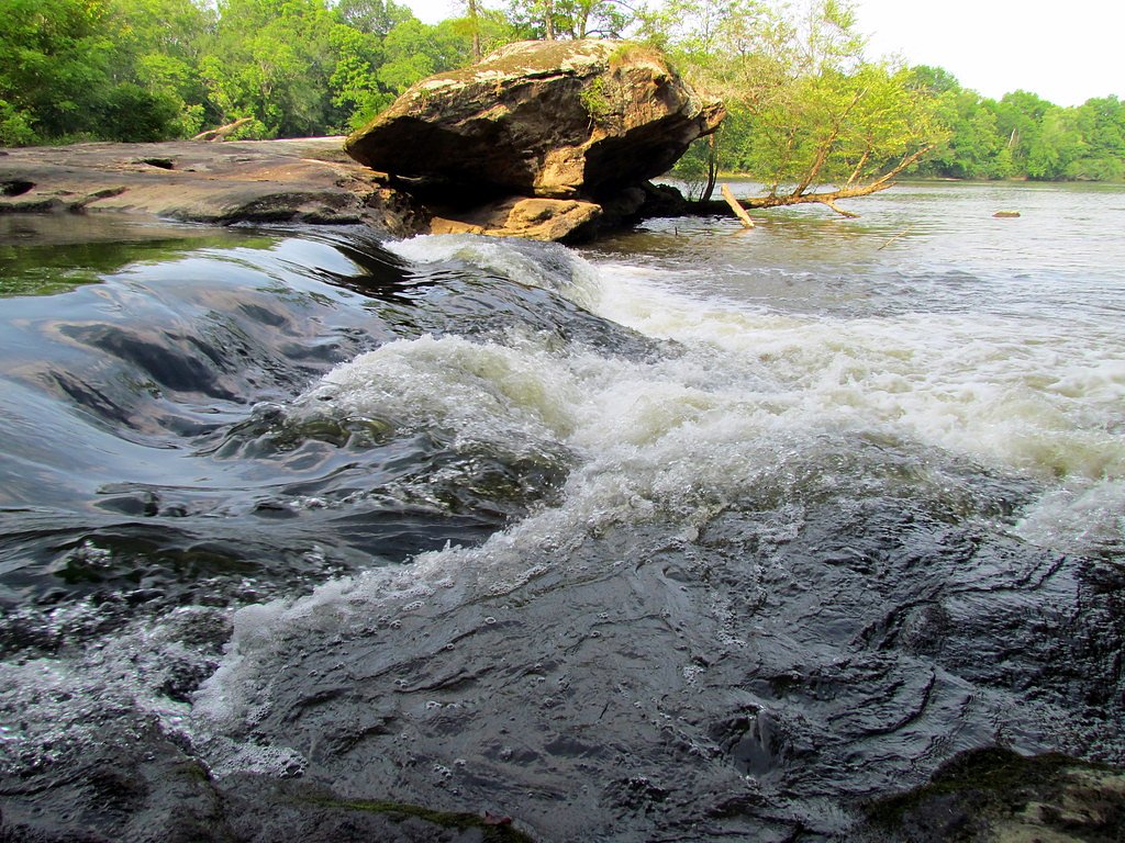
About Lanier Falls
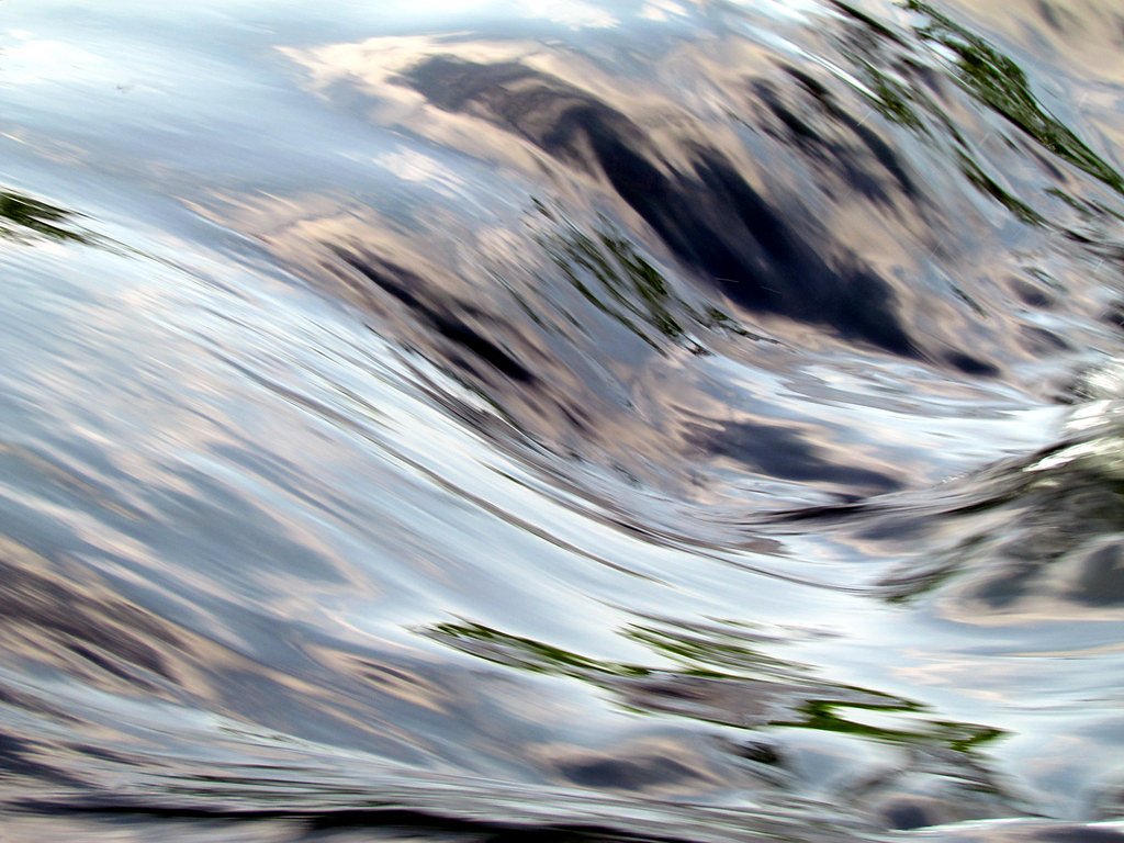
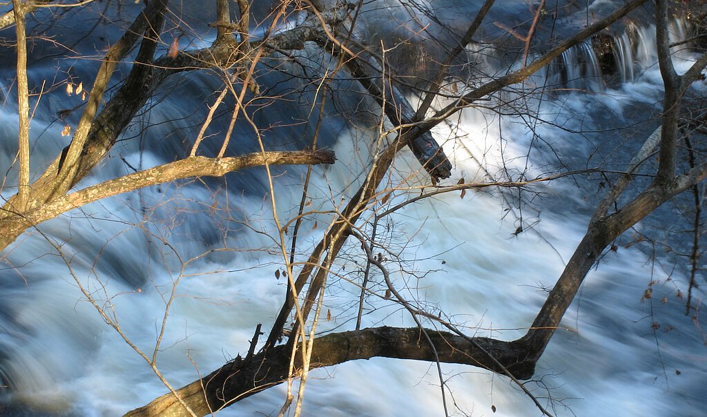
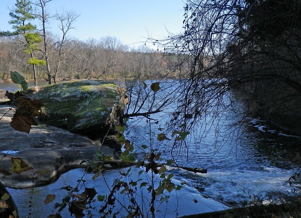
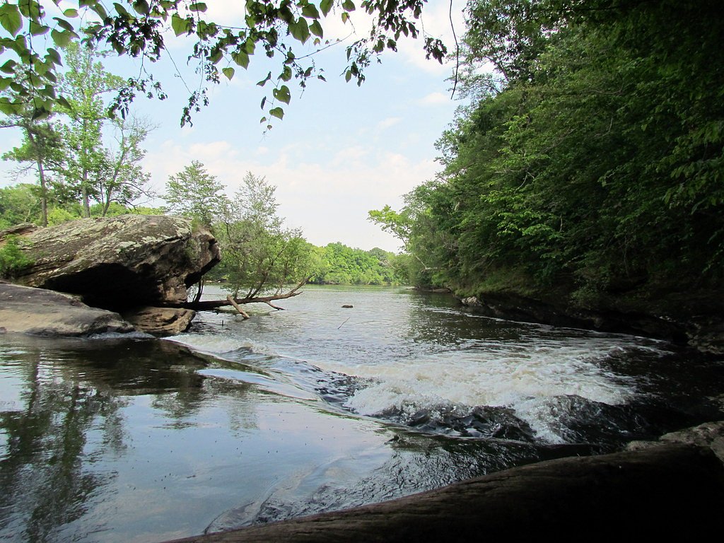
Lanier Falls is a small but scenic waterfall located within Raven Rock State Park in North Carolina. The falls are part of the Cape Fear River and are more of a cascading rapid than a traditional vertical waterfall. It is a popular destination for hikers and nature enthusiasts.
The Setting
Lanier Falls sits at 131 feet within Raven Rock State Park, fed by the Buckhorn Creek, in the coastal lowlands of North Carolina.
Trail & Hike Details
The Approach
The moderate 5.0-mile out-and-back trail gains 300 feet of elevation on the way to the falls.
Trail Description
The trail to Lanier Falls is a moderately challenging hike that takes visitors through a forested area with some elevation changes. The trail is well-marked and includes sections of dirt paths and rocky terrain. The final approach to the falls involves a short descent to the riverbank.
What to Expect
Dogs are welcome.
Accessibility
The trail is not wheelchair accessible. Uneven terrain and elevation changes require steady footing.
Frequently Asked Questions
🐶 Are Dogs Allowed at Lanier Falls?
✅ Dogs are allowed
Are There Any Fees or Permits Required?
🆖 No fees required
🏊 Is There Swimming at Lanier Falls?
❌ Swimming is not allowed
When to Visit
Spring and fall are the best times to visit due to mild weather and vibrant foliage. Summer is also popular, but the trail can be hot and humid.
Seasonal Access
The best time to visit is Spring, Summer, and Fall. Winter access may be limited.
Safety Information
The rocks near the falls can be slippery, especially after rain. Stay on marked trails and avoid getting too close to the water's edge. Be aware of ticks and other insects in the area.
Current Water Conditions
1 ft³/s
Current discharge — how much water is flowing
About average for this time of year
Based on 45 years of record
1.71 ft
Water depth at gauge
7-Day Discharge Trend
What does this mean for your visit?
Flow is about average for this time of year.
About This Gauge
This gauge is on a nearby waterway and may not reflect exact conditions at the falls.
7-Day Flow Outlook
Based on the USGS gauge BUCKHORN CREEK NR CORINTH, NC (10 km away).
Today
Strong
2 cfs
10/10Tomorrow
Strong
1 cfs
10/10Wed
Strong
1 cfs
10/10Thu
Strong
2 cfs
10/10Fri
Strong
1 cfs
10/10Sat
Roaring
1 cfs
6/10Sun
Roaring
1 cfs
6/10Best window: Today — strong flow, partly sunny (trip score 10/10).
Best time of year: this gauge typically runs highest from mid January to mid April, peaking in March.
How we calculate this
This is a transparent outlook, not a precise forecast. We take the waterfall's current flow strength (how it ranks against its historical normal for today, from the nearest USGS stream gauge), carry that ranking forward along the gauge's seasonal curve, and nudge it for forecast rain. Confidence is highest for the next day or two and falls further out. Always check official conditions and your own judgment before visiting — high flows can be dangerous.
Know when to go.
Get a free email alert when waterfalls near Mamers hit peak flow. We only send when conditions are worth the trip — no weekly newsletters, no spam.
Weather Forecast
Location & Access
Getting There
Lanier Falls is located within Raven Rock State Park. The park is accessible via Raven Rock Road, off US-401 near Lillington, North Carolina. From the main parking area, visitors can access the trailhead leading to the falls.
Get Directions on Google MapsParking
Parking is available at the main Raven Rock State Park parking lot. Spaces are typically sufficient, but it may get crowded on weekends and holidays.
Elevation
131 feet above sea level
Coordinates
35.479324° N, -78.929463° W
Land Management
Managed by UNK
Visitor Tips & Gear
Wear sturdy hiking shoes as the trail can be uneven and rocky in places. Bring water and snacks, especially during warmer months. Bug spray is recommended due to mosquitoes in the area. Arrive early to secure parking and avoid crowds.
As an Amazon Associate, we earn from qualifying purchases.
With 5.0 miles and 300 ft of elevation gain, sturdy boots and trekking poles will help on this moderate trail. Sun exposure on the trail makes good sun protection a must in summer.

Polarized Sunglasses (Knockaround)
Cuts glare off the water so you actually see the falls — and your photos turn out better too.

Columbia Watertight II Rain Jacket
Packs into its own pocket, seam-sealed, and keeps you dry from spray and surprise rain.

Earth Pak Waterproof Dry Bag
Keeps your phone and gear dry when waterfall mist soaks everything else.

Waterproof Phone Pouch (AiRunTech)
Cheap insurance — take photos right next to the falls without killing your phone.

Timberland Euro Sprint Mid Waterproof
Trusted waterproof boot with premium leather and grippy rubber sole — reliable on rocky, wet trails.

TrailBuddy Trekking Poles
Lightweight aluminum, cork grips, and flip-locks that actually hold — a best-seller for good reason.
Where to Stay

Holiday Inn Express Holly Springs - Raleigh Area by IHG

Holiday Inn Express Hotel & Suites Sanford by IHG

Comfort Suites Sanford

Hampton Inn & Suites Holly Springs
Browse vacation cabins and private rentals nearby
Unique outdoor stays — tents, yurts, and treehouses
Rent a campervan or RV for your waterfall road trip
Some links are affiliate links. We may earn a commission at no extra cost to you.
Nearby Campground
Poplar Point
17.6 miles away · 0 sites
This recreation area is part of B. Everett Jordan Lake
Book on Recreation.govAdditional Information
Nearby Attractions
Raven Rock, a large rock formation within the park, is another popular destination. The park also offers other hiking trails and picnic areas.
Wildlife
The area is home to various wildlife, including deer, birds, and small mammals. Be cautious of snakes, especially during warmer months.
Cities near Lanier Falls
Writing about Lanier Falls? Embed this waterfall on your site for free.