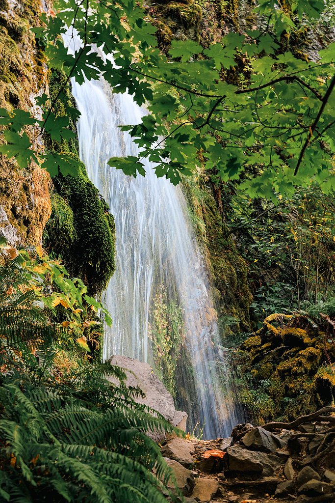
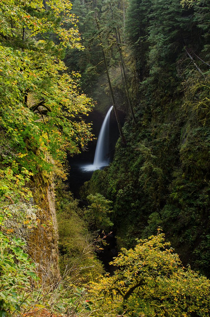
Lancaster Falls
By Armen Suny · Last verified Mar 2026
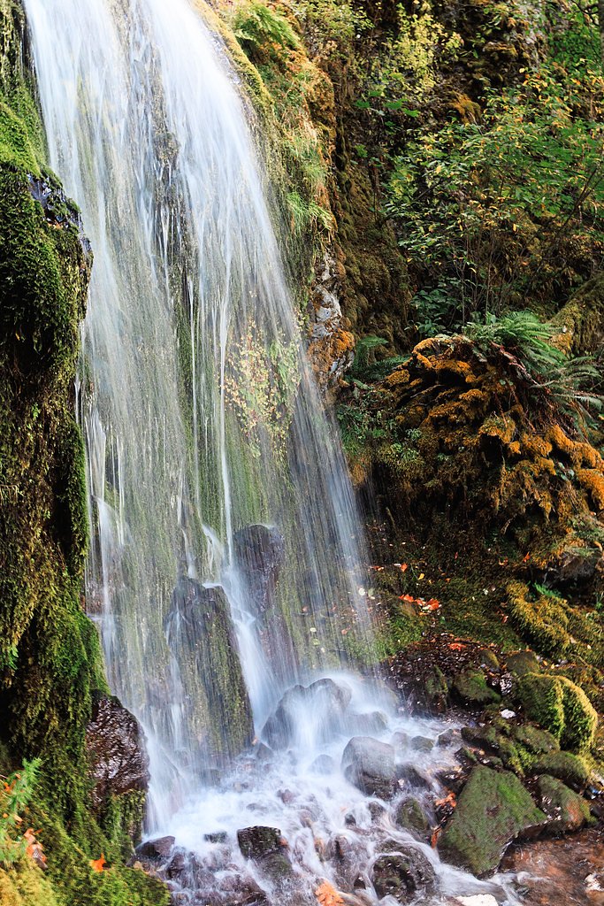
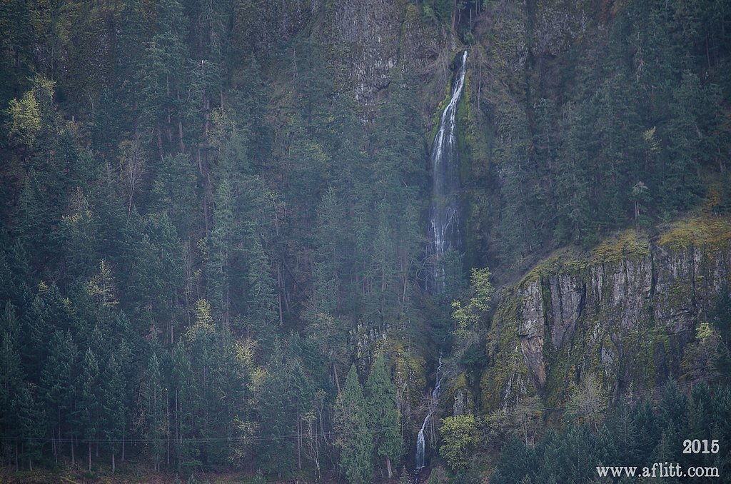
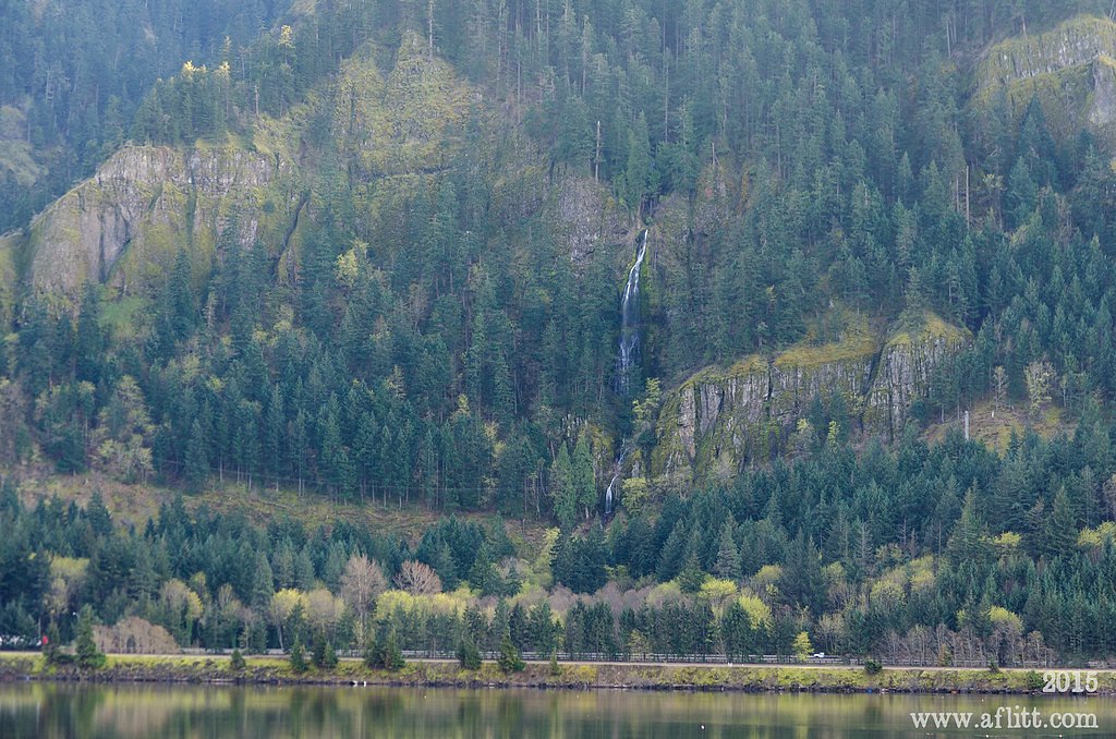
Photo Credits (5)
Difficulty
Moderate
Trail Length
2.6 miles
Trail Type
Out And Back
Elevation Gain
600 ft
About Lancaster Falls
Lancaster Falls is a picturesque, moss-draped cascade tucked into the Columbia River Gorge along the Historic Columbia River Highway in Hood River County, Oregon. The falls sit within the Starvation Creek State Park pocket of the Mt. Hood National Forest and are managed by the U.S. Forest Service. According to Wikipedia, Starvation Creek State Park is a concentrated waterfall area — Cabin Creek Falls, Hole In the Wall Falls, Lancaster Falls, and Starvation Creek Falls all lie within about two miles of one another — making Lancaster Falls an easy add-on when exploring the Gorge’s iconic roadside waterfalls. The setting is lush and inviting, with moss-covered cliffs and forested trails that reward short hikes with close-up views. Lancaster Falls is a popular stop for day-hikers driving the Historic Columbia River Highway corridor; the broader park even contains Starvation Creek Falls, noted on Wikipedia as a two-tier waterfall, so there’s plenty of waterfall viewing within a compact area under Mt. Hood National Forest stewardship.
The Setting
Lancaster Falls sits at 358 feet within Mt. Hood National Forest, fed by the Hood River, in the coastal lowlands of Oregon.
Nearby Falls Worth Visiting
Wah Gwin Gwin Falls (208 ft) lies 7.6 miles to the east. Also nearby: Metlako Falls (101 ft, 10.1 mi) and Punchbowl Falls (35 ft, 6.6 mi).
Trail & Hike Details
The Approach
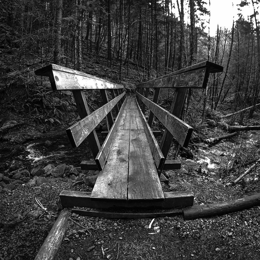
The moderate hike follows Starvation Ridge (#414), a 2.6-mile out-and-back trail over natural surface. Expect 600 feet of elevation gain with grades of 12-20%. The trail is moderately developed (Class 2).
USFS Trail
STARVATION RIDGE #414
Trail Class
Moderately Developed
Surface
Avg Grade
USFS Segment
0.10 miTrail Description
The official approach uses the Starvation Creek State Park parking area and the Historic Columbia River Highway corridor described in park materials. From that trailhead the USFS Starvation Ridge Trail (Trail #414) provides the maintained footpath to viewpoints. Per USFS data, Starvation Ridge Trail #414 is Class 2, primarily surfaced with native material, and typically steeper in places with grades of about 12–20% (GIS segment ~0.1 miles). The overall visit to Lancaster Falls is commonly done as a 2.6-mile out-and-back with roughly 600 feet of elevation gain and a moderate difficulty rating. Expect well-maintained sections interspersed with some rocky stretches and moderate climbs as you move through the forested gorge to the waterfall outlooks.
What to Expect
Dogs are welcome.
Accessibility
The trail is not wheelchair accessible. Uneven terrain and elevation changes require steady footing.
Frequently Asked Questions
🐶 Are Dogs Allowed at Lancaster Falls?
✅ Dogs are allowed
Are There Any Fees or Permits Required?
🆖 No fees required
🏊 Is There Swimming at Lancaster Falls?
❌ Swimming is not allowed
When to Visit
Spring and early summer are the best times to visit, as the waterfall flow is strongest due to snowmelt. Fall offers beautiful foliage, while winter may bring icy conditions.
Seasonal Access
The best time to visit is Spring, Summer, and Fall. Winter access may be limited. Check with Mt. Hood National Forest for seasonal road closures.
Safety Information
The trail can be slippery, especially during wet or icy conditions. Stay on the designated trail to avoid damaging the environment or risking injury. Watch for falling rocks near the waterfall.
Current Water Conditions
241 ft³/s
Current discharge — how much water is flowing
Much lower than usual for this time of year
Based on 62 years of record
2.59 ft
Water depth at gauge
57°F
ColdBracing — limit time in water
7-Day Discharge Trend
What does this mean for your visit?
Flow is well below normal for this time of year, so the waterfall may be a trickle. Water temperature is a bracing 57 degrees F, limit your time in the water.
About This Gauge
This gauge is on a nearby waterway and may not reflect exact conditions at the falls.
7-Day Flow Outlook
Based on the USGS gauge HOOD RIVER AT TUCKER BRIDGE, NEAR HOOD RIVER, OR (13 km away).
Today
Low
260 cfs
4/10Tomorrow
Low
289 cfs
4/10Sun
Low
269 cfs
4/10Mon
Low
249 cfs
4/10Tue
Low
249 cfs
4/10Wed
Low
241 cfs
4/10Thu
Low
234 cfs
4/10Best window: Today — low flow, rain showers (trip score 4/10).
Best time of year: this gauge typically runs highest from early April to early May, peaking in January.
How we calculate this
This is a transparent outlook, not a precise forecast. We take the waterfall's current flow strength (how it ranks against its historical normal for today, from the nearest USGS stream gauge), carry that ranking forward along the gauge's seasonal curve, and nudge it for forecast rain. Confidence is highest for the next day or two and falls further out. Always check official conditions and your own judgment before visiting — high flows can be dangerous.
Know when to go.
Get a free email alert when waterfalls near Carson hit peak flow. We only send when conditions are worth the trip — no weekly newsletters, no spam.
Weather Forecast
Location & Access
Getting There
Lancaster Falls is located along the Historic Columbia River Highway, near the town of Cascade Locks, Oregon. It is accessible via the Starvation Creek State Park parking area.
Get Directions on Google MapsParking
Parking is available at the Starvation Creek State Park parking lot, which is located off Interstate 84. The parking area can fill up quickly during peak seasons.
Elevation
358 feet above sea level
Coordinates
45.684760° N, -121.706133° W
Land Management
Managed by USFS
Visitor Tips & Gear
Arrive early to secure parking, especially during weekends and peak seasons. Bring water and wear sturdy hiking shoes. Be prepared for changing weather conditions, as the Columbia River Gorge can be windy and rainy.
As an Amazon Associate, we earn from qualifying purchases.
With 2.6 miles and 600 ft of elevation gain, sturdy boots and trekking poles will help on this moderate trail. Sun exposure on the trail makes good sun protection a must in summer.

Polarized Sunglasses (Knockaround)
Cuts glare off the water so you actually see the falls — and your photos turn out better too.

Columbia Watertight II Rain Jacket
Packs into its own pocket, seam-sealed, and keeps you dry from spray and surprise rain.

Earth Pak Waterproof Dry Bag
Keeps your phone and gear dry when waterfall mist soaks everything else.

Waterproof Phone Pouch (AiRunTech)
Cheap insurance — take photos right next to the falls without killing your phone.

Timberland Euro Sprint Mid Waterproof
Trusted waterproof boot with premium leather and grippy rubber sole — reliable on rocky, wet trails.

TrailBuddy Trekking Poles
Lightweight aluminum, cork grips, and flip-locks that actually hold — a best-seller for good reason.
Where to Stay

Westcliff Lodge

Carson Hot Springs Resort & Spa

Mt Adams View, walk to downtown HR

Skamania Lodge
Browse vacation cabins and private rentals nearby
Unique outdoor stays — tents, yurts, and treehouses
Rent a campervan or RV for your waterfall road trip
Some links are affiliate links. We may earn a commission at no extra cost to you.
Nearby Campground
Moss Creek campground
8.5 miles away · 17 sites
Overview Located in the southeast corner of the Gifford-Pinchot National Forest and close to Columbia River Gorge, Moss Creek Campground sits alongside the Little White Salmon River. At an elevation of 1,400 feet, the campground is shaded by a thick canopy of hemlock, cedars, firs and maples. Moss Creek is ideal for those wishing to escape the summer heat.Recreation The Little White Salmon River offers rainbow and brook trout for anglers. Visitors can enjoy wading in the cool waters. Facilities T
Book on Recreation.govNearby Hot Springs
Hot springs near Carson, Oregon

Collins Hot Springs
Collins Hot Springs emerges at 122 degrees just 127 feet above sea level in the Columbia River Gorge, producing water 68.4 degr...
St Martins Hot Springs
St. Martins Hot Springs flows at 120 degrees Fahrenheit at just 432 feet elevation in the Columbia River Gorge near Carson in S...
Rock Creek Hot Springs
Rock Creek Hot Springs emerges in the Columbia River Gorge in Skamania County, Washington, with water documented as 'hot' witho...
Moffetts (Bonneville) Hot Springs
Moffetts Hot Springs, also called Bonneville Hot Springs, flows at 97 degrees in the Gifford Pinchot National Forest at just 75...

Mount Hood Fumaroles
Mount Hood Fumaroles vent at 194°F from the flanks of Oregon's highest peak, among the state's most extreme geothermal features...

Swim Warm Springs
Swim Warm Springs emerges at 79°F within Mount Hood National Forest at 4,063 feet elevation, flowing just 6.9 meters from White...
Looking for a soak after your hike? Explore more hot springs near Carson, Oregon on SoakingSprings.
Explore Oregon springsAdditional Information
Nearby Attractions
Other nearby waterfalls include Starvation Creek Falls, Cabin Creek Falls, and Hole-in-the-Wall Falls. The Columbia River Gorge offers numerous hiking trails and scenic viewpoints.
Wildlife
The area is home to a variety of wildlife, including birds, deer, and small mammals. Keep an eye out for native plants and wildflowers along the trail.
Cities near Lancaster Falls
Nearby Waterfalls
Writing about Lancaster Falls? Embed this waterfall on your site for free.