Kilgores Rocks
Maryland • 17 ft
By Armen Suny · Last verified Mar 2026
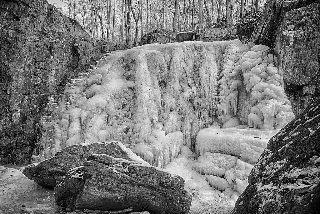
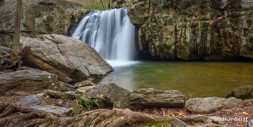
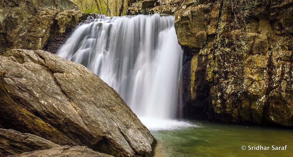
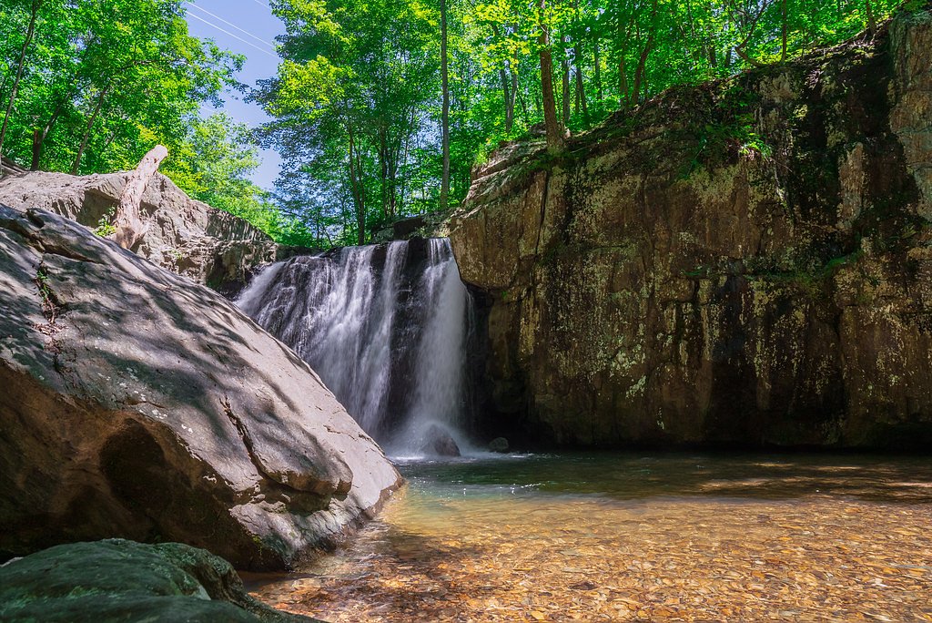

Photo Credits (5)
Difficulty
Moderate
Trail Length
2.4 miles
Trail Type
Out And Back
Elevation Gain
350 ft
About Kilgores Rocks
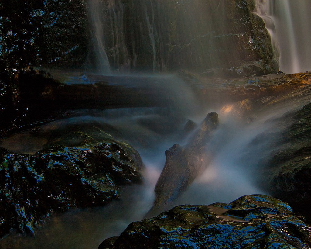
Kilgore Falls (sometimes called Falling Branch Falls) is a scenic 17-foot cascade tucked into Rocks State Park in Harford County, Maryland. The falls sit in Deer Creek Valley near Pylesville and are part of the park’s efforts to protect the distinctive King and Queen’s Seat geologic formation. Rocks State Park comprises roughly 1,060 acres spread across three non-contiguous areas near the junction of Maryland Route 24 and Maryland Route 165, and the park is managed by the Maryland Department of Natural Resources. The hike to Kilgore Falls rewards visitors with a pleasant stretch of forested landscape and a close-up view of the cascade—an inviting spot for nature lovers and photographers. Because the falls lie within a state park (Rocks Sp), trail maintenance and visitor information are provided by the Maryland DNR, making it an accessible day-trip destination from nearby towns in Harford County.
The Setting
Kilgores Rocks sits at 397 feet within Rocks Sp, fed by the Deer Creek, in the coastal lowlands of Maryland. The falls drop 17 feet.
Height: 17 feet
Trail & Hike Details
The Approach
The moderate 2.4-mile out-and-back trail gains 350 feet of elevation on the way to the falls.
Trail Description
The route to Kilgore Falls is an out-and-back trail of approximately 2.4 miles round-trip with about 350 feet of elevation gain and is rated moderate. The trail leads directly to the 17-foot waterfall; specific USFS trail surface/grade/class data are not applicable for this state park trail, so hikers should expect typical park singletrack and natural footing through forested terrain. Plan for a moderate effort and allow time to enjoy the falls once you arrive.
What to Expect
The falls drop a gentle 17 feet. Swimming is permitted. Dogs are welcome.
Accessibility
The trail is not wheelchair accessible. Uneven terrain and elevation changes require steady footing.
Frequently Asked Questions
🐶 Are Dogs Allowed at Kilgores Rocks?
✅ Dogs are allowed
Are There Any Fees or Permits Required?
🆖 No fees required
🏊 Is There Swimming at Kilgores Rocks?
✅ Swimming is allowed
When to Visit
Spring and early summer are ideal times to visit when the waterfall flow is strongest. Fall offers beautiful foliage, and weekdays are less crowded.
Seasonal Access
The best time to visit is Spring, Summer, and Fall. Winter access may be limited.
Safety Information
The rocks around the falls can be slippery, so wear appropriate footwear and exercise caution. Avoid climbing on the rocks near the falls. During heavy rain, the trail may become muddy and more challenging to navigate.
Current Water Conditions
49 ft³/s
Current discharge — how much water is flowing
Much lower than usual for this time of year
Based on 99 years of record
2.08 ft
Water depth at gauge
7-Day Discharge Trend
What does this mean for your visit?
Flow is well below normal for this time of year, so the waterfall may be a trickle.
About This Gauge
7-Day Flow Outlook
Based on the USGS gauge DEER CREEK AT ROCKS, MD (7 km away).
Today
Low
56 cfs
3/10Tomorrow
Moderate
58 cfs
4/10Mon
Low
55 cfs
5/10Tue
Barely Flowing
49 cfs
5/10Wed
Barely Flowing
47 cfs
5/10Thu
Barely Flowing
48 cfs
5/10Fri
Low
53 cfs
3/10Best window: Mon — low flow, patchy fog then mostly sunny (trip score 5/10).
Best time of year: this gauge typically runs highest from early March to mid May, peaking in April.
How we calculate this
This is a transparent outlook, not a precise forecast. We take the waterfall's current flow strength (how it ranks against its historical normal for today, from the nearest USGS stream gauge), carry that ranking forward along the gauge's seasonal curve, and nudge it for forecast rain. Confidence is highest for the next day or two and falls further out. Always check official conditions and your own judgment before visiting — high flows can be dangerous.
Know when to go.
Get a free email alert when waterfalls near Pylesville hit peak flow. We only send when conditions are worth the trip — no weekly newsletters, no spam.
Weather Forecast
Location & Access
Getting There
Kilgore Falls is located in the Falling Branch area of Rocks State Park in Harford County, Maryland. The trailhead can be accessed via Falling Branch Road. Visitors should follow signs to the designated parking area.
Get Directions on Google MapsParking
Parking is available at the Falling Branch parking lot, but it is limited. During peak seasons, reservations are required to secure a parking spot.
Elevation
397 feet above sea level
Coordinates
39.691224° N, -76.426722° W
Land Management
Managed by UNK
Visitor Tips & Gear
Arrive early, especially on weekends, as parking is limited and reservations are required during peak times. Wear sturdy shoes as the area around the falls can be slippery. Bring water and snacks, but pack out all trash to keep the area clean.
As an Amazon Associate, we earn from qualifying purchases.
With 2.4 miles and 350 ft of elevation gain, sturdy boots and trekking poles will help on this moderate trail. Sun exposure on the trail makes good sun protection a must in summer.

Polarized Sunglasses (Knockaround)
Cuts glare off the water so you actually see the falls — and your photos turn out better too.

Columbia Watertight II Rain Jacket
Packs into its own pocket, seam-sealed, and keeps you dry from spray and surprise rain.

Earth Pak Waterproof Dry Bag
Keeps your phone and gear dry when waterfall mist soaks everything else.

Waterproof Phone Pouch (AiRunTech)
Cheap insurance — take photos right next to the falls without killing your phone.

Timberland Euro Sprint Mid Waterproof
Trusted waterproof boot with premium leather and grippy rubber sole — reliable on rocky, wet trails.

TrailBuddy Trekking Poles
Lightweight aluminum, cork grips, and flip-locks that actually hold — a best-seller for good reason.
Where to Stay

Country Inn & Suites by Radisson, Bel Air-Aberdeen, MD

Candlewood Suites Aberdeen-Bel Air by IHG

Hilton Garden Inn Bel Air, Md

Comfort Inn & Suites Aberdeen
Browse vacation cabins and private rentals nearby
Unique outdoor stays — tents, yurts, and treehouses
Rent a campervan or RV for your waterfall road trip
Some links are affiliate links. We may earn a commission at no extra cost to you.
Additional Information
Nearby Attractions
Rocks State Park offers additional hiking trails and scenic overlooks, including the King and Queen Seat, a popular rock formation with panoramic views.
Wildlife
The area is home to various bird species, deer, and other small wildlife. Visitors may also encounter frogs and fish near the water.
Cities near Kilgores Rocks
Nearby Waterfalls
Writing about Kilgores Rocks? Embed this waterfall on your site for free.